The best road cycling routes around Sobral De São Miguel
5.0
(1)
89
riders
10
rides
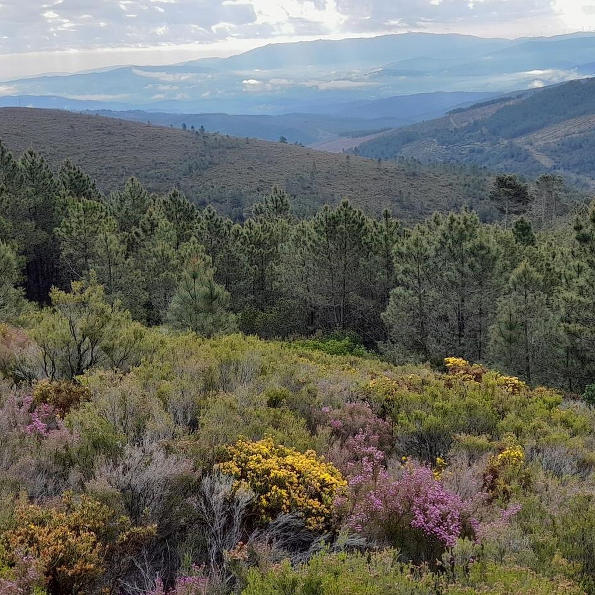
Road cycling around Sobral De São Miguel features a landscape characterized by significant elevation changes, river valleys, and mountainous terrain. The region is situated near the Serra da Estrela, Portugal's highest mountain range, which contributes to challenging road cycling routes. Cyclists can expect routes that traverse varied elevations, offering views of the Zêzere River and historical areas. The terrain primarily consists of demanding climbs and descents, suitable for experienced road cyclists.
Best road cycling routes around Sobral De São Miguel
…Last updated: July 8, 2026
23
riders
82.2km
04:06
1,180m
1,180m
Hard road ride. Very good fitness required. Some segments of this route may be unpaved and difficult to ride.
5.0
(1)
21
riders
102km
05:13
1,630m
1,630m
Hard road ride. Very good fitness required. Some segments of this route may be unpaved and difficult to ride.

Sign up for free
13
riders
55.8km
03:33
1,650m
1,650m
Hard road ride. Very good fitness required. Mostly well-paved surfaces and easy to ride.
9
riders
68.4km
04:09
1,730m
1,730m
Hard road ride. Very good fitness required. Mostly well-paved surfaces and easy to ride.
6
riders
50.2km
02:51
1,080m
1,080m
Hard road ride. Very good fitness required. Some segments of this route may be unpaved and difficult to ride.
Get access to more routes and recommendations from other explorers.
Sign up for free
Already have an account?
Our route recommendations are based on thousands of hikes, rides, and runs completed by other people on komoot.
Start today with a free account
Your next adventure awaits.
Login or Signup
Popular around Sobral De São Miguel


Tips from the Community

The Torre is the highest point of Continental Portugal, at 1,993 meters above sea level. It is located in the heart of the Serra da Estrela Natural Park and serves as the dividing line between the municipalities of Seia, Manteigas, and Covilhã. To reach the round 2,000 meters, King D. João VI had a stone monument built at the top of the plateau in the early 19th century.👍🥾
0
0

Here, the trail winds along the Ribeira dos Boxinos, revealing levadas, dams, mills, and ancient stone bridges. The landscape in this area is a constant invitation to hike.
1
0

goodbye vegetables 😔
0
0

The Serra da Estrela Natural Park is something truly special. This 1,000-square-kilometer park, spread across six municipalities, was the first and currently the largest protected natural park in Portugal. It is home to the highest point on the Portuguese mainland, the country's only ski slope, the source of two important rivers, and a fascinating, alpine-like landscape formed by glaciers.
5
1

At exactly 1993 meters above sea level, Torre is the highest point in mainland Portugal, where the only ski resort is located. The landscape on the upper plateau of the Serra da Estrela is like a sprinkling of granite rocks over low scrub and patches of snow and ice, which the sun threatens to melt soon in the summer and which always returns the following winter. In winter, it sometimes becomes inaccessible.
6
0

The Jardim do Lago extends around the Lago da Sereia and is a well-kept green area with paths, benches and lush vegetation. Perfect for a break from cycling.
0
0
Nestled along the banks of the Alva River, Côja is immersed in a green environment, surrounded by mountains and forests. The village is characterized by traditional architecture, a charming Roman bridge and a peaceful atmosphere.
1
0
Frequently Asked Questions
What kind of terrain can I expect when road cycling around Sobral De São Miguel?
Road cycling in Sobral De São Miguel is characterized by significant elevation changes, river valleys, and mountainous terrain, particularly due to its proximity to the Serra da Estrela. You can expect demanding climbs and descents, offering challenging routes primarily suited for experienced road cyclists.
Are there any easy or beginner-friendly road cycling routes in Sobral De São Miguel?
The road cycling routes around Sobral De São Miguel are predominantly challenging, with 8 out of 10 routes classified as difficult. While there are 2 moderate routes, the region's landscape, with its mountainous terrain and significant elevation changes, generally caters to more experienced road cyclists.
What is the typical length and duration of road cycling routes in this region?
Routes vary in length and duration, but many are substantial. For example, the View of the Zêzere River – Santuário do Paúl loop from Cabeço do Pião is 50.4 miles (81.1 km) and takes about 4 hours 2 minutes, while the Mural A Farrapeira – Jardim do Lago loop from Poço do Lagar is 61.9 miles (99.7 km) and typically takes around 5 hours.
Are there any circular road cycling routes available?
Yes, many of the routes around Sobral De São Miguel are designed as loops. Examples include the View of the Zêzere River – Santuário do Paúl loop from Cabeço do Pião and the Vale de Loriga Viewpoint – Serra da Estrela loop from Vide e Cabeça, allowing you to start and finish at the same point.
What are some scenic viewpoints or natural attractions I can see along the road cycling routes?
The routes often offer views of the Zêzere River and the Serra da Estrela mountains. You might also encounter natural monuments such as Poço Fundeiro Waterfall or Poço da Broca Waterfall. The Pico de Cebola is another notable natural highlight in the area.
Are there any historical sites or villages to explore near the road cycling routes?
Yes, the region is home to charming historical sites. You could visit the Historical Village of Piódão or the Chãs d'Égua Historical Village. These offer a glimpse into the local heritage and are often accessible from various routes.
What is the best season for road cycling in Sobral De São Miguel?
Given the mountainous terrain and potential for challenging conditions, spring and autumn generally offer the most pleasant weather for road cycling in Sobral De São Miguel. Summers can be hot, and winters may bring colder temperatures and more unpredictable weather in the higher elevations of Serra da Estrela.
Where can I find parking for road cycling routes in Sobral De São Miguel?
While specific parking areas are not detailed for every route, many routes start from villages or towns like Cabeço do Pião or Poço do Lagar. It's advisable to look for public parking in these starting locations or consult local maps for designated parking spots near trailheads.
What do other road cyclists enjoy most about road cycling in Sobral De São Miguel?
Road cyclists frequently praise the challenging nature of the routes and the stunning views of the Zêzere River and the Serra da Estrela. The region offers a rewarding experience for those seeking demanding ascents and descents through diverse landscapes.
Are there any less crowded road cycling routes in the area?
While specific crowd levels are not tracked, routes that venture deeper into the Serra da Estrela mountains, such as the Côja – Castelo de Avô loop from Vale do Torno, might offer a more secluded experience compared to those closer to more populated areas. Exploring during off-peak seasons can also help avoid crowds.
Can I find routes that offer extensive views of the Zêzere River?
Absolutely. The Zêzere River is a prominent feature of the landscape. Routes like the View of the Zêzere River loop from Cabeço do Pião are specifically designed to showcase these scenic river views, providing a picturesque backdrop to your ride.
Most popular routes around Sobral De São Miguel
Most popular attractions around Sobral De São Miguel

Get inspired with the komoot mobile app


Explore more
Browse the best Road cycling routes in other regions.
