The best road cycling routes around Almofala e Escarigo e Escarigo e Escarigo
135
riders
25
rides
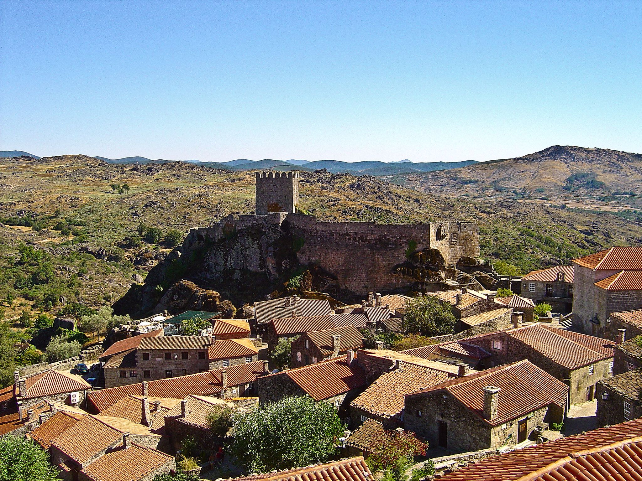
Road cycling routes around Almofala e Escarigo e Escarigo e Escarigo traverse a landscape characterized by rolling hills and river valleys. The region, situated in Portugal's Centro region, offers varied terrain for cyclists. With an average altitude of 682 meters above sea level, routes often feature significant elevation changes. This area provides diverse road cycling experiences within its natural features and historical context.
Best road cycling routes around Almofala e Escarigo e Escarigo e Escarigo
- The most popular road cycling…
Last updated: July 11, 2026
14
riders
95.6km
05:02
1,830m
1,830m
Cycle a difficult 59.4-mile loop through the Arribes del Duero International Park, gaining 6012 feet with stunning canyon views.
11
riders
75.7km
03:44
1,120m
1,120m
Hard road ride. Very good fitness required. Some segments of this route may be unpaved and difficult to ride.

Sign up for free
12
riders
47.1km
02:07
480m
480m
Moderate road ride. Good fitness required. Mostly well-paved surfaces and easy to ride.
10
riders
90.5km
04:26
1,380m
1,380m
Hard road ride. Very good fitness required. Mostly well-paved surfaces and easy to ride.
7
riders
Hard road ride. Very good fitness required. Mostly well-paved surfaces and easy to ride.
Get access to more routes and recommendations from other explorers.
Sign up for free
Already have an account?
Our route recommendations are based on thousands of hikes, rides, and runs completed by other people on komoot.
Start today with a free account
Your next adventure awaits.
Login or Signup



Other adventures around Almofala e Escarigo e Escarigo e Escarigo

Tips from the Community

Vila Nova de Foz Côa is a jewel of northern Portugal, located in the Guarda district of the Alto Douro region. It is known for its unique archaeological heritage, spectacular wine-growing landscapes, and its deep connection to history and nature.
3
0

The bridge was designed and built in 1955 by the renowned Portuguese engineer Edgar Cardoso. It is considered the first motorway bridge in the Portuguese section of the Douro River and is a concrete arch bridge with a length of approximately 300 meters. It is named after the Portuguese naval officer and colonial administrator Almirante Manuel Maria Sarmento Rodrigues, who served as governor of Guinea and Mozambique under the Salazar dictatorship and later became Minister of Colonies.
1
0

With its source near Guarda, the Massueime Stream flows through valleys and municipalities until it empties its waters into the Côa River, which in turn flows into the Douro. At the edge of this bridge, a bench invites you to stop: sit, take a deep breath, and let yourself be lulled by the serenity of the current.
2
0
The trail here merges with the Great Côa and Historic Villages Route, leading you down a steep descent to the river. After crossing, the hillside challenges you with its demanding climb, but the reward lies in each new look: ever-changing perspectives of the Côa Valley. Both directions offer incredible views: remember to look back!
2
0
Nestled in the Serra da Marofa valley, Freixeda do Torrão holds centuries of history. Its name dates back to 1190, and since then, time has left its mark. Among its treasures stands the Parish Church, with Romanesque roots, rebuilt after the devastating fire of 1908 but still faithful to the 16th-century portal that saw its birth. In the heart of the parish, the Solar dos Metelos stands tall with its medieval tower and stately coat of arms, a testament to times of power and distinction.
2
0
Castelo Rodrigo holds millennia of history, from Paleolithic and Roman remains to the Muslim presence in the castle. Conquered and reconquered between the 12th and 13th centuries, it became a town and municipality under King Alfonso IX of León and passed definitively to Portugal in 1297, when King Dinis rebuilt and repopulated the castle. Marked by wars, charters, and restorations, it welcomed pilgrims on their way to Santiago and remains today one of the twelve Historic Villages of Portugal.
3
0
At the entrance to Castelo Rodrigo, the Monastery of Santa Maria de Aguiar rises among chestnut trees, founded in 1174 by King Afonso Henriques and handed over to the Cistercian Order. From the sober church to the monks' quarters and the guesthouse loggia with its 1704 coat of arms, everything testifies to centuries of faith and hospitality for pilgrims to Santiago. Despite the damage caused by the French invasions and its abandonment in 1834, the monastery's former beauty remains intact.
2
0
Malpartida stands serenely on the border plain, preserving in its main church, with its romantic bell tower, the most visible trace of its memory. But the past here goes far beyond the stones: from the cave tombs of the Nave de Mouros to the ancient watchtower of the Restoration, from the echoes of the Castilian sack of 1762 to the fierce battle against the French in 1808. Even generals left their mark; Ney established his headquarters here, and Brenier boldly escaped the siege of Almeida. Malpartida is, therefore, a land where every stone tells of battles, losses, and exploits.
2
0
Frequently Asked Questions
How many road cycling routes are available in the Almofala e Escarigo region?
There are over 20 road cycling routes around Almofala e Escarigo, offering diverse experiences for cyclists. These routes traverse a landscape characterized by rolling hills and river valleys, with an average altitude of 682 meters above sea level.
What is the general difficulty level of road cycling routes around Almofala e Escarigo?
The road cycling routes in Almofala e Escarigo range from moderate to difficult. While there is 1 easy route, you'll find 9 moderate and 14 difficult routes, often featuring significant elevation changes due to the region's rolling hills and varied terrain.
Are there any easy road cycling routes suitable for beginners in Almofala e Escarigo?
Yes, there is 1 easy road cycling route available in the Almofala e Escarigo area. While many routes feature challenging climbs, this option provides a gentler introduction to the region's beautiful landscapes.
What kind of landscapes can I expect to see while road cycling in Almofala e Escarigo?
Road cycling in Almofala e Escarigo offers diverse landscapes, including rolling hills, scenic river valleys, and varied terrain. The region's average altitude of 682 meters above sea level contributes to panoramic views and engaging rides.
Are there any historical landmarks or attractions I can visit along the road cycling routes?
Yes, the region is rich in historical sites. You can explore the significant Almofala Ruins or Tower Mansion, which originated as a Roman temple. Other cultural points of interest include the Capela no Lugar de Santo André and various traditional stone crosses like the Cruzeiro de Almofala. For specific attractions, consider visiting the Castelo Rodrigo Discovery Trail or the Castle of San Felices de los Gallegos.
What is the best time of year to go road cycling in Almofala e Escarigo?
The region is generally appealing for outdoor activities, including road cycling, due to its diverse landscapes. While specific weather patterns vary, spring and autumn typically offer more temperate conditions, making them ideal for tackling the area's rolling hills and elevation gains.
Are there any circular road cycling routes in the area?
Yes, many of the routes in Almofala e Escarigo are designed as loops. For example, the challenging Arribes del Duero International Park Loop and the Castelo Rodrigo Village – Almeida Castle loop from Castelo Rodrigo are popular circular options that allow you to start and end in the same location.
What do other road cyclists enjoy the most about road cycling in Almofala e Escarigo?
Road cyclists frequently praise the region's varied terrain, which includes rolling hills and river valleys, offering both challenging climbs and scenic views. The presence of historical landmarks along routes also adds to the appeal, providing cultural points of interest during rides.
Are there any routes that pass through or near historical villages?
Yes, several routes offer opportunities to explore historical villages. The Castelo Rodrigo Village – Almeida Castle loop from Castelo Rodrigo, for instance, leads through historical villages and varied terrain, providing a blend of cycling and cultural exploration.
Are there any particularly challenging routes for experienced road cyclists?
Experienced road cyclists will find plenty of challenging options. Routes like the Arribes del Duero International Park Loop (95.6 km with 1832m elevation gain) and the Salto Viewpoint – Lumbrales loop from Sobradillo (90.5 km with 1377m elevation gain) are rated as difficult and feature substantial climbs.
Can I find routes that offer views of significant natural features?
Absolutely. The region's landscape is defined by its rolling hills and river valleys, providing numerous scenic viewpoints. The Salto Viewpoint – Lumbrales loop from Sobradillo, for example, offers rewarding views towards the Salto Viewpoint after a challenging climb.
Are there any long-distance road cycling routes available?
Yes, the region offers several long-distance routes. The Arribes del Duero International Park Loop is a substantial 95.6 km ride, and the End of N222 in Almendra – Steep terrain in the Côa Valley loop from Figueira de Castelo Rodrigo covers 93.7 km, both providing extensive cycling experiences.
Most popular routes around Almofala e Escarigo e Escarigo e Escarigo
Most popular attractions around Almofala e Escarigo e Escarigo e Escarigo

Get inspired with the komoot mobile app


Explore more
Browse the best Road cycling routes in other regions.
