The best road cycling routes around Carragozela
4.8
(14)
946
riders
43
rides
Road cycling routes around Carragozela provide access to the challenging terrain of the Serra da Estrela mountain range in Portugal. The region is characterized by significant elevation changes, mountainous roads, and deep valleys, offering demanding climbs and descents. Cyclists will find well-maintained roads that traverse varied landscapes, including high-altitude passes and open plateaus. This area is known for its diverse and demanding cycling routes, connecting charming villages and offering panoramic views.
Best road cycling routes around Carragozela
- The most popular…
Last updated: October 25, 2026
4.8
(5)
161
riders
57.3km
03:38
1,680m
1,680m
Hard road ride. Very good fitness required. Mostly well-paved surfaces and easy to ride.
5.0
(2)
74
riders
130km
07:34
3,110m
3,100m
Hard road ride. Very good fitness required. Mostly well-paved surfaces and easy to ride.

37
riders
53.5km
03:08
1,170m
1,170m
Hard road ride. Very good fitness required. Mostly well-paved surfaces and easy to ride.
23
riders
64.2km
03:06
830m
830m
Moderate road ride. Good fitness required. Mostly well-paved surfaces and easy to ride.
15
riders
78.6km
04:13
1,390m
1,390m
Hard road ride. Very good fitness required. Mostly well-paved surfaces and easy to ride.
Get access to more routes and recommendations from other explorers.
Already have an account?
Our route recommendations are based on thousands of hikes, rides, and runs completed by other people on komoot.
Start today with a free account
Your next adventure awaits.



Tips from the Community

The Torre is the highest point of Continental Portugal, at 1,993 meters above sea level. It is located in the heart of the Serra da Estrela Natural Park and serves as the dividing line between the municipalities of Seia, Manteigas, and Covilhã. To reach the round 2,000 meters, King D. João VI had a stone monument built at the top of the plateau in the early 19th century.👍🥾
0
0
Cântaro Magro is one of the "commonplaces" of the Serra da Estrela mountain range, whose summit rises to 1928 m altitude, deserving a visit at any time of year. Viewed from west to east, its silhouette resembles a pitcher. In summer, its rocky face is interrupted by small terraces of soil, where some of the rarest botanical jewels of the mountain range grow. In winter, it is covered in snow and ice which, as they melt, form ephemeral waterfalls. These recall the overflowing liquid from the pitchers carried on the heads of women when, in the past, they went to the fountains. #CISE #VisitSeia #ParqueNaturaldaSerradaEstrela
0
0

Offering breathtaking views of the southeastern slopes of the Serra da Estrela, Cova da Beira, and the charming city of Covilhã, the Varanda dos Carqueijais, which rises 1,130 meters above sea level, is a stunning suspended viewpoint, magnificently perched in the heart of the surrounding natural landscape. The suspended walkway was the best way to provide an excellent experience for visitors, creating a kind of amphitheater, a balcony overlooking the inspiring natural landscape. This viewpoint is an integral part of the viewpoint route, developed by the Municipality of Covilhã, with the aim of promoting the region's natural heritage.
0
0

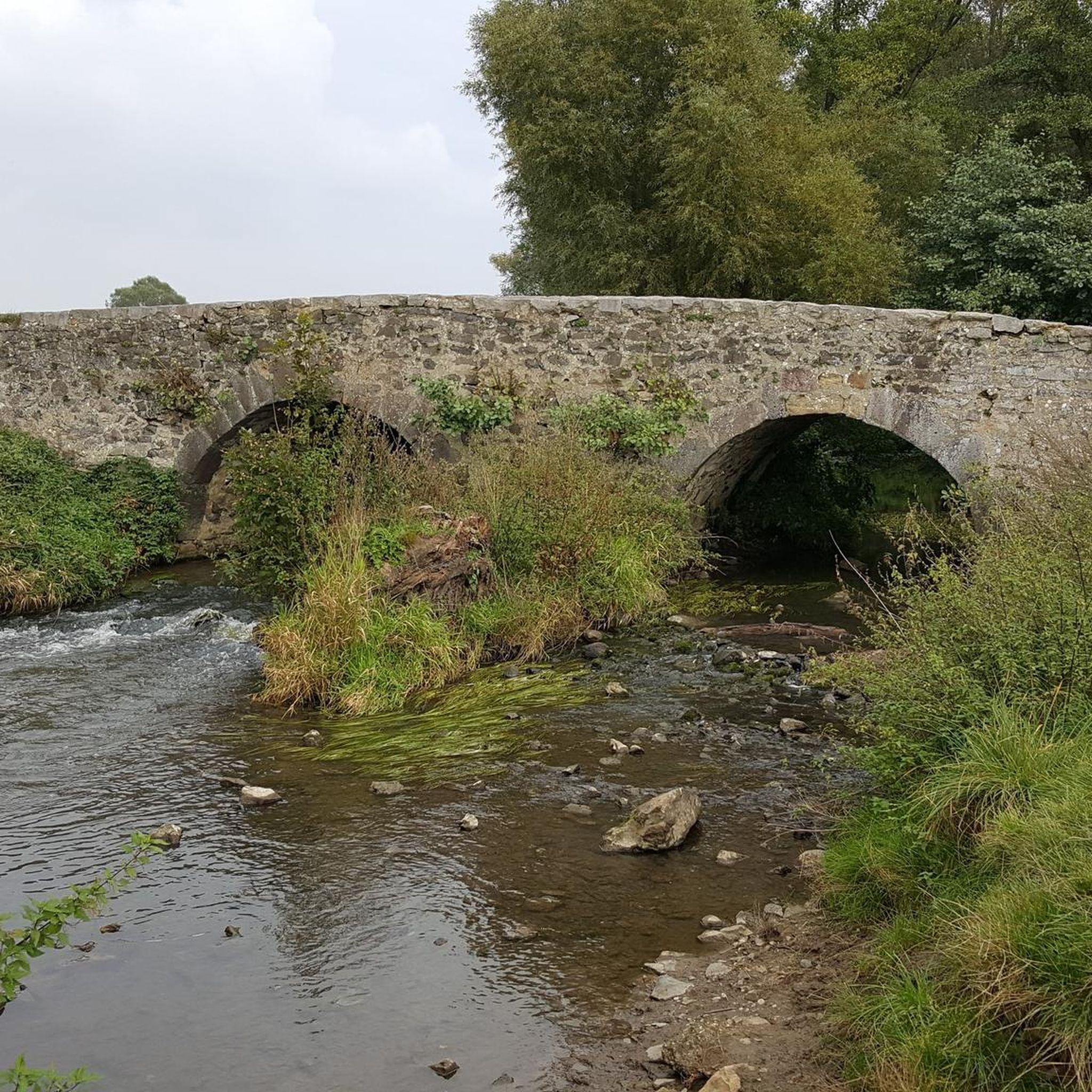
In the heart of Vide, the Alvoco River is crossed by a granite bridge, built in a perfect arch and likely of medieval origin. Among its stones echo the memories of centuries, while the bucolic setting invites one to contemplate the river, the village, and the dreams of bygone times.
1
0

goodbye vegetables 😔
0
0
Sabugueiro, the village vying for the title of highest in Portugal, is also one of the most authentic ambassadors of mountain life. Among granite houses and comforting flavors (cheese, sausages, roast kid, and honey), you can find the warmth of blankets and burel coats and the company of the faithful Serra da Estrela mountain dogs. Surrounding waterfalls, streams, and lakes remind you that here, nature is as generous as the table.
3
0

The Serra da Estrela Natural Park is something truly special. This 1,000-square-kilometer park, spread across six municipalities, was the first and currently the largest protected natural park in Portugal. It is home to the highest point on the Portuguese mainland, the country's only ski slope, the source of two important rivers, and a fascinating, alpine-like landscape formed by glaciers.
5
1
Serra da Estrela Cheese is a Portuguese cheese made from sheep's milk and has a protected designation of origin. The earliest mention of this cheese dates back to the 12th century, making it the oldest Portuguese cheese. It is one of the most famous sheep's milk cheeses in the world. I recommend it 👍 Wikipedia
1
0
Frequently Asked Questions
How many road cycling routes are available around Carragozela?
There are over 45 road cycling routes around Carragozela, offering a wide range of options for exploring the region. These routes primarily focus on challenging terrain, with 33 difficult and 14 moderate options available.
What is the typical difficulty level for road cycling routes in the Carragozela area?
Road cycling around Carragozela, particularly due to its proximity to the Serra da Estrela, is known for its challenging terrain. Most routes feature significant elevation changes, with 33 out of 47 routes classified as difficult. You can expect demanding climbs and exhilarating descents on well-maintained roads.
Are there any longer, more challenging road cycling routes for experienced riders?
Yes, for experienced riders seeking a significant challenge, the region offers routes like the Serra da Estrela – Cântaro Magro loop from Seia. This difficult 80.4-mile (129.3 km) path includes high-altitude mountain passes and dramatic landscapes, requiring substantial endurance.
What kind of landscapes and natural features can I expect to see while road cycling near Carragozela?
The landscapes around Carragozela are dominated by the dramatic beauty of the Serra da Estrela. Cyclists will encounter glacial valleys, open plateaus, and forested areas. Iconic natural features include the ascent to Torre, the highest point in mainland Portugal, offering expansive views, and picturesque river beaches like Praia Fluvial de Loriga and Lapa dos Dinheiros River Beach.
Are there any circular road cycling routes around Carragozela?
Many of the road cycling routes in the area are designed as loops. For instance, the popular Covão do Ferro Lagoon – Serra da Estrela loop from Seia is a difficult 35.5-mile (57.1 km) trail that takes you through the heart of the Serra da Estrela. Another option is the Sabugueiro – Casa das Obras Fountain loop from Seia, which covers 33.2 miles (53.5 km) through varied terrain.
What are some interesting landmarks or attractions to look out for along the road cycling routes?
Beyond the stunning natural scenery, routes often pass through picturesque historic villages, allowing riders to experience local culture. You might also encounter unique geological formations like Cornos do Diabo or man-made monuments such as the Aqueduct of the Caniça Route. The Long Lake is another notable point of interest.
What do other road cyclists enjoy most about road cycling in Carragozela?
The road cycling routes around Carragozela are highly rated by the komoot community, with an average score of 4.8 stars from over 10 reviews. Cyclists often praise the challenging terrain, the panoramic views of the Serra da Estrela, and the well-maintained roads that connect charming villages.
Is Carragozela a suitable destination for family-friendly road cycling?
While the region is primarily known for its challenging routes with significant elevation, there are some moderate options available. However, due to the mountainous terrain and demanding climbs, it's generally more suited for families with older, more experienced cyclists. Always check the route's difficulty and elevation profile before setting out with family.
What is the best time of year for road cycling in the Carragozela area?
The best time for road cycling in the Serra da Estrela region, including Carragozela, is typically during the spring (April to June) and autumn (September to October). During these periods, the weather is generally milder, and the landscapes are vibrant. Summers can be hot, especially in lower elevations, while winters bring cold temperatures and snow, making high mountain passes inaccessible.
Are there any road cycling routes that pass through historic villages?
Yes, many routes are designed to connect and pass through charming historic villages, allowing riders to experience the local culture and architecture. For example, the Anta do Pinheiro dos Abraços loop from Vila Cova à Coelheira offers a moderate ride through varied landscapes, often including local settlements.
Where can I find parking for road cycling routes in Carragozela and the surrounding area?
Parking for cyclists is generally available in the larger towns and villages that serve as starting points for routes, such as Seia or Vila Cova à Coelheira. Look for designated parking areas within these communities, especially near trailheads or town centers, which often provide convenient access to the road networks.
Are there cafes or places to stop for refreshments along the road cycling routes?
Yes, as routes often traverse or pass through historic villages, you'll find opportunities to stop for refreshments. These villages typically offer local cafes, restaurants, and small shops where you can refuel and experience local gastronomy. Planning your route with these stops in mind can enhance your cycling experience.
Most popular routes around Carragozela
Most popular attractions around Carragozela

Get inspired with the komoot mobile app


Explore more
Browse the best Road cycling routes in other regions.
