The best cycling routes around Santo António Da Serra
4.6
(29)
538
riders
17
rides
Touring cycling around Santo António Da Serra, situated at approximately 700 meters altitude, offers diverse terrain for cyclists. The region features lush vegetation, including extensive forest views with chestnut, acacia, and elderberry trees. Elevated plateaus and mountainous landscapes characterize the area, providing varied topography for cycling. Many routes follow unique levada irrigation channels, adding a distinctive feature to the trails.
Best touring cycling routes around Santo António Da Serra
- The most popular touring cycling route is Porto da Cruz, Portela e Poiso — circular route on Madeira Island, a 23.8 miles (38.3 km) trail that takes 3 hours 37 minutes to complete. This difficult circular route offers varied terrain and mountain views across the island.
- Another top favourite among local touring cyclists is Levada da Serra do Faial – View of Penha de Águia loop from Machico, a difficult 26.5 miles (42.7 km) path. This route follows a levada and provides views towards Penha de Águia.
- Local touring cyclists also love the View of Pico do Arieiro – Poiso Trailhead and Rest Area loop from Camacha, a 21.2 miles (34.1 km) trail leading through mountainous terrain, often completed in about 3 hours 17 minutes.
- Touring cycling around Santo António Da Serra is defined by elevated plateaus, lush forests, and mountainous terrain. The network offers options for different ability levels, from moderate to difficult.
- The routes in Santo António Da Serra are highly rated by the komoot community with an average score of 4.6 stars from more than 30 reviews. More than 500 touring cyclists have used komoot to explore Santo António Da Serra's varied terrain.
Last updated: July 3, 2026
4.5
(2)
3
riders
38.3km
03:37
1,700m
1,700m
Hard bike ride. Very good fitness required. Mostly paved surfaces. Suitable for all skill levels.
5.0
(2)
77
riders
35.5km
03:23
1,050m
1,050m
Hard bike ride. Very good fitness required. You may need to push your bike for some segments of this route.

Sign up for free
5.0
(1)
32
riders
42.9km
04:12
1,380m
1,380m
Hard bike ride. Very good fitness required. You may need to push your bike for some segments of this route.
27
riders
34.0km
03:20
1,080m
1,080m
Hard bike ride. Very good fitness required. You may need to push your bike for some segments of this route.
3.8
(4)
15
riders
59.8km
05:35
2,590m
2,600m
Hard bike ride. Very good fitness required. Mostly paved surfaces. Suitable for all skill levels.
Get access to more routes and recommendations from other explorers.
Sign up for free
Already have an account?
Our route recommendations are based on thousands of hikes, rides, and runs completed by other people on komoot.
Start today with a free account
Your next adventure awaits.
Login or Signup

Tips from the Community

Pico do Furado is the striking peak at the easternmost tip of Ponta de São Lourenço. From its summit, spectacular views open up across the rugged coastal cliffs, the deep blue sea, and the offshore islands. An impressive destination that showcases Madeira's wild and colorful volcanic landscape at its most striking.
4
0
From this point, you have a magnificent view of Pico do Furado, the striking peak at the easternmost tip of Ponta de São Lourenço. The steep cliffs, the changing colors of the volcanic layers, and the surrounding sea lend the panorama a breathtaking drama. An impressive viewpoint that perfectly showcases the wild beauty of Madeira's easternmost point.
1
0

Great view of Machico and the sea. Stop, catch your breath, enjoy the view, and keep walking.
0
0

Cervejaria and Talho dos Reis. If you like meat and beer and feel like a King after that climb… that’s the right place for you! The ideal local pitstop with coffee and snacks! “
0
0

Very nice panorama of Porto da Cruz.
1
0

The ABRISO DO POISO restaurant at 1412 meters above sea level offers good and inexpensive places to stop for a bite to eat with parking and toilets. There are also good picnic options on the other side of the road with tables and benches in the shade and in the sun. There is also a bus stop at the house. A great starting point for hiking and biking. A stage of the Enduro World Cup MTB series was even held nearby.
3
0

A classic here in Funchal, this place has everything a mountain bike needs, parking, a place to stop for refreshments, and plenty of trails nearby
5
0

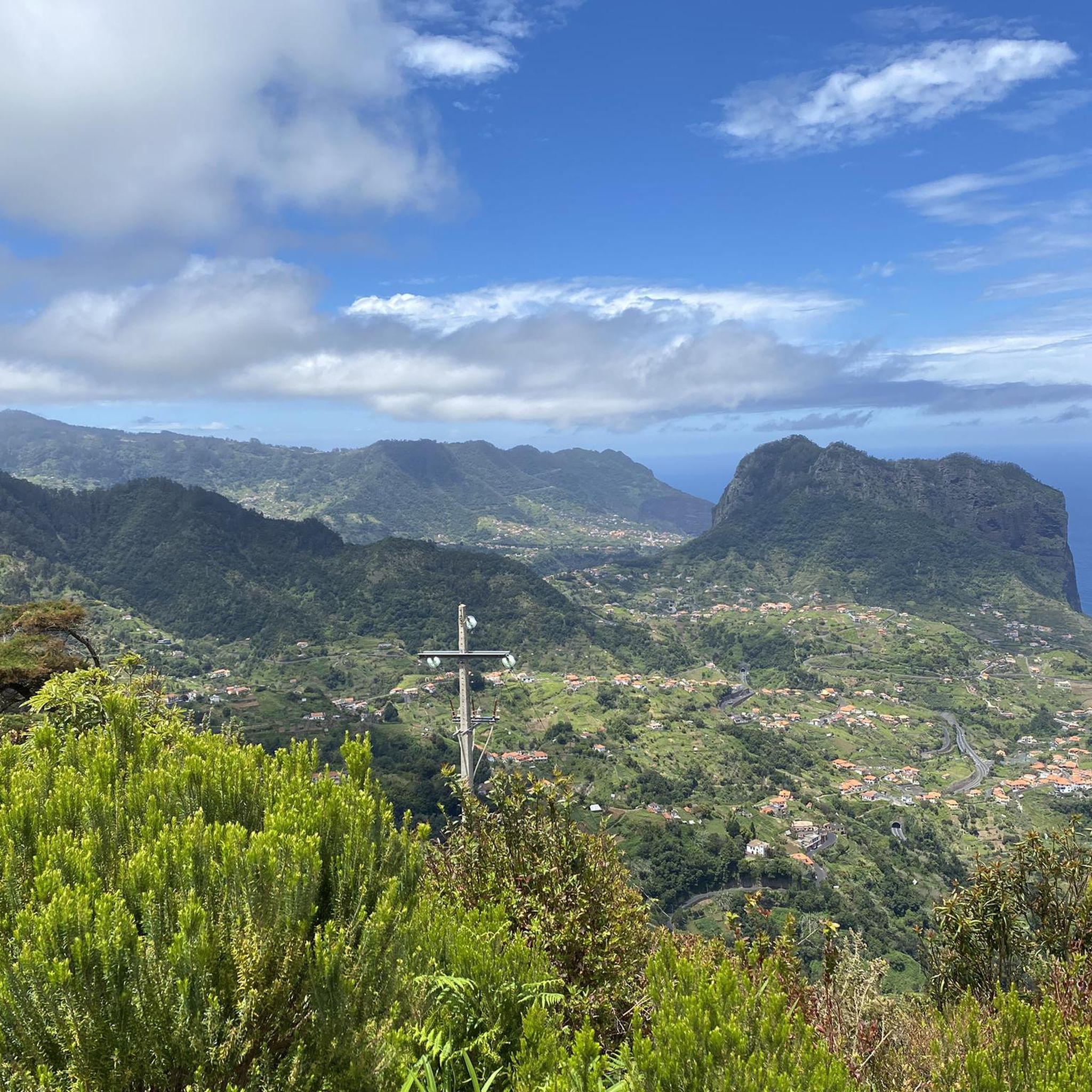
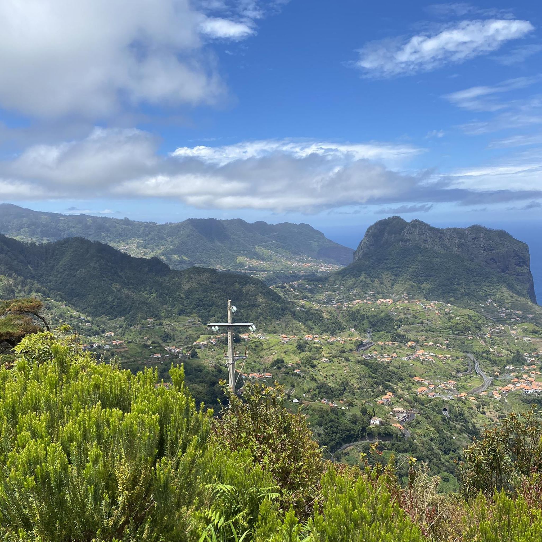
Green mountains that extend to the blue depths of the sea: is it possible to describe the scenery that awaits visitors to the Miradouro da Portela in Madeira. Located at an altitude of 670 meters, it offers breathtaking views. On the horizon rises the magnificent Penha d'Águia, a 600-meter-high geological formation that separates the municipalities of Machico and Santana. In addition, the entire landscape of the Miradouro da Portela is complemented by the sea in the background that washes the island.
7
0
Frequently Asked Questions
How many touring cycling routes are available around Santo António Da Serra?
There are over 20 touring cycling routes documented on komoot for the Santo António Da Serra area. These routes offer diverse experiences, primarily catering to cyclists looking for challenging rides.
What are the typical difficulty levels for touring cycling routes in this region?
The majority of touring cycling routes around Santo António Da Serra are classified as difficult, with 18 out of 20 routes falling into this category. There are also 2 moderate routes, but no easy routes are currently listed, indicating the terrain often involves significant climbs and varied surfaces.
Are there any circular touring cycling routes in Santo António Da Serra?
Yes, many routes in the area are circular. For example, the Porto da Cruz, Portela e Poiso — circular route on Madeira Island is a popular difficult option, covering 23.8 miles (38.3 km) with varied terrain and mountain views.
What kind of landscapes can I expect to see while cycling?
Cycling around Santo António Da Serra offers stunning natural beauty. You'll traverse an elevated plateau at 700 meters above sea level, surrounded by lush eucalyptus and pine forests. Routes often provide access to mountainous landscapes, panoramic viewpoints like Ninho da Manta, and even sections along ancient levada irrigation channels, such as the Levada da Serra do Faial – View of Penha de Águia loop from Machico.
Are there any family-friendly or beginner touring cycling routes?
The touring cycling routes around Santo António Da Serra are predominantly rated as moderate to difficult. Currently, there are no routes specifically classified as easy, suggesting that most trails may require a good level of fitness and cycling experience. Families or beginners might find some sections challenging due to the mountainous terrain and elevation changes.
What are some notable viewpoints or attractions along the cycling routes?
The region is rich in scenic spots. You can cycle towards viewpoints offering vistas of Pico Ruivo, the island's highest peak, or the dramatic rock formations from Ninho da Manta. The Quinta do Santo da Serra, a large public park, also features a viewpoint with panoramic views over the Machico valley and Ponta de São Lourenço.
Can I find waterfalls or gorges along the touring cycling routes?
While many touring cycling routes focus on mountain and forest paths, the broader region around Santo António Da Serra is known for its natural features. You can find nearby attractions such as the Caldeirão Verde Waterfall and various gorges like the Narrow Gorge Trail in Madeira Natural Park. Some cycling routes may pass close to these areas, offering opportunities for short detours.
What do other touring cyclists enjoy most about cycling in Santo António Da Serra?
The area is highly rated by the komoot community, with an average score of 4.6 stars from over 120 reviews. Cyclists often praise the challenging climbs, the stunning mountain views, and the immersive experience of riding through lush forests and along unique levada paths. Over 900 touring cyclists have used komoot to explore the varied terrain here.
What is the typical length of touring cycling routes in the area?
Route lengths vary, but many popular options are substantial. For instance, the Abrigo do Poiso Restaurant loop from Ladeira is 27.4 miles (44.0 km) long, and the Machico – View of Pico do Furado loop from Machico covers 21.4 miles (34.5 km). These routes typically take several hours to complete due to the challenging terrain.
Are there opportunities for refreshments or cafes along the routes?
While specific cafes on every route are not detailed, the presence of routes like the Abrigo do Poiso Restaurant loop from Ladeira suggests that some trails pass by or lead to establishments where you can find refreshments. It's advisable to carry sufficient water and snacks, especially on longer or more remote sections.
What is the best season for touring cycling in Santo António Da Serra?
Santo António Da Serra's elevated position at 700 meters above sea level provides a temperate climate, making it appealing for cycling throughout much of the year. The cooler temperatures are particularly welcome during warmer months. However, it's always recommended to check local weather forecasts, especially for mountainous areas, before heading out.
Where can I park my car when starting a touring cycling route?
While specific parking locations for every route are not detailed, many trailheads and popular starting points in the region, especially near towns or significant attractions like the Quinta do Santo da Serra, typically offer parking facilities. It's best to check the individual route details on komoot for recommended starting points and parking information.
Most popular routes around Santo António Da Serra
Most popular attractions around Santo António Da Serra

Get inspired with the komoot mobile app


Explore more
Browse the best Cycling routes in other regions.
