The best walks and hikes in Frosinone
4.4
(5939)
25,603
hikers
448
hikes
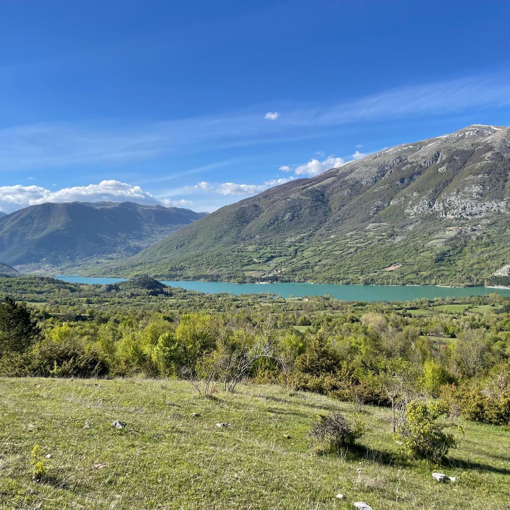
Hiking in Frosinone offers diverse landscapes characterized by significant mountain ranges, extensive parkland, and unique natural features. The region is encircled by the Ernici, Lepini, Ausoni, Aurunci, Simbruini, Mainarde, and Monti della Meta mountains. It features rugged terrain, dense forests, and crystal-clear streams, with parts of the Abruzzo, Lazio and Molise National Park extending into the area. Water features like the Gole di Lacerno and various lakes also contribute to the varied hiking environment.
Best hiking trails in Frosinone
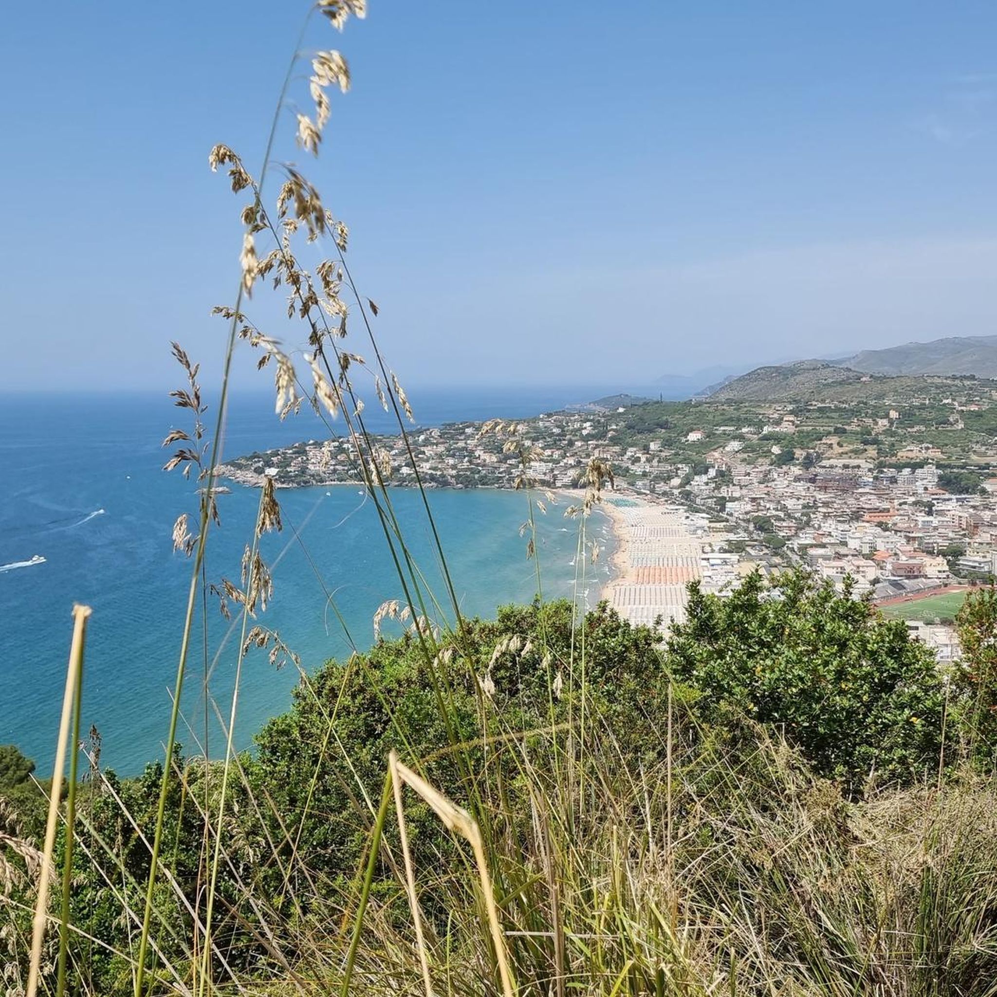
- The most popular hiking route is Monte Cacume from Patrica, a 4.4 miles (7.1 km) trail that takes 3 hours 27 minutes to complete. This moderate route ascends Monte Cacume, offering views of the surrounding area.
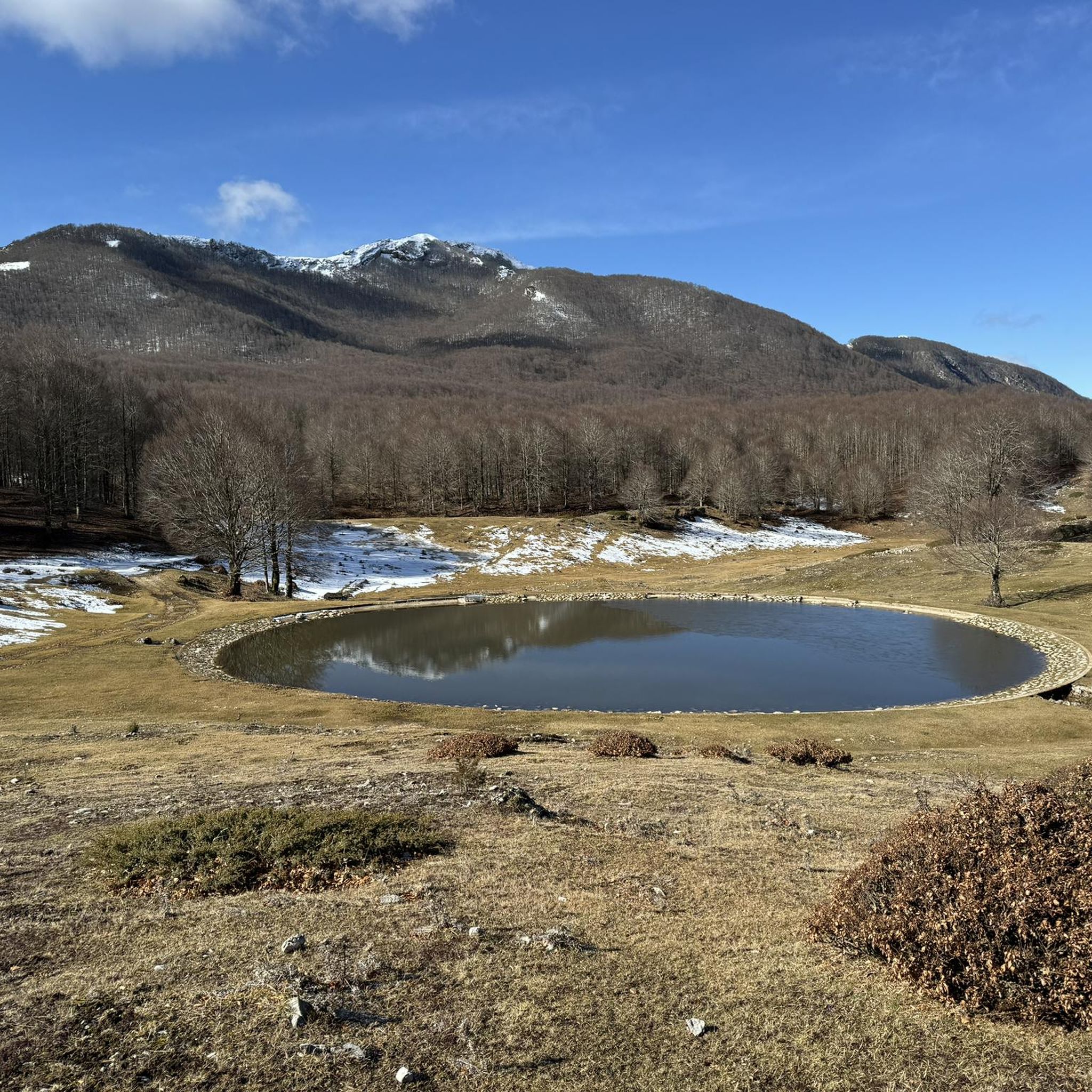
- Another top favourite among local hikers is Piana di Santa Serena to Monte Gemma – ring tour, a moderate 4.9 miles (7.8 km) path. This trail explores the Piana di Santa Serena and leads to Monte Gemma, providing varied mountain scenery.
- Local hikers also love the Monte Viglio Loop from Serra Sant'Antonio, a 7.9 miles (12.7 km) trail leading through the Simbruini Mountains, often completed in about 4 hours 28 minutes.
- Hiking in Frosinone is defined by prominent mountain ranges, extensive protected areas, and karstic formations. The network offers options for various ability levels, from leisurely walks to challenging multi-hour treks.
- The routes in Frosinone are highly rated by the komoot community with an average score of 4.5 stars from over 1600 reviews. More than 8000 hikers have used komoot to explore Frosinone's varied terrain.
Last updated: August 17, 2026
4.6
(61)
249
hikers
7.84km
03:05
430m
430m
Embark on the Piana di Santa Serena to Monte Gemma ring tour, a moderate hike through the scenic Lepini Mountains. This 4.9-mile (7.8 km) route, typically taking 3 hours and 4 minutes, features a diverse landscape. You will climb 1417 feet (432 metres) through wooded areas, including a dense beech forest, before reaching more open and rocky ridges. The trail offers expansive views from Monte Gemma, where a cross marks the summit, allowing you to see the Frosinone plain, the Sacco valley, and even the sea on clear days. In spring, look for wild narcissus and orchids near Monte Salerio.
The trail typically starts from the picturesque Piana di Santa Serena, a vast plain that serves as a natural crossroads in the Eastern Lepini Mountains. While the research does not specify parking or public transport options, planning your arrival at this starting point is key. The path is mostly accessible, though sure-footedness is required, especially on certain sections as you ascend towards Monte Gemma. Consider starting your hike earlier in the day to fully enjoy the panoramic views.
This route stands out for its transition through varied ecosystems, from the open plain to dense forests and then to exposed, rocky ridges. You will experience the characteristic carstic environments of the Lepini Mountains. Along the ascent, a panoramic balcony known as "La Teleferica" offers views of the Valloni, a spot historically used for timber transport. The rich flora, especially in spring, adds to the trail's natural appeal.
4.6
(63)
310
hikers
7.11km
03:27
550m
550m
Embark on the Monte Cacume from Patrica hike, a moderate route covering 4.4 miles (7.1 km) with an elevation gain of 1790 feet (546 metres), typically taking 3 hours and 27 minutes to complete. The trail begins with stone steps in Patrica before transitioning to a rocky mule track, leading you through pleasant grassy clearings and into a thick holm oak wood. As you ascend, you will notice the mountain's distinctive conical shape, a prominent feature of the landscape. From the summit, you can enjoy expansive panoramic views stretching across the Sacco valley to the distant Abruzzo peaks, the Circeo promontory, and the Tyrrhenian Sea. The final section to the peak is steep, rewarding your effort with these sweeping vistas. Along the way, keep an eye out for diverse flora, including various orchid species.
This trail is generally considered moderate, though some sections can be steep and rocky, requiring sure-footedness. Adequate footwear is recommended to navigate potentially slippery areas. While the research does not specify trailhead access or parking details, planning your visit during daylight hours is advisable to fully appreciate the views and navigate the terrain safely. There is no mention of permits, fees, or seasonal closures, suggesting it is accessible year-round. You can also find abundant springs, such as Fontana della Rava, along the route.
Monte Cacume holds unique historical and natural significance, famously mentioned by Dante Alighieri in his *Divine Comedy*, earning it the nickname "Dante's Mountain." To commemorate this, the trail features 12 iron sculptures depicting characters and scenes from the epic poem, creating an immersive "Dante's Path." At the summit, you will find a striking 14 to 15-meter-high iron cross, erected in 1903, and a small church consecrated in 1906. The mountain's distinctive conical shape is a result of its unique geology, contributing to a rich array of flora, including approximately fifty different species of orchids.

Sign up for free
4.5
(25)
154
hikers
12.7km
04:28
700m
700m
Embark on the Monte Viglio Loop from Serra Sant'Antonio, a challenging hike that takes you through the heart of the Parco Naturale Regionale dei Monti Simbruini. This difficult 7.9-mile (12.7 km) route involves a significant elevation gain of 2307 feet (703 metres), typically completed in about 4 hours and 27 minutes. You will start on pleasant paths winding through dense beech and oak forests, which gradually open up to expansive meadows. As you ascend, the terrain shifts to rocky ridges, leading you towards the prominent Monte Viglio summit. From the top, you are rewarded with sweeping panoramic views across the Fucino Valley and the Ciociaria region, with the Mount Simbruini chain stretching out before you. On clear days, you might even catch distant glimpses of both the Tyrrhenian and Adriatic seas. Be prepared for sections like "Il Gendarme," where some light scrambling might be necessary to navigate the path.
This difficult trail demands good physical fitness and sure-footedness, so ensure you are well-prepared for the ascent. Sturdy hiking shoes are essential for tackling the varied terrain, especially the rocky sections. Always check the local weather conditions before you set out, as mountain weather can change rapidly. If you plan to hike during the winter months, be aware that snow cover significantly increases the difficulty and may require specialized alpine experience. This route is best enjoyed during warmer seasons when the paths are clear and the views are unobstructed.
The Monte Viglio Loop offers a deep dive into the natural beauty of the Central Apennines, showcasing the diverse ecosystems of the Monti Simbruini. The transition from lush beech and oak forests to open alpine meadows and rugged peaks highlights the region's unique geological features. This area is known for its rich biodiversity, providing a habitat for various plant and animal species. The trail's challenging nature and rewarding summit views make it a standout option for experienced hikers seeking an immersive mountain adventure in this part of Italy.
4.9
(36)
114
hikers
4.07km
01:18
180m
180m
Hike the Gole di Lacerno trail, an easy 2.5-mile (4.1 km) route that takes about 1 hour and 18 minutes to complete, gaining 602 feet (184 metres) in elevation. You will navigate a dramatic natural canyon carved by the Lacerno stream, with impressive Jurassic limestone walls. The path starts narrow through dense vegetation before descending to the riverbed, where you will find numerous river crossings. As you go deeper, the canyon walls become increasingly high and narrow, leading to the "Cuccetto dell'Inferno" where light struggles to penetrate. This section culminates in a splendid 20-meter waterfall.
Plan your visit between late June and late August for the best experience. You will need trekking shoes for the varied terrain and should bring spare shoes for the many water crossings. A helmet is advisable for safety due to exposed sections and falling scree. Be prepared for cold water crossings, even in summer, and note that some sections are not recommended if you suffer from vertigo.
This trail is considered one of the most spectacular and adventurous excursions in the Lazio region, located within the external protection zone of the National Park of Abruzzo, Lazio and Molise. Its uniqueness lies in the immersive experience of traversing a deep canyon, constantly interacting with the flowing water. The area is also notable for its rich and relatively undisturbed fauna, including rare species such as the Marsican brown bear, Apennine wolf, peregrine falcon, golden eagle, and royal owl.
4.3
(24)
79
hikers
12.1km
04:10
620m
620m
Embark on the Frassati Trail - Stage 2, a moderate hike through the rugged and beautiful landscapes of the Simbruini Mountains. This route covers 7.5 miles (12.1 km) and involves a significant elevation gain of 2040 feet (622 metres), typically taking about 4 hours and 9 minutes to complete. You will experience diverse terrain as you ascend towards prominent peaks, with the Monte Crepacuore Summit offering expansive views across the region. Keep an eye out for the tranquil Pozzotello Spring, a refreshing natural highlight along the way, and enjoy the scenic backdrop provided by Monte Vermicano. The atmosphere is one of mountain solitude and natural beauty.
When planning your visit to the Frassati Trail - Stage 2, you should anticipate general parking availability close to the trailhead. The route is well-suited for hiking, but mountain weather can change quickly, so always check local conditions before you set out. There are no specific warnings regarding road closures or permits for this particular stage. Consider starting early in the day to make the most of the daylight and avoid the hottest parts of the afternoon, especially during warmer months. This preparation will help ensure a smooth and enjoyable experience on the trail.
This stage of the Frassati Trail is nestled within the Simbruini Mountains Regional Nature Park, an area renowned for its natural heritage and diverse ecosystems. The park protects a significant portion of the Apennine mountain range, offering a habitat for various wildlife and unique flora. As you traverse the trail, you are moving through a protected landscape that emphasizes conservation and outdoor recreation. The presence of features like Monte Crepacuore and Monte Vermicano highlights the geological grandeur of this Italian mountain region.
4.8
(25)
135
hikers
13.9km
04:08
410m
410m
Embark on Sentiero Italia - Stage O04, a moderate hike that takes you through the varied terrain of Parco Naturale Regionale dei Monti Simbruini. This route covers 8.6 miles (13.9 km) and involves a climb of 1349 feet (411 metres), typically completed in about 4 hours and 7 minutes. As you traverse this stage, you'll experience a true mountain atmosphere, with expansive views of prominent peaks like Monte Vermicano and Monte La Monna. The trail connects Campo Catino to Monte Monna, offering high-altitude landscapes that define this section of the Lazio region.
When planning your hike on this stage, consider that no specific permits or fees are required, making access straightforward. You should, however, think about parking availability near the starting point in Campo Catino to ensure a smooth beginning to your journey. Always check local conditions before you head out, as weather and trail status can change, especially in mountain environments. This preparation will help you make the most of your time on the trail.
This particular stage of the Sentiero Italia is notable for its journey through the heart of Parco Naturale Regionale dei Monti Simbruini. It offers a rewarding experience within the Lazio region, showcasing the natural beauty of its mountainous areas. The connection between Campo Catino and Monte Monna highlights the diverse landscapes you can encounter on this long-distance path.
4.2
(20)
80
hikers
12.9km
04:23
620m
620m
Embark on the Monte Scalambra Trail, a moderate hike that offers varied terrain and expansive views. This 8.0-mile (12.9 km) route involves a significant climb of 2041 feet (622 metres), taking approximately 4 hours and 23 minutes to complete. As you ascend, you will traverse meadows and unique karst formations. From the Monte Scalambra Summit, on a clear day, you can see both the Tyrrhenian and Adriatic seas, making the effort truly worthwhile. The trail provides a rewarding experience for hikers with good fitness.
This loop trail begins and ends in Serrone, where you will find general parking available. Since this route is rated moderate, it requires good fitness and sure-footedness. Always check the specific path you plan to take, as the overall difficulty of Monte Scalambra hiking trails can vary. Starting early in the day is advisable to allow ample time to complete the hike comfortably.
Beyond the panoramic views, the Monte Scalambra area is recognized as a Community Interest Site. This designation highlights its ecological importance, particularly as a habitat for the rare Melanargia arge butterfly. The diverse landscape, from accessible paths to more demanding ridge sections, contributes to its unique natural appeal. This trail offers a chance to connect with nature and experience a special part of the region.
4.6
(18)
73
hikers
11.2km
04:10
580m
580m
Embark on the Monte Forcellone Loop from Prati di Mezzo, a difficult hike that takes you through varied landscapes. You will begin in open meadows before ascending into a dense beech forest, where the path gradually becomes rockier. The route culminates at the summit of Monte Forcellone, offering expansive panoramic views of the Val Comino and the peaks of the Abruzzo, Lazio, and Molise National Park. On clear days, you might even spot the Tyrrhenian Sea in the distance. This challenging 7.0-mile (11.2 km) loop involves a significant elevation gain of 1901 feet (579 metres) and typically takes around 4 hours and 9 minutes to complete.
Planning your visit requires good physical fitness and some alpine experience. You should be sure-footed and wear sturdy shoes, as the terrain can be demanding. Be aware that the path may not always be clearly marked, especially beyond Fonte Fredda, so good navigational skills are essential. Some sections of the trail are only partially marked or even unmarked, adding to the adventure.
This route stands out for its unique
4.7
(7)
46
hikers
19.7km
07:35
1,100m
1,100m
Embark on the challenging Prati di Mezzo to Monte Meta ring tour, a difficult hike spanning 12.2 miles (19.7 km). You will gain 3600 feet (1097 metres) in elevation, requiring about 7 hours and 35 minutes to complete. The route takes you through ancient beech forests that transition into open, wild landscapes, featuring snowy karst fields and steep rocky cliffs. Expect stony and rugged sections, especially in the desolate Vallone della Meta, before reaching the panoramic views from Passo dei Monaci and the summit of Mount La Meta.
Planning your visit requires careful consideration, as this is a demanding route. Carry plenty of water, as there are no sources available along the trail. Access to the summit area is strictly regulated due to the Abruzzo chamois population; you might need a qualified guide and prior authorization from the park administration during certain times to use the designated footpath. Ensure you wear sturdy shoes and have alpine experience for this hike.
This trail offers a unique opportunity to experience the diverse ecosystems of the National Park of Abruzzo, Lazio and Molise. From Passo dei Monaci, you can enjoy sweeping views across the snow-covered Apennines, with the distant sea visible on clear days. The summit of Mount La Meta provides vast panoramas of the Abruzzo National Park and a significant portion of the Lazio Apennines, making it a notable destination for serious hikers.
4.3
(15)
53
hikers
10.1km
03:37
580m
580m
Embark on the difficult Monte Cairo Loop from Terelle, a challenging hike that spans 6.3 miles (10.1 km) and involves a significant 1894 feet (577 metres) of elevation gain. This route typically takes around 3 hours and 37 minutes to complete. You will traverse dense beech groves before emerging onto more exposed, rocky sections, culminating in panoramic views from the Monte Cairo Summit across Lazio, Abruzzo, and the Tyrrhenian Sea.
Given the difficult rating, you should be well-prepared with sturdy hiking boots and ensure you are sure-footed for the varied terrain. Expect unpaved sections, stretches of flat stones, and alpine conditions as you ascend. Higher elevations can even present snowy patches, so always check the weather and trail conditions before you set out. This demanding loop requires good physical fitness, so plan your start time to allow ample daylight.
Beyond its natural beauty, the Monte Cairo Loop offers a unique historical dimension. As you hike, you may notice visible shell impacts from World War II battles etched into the landscape. These historical remnants add a poignant and distinctive layer to your journey, connecting you to the past events that shaped this region. It is a compelling experience for those seeking both outdoor adventure and a glimpse into history.
Get access to more routes and recommendations from other explorers.
Sign up for free
Already have an account?
Our route recommendations are based on thousands of hikes, rides, and runs completed by other people on komoot.
Start today with a free account
Your next adventure awaits.
Login or Signup
Popular around Frosinone

Tips from the Community

Easily walkable path. There is a small bar 200 meters before the start for those who want to grab a coffee before the tour.
0
0

They say it's drinkable but I would never drink it anyway.
0
0


In August, you can only climb at the top with a guide, after booking the tour.
0
0

Piana di Santa Serena, a stunningly beautiful plateau, a crossroads of various trails in the Eastern Lepini, in particular Monte Gemma (the Creste), Monte Malaina, Sprone Maraoni, Monte Gemma (the direct route).
0
0

Campocatino transforms into an amazing ski and winter sports area during the winter. It offers a great view of the central Apennine mountains and lots of places to rent equipment and buy local food at accessible prices.
0
0
Once you reach the "peschio delle cornacchie" peaks, you can enjoy a wonderful 360° view! If you arrive at Mount Monna when there is snow, equip yourself with crampons or snowshoes, given that the path hidden by the snow remains a bit difficult!
0
0
Once you reach the first peak "peschio delle cornacchie" you have a 360° view that is worth it!
0
0
Frequently Asked Questions
How many hiking trails are available in Frosinone?
Frosinone offers a wide variety of hiking experiences, with over 370 routes available. These trails cater to all levels, from leisurely strolls to challenging multi-hour treks across diverse landscapes.
What is the best time of year to go hiking in Frosinone?
The most recommended seasons for hiking in Frosinone are spring and autumn. During these times, the temperatures are mild, and the landscapes are particularly vibrant, offering ideal conditions for exploring the region's mountains, forests, and valleys.
What do other hikers enjoy most about Frosinone's trails?
The hiking trails in Frosinone are highly regarded by the komoot community, boasting an average rating of 4.5 stars from over 1600 reviews. Hikers frequently praise the region's diverse terrain, from rugged mountains to serene forests, and the opportunity to discover both natural beauty and historical sites.
Are there easy hiking trails suitable for beginners or families in Frosinone?
Yes, Frosinone has over 80 easy hiking routes perfect for beginners or families. An excellent option is the Gole di Lacerno – National Park of Abruzzo, Lazio and Molise trail, which is an easy 4.1 km path, offering beautiful scenery without significant elevation gain.
Which trails offer the most challenging hikes in Frosinone?
For experienced trekkers seeking a challenge, Frosinone provides over 100 difficult routes. The Prati di Mezzo to Monte Meta - ring tour - National Park of Abruzzo, Lazio and Molise is a demanding 19.7 km route with over 1000 meters of elevation gain, offering a strenuous but rewarding experience to one of the region's prominent peaks.
Can I find hiking routes that feature waterfalls in Frosinone?
Yes, the Frosinone province is home to several impressive water features. The Gole di Lacerno and the Melfa Gorges are known for their wild landscapes with waterfalls and rapids. You can also find notable cascades like the Trevi Waterfalls and Fosso Canneto, which can be incorporated into hiking routes for dramatic scenery.
Are there circular hiking routes available in Frosinone?
Absolutely. Many trails in Frosinone are designed as circular routes, allowing you to start and end at the same point. An example is the Piana di Santa Serena to Monte Gemma – ring tour, a moderate 7.8 km path that explores varied mountain scenery.
Which hikes offer the best panoramic views in Frosinone?
For breathtaking vistas, consider hikes to prominent peaks. Monte Scalambra offers panoramic views of the entire valley from its 1,500-meter summit. Other mountains like Monte Viglio and Monte Cacume also provide expansive outlooks over the surrounding area. The Monte Cacume from Patrica route is a popular choice for its views.
Are there hiking trails that pass by lakes in Frosinone?
Yes, Frosinone's landscape includes several beautiful lakes. You can find trails near Lake Posta Fibreno, a protected nature reserve known for its unique floating island, and Lake Canterno. These areas offer serene walks with picturesque water views.
What historical or cultural attractions can I see along Frosinone's hiking trails?
Many trails in Frosinone integrate with the region's rich history. You can discover ancient ruins, medieval castles, and charming historic villages such as Arpino, Veroli, Alatri, and Pastena. Notable religious sites like the Abbey of Casamari and the Abbey of Montecassino also add a cultural dimension to your outdoor adventures.
Are there any long-distance hiking routes in Frosinone?
Yes, Frosinone is part of longer trekking networks. The Frassati Trail - Stage 2 is a 12.1 km route, and the Sentiero Italia - Stage O04 covers 13.9 km, both offering significant distances for those looking for multi-hour or multi-day trekking experiences within the region.
What kind of wildlife might I encounter while hiking in Frosinone?
Especially within the protected areas like the Abruzzo, Lazio and Molise National Park, which extends into Frosinone, hikers have the chance to observe diverse wildlife. This includes species such as the Marsican bear, Abruzzo chamois, and Italian wolf, alongside various birds and smaller mammals. The forests are rich with beech, holm oaks, and maples.
Most popular routes in Frosinone
Most popular attractions in Frosinone

Get inspired with the komoot mobile app


Didn’t find what you were looking for?
Check out more Hikes throughout Frosinone below and find the perfect route in your destination.
