The best walks and hikes in San Jacinto Wilderness
4.7
(181)
3,060
hikers
141
hikes
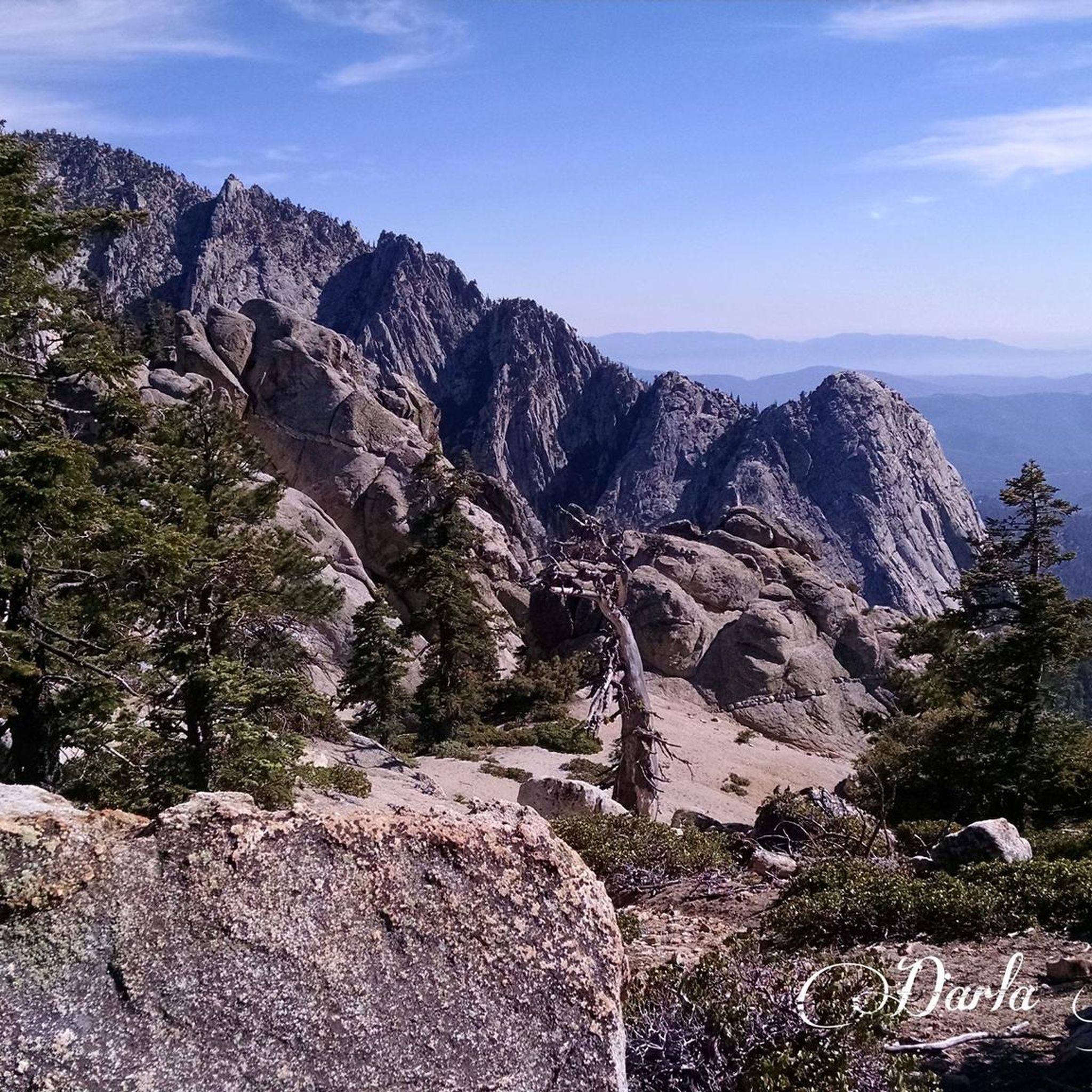
Hiking in San Jacinto Wilderness offers a diverse landscape characterized by dramatic elevation changes, ranging from approximately 6,000 feet to over 10,000 feet. The region features a striking contrast between arid desert environments and alpine settings, with pine-scented forests, sub-alpine areas, and granite peaks. Hikers can explore a variety of ecosystems, from desert oases to high mountain meadows.
Best hiking trails in San Jacinto Wilderness
- The most popular hiking route is Tahquitz Peak via Devil's Slide Trail — San Bernardino…
Last updated: June 24, 2026
4.0
(1)
86
hikers
28.5km
09:16
2,140m
20m
Hard hike. Very good fitness required. Easily-accessible paths. Suitable for all skill levels.
18
hikers
12.0km
04:30
1,290m
10m
Hard hike. Very good fitness required. Sure-footedness, sturdy shoes and alpine experience required.

Sign up for free
7
hikers
10.7km
03:36
720m
240m
Moderate hike. Good fitness required. Easily-accessible paths. Suitable for all skill levels.
1
hikers
3.87km
01:01
40m
10m
Easy hike. Great for any fitness level. Easily-accessible paths. Suitable for all skill levels.
19.3km
07:00
1,680m
390m
Hard hike. Very good fitness required. Sure-footedness, sturdy shoes and alpine experience required.
Get access to more routes and recommendations from other explorers.
Sign up for free
Already have an account?
Our route recommendations are based on thousands of hikes, rides, and runs completed by other people on komoot.
Start today with a free account
Your next adventure awaits.
Login or Signup

Other adventures in San Jacinto Wilderness

Tips from the Community

Wellman Divide is at a trail junction at 9700 feet above sea level. From here you can choose to go... South on Wellman's Cienaga Trail... East on Round Valley trail, taking you back to the restaurant... Or North on Peak Trail to the San Jacinto Summit.
0
0

With 10,883 feet, Mount San Jacinto is the highest peak in the San Jacinto Mountains. There is a network of hiking trails around the summit and the San Jacinto State Park itself. If the weather turns for the worst, you can find shelter in a little hut close to the summit. You can either take a hike from Idyllwild on the west side of the mountain or Palm Springs on the east side. There is also an aerial tramway you can use to get into the San Jacinto Wilderness. If you feel adventurous, you can cross the mountain range using the Pacific Crest Trail.
0
0
At the junction to Taquitz Valley, you will find some nice flat spots that are protected when the winds are howling along the ridge. There is also a creek which serves as a good water source.
4
0
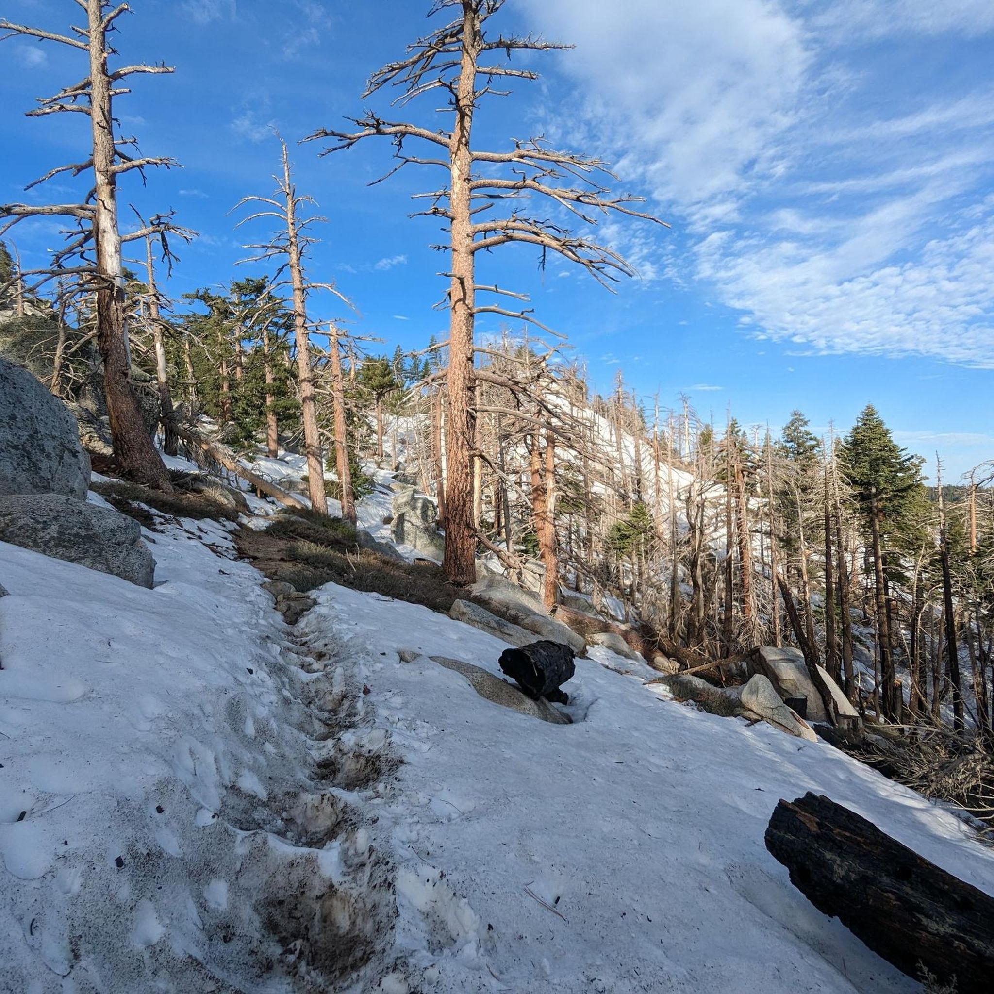
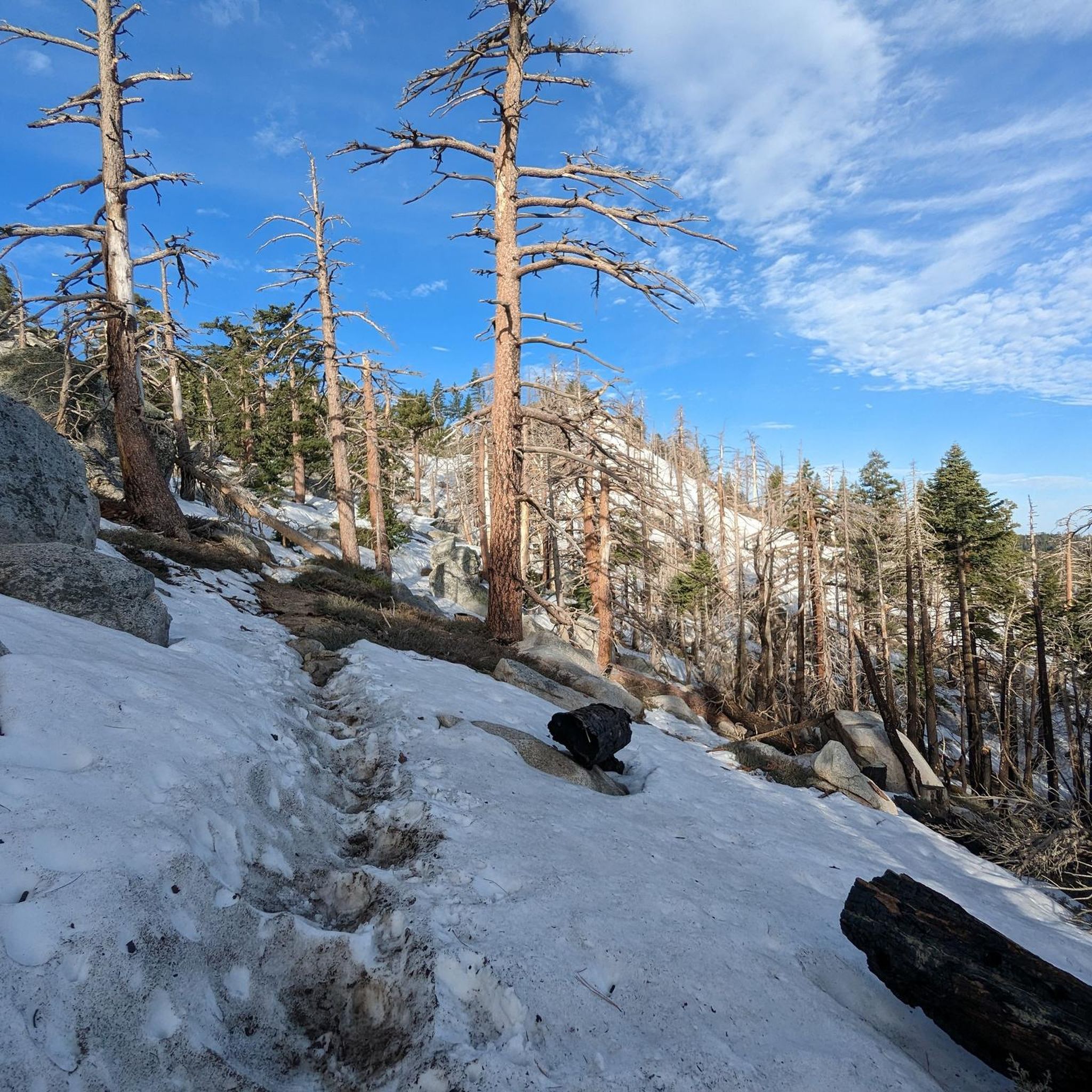
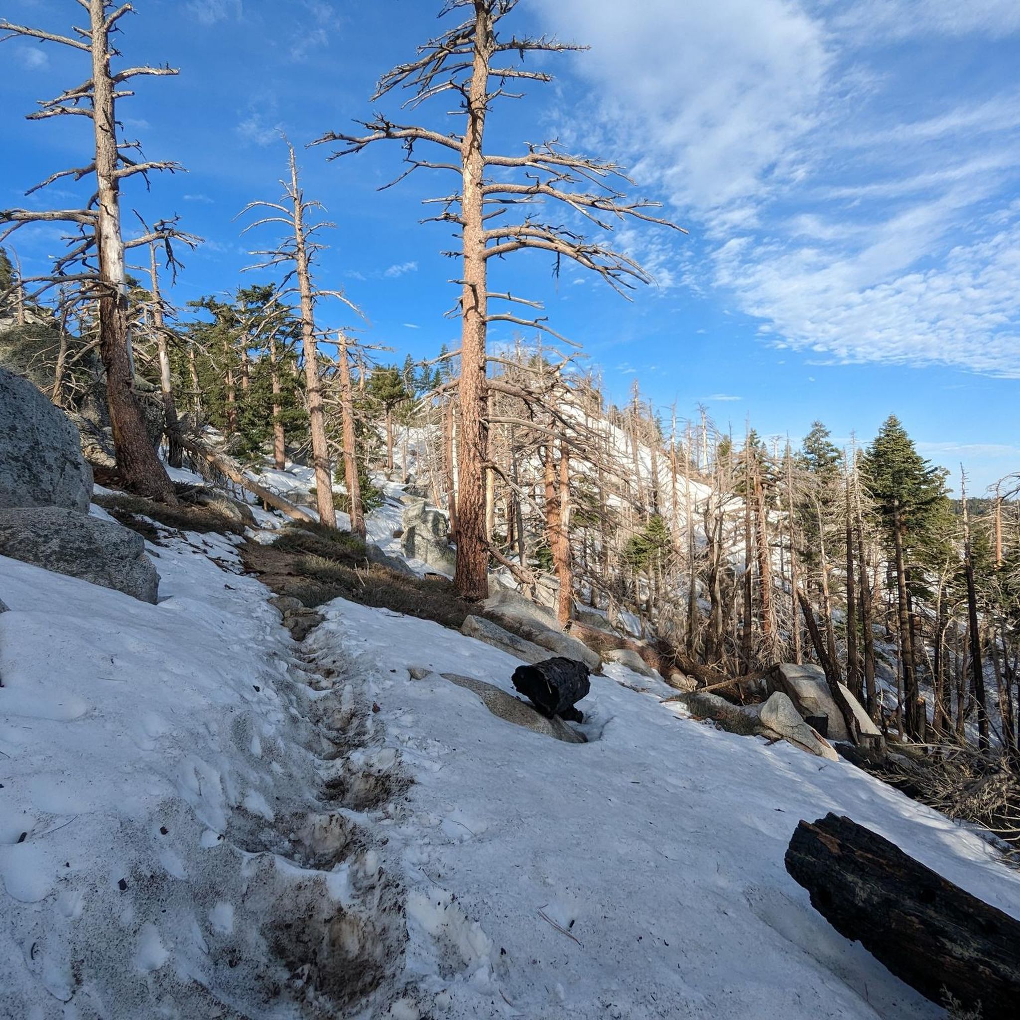
As you might expect, the Peak Trail leads you to the summit of Mount San Jacinto and the shelter hut below. There is snow very likely at least until late spring if not into early summer.
5
0
Snow Creek Road is a popular spot for trail magic that is provided for hikers of the Pacific Crest Trail and much appreciated along this hot section.
3
0
Cross over Snow Creek Paved Road momentarily. In one direction is the massive San Jacinto, and the other Cabazon and the windmill farms.
0
0
Turn a corner to some of the first views over the desert going north off San Jacinto. As you descend down the Pacific Crest Trail, the environment changes from pine forest to bouderous desert.
0
0
This is one of many Pacific Crest Trail (PCT) Markers showing hikers the emblem of the 2653 mile trail, going from the border of Mexico to the border of Canada.
0
0
Frequently Asked Questions
How many hiking trails are there in San Jacinto Wilderness?
The San Jacinto Wilderness offers over 110 hiking trails, catering to a wide range of abilities and preferences. You'll find everything from leisurely strolls to strenuous ascents, with 38 easy, 52 moderate, and 26 difficult routes available.
What are the notable natural features and landmarks to see while hiking?
The wilderness is rich with dramatic landscapes. Hikers can experience diverse ecosystems, from pine-scented forests and sub-alpine areas to granite peaks. Notable landmarks include Tahquitz Peak and Suicide Rock, both offering impressive views. The area also features unique desert oases like Palm Canyon and boulder-strewn desert canyons.
Are permits required for hiking in San Jacinto Wilderness?
Yes, free permits are required for both day hiking and overnight trips within the federal and state wilderness areas. These can be obtained at various ranger stations. It's advisable to check current regulations before your trip.
Are there any family-friendly hiking options in San Jacinto Wilderness?
Yes, the San Jacinto Wilderness offers trails suitable for families. While specific family-friendly routes are not detailed in the provided data, the overall trail network includes options for various ability levels, including leisurely walks. Look for routes categorized as 'easy' for the most suitable family experiences.
Can I bring my dog on the hiking trails?
Regulations regarding dogs can vary within wilderness areas. While the San Jacinto Wilderness is a popular hiking destination, it's important to check specific trail rules and permit requirements for dog access, as some areas, especially within state parks or federal wilderness, may have restrictions.
What is the best time of year to hike in San Jacinto Wilderness?
The San Jacinto Wilderness offers diverse conditions due to its dramatic elevation changes. Spring and fall generally provide pleasant temperatures for hiking. Summer can be hot at lower elevations but cooler in the higher mountains. Winter hiking is possible, but conditions can be challenging with snow and ice, especially at higher altitudes like San Jacinto Peak.
Are there any circular hiking routes in the San Jacinto Wilderness?
While the provided data does not explicitly list circular routes, many trails in the San Jacinto Wilderness can be combined to form loops or out-and-back options. For example, the Devils Slide Trail can be part of longer excursions to higher elevations, where various junctions allow for different return paths.
What do other hikers enjoy most about hiking in San Jacinto Wilderness?
The area is highly rated by the komoot community, with an average score of 4.8 stars from over 160 reviews. Hikers often praise the dramatic elevation changes, diverse ecosystems, and the stunning contrast between arid desert and alpine environments. The extensive trail network and panoramic views are frequently highlighted.
Is public transport available to access trailheads in San Jacinto Wilderness?
The Palm Springs Aerial Tramway provides unique access to the high-country side of the wilderness, transporting visitors from Palm Springs to Mountain Station, where numerous hiking trails begin. For other trailheads, especially those around Idyllwild, public transport options may be limited, and personal vehicles are often necessary.
Where can I park when visiting San Jacinto Wilderness trails?
Parking is available at various trailheads. For instance, many popular trails, including the Tahquitz Peak via Devil's Slide Trail, start from Humber Park in Idyllwild. Always check for specific parking regulations and fees at your chosen trailhead.
Are there any challenging hikes to San Jacinto Peak?
Yes, routes to San Jacinto Peak are challenging and offer significant elevation gain. One such difficult route is San Jacinto Peak from Idyllwild, which covers over 23 km with more than 1200 meters of ascent. Access to the peak is also possible via the Palm Springs Aerial Tramway, which shortens the hiking distance but still involves strenuous sections.
What kind of terrain can I expect on the trails?
The terrain in San Jacinto Wilderness is highly varied. You can expect everything from well-maintained paths to rugged, rocky ascents. Trails often traverse pine-scented forests, sub-alpine areas, and open granite slopes. The region's dramatic elevation changes mean you'll encounter steep climbs and descents, often with stunning panoramic views.
Most popular routes in San Jacinto Wilderness
Most popular attractions in San Jacinto Wilderness

Get inspired with the komoot mobile app


Explore more
Browse the best Hikes in other regions.
