The best cycling routes in Saint Mary'S Wilderness
4.9
(6)
33
riders
8
rides
Touring cycling in Saint Mary'S Wilderness offers routes in the surrounding region, providing access to the area's natural beauty. The landscape is characterized by rugged topography, steep ridges, and mixed hardwood forests, with elevations ranging from approximately 1,780 feet to 3,640 feet. While mechanized travel is prohibited within the wilderness area itself, nearby roads and the Blue Ridge Parkway provide scenic touring cycling opportunities. The region features mountain streams and overlooks, offering views of the diverse ecosystems.
Best touring cycling…
Last updated: July 8, 2026
6
riders
59.3km
04:10
1,190m
1,190m
Hard bike ride. Very good fitness required. Mostly paved surfaces. Suitable for all skill levels.
5.0
(2)
13
riders
92.7km
06:32
1,870m
1,870m
Hard bike ride. Very good fitness required. Mostly paved surfaces. Suitable for all skill levels.

Sign up for free
3
riders
Hard bike ride. Very good fitness required. Mostly paved surfaces. Suitable for all skill levels.
5.0
(1)
4
riders
72.1km
05:02
1,150m
1,150m
Hard bike ride. Very good fitness required. Mostly paved surfaces. Suitable for all skill levels.
2
riders
30.6km
02:43
700m
700m
Hard bike ride. Very good fitness required. Mostly paved surfaces. Suitable for all skill levels.
Get access to more routes and recommendations from other explorers.
Sign up for free
Already have an account?
Our route recommendations are based on thousands of hikes, rides, and runs completed by other people on komoot.
Start today with a free account
Your next adventure awaits.
Login or Signup
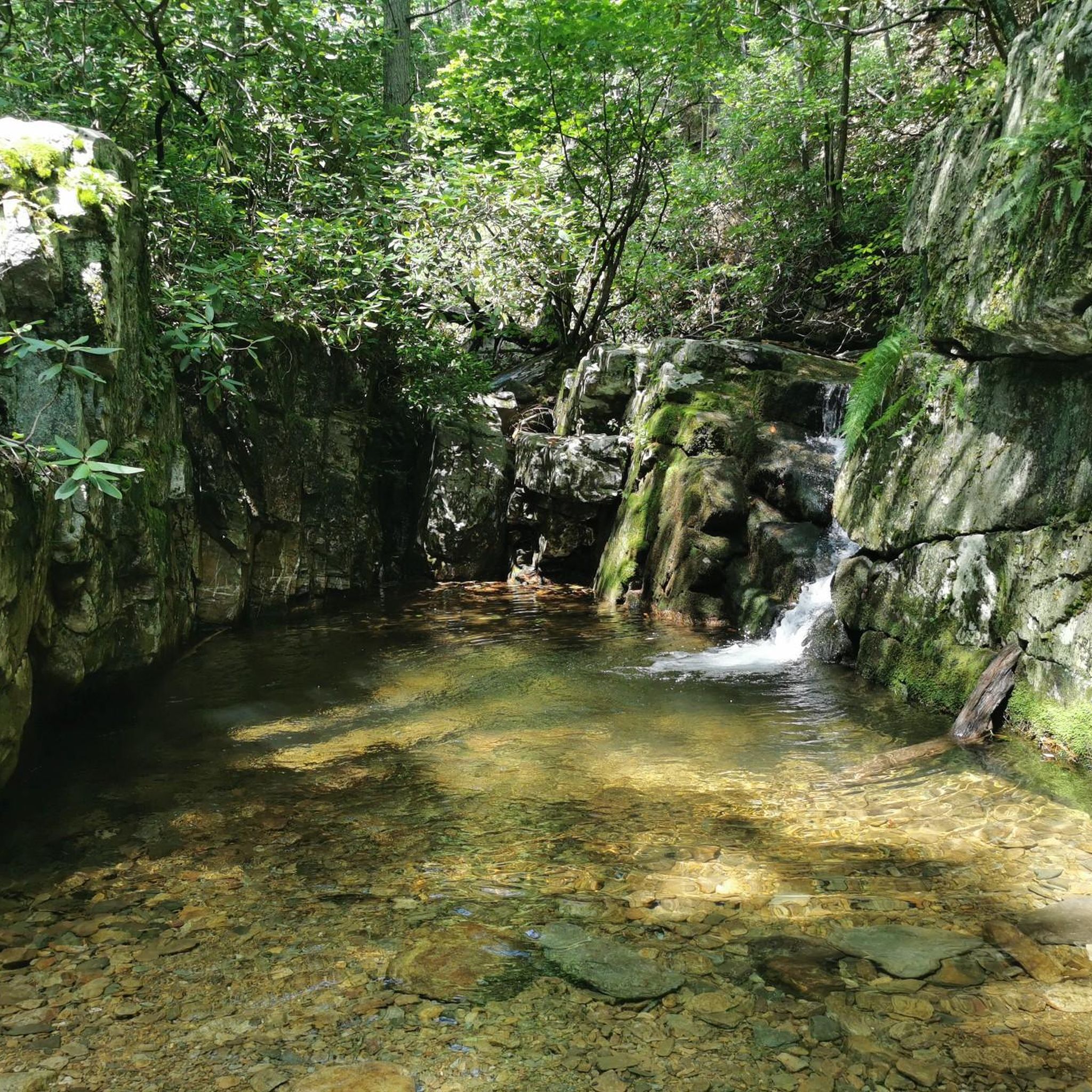


Tips from the Community

At Milepost 13.1 on the Blue Ridge Parkway is the 3 Ridges Mountain Overlook. You are at an elevation of 2,800 feet at the overlook, but the highest summit you can see from here is 3,900 feet. The Appalachian Trail also crosses the road here, so it can be a sort of busy overlook at times.
0
0
Ravens Roost Overlook is at Milepost 10.7 on the Blue Ridge Parkway and is one of the most popular overlooks in this part of Virginia. From an elevation of 3,200 feet, you can look down into the old farming valley and along mountain ridges running perpendicular to the parkway.
0
0
Located at Milepost 1.5 and at an elevation of 2,148 feet on the Blue Ridge Parkway, Rockfish Valley Overlook is a more popular stop than the nearby Afton Overlook. The Rockfish Valley Overlook is a little more than 200 feet higher in elevation and offers a wide open view of Rockfish Valley with a mountainous backdrop.
0
0
Located just 0.2 miles into the parkway, Afton Overlook is the first official overlook on the Blue Ridge Parkway. Like many of the overlooks of the parkway, this view is of the nearby town. As you climb and descend through the mountains, you get many more views of the network of valleys, rivers, and towns that help make up this unique region of the country. The Blue Ridge Parkway is a 469 mile paved highway through the states of Virginia and North Carolina. The road is extremely popular for cyclists, cars, and motorcycles, so you should always exercise caution biking on the roadways. Being maintained by the National Park Service, the Blue Ridge Parkway is known for its overlooks and access to natural and wilderness areas. Only paved roads (no paths or trails) are open to bikes within the boundaries of the parkway, and you can expect to see other visitors at most overlooks, trailheads, and campgrounds. Biking any section of the Blue Ridge Parkway offers an immersion into Southern Appalachia. Taking on the entire road in a multi-day push is an extreme undertaking for serious cyclists; that being said, any section of the parkway can be doable for cyclists with some road biking experience and the right gear.
1
0
The Sherando Lakes are commonly referred to as "the jewels of the Blue Ridge Mountains." The lower lake is much bigger than the upper lake, but both have their draws. There are a lot of recreational amenities surrounding the lakes, and there are also a number of different hiking trails that you can connect to for longer day hikes and overnight trips.
0
0
The Slacks Overlook Trail peers over the 20-minute Cliff area on the Blue Ridge Parkway. There are great views of the Copelands Rocks to the south and Upper Sherando Lake to the north.
0
0
Located at Milepost 8.8 on the Blue Ridge Parkway, Greenstone Overlook peers over the foothills of Virginia. The overlook is situated at exactly 3,000 feet on an outcrop of the Catoctin Greenstone. The rock in the area was formed from an ancient lava flow, which is unique to this particular area of Virginia.
0
0

Leave your bike at the start of the trail and hike 1.2 miles (1.9 km) to the magnificent White Rock Falls. The views are just as impressive as the falls.
0
0
Frequently Asked Questions
Can I go touring cycling directly within Saint Mary's Wilderness?
No, touring cycling and all other forms of mechanized travel, including mountain biking, are strictly prohibited within the federally designated Saint Mary's Wilderness area itself. This restriction is in place to preserve its natural condition and protect wildlife habitats. However, the surrounding region offers excellent opportunities for touring cyclists to experience the area's natural beauty.
How many touring cycling routes are available in the Saint Mary'S Wilderness region?
There are over 8 touring cycling routes available in the region surrounding Saint Mary'S Wilderness on komoot. These routes allow you to explore the rugged topography, mixed hardwood forests, and scenic overlooks characteristic of the area.
What is the general difficulty level of touring cycling routes near Saint Mary'S Wilderness?
The touring cycling routes in the Saint Mary'S Wilderness region are generally considered difficult. They feature significant elevation changes, with routes like Haines Cemetery to Ravens Roost Overlook involving over 1,100 meters of ascent, making them suitable for experienced cyclists seeking a challenge.
Are there any circular touring cycling routes in the area?
Yes, several circular touring cycling routes are available. For example, the Rockfish Valley Overlook – Afton Overlook loop from South River Number 27 Dam is a popular 53.3 km loop offering scenic views. Another option is the Trout Pond loop from Crabtree Falls Campgound, which is a 30.6 km trail through mountain terrain.
What kind of landscapes and natural features can I expect to see on a touring cycling route here?
The touring cycling routes in the Saint Mary'S Wilderness region traverse a landscape characterized by rugged topography, steep ridges, and mixed hardwood forests. You can expect scenic mountain roads and overlooks, providing views of diverse ecosystems. While cycling is outside the wilderness, you'll be in close proximity to areas with clear mountain streams and the potential for glimpses of wildlife.
What do other touring cyclists say about the routes in this region?
The touring cycling routes in the Saint Mary'S Wilderness region are highly rated by the komoot community, with an average score of 4.7 stars from several reviews. Cyclists often praise the challenging terrain, the rewarding views from overlooks, and the overall natural beauty of the area surrounding the wilderness.
Are there any family-friendly or beginner touring cycling routes available?
Given the rugged topography and significant elevation changes, most touring cycling routes in the Saint Mary'S Wilderness region are classified as difficult. There are no routes specifically designated as easy or moderate in the komoot guide for this area, so beginners or families with young children might find these routes challenging.
Where can I find parking for touring cycling routes in the Saint Mary'S Wilderness area?
Parking is typically available near the starting points of the touring cycling routes. For instance, routes like the Trout Pond loop start from locations such as Crabtree Falls Campground, where parking facilities are usually present. It's advisable to check the specific route details on komoot for parking information related to your chosen tour.
What is the best time of year to go touring cycling near Saint Mary'S Wilderness?
The best time for touring cycling in the Saint Mary'S Wilderness region generally aligns with spring, summer, and fall. Spring offers lush greenery and pleasant temperatures, while fall provides stunning foliage. Summer can be warm, but the higher elevations offer some relief. Always check local weather conditions before heading out, as mountain weather can change rapidly.
Can I see waterfalls or other water features on touring cycling routes?
While the Saint Mary's Wilderness itself is known for features like Saint Mary's Falls, touring cycling is prohibited within the wilderness. However, the surrounding region's routes often follow mountain roads that offer views of the broader landscape, which includes numerous creeks and streams. For direct access to waterfalls, you would need to explore the hiking trails within the wilderness on foot.
What kind of wildlife might I encounter while cycling in this region?
The Saint Mary'S Wilderness and its surrounding areas are home to diverse wildlife, including black bears, white-tailed deer, and various bird species. While cycling, you might spot deer or smaller mammals. Remember to maintain a respectful distance and never feed wild animals. Be aware of your surroundings, especially during dawn and dusk.
Are there any multi-day touring cycling options in the Saint Mary'S Wilderness region?
While specific multi-day tours are not explicitly listed, some routes are quite long and challenging, such as the Rockfish Valley Overlook – Afton Overlook loop from Aggies Mountain, which is over 140 km. Experienced touring cyclists could combine routes or plan overnight stays in nearby towns to create a multi-day experience, taking into account the significant elevation gains.
Most popular routes in Saint Mary'S Wilderness

Get inspired with the komoot mobile app


Explore more
Browse the best Cycling routes in other regions.
