The best cycling routes in Charles C. Deam Wilderness
19
riders
6
rides
Touring cycling in Charles C. Deam Wilderness is primarily found in the surrounding Hoosier National Forest, as wheeled vehicles are generally prohibited within the designated wilderness area itself. The broader region features rugged hills, dense hardwood forests, and diverse ecosystems, with opportunities for cycling on paved and unpaved routes. Monroe Lake forms the northern boundary, offering scenic views. The landscape includes varied terrain with moderate elevation changes, characteristic of south-central Indiana.
Best touring cycling routes in Charles C. Deam Wilderness
…Last updated: July 8, 2026
4
riders
40.2km
03:31
330m
330m
Moderate bike ride. Good fitness required. Mostly paved surfaces. Suitable for all skill levels.
2
riders
21.3km
01:59
190m
190m
Moderate bike ride. Good fitness required. Mostly paved surfaces. Suitable for all skill levels.

Sign up for free
3
riders
21.5km
02:00
190m
190m
Moderate bike ride. Good fitness required. Mostly paved surfaces. Suitable for all skill levels.
3
riders
23.2km
02:09
230m
230m
Moderate bike ride. Good fitness required. Mostly paved surfaces. Suitable for all skill levels.
2
riders
18.5km
01:28
200m
200m
Moderate bike ride. Good fitness required. Mostly paved surfaces. Suitable for all skill levels.
Our route recommendations are based on thousands of hikes, rides, and runs completed by other people on komoot.
Start today with a free account
Your next adventure awaits.
Login or Signup



Tips from the Community

Trailhead for the Nebo Ridge Trail, starting in the north. Parking is located right next to the trailhead.
0
0
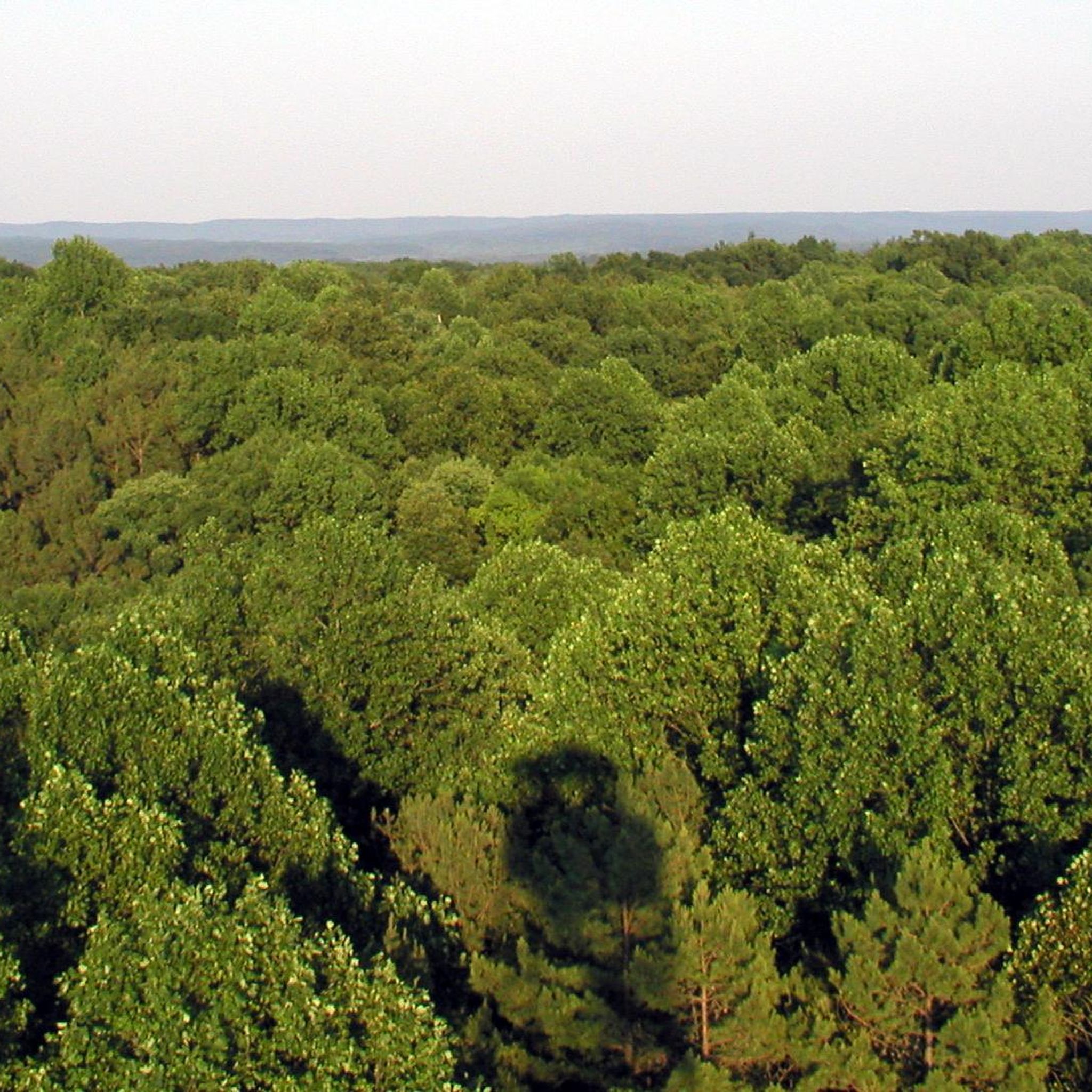
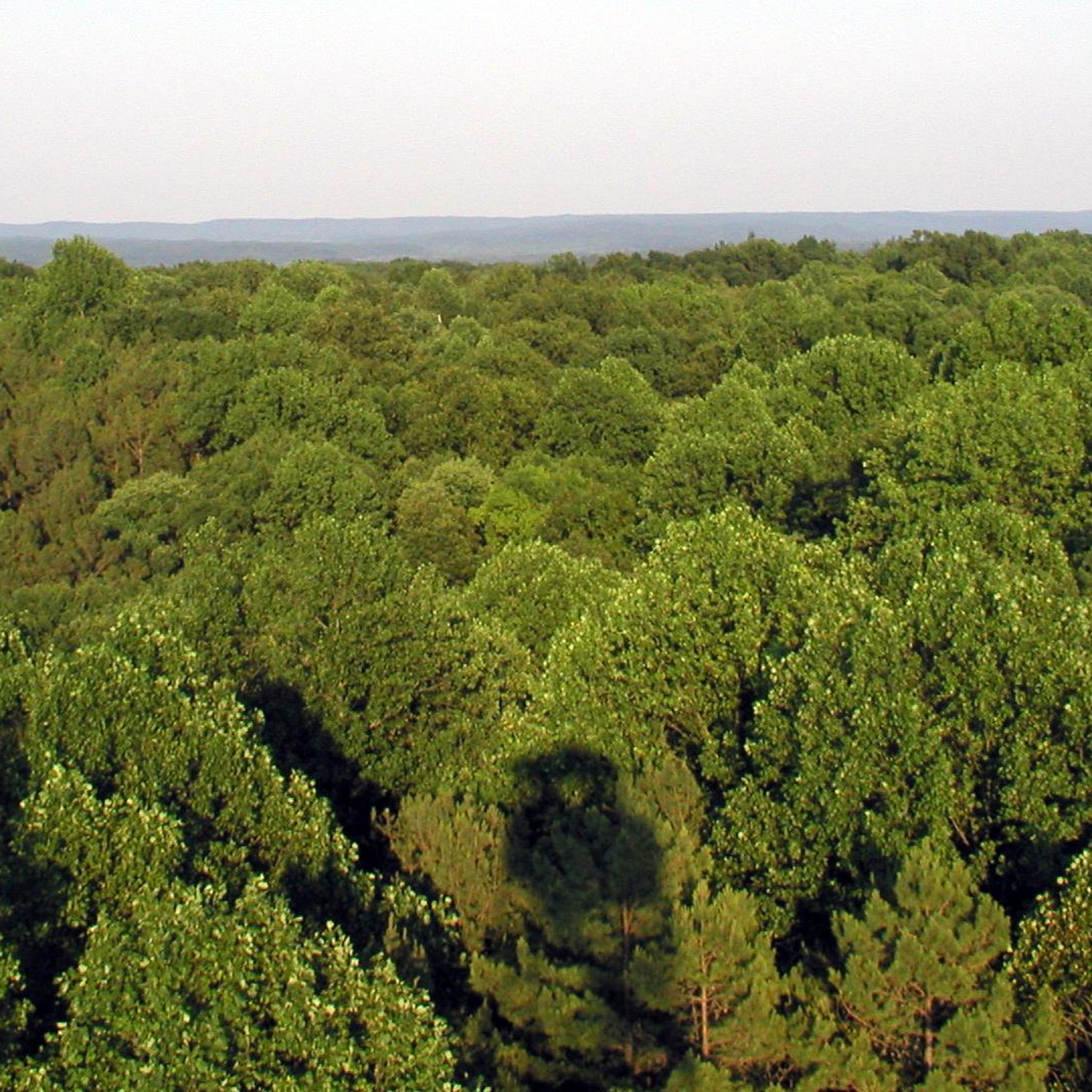
The Hickory Ridge Lookout Tower was constructed in 1936 in order to aid the National Park Service in spotting forest fires. The tower was manned for almost 40 years, until modern technologies superseded the need for human lookouts. The tower still stands as an observation point, and anyone who wants to scale the 133 steel steps will be rewarded with breathtaking views of the surrounding landscapes.
0
0
Frequently Asked Questions
Is touring cycling permitted within the Charles C. Deam Wilderness?
No, touring cycling and other wheeled vehicles are generally not permitted within the designated Charles C. Deam Wilderness area itself. However, the broader Hoosier National Forest and areas adjacent to the wilderness offer various cycling opportunities on roads and trails.
What kind of cycling can I do near the Charles C. Deam Wilderness?
While the wilderness itself is restricted, the surrounding Hoosier National Forest provides options for touring cycling on paved and unpaved roads. For mountain biking, areas like the Hickory Ridge Trail System (Trail 4) and Hardin Ridge Trail are available. Komoot also features several touring routes in the wider region, such as the Hickory Ridge Lookout Tower loop from Horsecamp Hill.
What are the typical difficulty levels for touring cycling routes in this region?
The touring cycling routes in the Charles C. Deam Wilderness region range from moderate to difficult. You can expect rolling hills and moderate elevation changes, characteristic of south-central Indiana's rugged terrain. For example, the Lake Monroe loop from Fairfax State Recreation Area is considered difficult, while routes like Wilkerson Hill loop from Nashville are moderate.
Are there any scenic viewpoints or landmarks to see while cycling?
Yes, the region offers several scenic spots. The Hickory Ridge Lookout Tower provides breathtaking panoramic views over the expansive forest. You can also find scenic views of Monroe Lake, Indiana's largest reservoir, which forms the northern boundary of the wilderness. The landscape also features fascinating karst topography with caves and sinkholes.
What is the best time of year for touring cycling in the Charles C. Deam Wilderness region?
Spring and fall generally offer the most pleasant cycling conditions with milder temperatures and beautiful foliage. Summer can be hot and humid, while winter may bring cold temperatures and potential for ice or snow, making some routes less accessible. Always check local weather conditions before heading out.
Are there any family-friendly cycling options near the wilderness?
While the designated wilderness area itself is not suitable for family cycling due to restrictions, the broader Hoosier National Forest and nearby recreation areas may offer more gentle, paved routes or trails suitable for families. It's advisable to check specific trail descriptions for suitability and difficulty before planning a family outing.
Can I bring my dog on cycling routes in the area?
Regulations regarding dogs vary by specific trail and area within the Hoosier National Forest. While dogs are generally welcome on many trails if kept on a leash, it's always best to verify the rules for the particular route or park you plan to visit to ensure it is dog-friendly.
Are there any loop routes available for touring cyclists?
Yes, several loop routes are available for touring cyclists in the region. Examples include the popular Hickory Ridge Lookout Tower loop from Horsecamp Hill, the Wilkerson Hill loop from Nashville, and the Bike loop from Eastern Heights, offering varied distances and terrains.
Where can I park my car when cycling in the Charles C. Deam Wilderness region?
Parking is typically available at designated trailheads and recreation areas within the broader Hoosier National Forest that permit cycling. For routes like the Hickory Ridge Lookout Tower loop, you might find parking near Horsecamp Hill. Always check the specific route details on komoot for recommended starting points and parking information.
What kind of natural features can I expect to see along the cycling routes?
The region is characterized by rugged hills, dense hardwood forests, and diverse ecosystems. You'll encounter varied terrain, including areas with fascinating karst topography featuring caves like Patton Cave and sinkholes. The routes often provide glimpses of the rich wildlife, including white-tailed deer and various bird species.
How long do the touring cycling routes typically take to complete?
The duration of touring cycling routes varies depending on their length and difficulty. For instance, the Hickory Ridge Lookout Tower loop from Horsecamp Hill is about 25 miles and takes approximately 3 hours 30 minutes, while the shorter Bike loop from Woodview Hills, at 11.6 miles, can be completed in about 1 hour 30 minutes.
Are there any cafes or places to eat near the cycling routes?
While the wilderness area itself is remote, you can find cafes, pubs, and accommodation in nearby towns such as Nashville or Bloomington. It's recommended to plan your stops in advance, especially for longer rides, as amenities might not be directly along every route.
Most popular routes in Charles C. Deam Wilderness
Most popular attractions in Charles C. Deam Wilderness

Get inspired with the komoot mobile app


Explore more
Browse the best Cycling routes in other regions.
