The best road cycling routes around Stockholm
37
riders
4
rides
Road cycling around Stockholm is characterized by a blend of urban landscapes, extensive natural areas, and a strong cycling infrastructure. The city's geography includes numerous islands, waterways, and green spaces, providing a diverse backdrop for cycling. Terrain is generally flat with gentle hills, accommodating various fitness levels. Routes often pass through charming neighborhoods, farmlands, and coastal areas.
Best road cycling routes around Stockholm
- The most popular road cycling route is Geographic Monument/Scenic Overlook – View of the Mississippi River loop from Lake Pepin, a 74.1 miles (119.3 km) trail that takes 5 hours 24 minutes to complete. This difficult route features an elevation gain of 2,281 feet (695 meters).
- Another top favourite among local road cyclists is Red Wing Arts – Bay Point Park loop from Lake Pepin, a moderate 39.3 miles (63.2 km) path. This route includes 874 feet (266 meters) of elevation gain.
- Local road cyclists also love the Geographic Monument/Scenic Overlook – Wabasha Hill loop from Lake Pepin, a 41.7 miles (67.1 km) trail leading through varied terrain, often completed in about 3 hours 39 minutes.
- Road cycling around Stockholm is defined by urban paths, coastal routes, and green spaces. The network offers options for different ability levels, from moderate to difficult.
- The guide includes highly-rated routes that showcase the best of the region's landscape. More than 30 road cyclists have used komoot to explore Stockholm's varied terrain.
Last updated: June 28, 2026
34
riders
Hard road ride. Very good fitness required. Mostly well-paved surfaces and easy to ride.
1
riders
48.5km
02:07
370m
370m
The View of the Mississippi River loop from Pepin offers a truly classic Midwestern road cycling experience, tracing the majestic Mississippi River with its dramatic bluffs and serene bottomlands. You'll pedal through a landscape where the river is a constant companion, passing by charming small cities and enjoying the open road. The scenery is a significant draw, making this one of the best bike routes near Pepin, Wisconsin, for those who love river vistas.
This moderate route covers 30.1 miles (48.5 km) with 1198 feet (365 metres) of elevation gain, typically taking about 2 hours and 7 minutes to complete. Much of the ride follows the Great River Road (WIS 35), which often provides wider paved shoulders for safety, though some county roads might have narrower sections. It's a great option for cyclists looking for a substantial ride with a good mix of rolling terrain and scenic overlooks.
As part of the larger Mississippi River Trail (MRT) and the Great River Road National Scenic Byway, this loop is well-regarded for its accessibility and scenic value. It connects you to the unique recreational and cultural opportunities of the region, offering a blend of dedicated multi-use paths and paved road shoulders. The route's popularity stems from its consistent river views and the chance to explore the historic Mississippi Valley.

Sign up for free
1
riders
63.6km
02:46
280m
280m
The Red Wing Arts – Bay Point Park loop from Lake Pepin offers a unique road cycling experience, blending scenic river views with cultural exploration. You'll ride through rolling countryside and river valleys, enjoying extensive vistas of the Mississippi River and the wide expanse of Lake Pepin. Keep an eye out for public art installations, including a tipi sculpture, as you pass through Bay Point Park, adding an artistic dimension to your ride.
This moderate road cycling route covers 39.5 miles (63.6 km) with 924 feet (282 metres) of elevation gain, typically taking about 2 hours and 46 minutes. It's best suited for cyclists with good fitness levels who appreciate varied terrain and cultural stops. Consider starting your ride from Bay Point Park, a key landmark on the route, and plan for stops in charming river towns like Stockholm or Pepin for refreshments.
What sets this route apart is its integration with Red Wing's vibrant arts scene, allowing you to combine physical activity with cultural enrichment. The Red Wing Art Walk showcases over 30 contemporary and permanent art pieces, with rotating installations in the downtown area and along the riverfront. This makes the loop more than just a ride; it's a journey through art and nature.
49.3km
02:13
460m
460m
Moderate road ride. Good fitness required. Mostly well-paved surfaces and easy to ride.
1
riders
67.1km
03:39
600m
600m
Moderate road ride. Good fitness required. Some segments of this route may be unpaved and difficult to ride.
Our route recommendations are based on thousands of hikes, rides, and runs completed by other people on komoot.
Start today with a free account
Your next adventure awaits.
Login or Signup
Popular around Stockholm
Tips from the Community

In 1686, French explorer Nicholas Perrot established Fort St. Antoine on the shores of Lake Pepin, an expansive stretch of the Mississippi River. Intended as a fortified trading post, the fort helped forge alliances and expand the French fur trade with the Dakota and other local tribes. On May 8, 1689, Perrot held a ceremony at the fort to formally claim the entire Upper Mississippi Valley for France. However, due to conflict in the region and the fort’s crude construction, it was abandoned around 1690. No physical trace of the fort remains today, but its location is commemorated by Wisconsin State Historical Marker 22 along the Great River Road, overlooking scenic Lake Pepin.
3
0

Nice place to see the river, playground, picnic area, benches along the shore line. I have peddled it several times, but it's not very good for that, small trails and a lot of people walking 2 by 2 that don't hear that you want to go past them.
0
0
Menu looks interesting, the building didn't look super friendly in the winter
0
0
Nice parking lot and access to the trail. During the summer has a porta potty too. (Didn't today for some reason)
0
0
Great beer and pizza, nice stop at the end of the trail before turning to head back to Welch or Cannon Falls.
1
0

Bay Point Park in Red Wing is a well equipped riverside park that also plays host to a number of community events. There's also a boat launch, picnic tables, playground, and volleyball court.
0
0

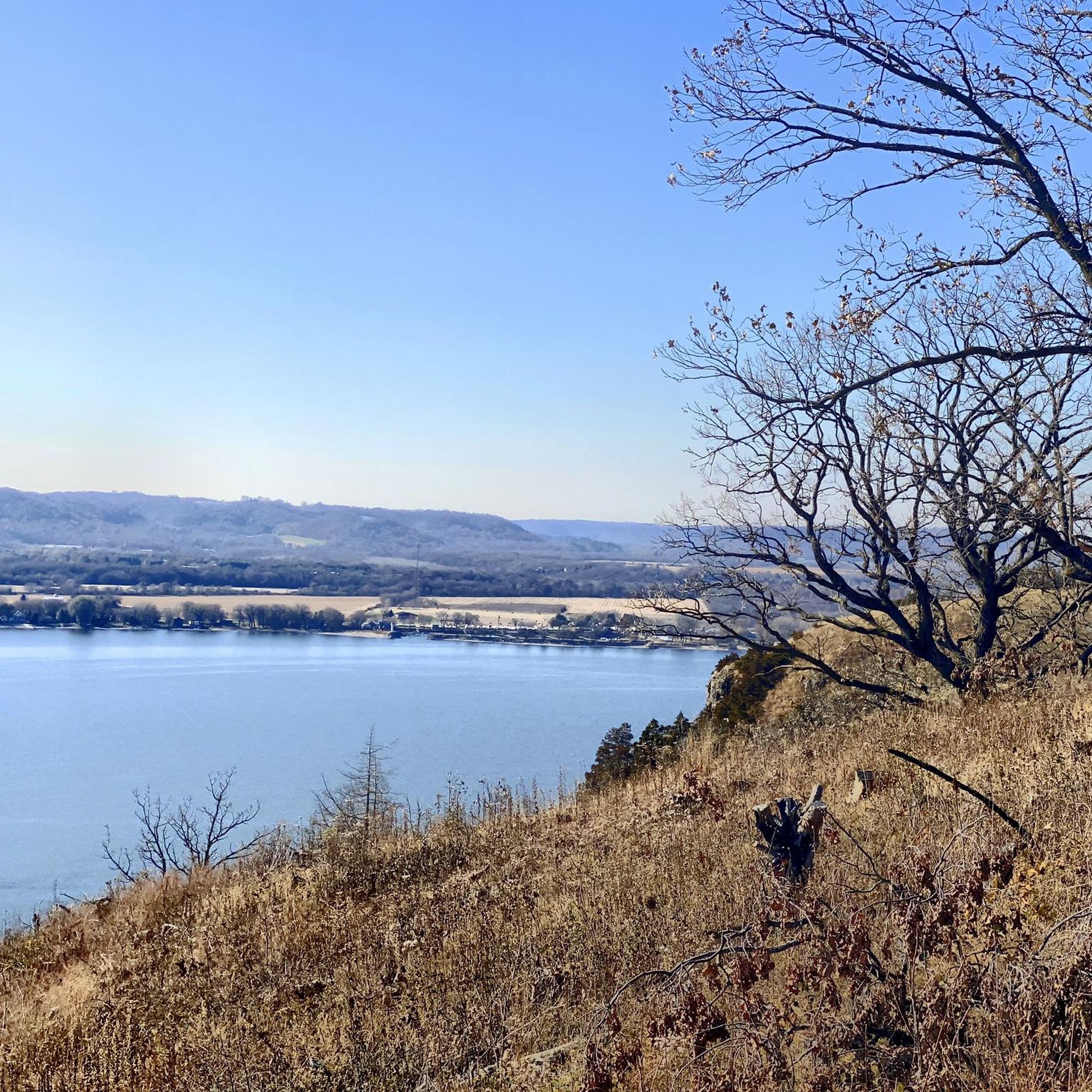
A few plaques old and new and a beautiful view of Lake Pepin. No picnic tables or other facilities.
0
0
Frequently Asked Questions
What kind of terrain can I expect when road cycling around Stockholm?
Stockholm's road cycling terrain is diverse, featuring a blend of urban landscapes, extensive natural areas, and numerous islands and waterways. You'll find generally flat paths with gentle hills, accommodating various fitness levels. Routes often pass through charming Swedish neighborhoods, farmlands, and coastal areas, offering picturesque views of the Baltic Sea and Lake Mälaren.
Are there many cycle paths in Stockholm?
Yes, Stockholm boasts an extensive cycling infrastructure with over 1,000 km of cycle paths. Bike paths are a city-planning priority, with routes extending along the entire harbor and across many of its largely traffic-free, park-like islands.
What are some scenic areas for road cycling within Stockholm city limits?
Within the city, you can enjoy tranquil rides through leafy parks and open grasslands on Djurgården island, or explore the vibrant urban landscape and panoramic views from Södermalm Island. Cycling along Strandvägen offers views of historic sloops and impressive architecture, while the perimeters of Gamla Stan and Kungsholmen provide a mix of urban and natural beauty.
Can I find routes that offer views of the Stockholm archipelago or lakes?
Absolutely. Many routes offer stunning views of the Stockholm archipelago, especially those along coastal areas. For lake views, the trendy shoreline of Lake Mälaren provides beautiful cycling opportunities, including a more adventurous 50 km loop that passes numerous beaches and offers views of Drottningholm Palace.
Are there any historical or cultural sites accessible by road bike?
Yes, Stockholm's cycling routes often pass by significant historical and cultural sites. You can cycle to Riddarholmen island with its historic church, explore Gamla Stan (Old Town), or visit attractions on Djurgården like the Vasa Museum, ABBA Museum, and Skansen folk museum.
What is the difficulty level of road cycling routes in Stockholm?
The routes around Stockholm cater to various abilities. While the terrain is generally flat with gentle hills, you can find options ranging from moderate to more difficult. For example, some routes around Lake Mälaren can be quite long, offering a good challenge.
What do other road cyclists enjoy most about cycling in Stockholm?
The komoot community frequently praises Stockholm's diverse landscapes, from urban paths to serene natural reserves, and the excellent cycling infrastructure. Cyclists particularly enjoy the blend of city sights with peaceful natural areas, and the opportunity to combine rides with 'fika' breaks at numerous cafes along the routes.
Are there any natural reserves or parks suitable for road cycling near Stockholm?
Yes, several natural reserves are easily accessible. While some feature gravel roads, areas like Nacka Nature Reserve offer scenic cycling paths. For those seeking more rugged experiences, Tyresta National Park and Paradiset Nature Reserve provide diverse terrain, though some sections might be better suited for gravel or mountain bikes.
Can I combine road cycling with public transport to access longer routes?
Yes, Stockholm's public transport system is well-integrated, making it easy to combine rides. You can use public transport to reach starting points for longer rides outside the immediate city center, enhancing your cycling experience and allowing you to explore further afield.
Are there any specific attractions or landmarks I should look out for while cycling?
Along your rides, you can discover various attractions. On Djurgården, you might pass Rosendals Slott or Rosendals Garden Café. On Södermalm, enjoy panoramic city views from Monteliusvägen or Skinnarviksberget. Further out, Drottningholm Palace on Lovö island is a notable landmark. For specific points of interest, consider visiting Seine Hill or the Site of Fort St. Antoine (1686) Historic Marker and Wayside.
What are the options for taking a break or getting refreshments during a ride?
Stockholm's cycling culture embraces 'fika' (coffee and cake) breaks. You'll find numerous cafes along the routes, especially in popular areas like Djurgården (e.g., Rosendals Garden Café) and around Lake Mälaren. Some nature reserves like Hellasgården also have cafes. For a meal, The Pickle Factory Bar and Grill is an option.
Are there any circular road cycling routes in Stockholm?
Yes, Stockholm offers several excellent circular routes. A popular choice is the 13 km route around Djurgården, which follows the scenic shoreline. Another is the 14 km loop around Södermalm Island, navigating quays and natural sections. For a longer ride, a 50 km loop around Lake Mälaren is also available.
Most popular routes around Stockholm
Most popular attractions around Stockholm

Get inspired with the komoot mobile app


