The best road cycling routes around Roy
4.6
(42)
436
riders
26
rides
Road cycling routes around Roy are characterized by a rural setting, agricultural surroundings, and views of distant natural landmarks. The area is situated near the Muck and Nisqually valleys, featuring pastures and farmlands. While the region is relatively flat, some routes offer varied topography. The planned extension of the Yelm-Rainier-Tenino Trail will further enhance dedicated, paved cycling options.
Best road cycling routes around Roy
- The most popular road cycling route is Denver and Rio Grande Western Rail Trail, a…
Last updated: July 2, 2026
3.0
(1)
28
riders
78.7km
03:04
160m
160m
Moderate road ride. Good fitness required. Mostly well-paved surfaces and easy to ride.
9
riders
49.5km
02:31
710m
710m
Moderate road ride. Good fitness required. Mostly well-paved surfaces and easy to ride.

Sign up for free
9
riders
15.7km
00:41
20m
20m
Easy road ride. Great for any fitness level. Mostly well-paved surfaces and easy to ride.
3
riders
84.5km
03:59
1,010m
1,010m
Hard road ride. Very good fitness required. Mostly well-paved surfaces and easy to ride.
4.3
(3)
34
riders
68.3km
02:39
160m
160m
Moderate road ride. Good fitness required. Mostly well-paved surfaces and easy to ride.
Get access to more routes and recommendations from other explorers.
Sign up for free
Already have an account?
Our route recommendations are based on thousands of hikes, rides, and runs completed by other people on komoot.
Start today with a free account
Your next adventure awaits.
Login or Signup


Tips from the Community

The Legacy Nature Preserve encompasses 2,100 acres of wetlands set aside for wildlife. The preserve can only be viewed from the Legacy Parkway Trail.
0
0

Short bike path (about 0.5 mile) bordering a large park providing an easy connection between D&RGW rail trail and Legacy Parkway trail.
0
0


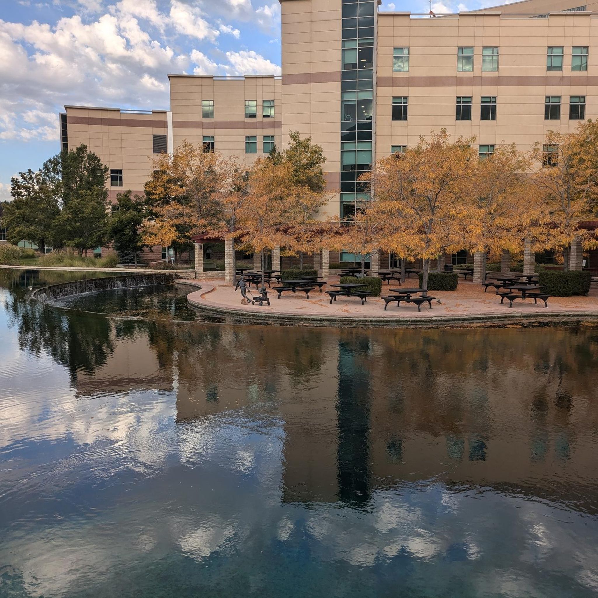
Steed Pond is a lovely little pond next to the D&RGW Trail. Theres plenty of grass around it and shaded from trees to rest under on a hot summers day.
0
0
The Legacy Nature Preserve encompasses 2,100 acres of wetlands set aside for wildlife. The preserve can only be viewed from the Legacy Parkway Trail.
0
0

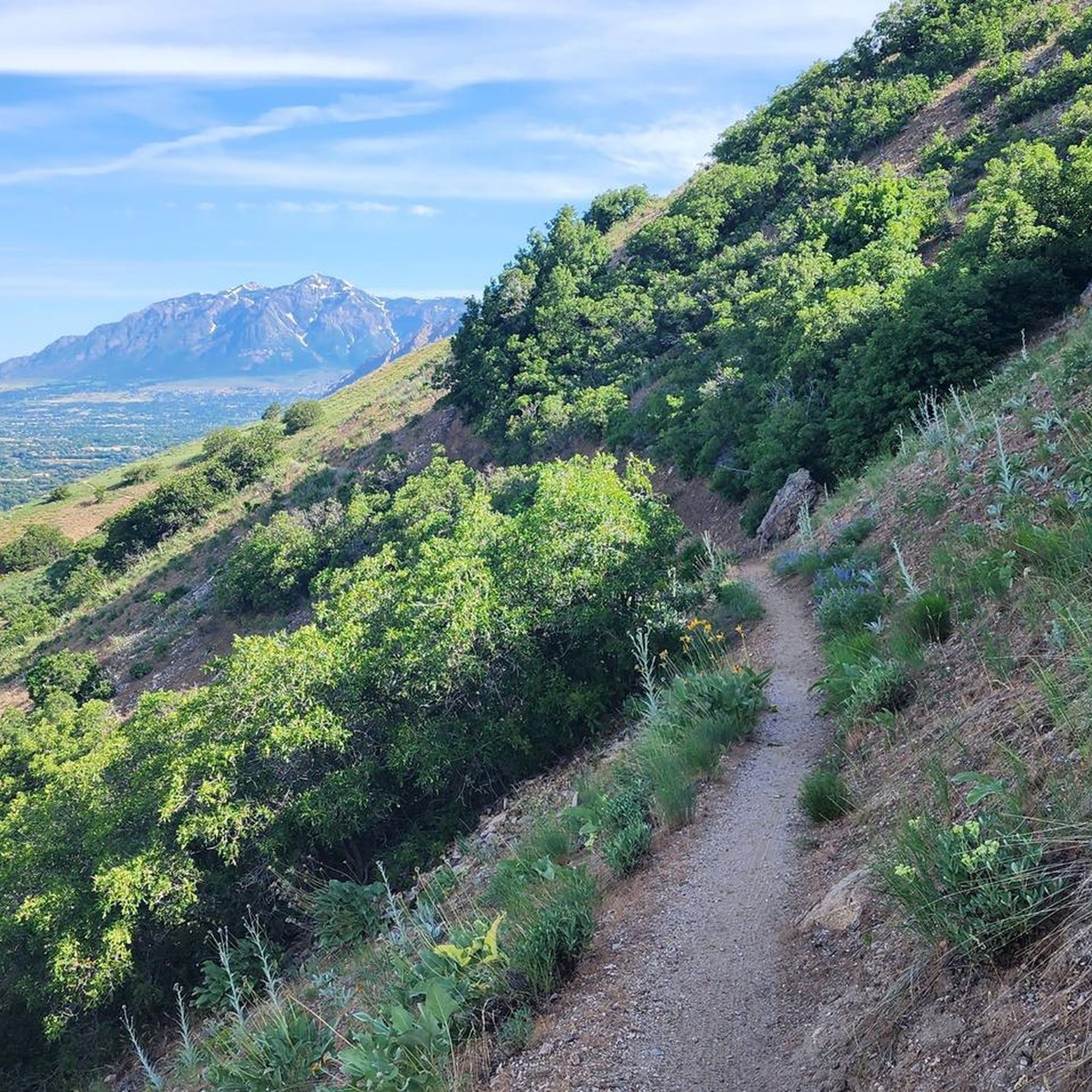
The Denver and Rio Grande Western Rail Trail (D&RGW Rail Trail) is a 24-mile long paved path from Roy to Bountiful. This section of the trail, between West Barton Lane and Clark Lane, is rather flat and offers absolutely breathtaking views of the mountains to the east. A nice escape from the cars to really take in the scenery!
0
0
Ogden is set adjacent to the Wasatch Mountains and is the gateway for the Snowbasin and Powder Mountain ski resorts. Offering a variety of food an drink options for during or after a ride, it is a great starting point for rides out in Uinta-Wasatch-Cache National Forest.
0
0
Known by locals as "The Divide", North Ogden Canyon Road is a breathtaking 6-mile stretch of asphalt not to miss in the area! Nestled in Uinta-Wasatch-Cache National Forest, the road offers lush mountain views. The climb tops out at 6,190 ft, climbing with a maximum gradient of 11%. Beware of avalanche risk during the winter and spring.
0
0
Frequently Asked Questions
How many road cycling routes are available around Roy?
There are over 25 road cycling routes around Roy, offering a variety of experiences for different skill levels. You'll find everything from easy parkway rides to more challenging loops with significant elevation gain.
What kind of terrain can I expect on road cycling routes near Roy?
Road cycling around Roy is characterized by rural roads, farmlands, and scenic views. While many routes are relatively flat, especially those following former railway lines like the Denver and Rio Grande Western Rail Trail, others, such as the Pineview Reservoir via North Ogden Canyon Road loop, include significant elevation gain, providing varied topography.
Are there any easy road cycling routes suitable for beginners or families?
Yes, Roy offers several easy routes. The Weber River Parkway is a great option, leading through a river corridor and offering a generally flat and accessible ride. There are 17 easy routes in total, perfect for a relaxed outing.
Where can I find challenging road cycling routes with significant climbs?
For those seeking a challenge, routes like the Pineview Reservoir via North Ogden Canyon Road loop offer substantial elevation gain, providing a demanding ride with rewarding views of the surrounding landscape and Pineview Reservoir. There are 3 difficult routes available.
What natural features or landmarks can I see while cycling around Roy?
The region offers picturesque views of Mount Rainier and the surrounding prairie lands. You can also explore areas near the Muck and Nisqually valleys, characterized by pastures and farmlands. Specific highlights include the Weber River Parkway and the Ogden River Parkway. The 21st Street Pond (Goode Ski Lake) is another notable spot.
What do other cyclists say about road cycling in Roy?
The road cycling routes around Roy are highly rated by the komoot community, with an average score of 4.6 stars from over 30 reviews. Cyclists often praise the tranquil rural roads, scenic farmlands, and the distant views of Mount Rainier.
Are there any long-distance road cycling routes near Roy?
Yes, for longer rides, consider routes like the Denver and Rio Grande Western Rail Trail, which spans nearly 49 miles (78.7 km) and follows a generally flat, scenic path. Another option is the Pineview Reservoir via North Ogden Canyon Road loop, which is over 52 miles (84.5 km).
What is the best season for road biking in Roy, Washington?
The rural nature of Roy makes spring and summer particularly appealing, when pastures and farmlands bloom with camas flowers and lupine. These seasons offer pleasant weather and vibrant scenery for cycling. Always check local weather conditions before heading out.
Is there public transport access to cycling routes in Roy?
Currently, the primary access to road cycling routes in Roy is typically by car. However, there are plans for the extension of the Yelm-Rainier-Tenino Trail to Roy, which will eventually provide a dedicated paved path and improve connectivity to a regional trail system. For more information on the trail, you can visit Wikipedia.
Are there any loop road bike trails around Roy?
Yes, there are several loop options for road cyclists. The Ogden Canyon Kiln via Pineview Reservoir loop and the Pineview Reservoir via North Ogden Canyon Road loop are examples of routes designed as loops, allowing you to start and end at the same point.
Can I find quiet road cycling routes away from heavy traffic in Roy?
Absolutely. Roy's rural setting and agricultural surroundings mean many of its roads offer a tranquil cycling experience away from heavy urban traffic. The routes traversing farmlands provide a peaceful backdrop for your ride.
Most popular routes around Roy
Most popular attractions around Roy

Get inspired with the komoot mobile app


Explore more
Browse the best Road cycling routes in other regions.
