The best road cycling routes around Mowbray Mountain
5.0
(1)
28
riders
11
rides
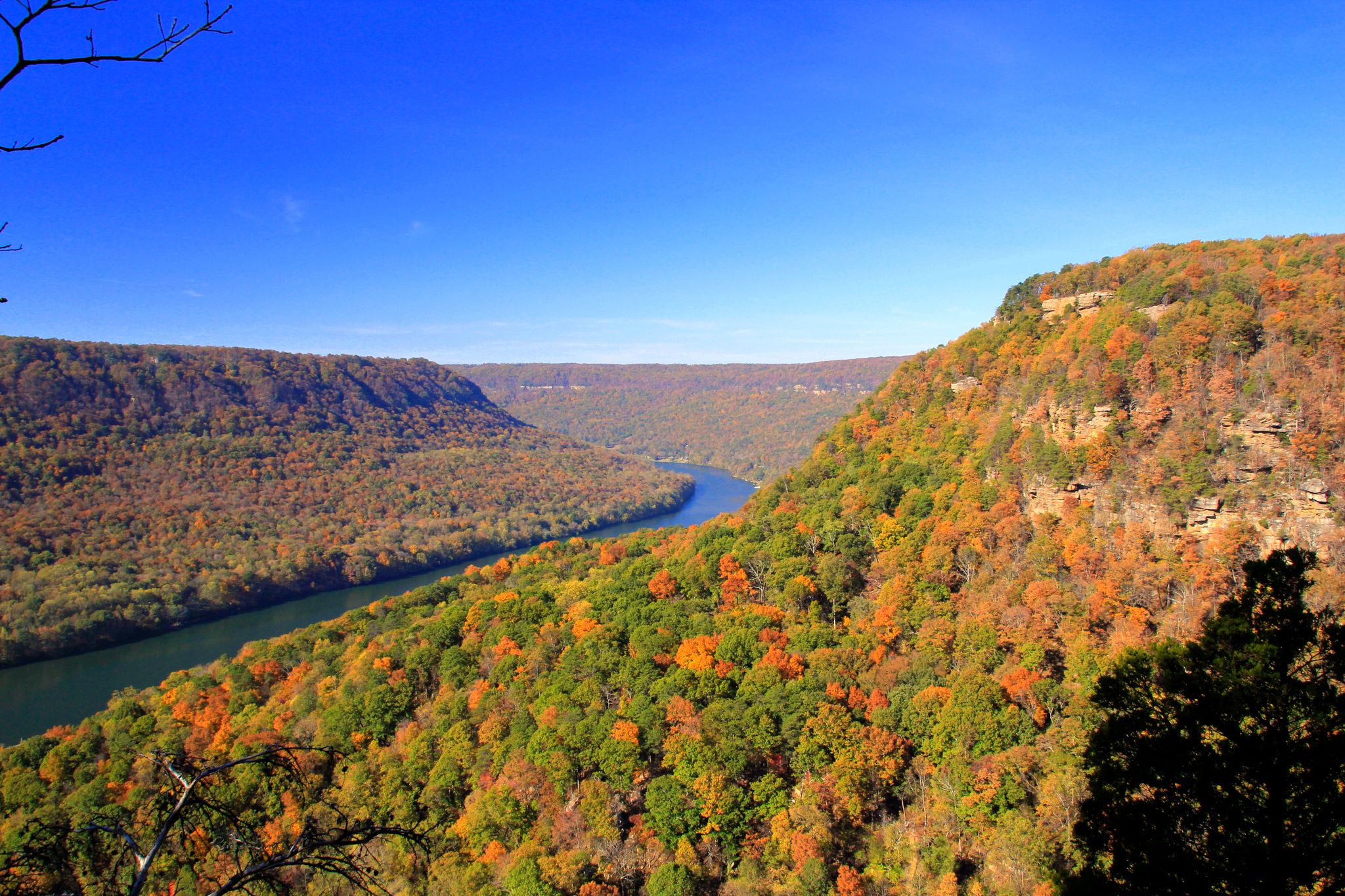
Road cycling routes around Mowbray Mountain feature diverse landscapes, including lush forests and rolling hills, characteristic of the Cumberland Plateau. The area offers rugged terrain and winding mountain roads that provide panoramic views. Elevations can reach over 1,800 feet, with notable climbs like Montlake Road presenting sections with gradients above 10%. This region provides a variety of road cycling experiences away from urban areas.
Best road cycling routes around Mowbray Mountain
- The most popular road cycling route is Bakewell Mountain…
Last updated: June 5, 2026
5.0
(1)
5
riders
101km
05:03
1,020m
1,020m
Hard road ride. Very good fitness required. Mostly well-paved surfaces and easy to ride.
1
riders
34.5km
01:41
490m
490m
Moderate road ride. Good fitness required. Mostly well-paved surfaces and easy to ride.

8
riders
31.1km
01:34
280m
280m
Easy road ride. Great for any fitness level. Mostly well-paved surfaces and easy to ride.
10
riders
143km
07:13
1,390m
1,390m
Hard road ride. Very good fitness required. Mostly well-paved surfaces and easy to ride.
4
riders
62.4km
03:16
700m
700m
Moderate road ride. Good fitness required. Mostly well-paved surfaces and easy to ride.
Get access to more routes and recommendations from other explorers.
Already have an account?
Our route recommendations are based on thousands of hikes, rides, and runs completed by other people on komoot.
Start today with a free account
Your next adventure awaits.
Popular around Mowbray Mountain

Other adventures around Mowbray Mountain

Tips from the Community

The Sequatchie River flows 116 miles through the Sequatchie Valley before emptying into the Tennessee River. The river is known for excellent fishing, as well as canoeing and kayaking.
0
0

Catch lush & stunning views of the surrounding Appalachian Mountains from Bakewell Mountain!
0
0
Located in the town of Montlake, Montlake is a local icon. Situated atop a mountain with unknown depths, this sinkhole is an incredibly unique and interesting lake with vibrant hues, chemically pure water, and massive sandstone walls.
0
0
Chickamauga Reservoir, nestled along the Tennessee River, captivates with its expansive waters and picturesque shores.
0
0
Frequently Asked Questions
How many road cycling routes are available around Mowbray Mountain?
There are over 10 road cycling routes around Mowbray Mountain, offering a variety of experiences from moderate loops to more challenging, long-distance rides. The komoot community has explored these diverse routes extensively.
What kind of terrain can I expect when road cycling in Mowbray Mountain?
Road cycling in Mowbray Mountain features diverse landscapes, including lush forests and rolling hills characteristic of the Cumberland Plateau. You'll encounter rugged terrain and winding mountain roads that provide panoramic views, with elevations reaching over 1,800 feet.
Are there challenging climbs for experienced road cyclists in the Mowbray Mountain area?
Yes, Mowbray Mountain offers significant challenges for experienced road cyclists. Notable climbs like Montlake Road present sections with gradients above 10%. Routes such as the Bakewell Mountain & Chickamauga Reservoir loop feature over 1,000 meters of elevation gain, providing a demanding yet rewarding experience.
Can I find easier or beginner-friendly road cycling routes around Mowbray Mountain?
While many routes offer significant climbs, there are options for varying skill levels. The Read Lake loop from Falling Water is an example of an easier route, covering about 31 kilometers with less elevation gain, making it suitable for those seeking a more relaxed ride.
What are some scenic viewpoints or natural attractions along the road cycling routes?
The winding mountain roads themselves offer spectacular views, especially during the fall foliage season. You can expect glimpses of the valley below and panoramic vistas of the Cumberland Plateau. While not directly on cycling routes, nearby attractions like Edwards Point offer expansive views of the Tennessee River Gorge.
Are there any loop routes for road cycling in Mowbray Mountain?
Yes, many road cycling routes in Mowbray Mountain are designed as loops. Examples include the popular Bakewell Mountain & Chickamauga Reservoir loop and the Woods loop from Hamilton County, allowing you to start and finish at the same point.
What is the best time of year to go road cycling in Mowbray Mountain?
The roads of Mowbray Mountain offer spectacular views, particularly during the fall, with a vibrant display of colored trees. This makes autumn an ideal time for scenic road cycling. Spring and early summer also provide pleasant conditions with lush greenery.
Is there parking available for road cyclists near the routes?
While specific parking areas for each route are not detailed, many routes originate from areas like Hamilton County or Soddy Daisy, where public parking options are generally available. It's advisable to check specific starting points for the most convenient parking.
Are there family-friendly road cycling options in Mowbray Mountain?
For families, the easier routes with less elevation gain, such as the Read Lake loop from Falling Water, might be more suitable. However, the rugged terrain and challenging climbs on many Mowbray Mountain roads mean that some routes are better suited for more experienced cyclists.
What do other road cyclists say about their experience in Mowbray Mountain?
The road cycling routes in Mowbray Mountain are highly rated by the komoot community, with an average score of 5.0 stars. Cyclists often praise the diverse landscapes, challenging climbs, and the tranquil environment away from urban areas, highlighting the region's natural beauty.
How long are the road cycling routes typically in Mowbray Mountain?
Route lengths vary significantly, catering to different preferences. You can find moderate paths like the Daisy to Chickamauga Reservoir loop via Montlake at around 34.5 kilometers, up to much longer and more challenging routes such as the Bakewell Mountain & Chickamauga Reservoir loop, which spans over 100 kilometers.
Are there any routes that offer views of the Chickamauga Reservoir?
Yes, several routes incorporate views of the Chickamauga Reservoir. The Bakewell Mountain & Chickamauga Reservoir loop and the Daisy to Chickamauga Reservoir loop via Montlake are excellent choices for experiencing expansive views of the reservoir.
What is Montlake Road known for in terms of road cycling?
Montlake Road is a significant feature for road cyclists in Mowbray Mountain, known for its challenging climb. It covers approximately 3.4 miles with an average gradient of 6.2% and an elevation gain of 1,111 feet, reaching an elevation of 1,877 feet. It's often integrated into longer rides for its challenging sections and scenic stretches, as seen in the Daisy to Chickamauga Reservoir loop via Montlake.
Most popular routes around Mowbray Mountain

Get inspired with the komoot mobile app


Explore more
Browse the best Road cycling routes in other regions.
