The 20 Most Amazing Peaks around Linthal
Best mountain peaks around Linthal are situated in the Glarus Alps of Switzerland, providing diverse experiences for hikers and nature enthusiasts. This region is characterized by deep valleys and majestic mountains, including Tödi, the highest peak in the Glarus Alps. The area features significant geological formations, such as the Sardona Tectonic Arena, a UNESCO World Heritage Site. These peaks offer a range of activities from challenging ascents to scenic viewpoints.
Best mountain peaks around Linthal
- The most popular mountain peaks…
Last updated: September 27, 2026
Kistenstöckli
Highlight • Summit
Translated by Google •
Tip by

Fiseten Pass
Highlight • Mountain Pass
The Fisetenpass is a mountain pass in the municipality of Spiringen (Urnerboden exclave) in the canton of Uri. Its pass is at an altitude of 2036 meters …
Translated by Google •
Tip by

Sign up now to discover places like this
Get recommendations on the best single tracks, peaks, & plenty of other exciting outdoor places.
Sardona Tectonic Arena UNESCO World Heritage Site
Highlight • Natural Monument
Translated by Google •
Tip by

Silberen / Twärenen
Highlight • Natural Monument
Translated by Google •
Tip by

Gemsfairenstock Summit
Highlight • Summit
Translated by Google •
Tip by

Sign up for free to discover even more peaks around Linthal.
Already have an account?
Start today with a free account
Your next adventure awaits.




Tips from the Community

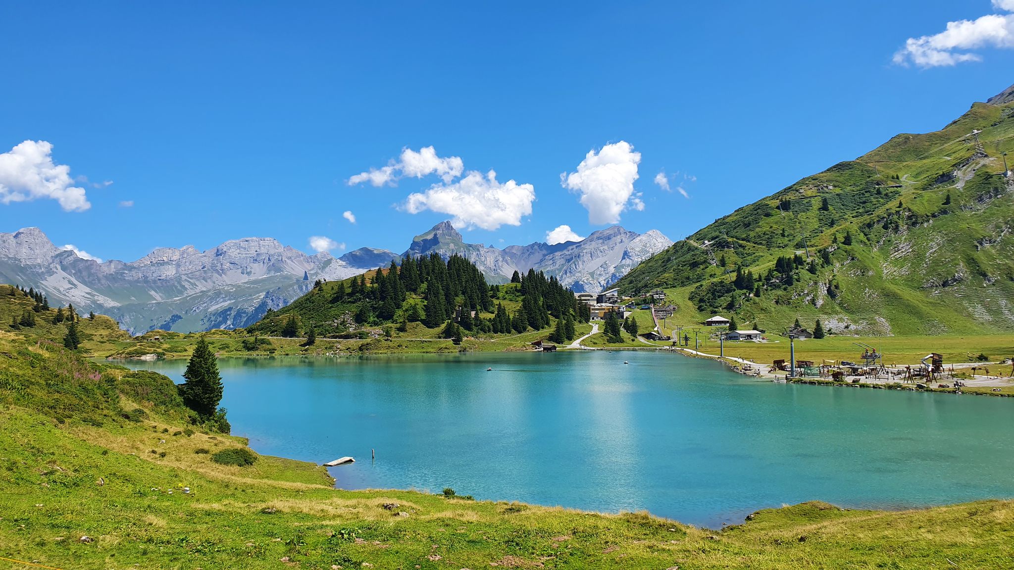
Great view, several benches to sit and enjoy. I would definitely climb through the forest myself instead of taking the gondola – it's so much more beautiful up there...and the path through the forest is really beautiful.
1
0

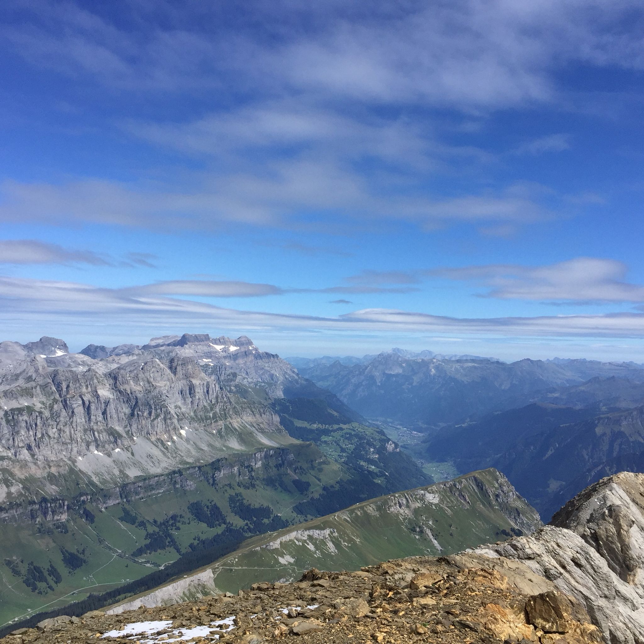
While previously you could only get to the Gemsfairenstock by touching the glacier, it is now possible without it. There is a slightly exposed section on the ascent, but it is secured with chains.
0
0

Good for taking off with a paraglider. Great view of the Tödi!
0
0

fantastic panoramic view of the Glärnisch
0
0

Fisetenpass 2023 m The Fisetenpass is a mountain pass in the municipality of Spiringen (Urnerboden exclave) in the canton of Uri. Its pass is at an altitude of 2036 meters above sea level between the Gemsfairenstock (2971m) in the southwest and the Fisetengrat or the Chamerstock (2123m) in the east. The easiest way to reach the pass is to take the mountain cable car from Urnerboden to the Fisetengrat mountain station and from there in a few minutes to the top of the pass. You hike over the pass from the Urnerboden to the Fiseten area and on to the Claridenhütte and Tierfehd. The specified hiking time from the Fisetenpass to the Claridenhütte is 2h40min, down to Linthal 4h55min and also down the valley to the Urnerboden 3h10min. In a four-hour mountain hike from the top of the pass you can also reach the Klausen Pass (Clariden high-altitude trail). Text / source: Fuorcla.ch https://fuorcla.ch/fisetenpass/
14
0

One of the most beautiful places in the region. The view at sunrise is phenomenal, but you have to be prepared to walk up that far in the early hours ;)
1
1

Simply super nice up there, starting point for the SAC huts Planura 2947 m above sea level, Clarieden hut 2453 m above sea level and the Fridolinshütte at 2111 m above sea level, which we renovated with the construction company Rüesch AG. At that time there was still dear Gabi Aschwanden Hütten Wärtin, who cooked and cared for us for almost 4 months at a time. The beautiful hut is the starting point for a tour up to the most beautiful Glarus mountain, the Tödi.
1
0

Pay attention to snow conditions, there could be tricky spots if there is little snow.
0
0
Frequently Asked Questions
What are some of the most notable mountain peaks around Linthal?
Linthal is surrounded by impressive peaks. Tödi, at 3,614 m, is the highest in the Glarus Alps. Other significant peaks include Clariden (3,267 m), Bifertenstock (3,419 m), and Hausstock (3,158 m). For a challenging experience with panoramic views, consider Kistenstöckli, known for its steep ascent and sections with chains.
Which peaks offer the best panoramic views in the Linthal region?
Many peaks around Linthal provide stunning views. The flat summit of Kistenstöckli offers great panoramic views after a challenging climb. Gemsfairenstock Summit is also highly regarded for its wonderful 360-degree views over the Alps. Additionally, Silberen / Twärenen provides fantastic views of the surrounding mountains.
Are there any family-friendly mountain experiences around Linthal?
While many peaks offer challenging ascents, the region also provides options for families. The Sardona Tectonic Arena UNESCO World Heritage Site, with its unique geological formations like the Tschingelhörner and Elmer Martinsloch, offers an educational and visually impressive experience that can be enjoyed by families. The nearby Elm Village Center is also noted as family-friendly.
What unique geological features can I explore near Linthal's peaks?
The most prominent geological feature is the Sardona Tectonic Arena UNESCO World Heritage Site. This area is unique for showcasing how older rock layers were pushed over younger ones during the formation of the Alps, featuring the distinctive Tschingelhörner and the famous Elmer Martinsloch. You can also find impressive cart fields at Silberen / Twärenen.
What are the difficulty levels for hiking and climbing the peaks around Linthal?
The peaks around Linthal offer a range of difficulties. Many mountaineering routes, especially to higher peaks like Tödi, require good to very good fitness, sturdy shoes, and alpine experience, often corresponding to SAC 2-6 difficulty levels. For instance, Kistenstöckli involves a steep ascent with sections secured by chains. However, there are also various hiking trails catering to different fitness levels, from easy paths to moderate routes requiring good fitness and sure-footedness.
What outdoor activities can I do near the mountain peaks of Linthal?
Beyond peak bagging, the Linthal region is excellent for various outdoor activities. You can find numerous cycling routes, including challenging ones like the 'View of Urnerboden Valley – Berglistüber Waterfall loop' from Klausenpass, as detailed in the Cycling around Linthal guide. Gravel biking is also popular, with routes like 'Brigels Bella Vista' available in the Gravel biking around Linthal guide. For mountain biking, explore trails such as 'Bächi Bike Trail' from the MTB Trails around Linthal guide.
Are there any historical sites or landmarks associated with the mountain peaks?
Yes, the Sardona Tectonic Arena UNESCO World Heritage Site is recognized for its geological significance and its history as a research object in geology. Additionally, the first ascent of Tödi in 1837 by chamois hunters from Linthal marks a significant historical event for the region. The nearby Elm Village Center, though not a peak, is a historical settlement that was affected by a landslide in 1881 and retains many listed traditional buildings.
What is the best time of year to visit Linthal for mountain activities?
The best time to visit Linthal for mountain activities largely depends on the specific activity. Summer and early autumn are ideal for hiking and climbing, offering more stable weather and accessible trails. High-mountain trekking tours to peaks like Tödi are typically undertaken in the warmer months. The region also offers winter activities, but these require different gear and expertise.
What kind of accommodation is available for multi-day tours in the mountains?
For multi-day tours, the region is home to several SAC (Swiss Alpine Club) huts. These huts, such as the Grünhorn hut (the first SAC hut in Switzerland, built in 1863), provide essential shelter and serve as a base for longer excursions into the high mountains.
How can I access the mountain regions around Linthal?
Access to the mountain regions around Linthal is possible through various means. Public transport options are available, and the region benefits from mountain transport options like the Braunwald Railway and aerial cableways, which provide easier access to some hiking areas. The Klausen Pass also offers scenic routes and serves as a starting point for many adventures.
What do visitors enjoy most about the mountain peaks around Linthal?
Visitors frequently praise the stunning panoramic views and the challenging yet rewarding experiences. The unique geological formations, such as the cart fields at Silberen / Twärenen, are particularly impressive. The sense of accomplishment after a steep climb to a summit like Kistenstöckli, with its great views, is also a highlight for many.
Most popular attractions around Linthal

Get inspired with the komoot mobile app


Explore more
See even more amazing summits around Linthal with these guides:
