The best cycling routes around Linville
5.0
(1)
39
riders
4
rides
Touring cycling around Linville, North Carolina, is characterized by its mountainous terrain within the Blue Ridge Mountains. The region features the dramatic Linville Gorge Wilderness Area, carved by the Linville River, with rugged cliffs and steep inclines. Cyclists encounter diverse landscapes including dense hardwood and pine forests, alongside significant elevation changes. The area is also home to prominent features like Grandfather Mountain and the scenic Blue Ridge Parkway.
Best touring cycling routes around Linville
- The most popular touring cycling route…
Last updated: May 12, 2026
12
riders
22.4km
01:31
390m
390m
Moderate bike ride. Good fitness required. Mostly paved surfaces. Suitable for all skill levels.
6
riders
7.33km
00:45
150m
150m
Easy bike ride. Great for any fitness level. Mostly paved surfaces. Suitable for all skill levels.

Sign up for free
4
riders
29.2km
01:58
490m
490m
Hard bike ride. Very good fitness required. Mostly paved surfaces. Suitable for all skill levels.
2
riders
61.5km
04:21
1,240m
1,240m
Hard bike ride. Very good fitness required. Mostly paved surfaces. Suitable for all skill levels.
2
riders
43.7km
04:08
980m
980m
Hard bike ride. Very good fitness required. Mostly paved surfaces. Suitable for all skill levels.
Our route recommendations are based on thousands of hikes, rides, and runs completed by other people on komoot.
Start today with a free account
Your next adventure awaits.
Login or Signup
Popular around Linville


Tips from the Community

With a pavillion and playground, this swimming lake makes a great spot to stop for a pitstop and perhaps a cool off.
0
0

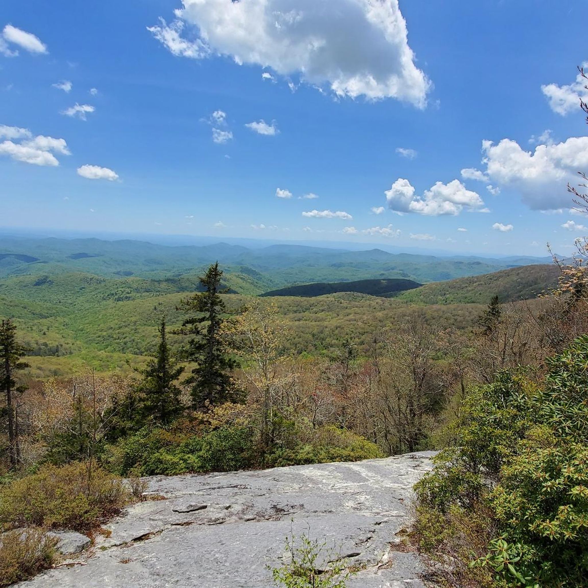
At Milepost 302.8 on the Blue Ridge Parkway, you can find the Rough Ridge Overlook. There is a trail that offers even better views from a better vantage point, but there are a few window views through the trees from the parking area. The section of the parkway bordering Grandfather Mountain State Park is especially beautiful in the fall when the colors on the trees are changing.
0
0
At Milepost 302.8 on the Blue Ridge Parkway, you can find the Rough Ridge Overlook. There is a trail that offers even better views from a better vantage point, but there are a few window views through the trees from the parking area. The section of the parkway bordering Grandfather Mountain State Park is especially beautiful in the fall when the colors on the trees are changing.
0
0
The Yonahlossee Overlook is located at Milepost 303.9 on the Blue Ridge Parkway and is one of the most frequented stop on the roadside in this area. The overlook, itself, is a bit overgrown, but you can get a great view of the Linn Cove Viaduct just south of the overlook, which is where most people who park at the overlook are headed anyway.
1
0
Pilot Ridge Overlook is at Milepost 301.8 on the Blue Ridge Parkway. It is heavily overgrown and only offers a window view of the valley floor through the trees.
0
0
Green Mountain Overlook is situated at Milepost 300.6 on the Blue Ridge Parkway at an elevation of 4,134 feet. You can see the tops of some lower-lying mountains in the distance, but the valley views from the overlook are overgrown now.
0
0
Frequently Asked Questions
How many touring cycling routes are available in Linville?
Komoot currently features 3 touring cycling routes around Linville. These routes are highly rated by the komoot community, with an average score of 5.0 stars from 1 review, and have been explored by over 20 touring cyclists.
What kind of terrain can I expect on touring cycling routes in Linville?
Touring cycling in Linville is characterized by mountainous terrain within the Blue Ridge Mountains. You'll encounter diverse landscapes including dense hardwood and pine forests, rugged cliffs, and steep inclines. Routes often feature significant elevation changes and can include a mix of paved roads and gravel sections, offering a challenging and scenic experience.
Are there challenging touring cycling routes in Linville?
Yes, Linville offers several challenging touring cycling routes. For instance, the Cliff Hill – Mill Pond loop from Banner Elk is a difficult 24.3-mile path with significant elevation changes. Another demanding option is the Lake Kawahna loop from Pineola Bog State Natural Area, a 27.1-mile trail with substantial climbs.
Are there any circular touring cycling routes in the Linville area?
Yes, several touring cycling routes in the Linville area are designed as loops. Examples include the Hemlock Hill – Mill Pond loop from Banner Elk, a moderate 5.5-mile ride, and the more challenging Cliff Hill – Mill Pond loop from Banner Elk. Another option is the Linn Cove Viaduct – Rough Ridge Overlook loop from Grandfather Mountain, which offers stunning views.
What natural landmarks can I see while touring cycling in Linville?
Linville is rich in natural landmarks. You can cycle along sections of the iconic Blue Ridge Parkway, offering access to stunning vistas like the Rough Ridge Overlook (Rough Ridge Lookout). The region is also home to Grandfather Mountain, with its famous Mile High Swinging Bridge (Mile High Swinging Bridge), and the dramatic Linville Gorge Wilderness Area.
Are there any waterfalls accessible by touring bike in Linville?
While direct bike access to the base of Linville Falls is limited, the falls are a major highlight of the region, located at milepost 316.3 on the Blue Ridge Parkway. You can cycle to the vicinity of the falls and then explore multiple overlooks and hiking trails on foot to experience this famous waterfall, which drops about 45 feet into the Linville Gorge.
What is the best time of year for touring cycling in Linville?
The Linville area, particularly along the Blue Ridge Parkway, is exceptionally scenic, especially during the fall when autumn foliage is at its peak. Spring and summer also offer pleasant conditions for cycling, with lush greenery and comfortable temperatures, though summer can bring higher humidity. Always check local weather conditions before your ride.
Where can I find parking for touring cycling routes in Linville?
Parking is available at various points along the Blue Ridge Parkway and near trailheads. For example, there's a parking area near Grandfather Mountain (Parkinglot) which can serve as a starting point for routes like the Linn Cove Viaduct – Rough Ridge Overlook loop. Always look for designated parking areas to ensure safety and compliance with local regulations.
Are there family-friendly touring cycling routes in Linville?
While many routes in Linville feature significant elevation changes and can be challenging, there are options for varying skill levels. The Hemlock Hill – Mill Pond loop from Banner Elk is a moderate 5.5-mile route that might be suitable for families looking for a less strenuous ride, depending on their experience and fitness levels.
Can I bring my dog on touring cycling routes in Linville?
Regulations regarding dogs on cycling routes can vary. While many outdoor areas in the Linville region are dog-friendly, especially on leash, it's always best to check specific trail or park rules before heading out. The Blue Ridge Parkway generally allows leashed dogs, but individual trails or protected wilderness areas like Linville Gorge may have stricter guidelines.
Are there places to eat or stay near the touring cycling routes?
The Linville area, being a popular tourist destination, offers various options for accommodation and dining. You'll find cafes, restaurants, and lodging in nearby towns like Banner Elk and along the Blue Ridge Parkway. These establishments cater to visitors and cyclists, providing convenient stops for refreshments and overnight stays.
Is public transport available to reach touring cycling routes in Linville?
Public transport options directly to specific touring cycling trailheads in the Linville area are generally limited. Most visitors rely on personal vehicles to access the starting points of routes, especially those along the Blue Ridge Parkway or within the Linville Gorge Wilderness Area. Planning for car transport or shuttle services is advisable.
Most popular routes around Linville
Most popular attractions around Linville

Get inspired with the komoot mobile app


Explore more
Browse the best Cycling routes in other regions.
