The best walks and hikes around Etowah
4.5
(59)
854
hikers
57
hikes
Hiking around Etowah is characterized by rolling hills, dense woodlands, and numerous waterfalls. The region provides access to both Pisgah National Forest and DuPont State Recreational Forest. The terrain offers a mix of riverside paths along the French Broad River and forest trails that lead to scenic viewpoints and natural features. This area features an extensive network of forest trails, numerous waterfalls, and riverside walks.
Best hiking trails around Etowah
- The most popular hiking route is Wintergreen Falls Trail via Tarkiln Branch Road, a 3.2 miles (5.1 km) trail that takes around 1 hour 25 minutes to complete. This easy hike follows a path through DuPont State Recreational Forest to a waterfall.
- Another top favourite among local hikers is the Sharpy Mountain & South Mills River Road loop, a moderate 6.2 miles (10.0 km) path. This route in Pisgah National Forest involves some elevation gain leading to views from the mountain.
- Local hikers also love the Stone Mountain and Rocky Ridge Trail Loop, a 4.1 miles (6.6 km) trail leading through forest, often completed in about 2 hours 8 minutes.
- Hiking around Etowah is defined by its extensive network of forest trails, numerous waterfalls, and riverside walks. The trail system includes options for various ability levels, from short, family-friendly hikes to more demanding routes.
- The routes in Etowah are highly rated by the komoot community with an average score of 4.6 stars from over 50 reviews. More than 900 hikers have used komoot to explore Etowah's varied terrain.
Last updated: July 9, 2026
3
hikers
9.87km
02:56
300m
310m
Moderate hike. Good fitness required. Easily-accessible paths. Suitable for all skill levels.
549m
00:10
10m
30m
Easy hike. Great for any fitness level. Easily-accessible paths. Suitable for all skill levels.

Sign up for free
5.0
(2)
7
hikers
10.0km
03:01
300m
310m
Moderate hike. Good fitness required. Easily-accessible paths. Suitable for all skill levels.
4.8
(6)
5
hikers
5.96km
01:45
160m
160m
Easy hike. Great for any fitness level. Easily-accessible paths. Suitable for all skill levels.
4.0
(1)
5
hikers
6.64km
02:08
300m
300m
Moderate hike. Good fitness required. Easily-accessible paths. Suitable for all skill levels.
Get access to more routes and recommendations from other explorers.
Sign up for free
Already have an account?
Our route recommendations are based on thousands of hikes, rides, and runs completed by other people on komoot.
Start today with a free account
Your next adventure awaits.
Login or Signup


Tips from the Community

Jump Off Rock is the centerpiece of a small park in Laurel Park. The viewpoint is reached by a short trail which takes you to the platform that has amazing views of Western North Carolina.
0
0

Sharpy Mountain is the highest of the peaks directly bordering Turkey Pen Gap in Pisgah National Forest. A steep climb to the top offers views of the South Fork Mills River, Pine Mountain, and Laurel Mountain.
0
0
At 3,620 feet, Stone Mountain is the most northern and the tallest summit in DuPont State Recreational Forest. The summit, itself, is rocky and offers some great views to the southwest (basically peering into the rest of the State Forest). The trail to the top is challenging, and there are two different approaches you can use to get to the final summit trail.
0
0
Holmes Educational State Forest has a handful of different interpretive and nature trails. The most popular is the Demonstration Trail, which is a loop trail traveling around the perimeter of the forest. This is a lesser visited area than the nearby Dupont State Recreational Forest.
1
0
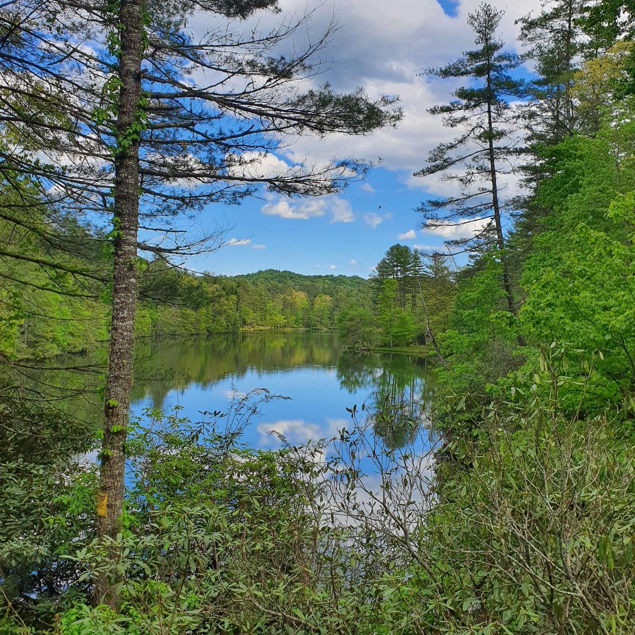
This small pond is right off the side of the trail. It's a small pond, and a lot of it is covered in algae and fallen sticks in the warmer months. It's still a good place to see wildlife if you're lucky.
0
0
Jump Off Rock Park is one of the main attractions in the small mountain town of Laurel Park. The informational and inspirational area provides benches, walking trails, viewing areas, and educational readings for guests to use. During daylight hours, the park is open year round, free of charge.
0
0
Jump Off Rock is a giant boulder sitting on the top of the 3,100 foot summit. There are informational signs at the lookout telling you what peaks are you are looking at. This area can become crowded since you can almost drive to the summit, and the observation area is free to access by the public all year long.
0
0
Sharpy Mountain is the highest of the peaks directly bordering Turkey Pen Gap in Pisgah National Forest. A steep climb to the top offer's views of the South Fork Mills River, Pine Mountain, and Laurel Mountain.
0
0
Frequently Asked Questions
Are there many waterfall hikes near Etowah, NC?
Yes, the area around Etowah is renowned for its waterfalls, particularly within DuPont State Recreational Forest. Many trails lead directly to stunning falls. For an easy and rewarding option, consider the Wintergreen Falls Trail. Other popular waterfalls in the region include Triple Falls and High Falls, which are also accessible via well-maintained trails.
What are the best options for easy, family-friendly hikes?
There are numerous gentle trails suitable for families. The landscape offers many shorter, flatter walks through the forests and along rivers. A great choice is the Stone Mountain via Rocky Ridge Trail, which is a relatively short hike of about 2.6 miles (4.2 km). Additionally, Etowah Park offers a simple walking trail perfect for a relaxed family outing.
Can I bring my dog on the hiking trails around Etowah?
Dogs are generally welcome on trails in both Pisgah National Forest and DuPont State Recreational Forest, but they must be kept on a leash at all times. It's important to be prepared to clean up after your pet and ensure they have enough water, especially on warmer days. Always check the specific regulations for the trail you plan to hike before you go.
Are there any challenging, long-distance hikes in the area?
Yes, for experienced hikers looking for a full-day adventure, the region offers several strenuous routes. A prime example is the Outer Loop in DuPont State Forest. This trail covers over 18 miles (30 km) and involves significant elevation gain, taking you through diverse and remote sections of the forest.
What do other hikers enjoy most about the trails in Etowah?
The trails around Etowah are highly rated by the komoot community, with an average score of 4.6 stars. Hikers frequently praise the incredible access to numerous waterfalls and the well-maintained trail networks within both Pisgah and DuPont State Forests. The variety of hikes, from easy riverside walks to challenging mountain climbs, is another commonly highlighted feature.
How many hiking trails are available around Etowah?
You'll find a wide variety of trails to explore, with over 40 curated hiking routes available on komoot alone. These range from short, easy walks to difficult all-day treks, covering the diverse terrain of the surrounding national and state forests.
Are there any good loop trails so I can avoid backtracking?
Absolutely. Many hikers prefer circular routes, and the Etowah area has some excellent options. For a moderately challenging loop with rewarding views, the Sharpy Mountain & South Mills River Road loop in Pisgah National Forest is a fantastic choice. It's about 6.2 miles (10 km) and offers a varied hiking experience.
What is the terrain like for hiking in the Etowah area?
The hiking terrain is characterized by rolling hills, dense hardwood forests, and scenic river valleys, particularly along the French Broad River. Trails range from wide, gravel paths to narrow, root-covered singletrack. You can expect to encounter numerous creek crossings and elevation changes that lead to beautiful waterfalls and mountain overlooks.
Which major forests are accessible from Etowah?
Etowah serves as an excellent base for exploring two of North Carolina's premier outdoor destinations: Pisgah National Forest and DuPont State Recreational Forest. Both are just a short drive away and contain hundreds of miles of trails, offering everything from roadside waterfalls to backcountry adventures.
Are there any paved or very easy walking trails for a gentle stroll?
For a more relaxed outdoor experience, you can visit Etowah Park, which features a simple walking trail suitable for all ages and fitness levels. While most of the region's main hiking trails are unpaved, some routes in DuPont State Forest are on wider, gravel service roads that provide an easier walking surface.
What kind of views can I expect on the trails?
The views vary depending on the trail. Many routes are deep within lush forests, offering serene woodland scenery. Other hikes, like the Old CCC Road to Stone Mountain, climb to exposed granite domes that provide panoramic vistas of the surrounding Blue Ridge Mountains. And of course, the waterfall views are a major highlight throughout the area.
Most popular attractions around Etowah

Get inspired with the komoot mobile app


Explore more
Browse the best Hikes in other regions.
