The best walks and hikes around Fort Salonga
4.7
(35)
232
hikers
39
hikes
Hiking around Fort Salonga offers diverse natural landscapes, including dense woodlands, marshland, and rolling hills. The region features several streams leading to ponds, as well as tidal creeks and mixed deciduous forests. Terrain varies from flat paths to sections with roots, rocks, and slopes, catering to different hiking preferences. The area is characterized by its proximity to the Long Island Sound and its well-maintained trail systems.
Best hiking trails around Fort Salonga
- The most popular hiking route is Nissequogue River Loop, a 4.2 miles (6.7 km) trail that takes 1 hour 47 minutes to complete. This easy route offers views of the Nissequogue River within Sunken Meadow State Park.
- Another top favourite among local hikers is Makamah Loop Trail, an easy 2.4 miles (3.8 km) path. This trail navigates through varied terrain with roots, rocks, and slopes, and follows streams to a large pond.
- Local hikers also love the Long Island Greenbelt Trail Loop via Old Dock Rd, a 1.6 miles (2.6 km) trail leading through wooded parkland, often completed in about 40 minutes.
- Hiking around Fort Salonga is defined by dense woodlands, tidal creeks, and rolling hills. The network offers options for easy family-friendly walks and more moderate trails with varied terrain.
- The routes in Fort Salonga are highly rated by the komoot community with an average score of 4.8 stars from over 30 reviews. More than 200 hikers have used komoot to explore Fort Salonga's varied terrain.
Last updated: May 12, 2026
4
hikers
2.55km
00:41
30m
30m
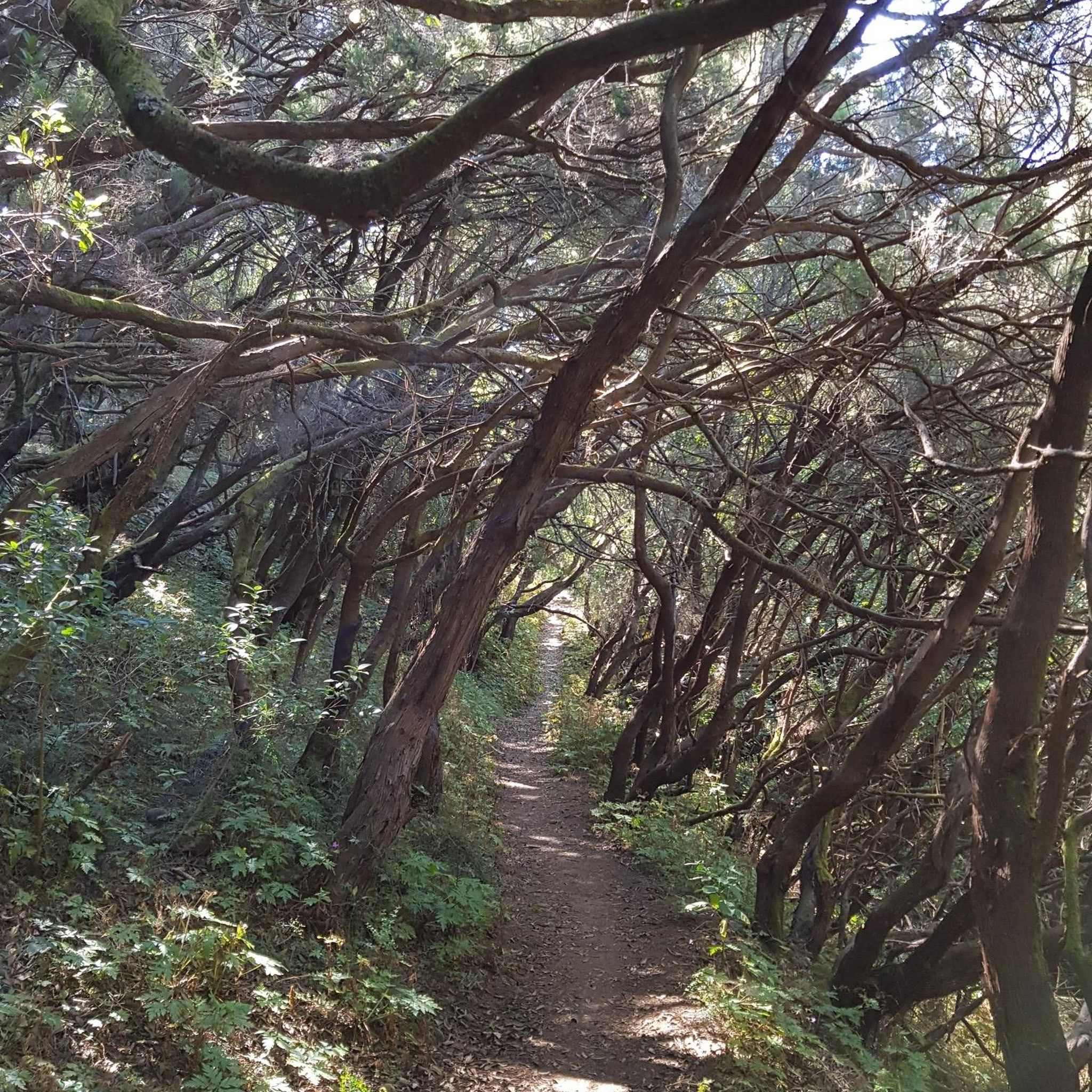
Embark on an easy 1.6-mile (2.6 km) hike along the Long Island Greenbelt Trail Loop via Old Dock Rd, a route that takes about 40 minutes to complete. You will experience diverse terrain, moving from paved sections to sandy bluffs. The trail offers coastal scenery blended with deciduous forests, creating a varied natural experience. As you hike, you will gain a gentle 90 feet (28 metres) in elevation. Keep an eye out for the Kings Park Bluff, which provides spectacular viewpoints overlooking the Nissequogue River and Smithtown Bay, including a clear view of Sunken Meadow Creek. This short outing is perfect for a quick nature escape.
Accessing the trailhead for this hike is straightforward, as it begins directly from Old Dock Road. If you plan to arrive by public transport, the trailhead is conveniently situated within two blocks of the Kings Park Long Island Railroad station. For those driving, parking is readily available in a church parking lot at the intersection of Church Street and Old Dock Road. This makes planning your visit simple, whether you prefer to drive or use public transit.
This loop offers a good sense of the broader Long Island Greenbelt Trail system, showcasing a mix of coastal views and deciduous woodlands. You will find yourself exploring sections that highlight the natural beauty of the area. The route provides unique perspectives of Sunken Meadow Creek and the surrounding bay, making it a notable option for experiencing the local landscape.
2
hikers
3.80km
01:01
40m
40m
Embark on an easy hiking adventure along the Makamah Loop Trail, a 2.4-mile (3.8 km) route that winds through the diverse landscapes of the Makamah Nature Preserve. You'll experience a gentle elevation gain of 133 feet (41 metres), making it a perfect choice for a leisurely outing that typically takes about 1 hour to complete. As you hike, the trail transitions between peaceful woodlands and serene marshland, offering a varied natural experience. The path itself is often undulating and can feature sections of singletrack with exposed roots and small rocks, so wear appropriate footwear. Look out for glimpses of the adjacent Jerome A. Ambro Memorial Wetlands Preserve through breaks in the tall grass, adding to the scenic charm.
Planning your visit to the Makamah Loop Trail is straightforward, as the route is well-marked with clear and regular trail blazing, ensuring easy navigation. Parking is generally available, making access convenient for most visitors. If you plan to bring your canine companion, dogs are welcome on the trail, but please ensure they remain on a leash at all times. This trail offers a quiet hiking experience, ideal for those seeking a peaceful escape into nature.
The Makamah Nature Preserve is a haven for local wildlife, particularly for birdwatching enthusiasts, with many species making their home in these woods and wetlands. The varied ecosystem, from dense woodlands to open marshland, provides a rich habitat and a dynamic environment to explore. This trail stands out as a great option for a quick nature fix, allowing you to immerse yourself in a tranquil setting without committing to a long or strenuous journey.

Sign up for free
5.70km
01:29
30m
40m
Hike the easy 3.5-mile Huntington Greenway Trail in Veterans Park, featuring wooded paths, gentle hills, and views of local scenery.
9.16km
02:25
70m
90m
Hike the Greenbelt Trail from Sunken Meadow to Smithtown Landing for 5.7 miles of varied terrain, river views, and challenging hills.
4.5
(4)
24
hikers
6.72km
01:48
80m
80m
Hike the easy 4.2-mile Nissequogue River Loop for waterfront views, diverse terrain, and unique abandoned buildings in Sunken Meadow State P
Get access to more routes and recommendations from other explorers.
Sign up for free
Already have an account?
Our route recommendations are based on thousands of hikes, rides, and runs completed by other people on komoot.
Start today with a free account
Your next adventure awaits.
Login or Signup


Tips from the Community

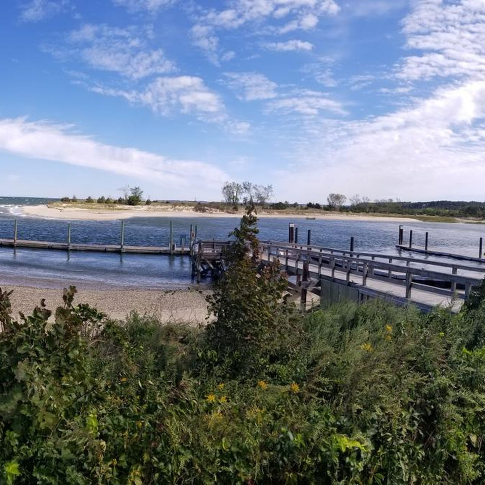
This overlook on the Long Island Greenbelt Trail offers breathtaking views of Sunken Meadow Creek flowing into the Nissequogue River. It's a scenic spot to take in the natural beauty of the area.
0
0
Nestled alongside the Nissequogue River, Arthur Kunz County Park invites visitors to bask in the natural beauty of its waterfront location. The park's highlight is its scenic walking trails that wind along the riverbanks, treating explorers to stunning vistas of the gently flowing water.
0
0

This is a pleasant spot to take a break by the river.
0
0
The view is definitely worth the small detour from Sunken Meadow Road!
1
0
Frequently Asked Questions
How many hiking trails are available around Fort Salonga?
There are over 25 hiking routes around Fort Salonga, offering a diverse range of experiences. These include easy walks through woodlands and marshlands, as well as more moderate trails with varied terrain.
What kind of terrain can I expect on hikes around Fort Salonga?
The terrain around Fort Salonga is quite varied. You'll find everything from relatively flat paths through woodlands and marshland to more challenging sections with roots, rocks, slopes, and rolling hills. Many trails feature streams, ponds, and tidal creeks, offering a mix of natural landscapes.
Are there family-friendly hiking options in Fort Salonga?
Yes, Fort Salonga offers many family-friendly hiking options. A significant number of the trails are rated as easy, making them suitable for shorter excursions and outings with children. These paths often lead through serene woodlands and offer opportunities for wildlife observation.
Are dogs allowed on the hiking trails in Fort Salonga?
Many parks and preserves in the Fort Salonga area, including sections of the Long Island Greenbelt Trail, are dog-friendly. However, it's always best to check specific park regulations before you go, as some areas may require dogs to be on a leash or have restricted access.
What are some notable natural features or landmarks to see while hiking?
Hikers can explore diverse natural features such as the heavily wooded hills and marshlands of Makamah Nature Preserve, or the tidal creeks and mixed deciduous forests of Arthur Kunz County Park. You might also encounter natural springs near the Erwin J. Ernst Marine Conservation Center.
Are there any circular hiking routes in the area?
Yes, there are several circular routes available. For example, the Caleb Smith State Park loop is a popular 3.0-mile (4.8 km) trail that takes you through wooded parkland. Another option is the Phragmites & Betty Allen Twin Ponds Nature Parks loop, which is an easy 1.1-mile (1.8 km) walk.
What kind of wildlife can I expect to see on the trails?
The diverse habitats around Fort Salonga, especially in Makamah Nature Preserve and Arthur Kunz County Park, make it an excellent spot for wildlife observation. You might spot various bird species, including owls and woodpeckers, and other local wildlife that thrive in the dense forests and wetlands.
Are there any moderate difficulty trails for more experienced hikers?
Yes, while many trails are easy, there are also moderate options for those seeking a bit more challenge. The Arthur Kunz County Park via Long Island Greenbelt Trail is a moderate 8.2-mile (13.1 km) hike that offers varied terrain and scenic views.
What do other hikers enjoy most about hiking in Fort Salonga?
The hiking routes in Fort Salonga are highly rated by the komoot community, with an average score of 4.8 stars from over 30 reviews. Hikers often praise the diverse natural landscapes, the peaceful atmosphere of the preserves, and the variety of trails suitable for different skill levels.
Is there parking available at the trailheads?
Many of the preserves and parks in the Fort Salonga area, such as Makamah Nature Preserve and Arthur Kunz County Park, offer designated parking areas for hikers. It's advisable to check the specific park's website or signage for detailed parking information before your visit.
Are there any trails that offer views of the Nissequogue River?
Yes, the Nissequogue River Loop — Sunken Meadow State Park is an easy 4.2-mile (6.7 km) trail that provides excellent views of the Nissequogue River as it winds through Sunken Meadow State Park.
Can I find trails that explore marshland areas?
Absolutely. The Sunken Meadow Creek Marsh — Sunken Meadow State Park is an easy 3.3-mile (5.3 km) path specifically designed to explore the marshland and creek areas within Sunken Meadow State Park, offering unique ecological insights.
Most popular attractions around Fort Salonga

Get inspired with the komoot mobile app


Explore more
Browse the best Hikes in other regions.
