The best running trails around Maywood
5.0
(1)
85
runners
17
runs
Jogging routes around Maywood offer a diverse range of natural settings, from established parklands to river corridors and forested areas. The region features varied ecosystems, including wetlands, prairies, and mature forests, providing a dynamic backdrop for running. Trails often follow rivers, wind through woodlands, or traverse open green spaces, with some routes incorporating moderate elevation changes. These natural landscapes provide a mix of flat paths and undulating terrain suitable for different running preferences.
Best jogging routes around Maywood
- The most…
Last updated: May 14, 2026
39
runners
5.06km
00:31
0m
0m
Moderate run. Good fitness required. Mostly paved surfaces. Suitable for all skill levels.
4
runners
10.3km
01:05
40m
40m
Moderate run. Good fitness required. Mostly paved surfaces. Suitable for all skill levels.

Sign up for free
6
runners
5.29km
00:33
20m
20m
Moderate run. Good fitness required. Mostly paved surfaces. Suitable for all skill levels.
4
runners
6.92km
00:43
30m
30m
Moderate run. Good fitness required. Mostly paved surfaces. Suitable for all skill levels.
4
runners
7.45km
00:46
30m
30m
Moderate run. Good fitness required. Mostly paved surfaces. Suitable for all skill levels.
Get access to more routes and recommendations from other explorers.
Sign up for free
Already have an account?
Our route recommendations are based on thousands of hikes, rides, and runs completed by other people on komoot.
Start today with a free account
Your next adventure awaits.
Login or Signup
Popular around Maywood


Tips from the Community

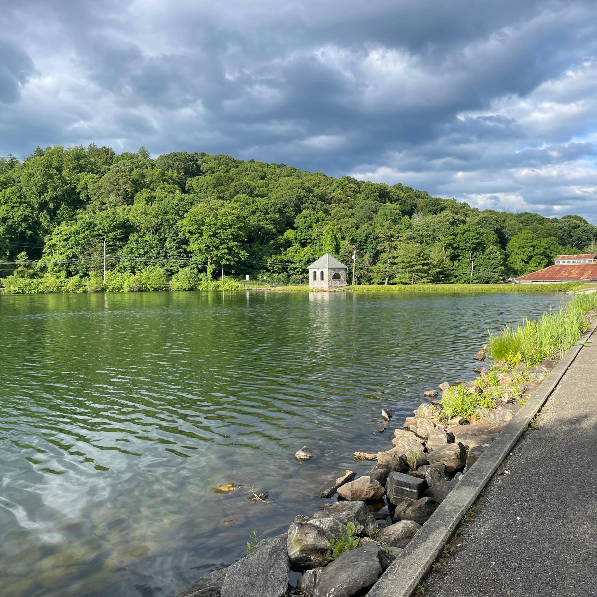
The Oradell Reservoir is an important source of clean drinking water to around 750,000 people. Built up over the early 1900s and completed in 1923, it’s now protected as a Category 1 water source, meaning it’s some of the purest in the state. It is a critical part of the region’s infrastructure and a reminder of how closely nature and community are connected.
0
0


Lake Shore Drive is a great gravel road that runs along Oradell Reservoir. Along the path, there are several clearings in the trees, which give you a good view of the water.
0
0

The majority of the river courses through popular suburban areas. It earns its name from a river in Scotland near Saddell. This section of the river winds its way through several parks, offering a delightful view of the flowing waters from this point.
0
0
This trail offers a mostly flat hike through a lush forest on hard-packed dirt. It meanders along the southern shore of Oradell Reservoir, providing occasional water views along the way.
1
0
The Oradell Dam forms this freshwater reservoir, which feeds the Lower Hackensack River. Created to supply drinking water to over 800,000 people, it holds 29.4 billion gallons of water. This spot offers a nice view of the crystal-clear water.
0
0

The reservoir is beautiful, but completely fenced! A rest on the shore is unfortunately not possible... But the gravel road writer north is a pleasure and absolutely recommendable.
3
0

On Lake Shore Drive, you get to ride along the reservoir. It's quiet and pretty.
1
1
Frequently Asked Questions
How many running routes are available around Maywood?
There are over a dozen dedicated running routes around Maywood, offering a variety of distances and difficulty levels. The komoot community has explored 16 different trails in the area.
Are there any easy jogging routes for beginners in Maywood?
Yes, for those looking for an easier run, the Flat Rock Brook Red Loop Trail is an excellent choice. This 2.1-mile (3.3 km) loop is considered easy and winds through diverse natural habitats, making it perfect for a relaxed jog.
What kind of terrain can I expect on Maywood's jogging trails?
Maywood's running trails offer a diverse range of terrain. You'll find paths through wetlands, prairies, and mature forests. Some routes follow river corridors, while others feature moderate elevation changes, such as the Hillside Trails in Maywood Environmental Park (Sheboygan, WI), which include inclines and stairs. Many trails are generally flat, but some sections, especially along rivers, can be wet or muddy.
Are there any scenic running routes with water features?
Absolutely. Many routes in the Maywood area feature beautiful water views. For instance, the Demarest Duck Pond loop from Tenafly offers scenic views as it circles the duck pond. Another popular option is the Oradell Reservoir – Oradell Reservoir loop from Oradell, which provides a picturesque run around the reservoir. You can also explore highlights like the Oradell Reservoir and Wild Duck Pond.
Can I find any loop trails for running in Maywood?
Yes, loop trails are a common feature in Maywood. Popular options include the easy Flat Rock Brook Red Loop Trail, the moderate Demarest Duck Pond loop from Tenafly, and the Oradell Reservoir – Oradell Reservoir loop from Oradell. These loops provide a continuous running experience without needing to retrace your steps.
What do other runners think about the trails in Maywood?
The running routes in Maywood are highly regarded by the komoot community, boasting an average rating of 5.0 stars. Over 95 runners have used komoot to explore the varied terrain, often praising the diverse natural settings and well-maintained paths.
Are there any running routes that go through forests or wooded areas?
Many running routes in Maywood immerse you in natural woodlands. For example, the Flat Rock Brook Nature Preserve offers trails through forested areas. In Maywood Environmental Park (Sheboygan, WI), you can find the Maple Forest Trail with century-old hardwood trees and the quiet Pine Forest Trails, perfect for a peaceful run among evergreens.
Are there any specific attractions or points of interest along the running trails?
Yes, several trails offer points of interest. Along routes near the Oradell Reservoir or Wild Duck Pond, you can enjoy scenic lake views. In Maywood Environmental Park (Sheboygan, WI), you might encounter an Arboretum, a Hummingbird Garden, or a Rain Garden. The River Trails in the same park feature a suspension bridge over the Pigeon River.
Can I find trails suitable for winter running or other winter activities?
While specific winter running conditions vary, some areas are suitable for winter activities. In Maywood Environmental Park (Sheboygan, WI), the Prairie Trails are suitable for snowshoeing in winter, and portions of the Hillside Trails are used for cross-country skiing, suggesting they might also be navigable for winter running depending on snow conditions.
Are there any longer, moderate running routes for a more challenging workout?
Yes, for a more extended and moderate workout, consider routes like the Demarest Duck Pond loop from Tenafly, which is 5.8 miles (9.3 km) long, or the Oradell Reservoir – Oradell Reservoir loop from Oradell, spanning 6.3 miles (10.2 km). These routes offer a good balance of distance and moderate challenge.
Are there any running routes that offer views of prairies or open grasslands?
Yes, particularly in areas like Maywood Environmental Park (Sheboygan, WI), you can find Prairie Trails that wind through 21 acres of open grasslands. These areas are known for tall grasses and wildflowers, especially from mid to late summer, offering a unique and expansive running experience.
Most popular routes around Maywood
Most popular attractions around Maywood

Get inspired with the komoot mobile app


Explore more
Browse the best Running Trails & Routes in other regions.
