The best walks and hikes around Lolo
5.0
(2)
80
hikers
10
hikes
Hiking around Lolo offers diverse and rugged landscapes within the Lolo National Forest, characterized by dramatic topography. The region features parts of the Bitterroot Mountains, dense forests, and numerous alpine lakes nestled within cirque basins. Trails often involve significant elevation changes, providing views of the surrounding wilderness. This area provides a range of experiences for hikers seeking varied terrain.
Best hiking trails around Lolo
- The most popular hiking route is Blue Mountain Trail — Lolo National Forest, a 18.9 miles…
Last updated: September 28, 2026
8
hikers
7.27km
02:10
230m
230m
Embark on the Blue Mountain Rocky Top Loop, a moderate hike that spans 4.5 miles (7.3 km) and climbs 743 feet (227 metres). This route typically takes around 2 hours…
1
hikers
6.61km
02:03
260m
240m
The Blue Mountain Loop is a moderate hiking route that offers expansive views of Missoula and the surrounding valley. As you hike the 4.1 miles (6.6 km), the trail winds…

1
hikers
4.16km
01:17
250m
0m
Embark on the Inez Creek Trail to Legacy Peak for an easy hike covering 2.6 miles (4.2 km). You will gain 818 feet (249 metres) in elevation over approximately 1…
8.19km
02:39
600m
0m
Embark on the Blue Mountain Lookout Trail for a moderate hike featuring continuous steep, rocky, and loose hill climbs on a single track. This 5.1 miles (8.2 km) route challenges…
2.12km
00:32
0m
0m
The Traveler's Rest State Park Loop offers an easy hiking experience, perfect for a relaxed outing. You will follow gentle trails that wind through rolling hills and open meadows, with…
Get access to more routes and recommendations from other explorers.
Already have an account?
Our route recommendations are based on thousands of hikes, rides, and runs completed by other people on komoot.
Start today with a free account
Your next adventure awaits.



Tips from the Community

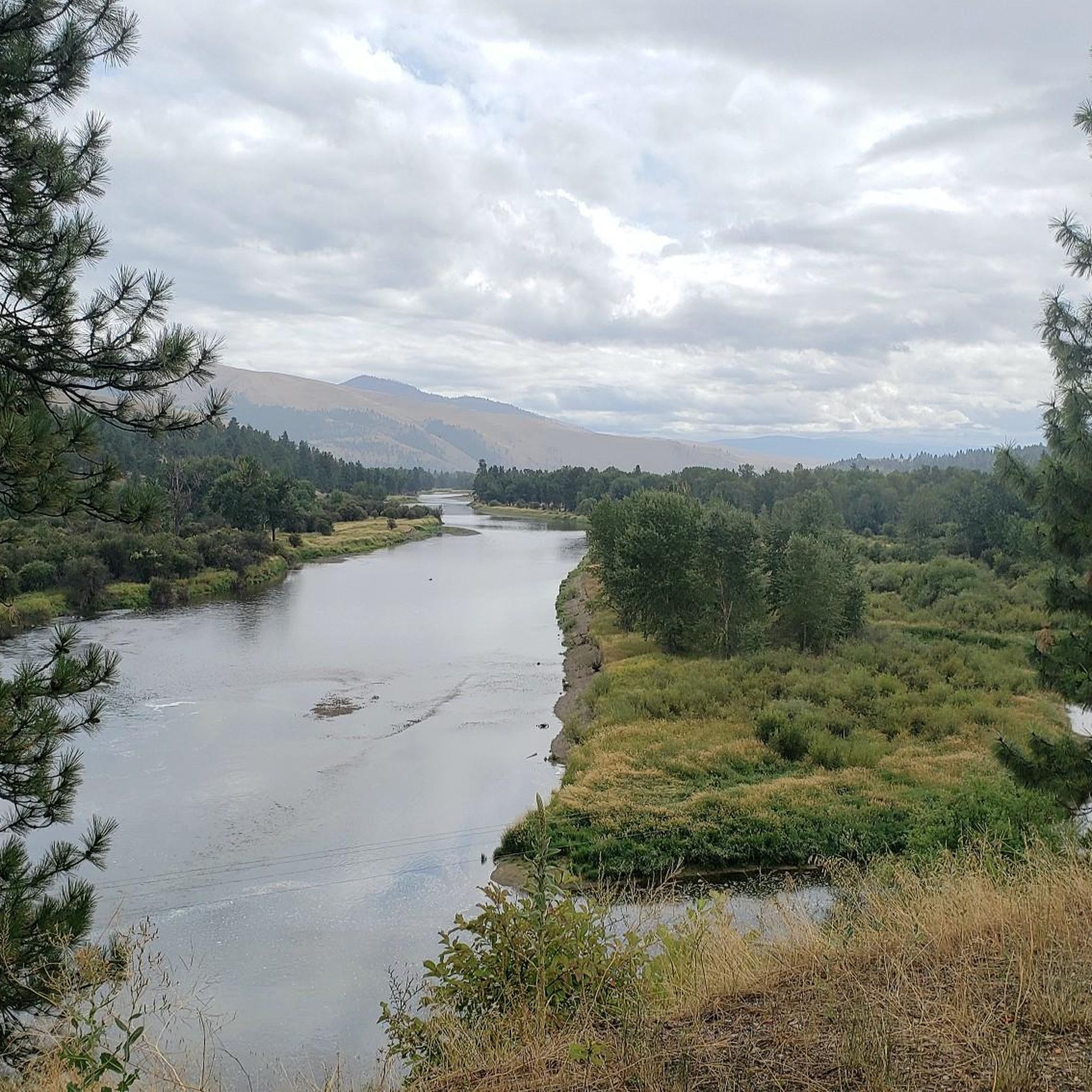
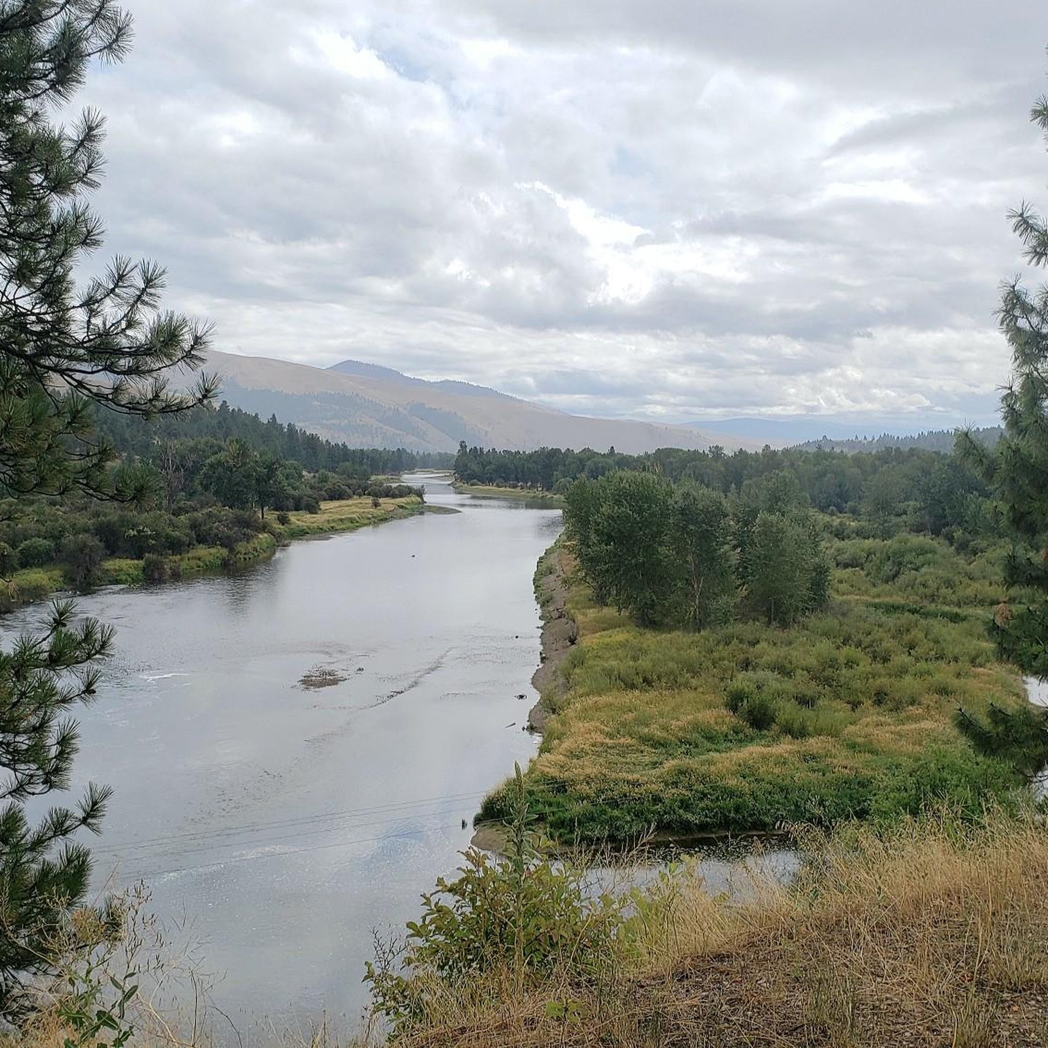
From the trail, there is a nice view of the valley just before the land kicks up into the mountains. You can parts of the Bitterroot River and into Missoula.
0
0
Frequently Asked Questions
How many hiking trails are available around Lolo?
Lolo offers a diverse network of over 2,400 miles of trails, with komoot featuring 7 distinct hiking routes. These range from easy strolls to challenging ascents, catering to various preferences and skill levels.
What are the difficulty levels of hiking trails in Lolo?
The trails around Lolo offer a range of difficulty levels. You'll find 2 easy routes, 3 moderate paths, and 2 difficult trails. For instance, the Blue Mountain Trail — Lolo National Forest is considered difficult, while the Hiking loop from Blue Mountain offers an easier experience.
Are there any family-friendly hiking options in Lolo?
Yes, Lolo has options suitable for families. For less strenuous walks, the Maclay Flat Nature Trail is excellent for wildlife observation, and the Kim Williams Nature Trail offers gentle river's edge hiking. The Hiking loop from Blue Mountain is also an easy route, making it a good choice for families.
Can I bring my dog on the trails in Lolo?
Many trails within the Lolo National Forest are dog-friendly, but it's always best to check specific regulations for each trail or wilderness area. Generally, dogs should be kept on a leash to protect wildlife and ensure a pleasant experience for all hikers.
Are there any circular hiking routes in Lolo?
Yes, Lolo offers several circular hiking routes. A popular moderate option is the Legacy Point loop from Lolo, which provides a balanced experience with varied gradients. Another shorter, easy loop is the Hiking loop from Blue Mountain.
What kind of natural features or landscapes can I expect to see while hiking in Lolo?
Lolo is characterized by its dramatic and varied topography. You'll encounter rugged mountain ranges like the Bitterroot Mountains, dense forests, and picturesque alpine lakes such as Cliff Lake, Diamond Lake, and the Blossom Lakes, often nestled within stunning cirque basins. High-country areas like Lolo Peak and Carlton Ridge offer spectacular panoramic views.
Are there opportunities for wildlife spotting in Lolo?
Lolo is home to abundant wildlife, offering excellent opportunities for spotting animals. Hikers might encounter deer, elk, black bears, mountain lions, coyotes, and various bird species. Early mornings or late evenings are often the best times for wildlife viewing.
What are some notable landmarks or points of interest I can explore near the trails?
Beyond the trails themselves, you can explore several interesting points. The Bitterroot Trail offers scenic views, including the View of the Bitterroot River from the Bitterroot Trail. Other highlights include Miller Creek Road and the Barmeyer Loop and Scenic Overlook.
Is there public transportation available to reach hiking trailheads in Lolo?
Public transportation options directly to remote trailheads in the Lolo National Forest are generally limited. Most hikers rely on personal vehicles to access the diverse trail network. Some trail systems, like those in Pattee Canyon Recreation Area or Blue Mountain, are conveniently located just minutes from Missoula, which may have more local transport options.
Do I need a permit or is there a fee to hike in the Lolo area?
Generally, day hiking in the Lolo National Forest does not require a permit or fee. However, some specific wilderness areas or developed recreation sites might have different regulations or require a pass. It's always advisable to check with the local Forest Service office for the most current information, especially for overnight stays or specific activities.
What do other hikers enjoy most about hiking in Lolo?
The hiking experiences in Lolo are highly rated by the komoot community, with an average score of 5.0 stars. Hikers often praise the rugged mountain scenery, the pristine alpine lakes, and the diverse ecosystems that provide both challenging adventures and peaceful communion with nature. The variety of trails, from easy walks to strenuous climbs, is also frequently highlighted.
Are there any challenging hikes for experienced hikers in Lolo?
Yes, Lolo offers several challenging hikes for experienced adventurers. The Blue Mountain Trail — Lolo National Forest is a difficult route with significant elevation gain. Another demanding option is Blue Mountain via Deadmans Ridge — Lolo National Forest, which also features substantial climbs and rewarding views.
Most popular attractions around Lolo

Get inspired with the komoot mobile app


Explore more
Browse the best Hikes in other regions.
