The best running trails around Bonner-West Riverside
5.0
(1)
537
runners
92
runs
Jogging routes around Bonner-West Riverside are primarily characterized by their proximity to the Clark Fork River and the surrounding hills. The region offers a mix of flat riverside paths and more challenging ascents into the local terrain. Runners can expect varied landscapes, from urban green spaces to forested slopes and open views. This area provides diverse running experiences for different fitness levels.
Best jogging routes around Bonner-West Riverside
- The most popular jogging route is Jacob's Island – Kim Williams Trail…
Last updated: June 25, 2026
16
runners
7.16km
01:06
400m
400m
Hard run. Very good fitness required. Mostly paved surfaces. Suitable for all skill levels.
15
runners
Hard run. Very good fitness required. Mostly paved surfaces. Suitable for all skill levels.

Sign up for free
10
runners
7.64km
00:58
210m
210m
Moderate run. Good fitness required. Mostly paved surfaces. Suitable for all skill levels.
8
runners
11.3km
01:25
350m
340m
Hard run. Very good fitness required. Mostly paved surfaces. Suitable for all skill levels.
10
runners
32.0km
04:32
1,330m
1,330m
Hard run. Very good fitness required. Mostly paved surfaces. Suitable for all skill levels.
Get access to more routes and recommendations from other explorers.
Sign up for free
Already have an account?
Our route recommendations are based on thousands of hikes, rides, and runs completed by other people on komoot.
Start today with a free account
Your next adventure awaits.
Login or Signup



Tips from the Community

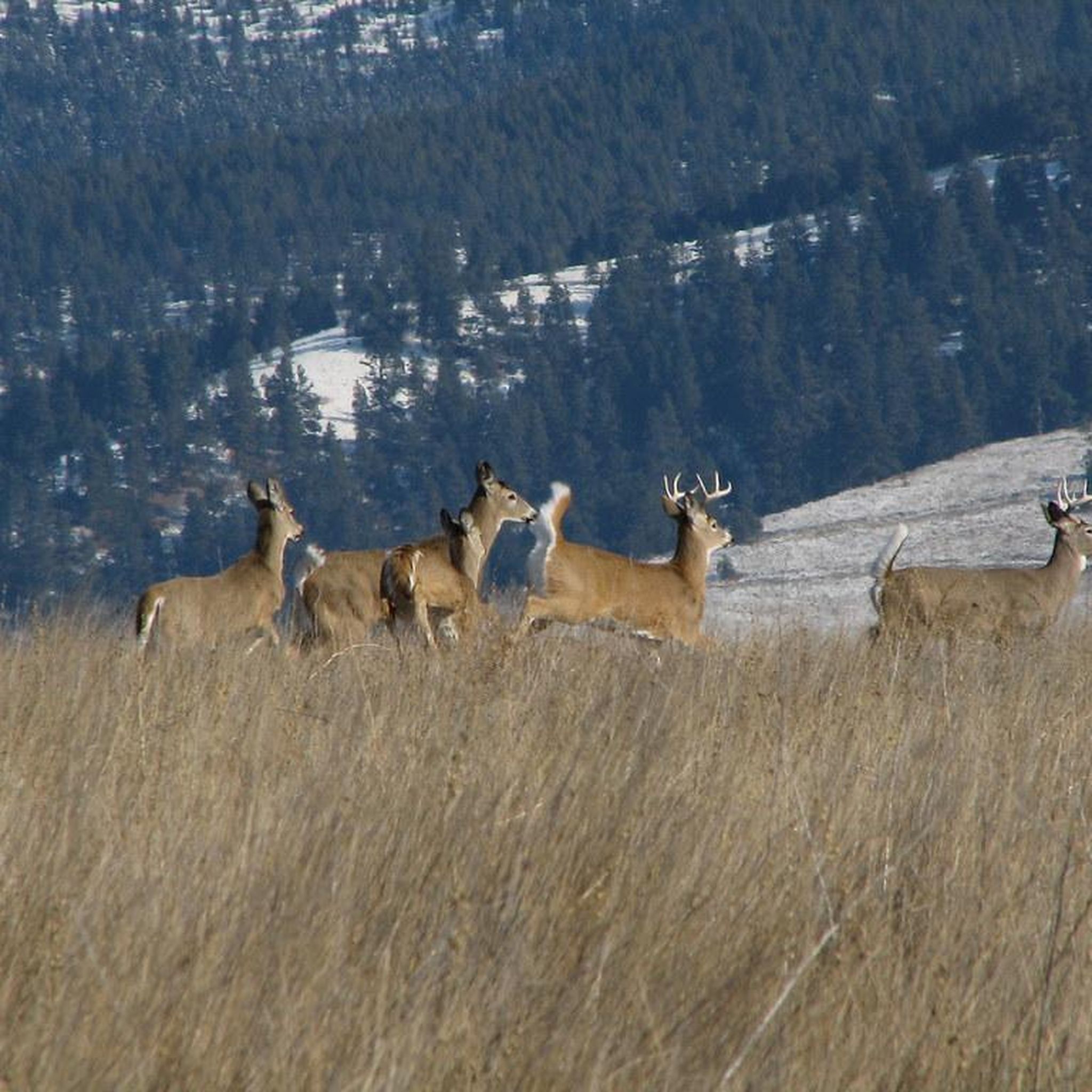
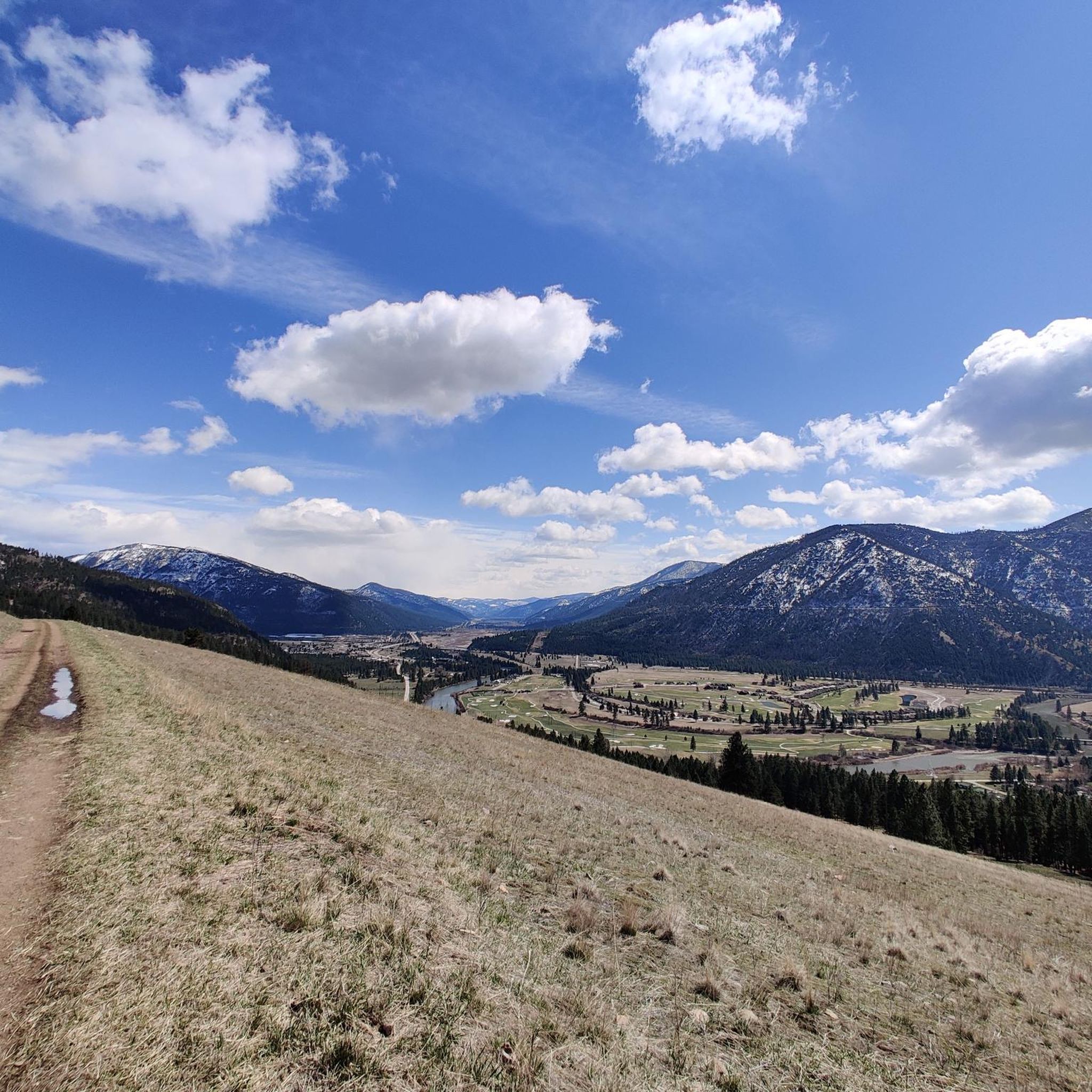
There is a great view here of Woody Mountain and the Mount Jumbo Wildlife Management Area. This double-track road is pretty smooth and most bikes can handle the terrain pretty easily.
0
0

Jacob's Island is a dog park on the banks of Clark Fork River. The park is 6-acres and the river works as a beautiful natural barrier for the dogs. It also offers a series of paved and unpaved trails, benches, picnic tables and dog-waste bags.
0
0
Jacob's Island is a dog park on the banks of Clark Fork River. The park is 6 acres and the river works as a beautiful natural barrier for the dogs. It also offers a series of paved and unpaved trails, benches, picnic tables and dog-waste bags.
0
0
The Mount Jumbo Wildlife Management Area sits northeast of Missoula and is filled with hiking, mountain biking, and running trails. There are also a load of double-track trails and fire roads that are perfect for bike touring. This is a really popular spot for outdoor enthusiasts, and you'll likely be sharing the trails with others.
0
0

The hike up to the "L" and onward is a challenging route with switchbacks and no shade. The letter “L” cemented onto the face of Mount Jumbo represents Loyola Sacred Heart Catholic High School, situated at the base of the mountain. The trail to the “L” gains 500 feet in elevation over 1.5 miles.
0
0
The "M" on the west face of Mount Sentinel has been a Missoula landmark since 1908, when Forestry Club members forged a zigzag trail up the mountain and students carried up stones to shape the symbol of the University of Montana. The "M" Trail is a very popular area for hiking and running, so you'll likely encounter other people while exploring. Dogs are welcome, but must be on a leash. There are great views of Missoula and the entire valley from the trail, but should be noted that there is no shade, so try and get there early! Being that this trail can get crowded, there are two alternative trails back down the mountain, one in the north towards the tree-line, and a slightly longer detour trail in the south if you continue on Evan's Trail.
0
0

This stretch of riding has incredible views looking down the valley over the bend in the river. There's no doubt you're in Montana here.
0
0

Frequently Asked Questions
How many running routes are available in Bonner-West Riverside?
There are over 80 running routes around Bonner-West Riverside listed on komoot. These range from easy riverside paths to more challenging ascents in the surrounding hills, offering diverse experiences for all fitness levels.
Are there easy running routes suitable for beginners or families?
Yes, Bonner-West Riverside offers several easy running routes. For a gentle experience, consider routes that follow the riverbanks, which are generally flatter. While specific 'family-friendly' routes aren't explicitly categorized, the 4 easy routes available are a good starting point for those new to running or looking for a relaxed pace.
Which running trails offer the best scenic views or viewpoints?
For panoramic vistas, you'll want to explore routes that ascend the local hills. The The M Trail on Mount Sentinel loop from Missoula is renowned for providing stunning views of the valley and city below. Another option that combines riverside paths with a climb to a landmark is the Jacob's Island – The M Trail on Mount Sentinel loop from Missoula.
Are there options for longer distance running or more challenging trails?
Absolutely. Bonner-West Riverside features a significant number of moderate and difficult trails. For a longer, challenging run, the River Valley View – Jumbo Saddle Road loop from Rattlesnake Dr & Lower Lincoln Hills Dr is a difficult route covering over 13 km with substantial elevation gain. There are 30 difficult routes in total for experienced runners seeking a challenge.
What kind of terrain can I expect on the running routes in Bonner-West Riverside?
The region's running routes are characterized by a mix of terrain. You'll find flat paths along the Clark Fork River, urban green spaces, and forested slopes with varying degrees of ascent. This diversity ensures a varied running experience, from smooth riverside trails to more rugged hill climbs.
Can I bring my dog on the running trails?
Many trails in outdoor areas like Bonner-West Riverside are dog-friendly, especially those in natural settings. However, it's always best to check local regulations for specific trails or parks, as leash laws and access rules can vary. Generally, if dogs are permitted, they should be kept on a leash.
Are most running routes in Bonner-West Riverside circular?
Many of the popular running routes in Bonner-West Riverside are indeed loops, offering a convenient way to start and end your run at the same point without needing to retrace your steps. Examples include the Jacob's Island – Kim Williams Trail loop from Missoula and the North Hills Ridge Summit – Cherry Gulch Trail loop from Missoula.
What are some interesting landmarks or attractions I might see along the running routes?
Several routes offer views of or pass by notable landmarks. The The M Trail on Mount Sentinel is a prominent feature, providing excellent views. The Kim Williams Trail is another popular highlight, known for its scenic riverside path. You might also encounter parts of the Deer Creek Sneak Trail or pass by McCormick Park.
Is public transport available to access the running trails?
While specific public transport links to every trailhead are not detailed in the route information, Bonner-West Riverside is near Missoula, which has a public transportation system. It's advisable to check the local bus routes (e.g., Mountain Line in Missoula) to see if they offer stops convenient to your chosen trailhead.
What do other runners enjoy most about jogging in Bonner-West Riverside?
The komoot community frequently praises the varied landscape and accessibility of the routes. With over 200 visitors exploring the area, runners often highlight the beautiful riverside paths, the challenge and reward of the hill climbs, and the overall natural beauty of the region, which offers a great escape close to urban areas.
Are there any routes that are less crowded, offering a 'hidden gem' experience?
While popular routes like the Kim Williams Trail can see more traffic, exploring some of the 30 difficult routes or those slightly further from central Missoula might offer a more secluded experience. These trails often venture deeper into the forested hills, providing a quieter run away from the main thoroughfares.
Most popular attractions around Bonner-West Riverside

Get inspired with the komoot mobile app


Explore more
Browse the best Running Trails & Routes in other regions.
