The best MTB trails around St. Charles
5.0
(3)
84
riders
7
rides
Mountain biking around St. Charles, Missouri, offers diverse landscapes for outdoor enthusiasts. The region features extensive trail networks through native oak-hickory woodlands, savannas, and along the Missouri River. Varied terrain includes multi-use cross-country single-track trails and dedicated downhill systems. These natural features provide a range of experiences for mountain bikers.
Best mountain bike trails around St. Charles
- The most popular mountain bike trail is Chesterfield Settlers Cemetery – Monarch Levee Trail loop from Legend Hill, a 26.1 miles (42.0 km) trail that takes 2 hours 17 minutes to complete. This route offers a moderate challenge through varied landscapes.
- Another top favourite among local mountain bikers is Creve Coeur Lake – View of the Missouri River loop from Heritage Museum Parking, a moderate 19.0 miles (30.6 km) path. This trail features views of the Missouri River and takes approximately 1 hour 57 minutes.
- Local mountain bikers also love the Historic Downtown St. Charles – Frontier Park loop from Saint Charles, a 7.6 miles (12.3 km) trail leading through urban and riverside areas, often completed in about 48 minutes.
- Mountain biking around St. Charles is defined by dense woodlands, riverfront paths, and varied single-track trails. The network offers options for different ability levels, from easy loops to more challenging cross-country routes.
- The routes in St. Charles are highly rated by the komoot community with an average score of 5.0 stars from 2 reviews. More than 53 mountain bikers have used komoot to explore St. Charles's varied terrain.
Last updated: October 11, 2026
39
riders
7.20km
00:37
70m
70m
Moderate mountain bike ride. Great for any fitness level. Advanced riding skills necessary.
5.0
(1)
11
riders
17.2km
01:06
50m
50m
Easy mountain bike ride. Great for any fitness level. Suitable for all skill levels.

5.0
(1)
11
riders
Easy mountain bike ride. Great for any fitness level. Suitable for all skill levels.
7
riders
44.9km
02:30
100m
100m
Moderate mountain bike ride. Good fitness required. Suitable for all skill levels.
5.0
(1)
7
riders
11.8km
00:47
40m
40m
Easy mountain bike ride. Great for any fitness level. Suitable for all skill levels.
Get access to more routes and recommendations from other explorers.
Already have an account?
Our route recommendations are based on thousands of hikes, rides, and runs completed by other people on komoot.
Start today with a free account
Your next adventure awaits.
Tips from the Community

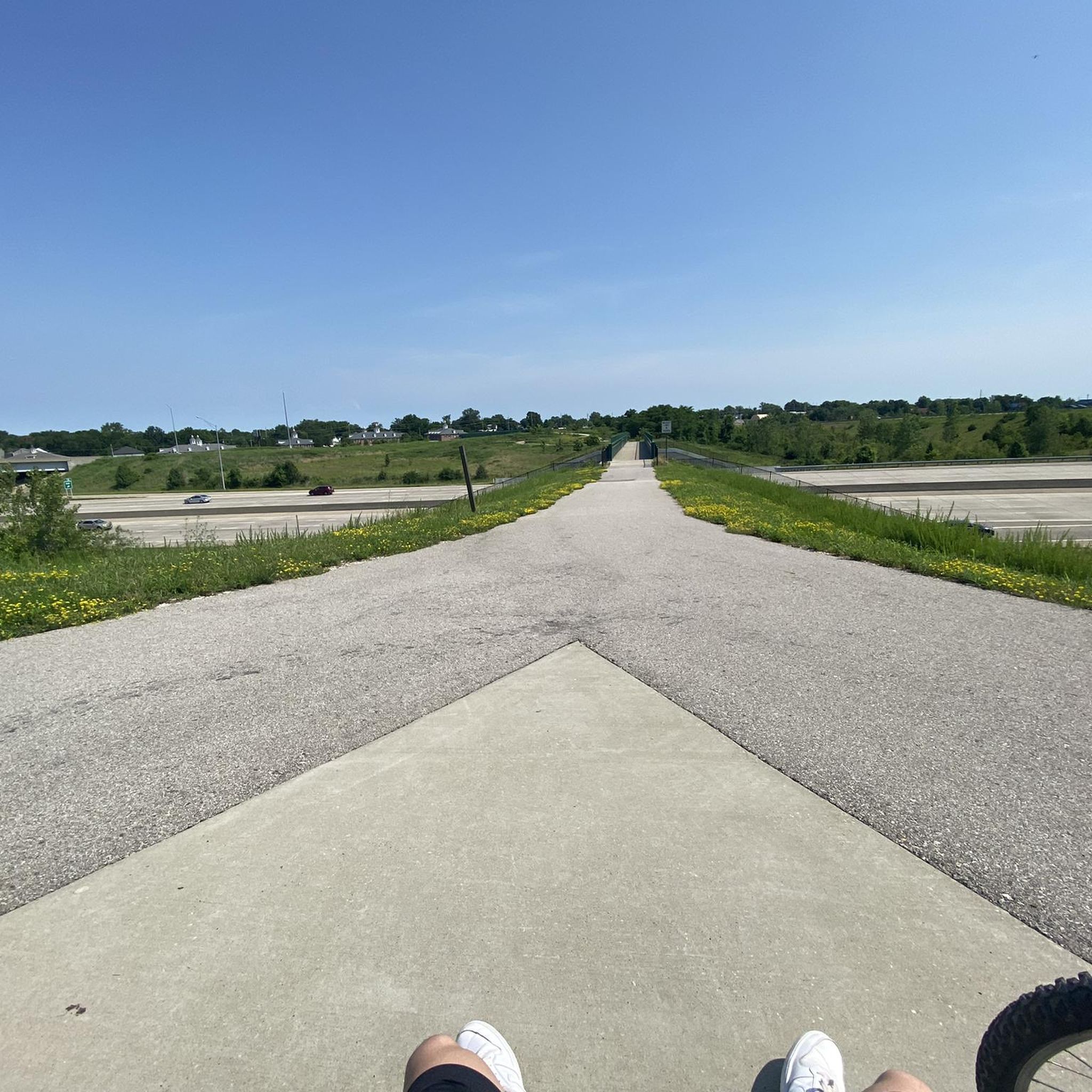
Scenic lake park with many great amenities and sites including the namesake lake and Dripping Springs waterfall The primary MTB trail called Bootleggers Run is a fun, well maintained trail with tight turns and nice berms that provides for a fun fast ride.
0
0

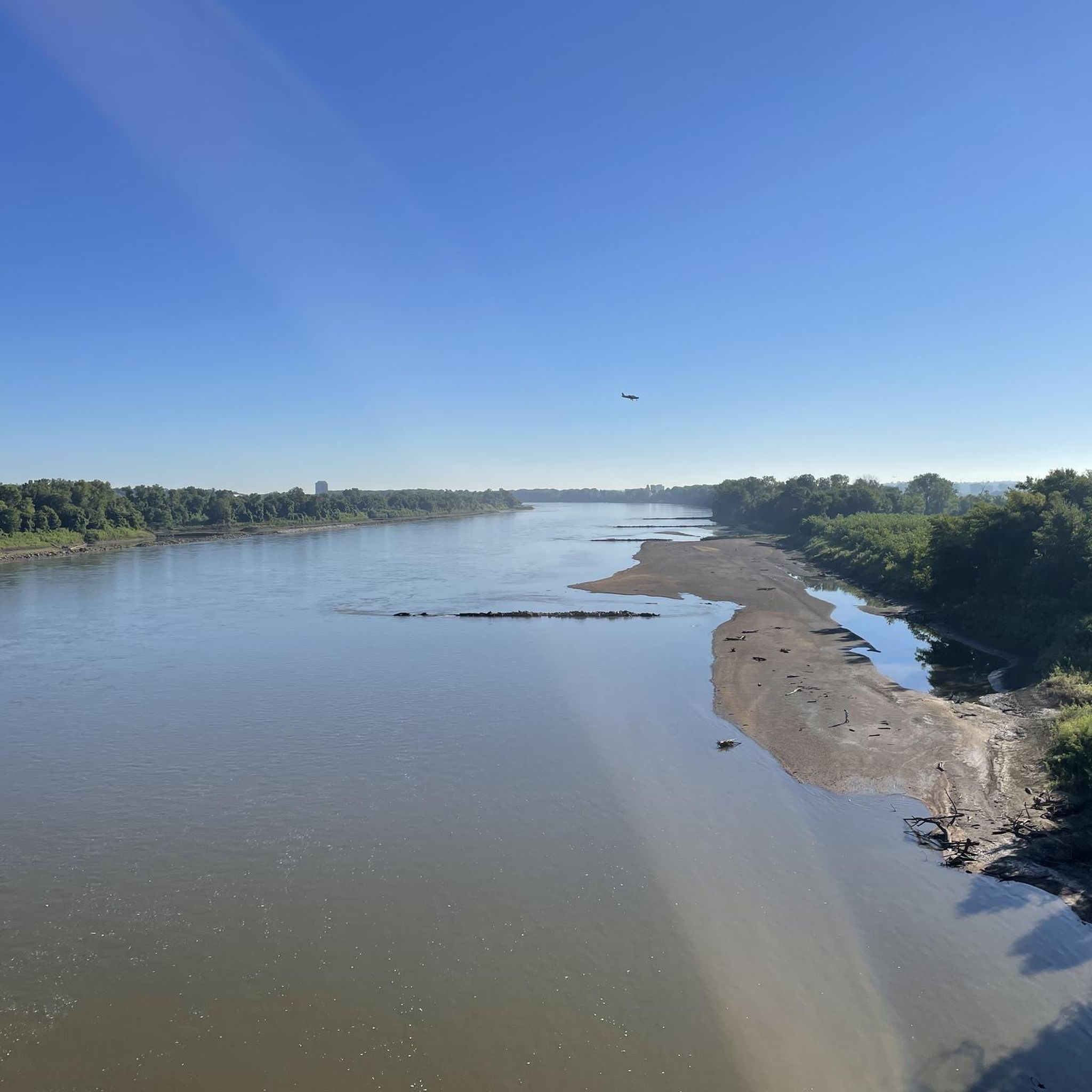
This section of the Katy Trail extends from Greens Bottom Road to Missouri Research Trail. Here, you'll discover a shady, compact gravel road with views of the Missouri River.
0
0
Historic St. Charles is just a 30-minute drive from downtown St. Louis. The brick streets in its Nationally Registered Historic District add to its charm. You can find special items like home accessories, jewelry, and unique gifts in the shops there. It's a great place to stop and take a break!
0
0
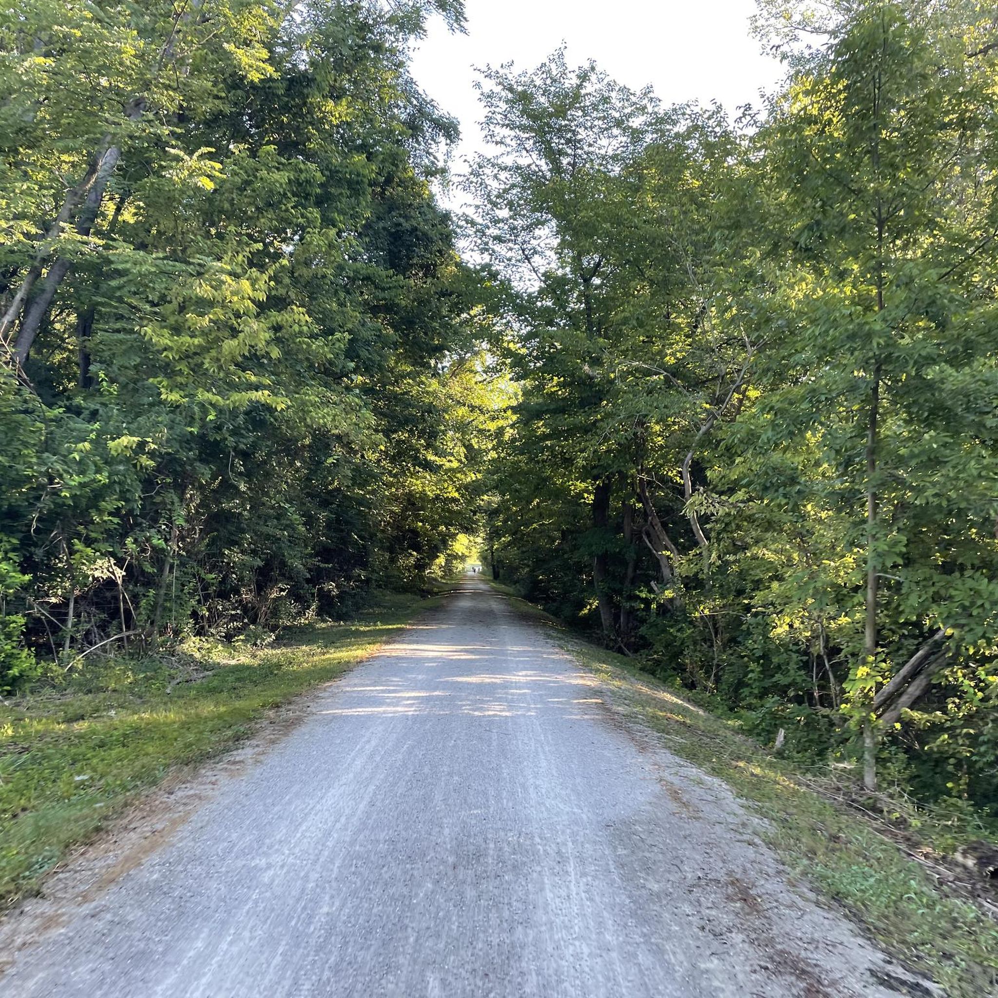
This section of the Katy Trail starts right after St. Charles and goes all the way to the 364 bridge. The gravel is compact.
1
0
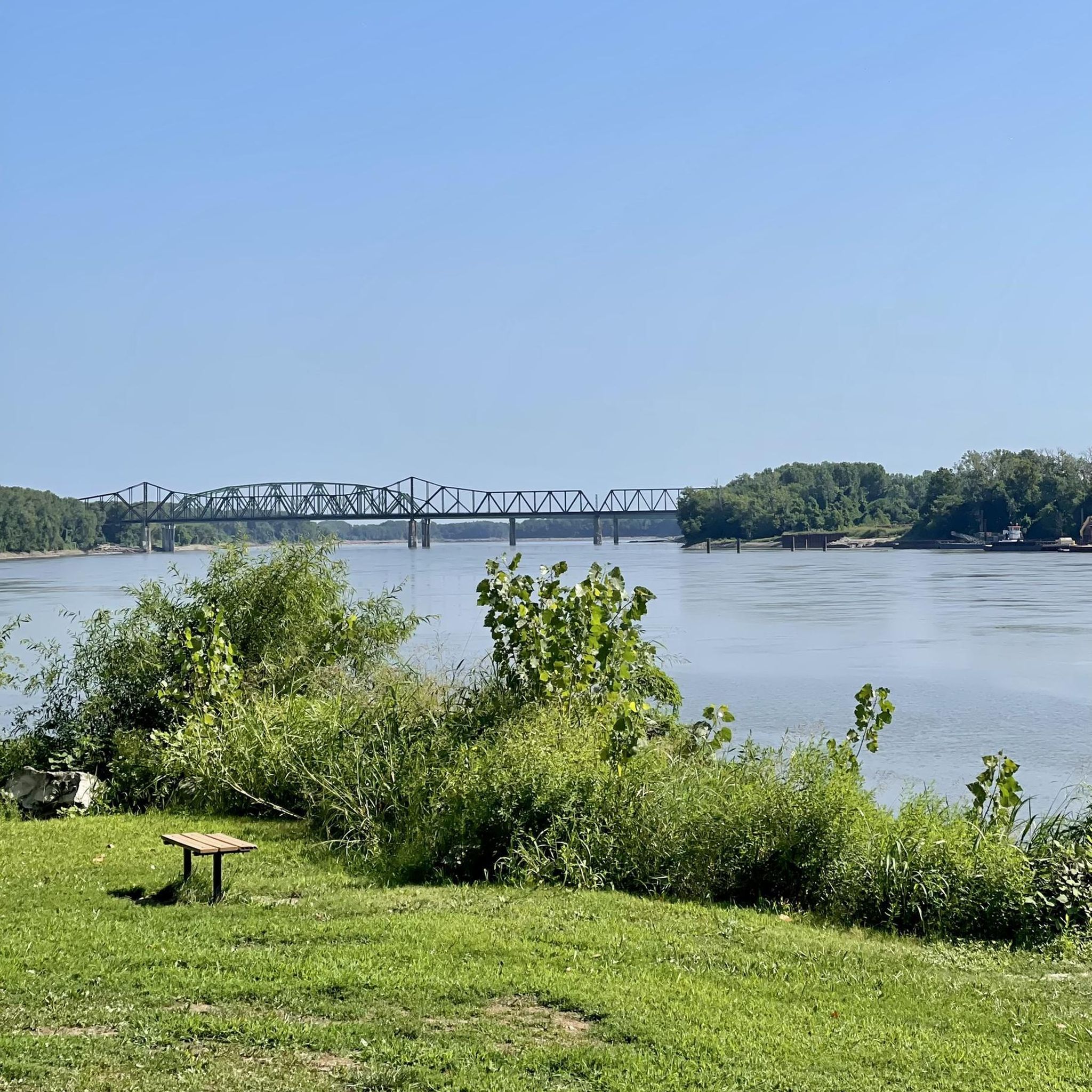
Frontier Park spans 16 acres and rests alongside the Missouri River, just across the street from Historic St. Charles. Several historic pavilions and lovely trails wind their way through the park.
0
0
This section of the Katy Trail extends from Greens Bottom Road to Missouri Research Trail. Here, you'll discover a compact gravel road shaded with views of the Missouri River.
0
0
This section of the Katy Trail starts right after St. Charles and goes all the way to the 364 bridge. The gravel is compact and better for bikes with gravel or mountain bike tires.
0
0
Frontier Park spans 16 acres and rests alongside the Missouri River, just across the street from Historic St. Charles. Several historic pavilions and lovely trails wind their way through the park.
0
0
Frequently Asked Questions
Are there mountain bike trails suitable for beginners in St. Charles?
Yes, St. Charles offers several options for beginner mountain bikers. The Historic Downtown St. Charles – Frontier Park loop from Saint Charles is an easy 7.6-mile route that takes you through urban and riverside areas. Additionally, Kinetic Park features a large pump track with beginner sections, and Klondike Park's Hogsback Trail is known as an easy loop.
Where can I find more challenging mountain bike trails in St. Charles?
For those seeking a greater challenge, St. Charles has several moderate trails. The Chesterfield Settlers Cemetery – Monarch Levee Trail loop from Legend Hill is a moderate 26.1-mile route. Missouri Bluffs Park offers a dedicated mountain bike-only downhill trail system, alongside several miles of multi-use cross-country single-track. Lost Valley also provides highly rated intermediate singletrack trails like the Lost Valley Trail.
Are there family-friendly mountain bike trails in St. Charles?
Absolutely. Beyond the beginner sections at Kinetic Park, the Katy Trail offers a long, relatively flat crushed limestone path suitable for families. The Boschert Greenway is another 3.8-mile option that's great for a leisurely ride with children. For a slightly longer, easy ride, consider the Historic Downtown St. Charles – Frontier Park loop from Saint Charles.
What kind of natural features and landscapes can I expect on St. Charles mountain bike trails?
St. Charles mountain bike trails traverse diverse landscapes, including native oak-hickory woodlands, fens, wetlands, savannas, and prairies. Many routes offer scenic views of the Missouri River, such as the Creve Coeur Lake – View of the Missouri River loop from Heritage Museum Parking. You'll also encounter dense, old-growth forests and scenic creek crossings, particularly in parks like Matson Hill Park.
Are there any notable landmarks or points of interest along the mountain bike routes?
Yes, several routes offer access to interesting landmarks. The Historic Downtown St. Charles – Frontier Park loop from Saint Charles passes by Frontier Park, offering views of the Missouri River. You might also spot the Veterans Memorial Bridge. The area around Creve Coeur Lake, accessible via the Creve Coeur Lake – View of the Missouri River loop from Heritage Museum Parking, features Mallard Lake and offers a Sunset View of Creve Coeur Lake.
What do other mountain bikers enjoy the most about mountain biking in St. Charles?
The mountain biking experience in St. Charles is highly rated by the komoot community, with an average score of 5.0 stars. Reviewers often praise the varied terrain, from dense woodlands to riverfront paths, and the well-maintained single-track trails that cater to different ability levels.
Are there many loop mountain bike trails available in St. Charles?
Loop trails are a popular feature in St. Charles. Many parks offer circular routes, such as the Matson Hill Loop in Matson Hill Park, the Hogsback Trail in Klondike Park, and the 5-mile mountain biking route in Broemmelsiek Park. The Bootlegger's Run Trail is another great loop option.
What is the best time of year to go mountain biking in St. Charles?
The best time for mountain biking in St. Charles is typically during the spring and fall months when temperatures are mild and the foliage is vibrant. Summer can be enjoyable, but be prepared for warmer temperatures and potential humidity. Winter riding is possible, but some trails may be affected by snow or ice, so checking local trail conditions is always recommended.
Are there any specific parks known for mountain biking in St. Charles?
Several parks are renowned for their mountain biking offerings. Kinetic Park is famous for its pump track, while Bangert Island Park provides 4 miles of natural surface trails with good flow. Missouri Bluffs Park features a dedicated downhill system, and Lost Valley, Matson Hill Park, Klondike Park, and Broemmelsiek Park all contribute significantly to the robust trail network in the region.
Are there places to eat or get supplies near the mountain bike trails?
Yes, St. Charles has a vibrant community with amenities. Historic Downtown St. Charles, which is accessible via routes like the Historic Downtown St. Charles – Frontier Park loop from Saint Charles, offers various cafes, pubs, and restaurants. Additionally, local bike shops like Bike Stop Café and Take a Hike Shop provide rentals, gear, and repair services, often located conveniently near popular trailheads.
What is the typical terrain and elevation gain like on St. Charles mountain bike trails?
The terrain in St. Charles is quite varied, ranging from crushed limestone paths on the Katy Trail to natural surface singletrack, dense forest trails, and even dedicated downhill sections. Elevation gain varies significantly; for example, the Bootlegger's Run Trail has around 67 meters of elevation gain, while longer routes like the Creve Coeur Lake – View of the Missouri River loop from Heritage Museum Parking can feature over 230 meters of ascent, offering a good workout.
Most popular routes around St. Charles
Most popular attractions around St. Charles

Get inspired with the komoot mobile app


Explore more
Browse the best MTB trails in other regions.
