The best running trails around Long Lake
4.0
(1)
308
runners
26
runs
Jogging around Long Lake offers diverse terrain, from municipal trails and sidewalks in downtown areas to dedicated running tracks and natural paths. The region features extensive lakeside routes, including those around Nelson Lakeside Park, and longer trails like sections of the Luce Line State Trail. Some areas, such as those in the Uinta Mountains, present more challenging, rocky trails with significant elevation gain, while others provide gentler, wooded paths suitable for varied running experiences.
Best jogging routes around Long Lake
…Last updated: October 2, 2026
19
runners
25.0km
02:35
90m
90m
Hard run. Very good fitness required. Mostly paved surfaces. Suitable for all skill levels.
20
runners
13.2km
01:22
40m
40m
Moderate run. Good fitness required. Mostly paved surfaces. Suitable for all skill levels.

15
runners
18.6km
01:56
60m
60m
Hard run. Very good fitness required. Mostly paved surfaces. Suitable for all skill levels.
12
runners
7.54km
00:47
30m
30m
Moderate run. Good fitness required. Mostly paved surfaces. Suitable for all skill levels.
10
runners
Moderate run. Good fitness required. Mostly paved surfaces. Suitable for all skill levels.
Get access to more routes and recommendations from other explorers.
Already have an account?
Our route recommendations are based on thousands of hikes, rides, and runs completed by other people on komoot.
Start today with a free account
Your next adventure awaits.
Tips from the Community


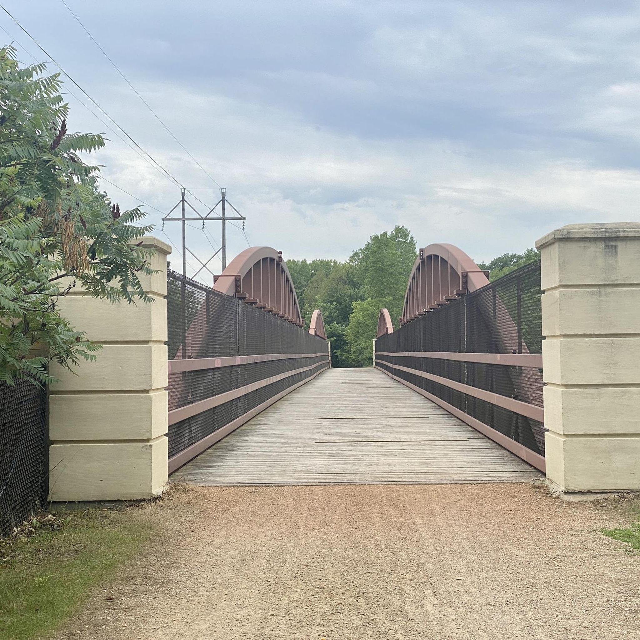
A short bridge that carries the Luce Line State Trail over Wayzata Boulevard.
0
0
A short pedestrian bridge that saves you from the chaos of trying to dart across U.S. Route 12.
0
0

This short bridge on the Lake Minnetonka Regional Trail give you great views of Saint Albans Bay. It is purpose built for trail users and set apart from the road traffic bridge.
0
0

The St. Albans Bay Bridge carries Minnetonka Boulevard over St. Albans Bay, an inlet of Lake Minnetonka, connecting the cities of Excelsior and Greenwood in Minnesota. From the bridge you get great views over the bay, making it a pleasant place to stop and take in the views as you ride around the area.
1
0

The Dakota Rail Regional Trail stretches 28.1 miles from Wayzata to Lester Prairie, Minnesota, along the former Hutchinson Spur of the Great Northern Railway. This paved trail is popular with bikers, skaters, and hikers, offering a look at lakes, wetlands, woodlands, and farmlands. Starting in Wayzata, you can park at the trailhead on Grove Lane and grab a bite or fill up water downtown. The Carver County section extends an additional 12.5 miles west of St. Bonifacius to Mayer. Maps along the trail show your location, restrooms, and nearby services, with parking available at several locations.
0
0
This portion of the Dakota Rail Regional Trail near Minnetonka Beach offers scenic views along the shores of Lake Minnetonka. This section of the 29-mile paved trail is popular due to its proximity to the water; you get nearly continuous lake vistas and pass by buildings and attractions that reflect the area’s history as a 19th-century resort destination. The trail is open for walking, running, and cycling, with easy access to parking and facilities along its route.
0
1

This spot along the Dakota Rail Regional Trail offers views of Crystal Bay and Lake Minnetonka. It can be an awesome spot for a sunset.
0
0
Frequently Asked Questions
How many running routes are available around Long Lake, and what are their difficulty levels?
Long Lake offers a diverse selection of over 15 running routes. These include 1 easy route, 10 moderate routes, and 5 difficult routes, providing options for every fitness level and preference.
Are there any easy or beginner-friendly jogging paths in the Long Lake area?
Yes, for beginners or those seeking a gentler run, there is at least one easy route available. Additionally, many municipal trails and sidewalks in downtown areas, such as those in Long Lake, Minnesota, or the 1/3 mile track at Haywood Park in Long Lake Township, Michigan, offer accessible and less strenuous options.
What are some of the more challenging running routes around Long Lake?
For experienced runners looking for a challenge, Long Lake features 5 difficult routes. One notable option is the Bederwood Park loop from St Philip Park & Ride, a 14.1-mile (22.7 km) path that offers a demanding run through varied landscapes. The Uinta Mountains in Utah also present strenuous jogging experiences with rocky trails and significant elevation gain.
Are there any family-friendly jogging routes or areas suitable for running with children?
Yes, several areas around Long Lake are suitable for families. In the Adirondacks, the Mt. Sabattis Recreation Area offers trails that are excellent walking paths, providing scenic views. In Long Lake, Minnesota, municipal trails and parks like Nelson Lakeside Park offer pleasant, accessible environments for family jogs. Long Lake Township, Michigan, also has Haywood Park with a running track and Fisher's Run, a 1.1-mile walk in the woods.
Can I bring my dog on the running trails around Long Lake?
While specific dog-friendly regulations can vary by location, many natural trails around Long Lake are generally suitable for dogs, provided they are kept on a leash. Areas like the Luce Line State Trail in Minnesota or Fisher's Run in Michigan offer natural settings where dogs are often welcome. Always check local signage for specific rules regarding pets.
Are there any circular running routes in the Long Lake region?
Yes, many of the routes around Long Lake are designed as loops, offering a convenient circular experience. For example, the St. Albans Bay Bridge – Excelsior Brewing loop from Shorewood is a popular 4.7-mile (7.6 km) circular route. Another option is the Running loop from St Philip Park & Ride, an 8.2-mile (13.2 km) trail through parklands.
What kind of viewpoints or scenic attractions can I expect along the jogging routes?
The Long Lake region boasts numerous scenic spots. In the Adirondacks, trails at Mt. Sabattis offer breathtaking views of Long Lake, while Owls Head Mountain and the Blue Mountain Fire Tower provide spectacular vistas. In Minnesota, Nelson Lakeside Park offers pleasant lakeside jogs. The Uinta Mountains in Utah feature views of Crystal Lake and Mount Watson, with high-elevation meadows. You might also encounter highlights like the St. Albans Bay Bridge or the Ferndale Marsh along some routes.
Are there any less crowded running options for a more peaceful experience?
For a quieter run, consider exploring trails slightly off the main paths or visiting during off-peak hours. While specific 'less crowded' routes aren't explicitly listed, areas like Fisher's Run in Long Lake Township, Michigan, which offers a walk in the woods, or the more rugged trails in the Uinta Mountains, might provide a more secluded experience compared to popular lakeside or municipal routes.
What do other runners say about the jogging routes in Long Lake?
The running routes in Long Lake are highly regarded by the komoot community, holding an average rating of 4.0 stars. Over 100 runners have used komoot to explore the area, often praising the diverse terrain, from lakeside paths to wooded trails, and the variety of options available for different ability levels.
Are there any routes that incorporate bridges or unique natural features?
Yes, several routes feature interesting bridges and natural landmarks. The St. Albans Bay Bridge – Excelsior Brewing loop from Shorewood, for instance, includes the scenic St. Albans Bay Bridge. Other natural features in the broader Long Lake area include Buttermilk Falls in the Adirondacks and the rugged volcanic basalt cliffs near Long Lake in Eastern Washington, offering unique landscapes for adventurous runners.
What are the typical distances and durations for running routes around Long Lake?
Running routes around Long Lake vary significantly in length and time. You can find shorter loops like the 4.7-mile (7.6 km) St. Albans Bay Bridge – Excelsior Brewing loop from Shorewood, which takes about 47 minutes. Longer, more challenging routes, such as the 14.1-mile (22.7 km) Bederwood Park loop from St Philip Park & Ride, can take over 2 hours to complete, depending on your pace.
Are there any specific trails that are part of a larger network, like state trails?
Yes, in Long Lake, Minnesota, a significant natural feature is the Luce Line State Trail. This 63-mile-long former railroad grade is ideal for biking, hiking, and horseback riding, and can also be utilized for running, offering extensive mileage for those looking to explore a larger network.
Most popular attractions around Long Lake

Get inspired with the komoot mobile app


Explore more
Browse the best Running Trails & Routes in other regions.
