The best running trails around Oakdale
4.4
(7)
635
runners
63
runs
Jogging routes around Oakdale offer a diverse landscape for runners, featuring a mix of natural preserves, parklands, and dedicated trails. The region includes areas with extensive prairie, mature trees, and lakes, providing varied scenery. Many running routes incorporate paved paths and bikeways, alongside natural surfaces, catering to different preferences. This blend of environments makes Oakdale suitable for a range of running experiences.
Best jogging routes around Oakdale
- The most popular jogging route is Lower Afton Bikeway and Battle Creek Park…
Last updated: May 21, 2026
1
runners
16.5km
01:46
120m
120m
Jog the difficult 10.2-mile Lower Afton Bikeway and Battle Creek Park Loop, gaining 382 feet through diverse woods, wetlands, and grasslands
19
runners
9.68km
01:10
130m
130m
Moderate run. Good fitness required. Mostly paved surfaces. Suitable for all skill levels.

Sign up for free
5.0
(1)
9
runners
Moderate run. Good fitness required. Mostly paved surfaces. Suitable for all skill levels.
8
runners
9.34km
00:58
50m
50m
Moderate run. Good fitness required. Mostly paved surfaces. Suitable for all skill levels.
7
runners
15.8km
01:38
70m
70m
Hard run. Very good fitness required. Mostly paved surfaces. Suitable for all skill levels.
Get access to more routes and recommendations from other explorers.
Sign up for free
Already have an account?
Our route recommendations are based on thousands of hikes, rides, and runs completed by other people on komoot.
Start today with a free account
Your next adventure awaits.
Login or Signup
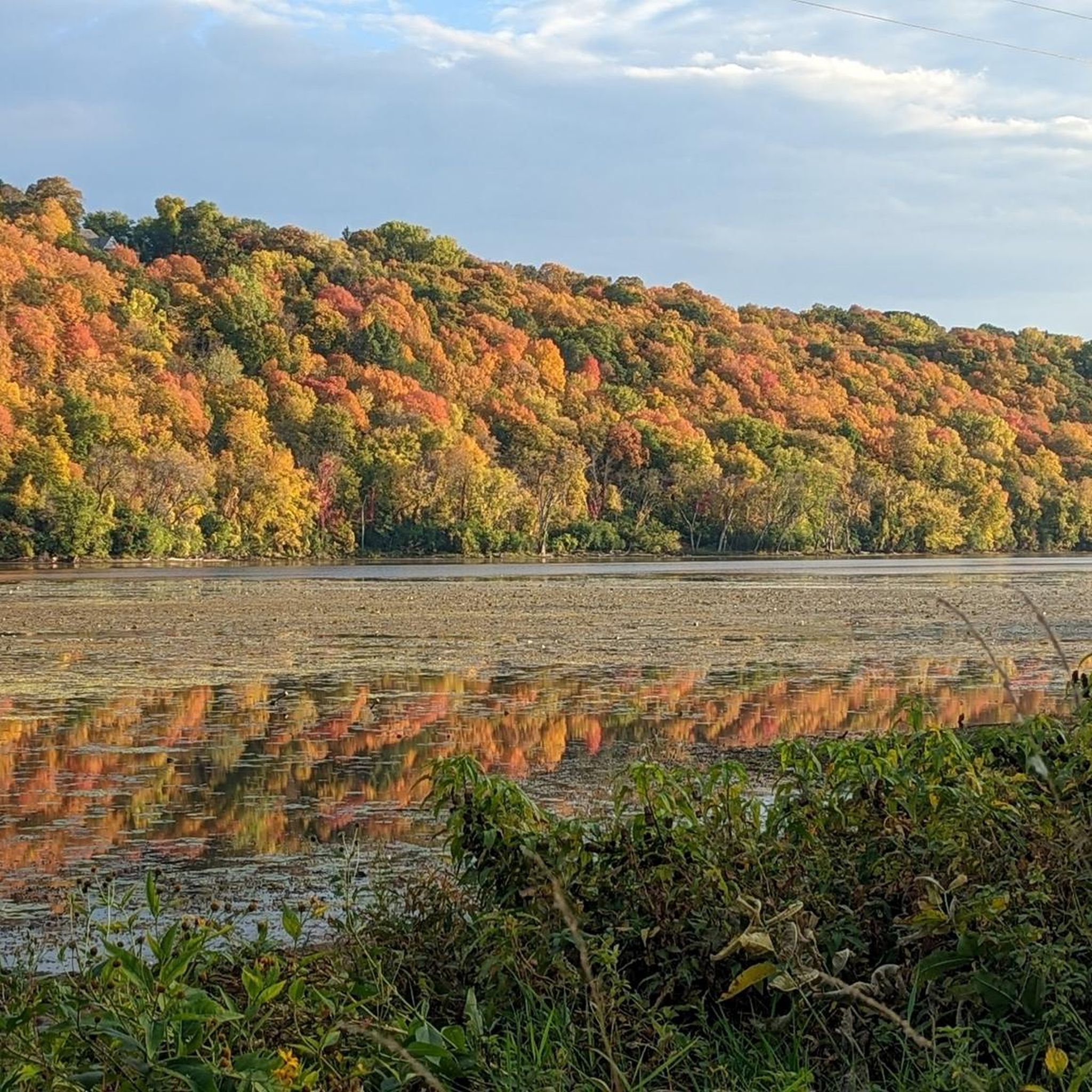
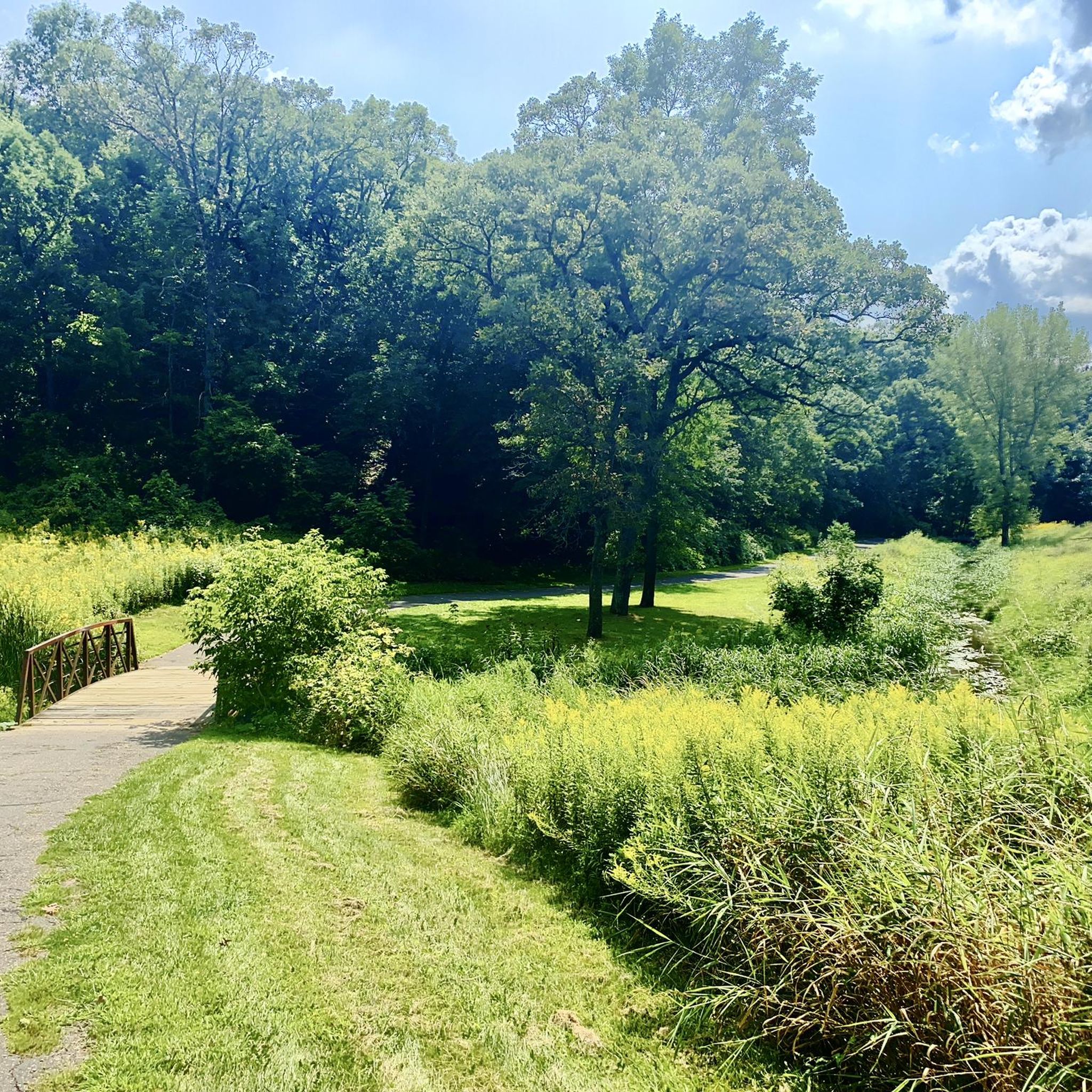
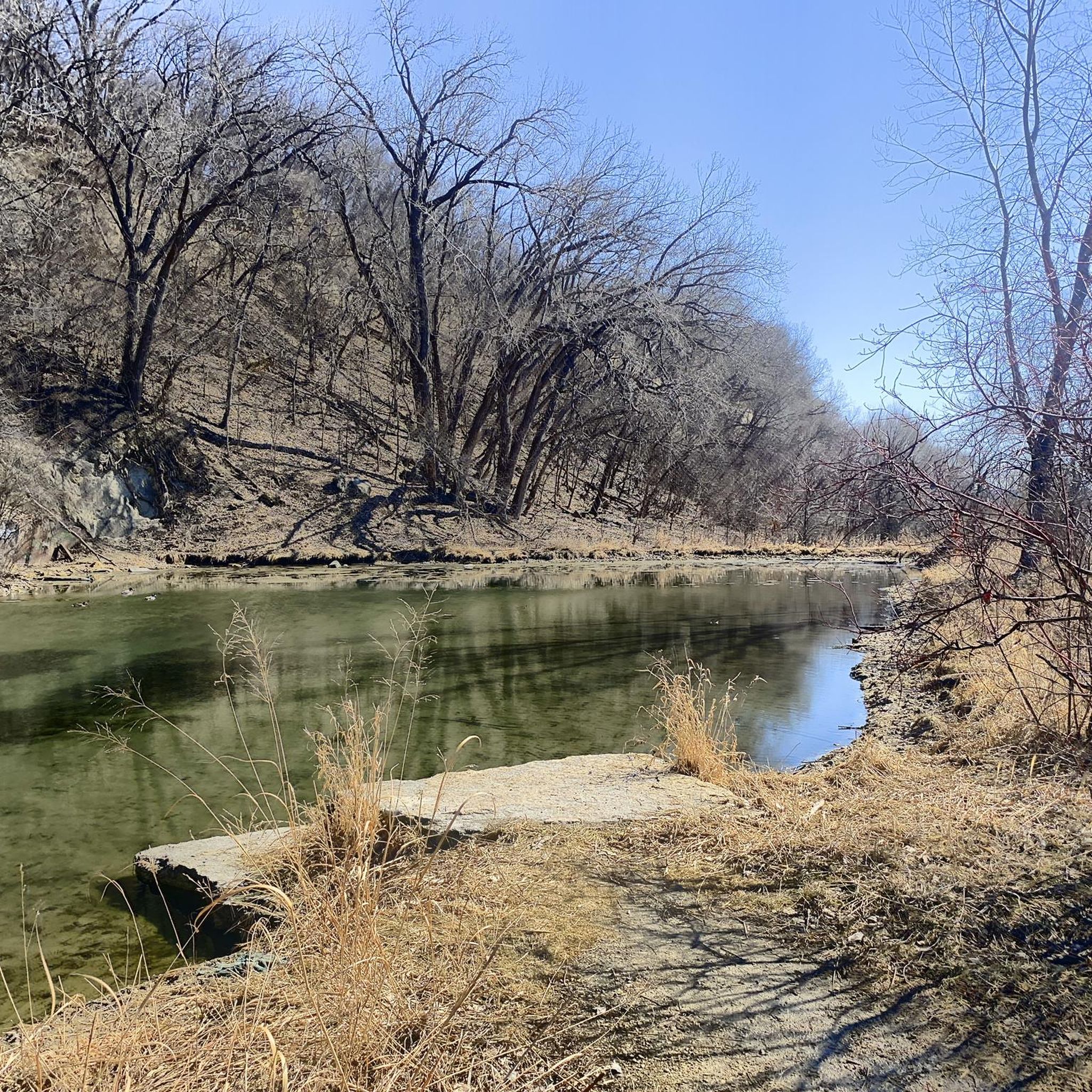
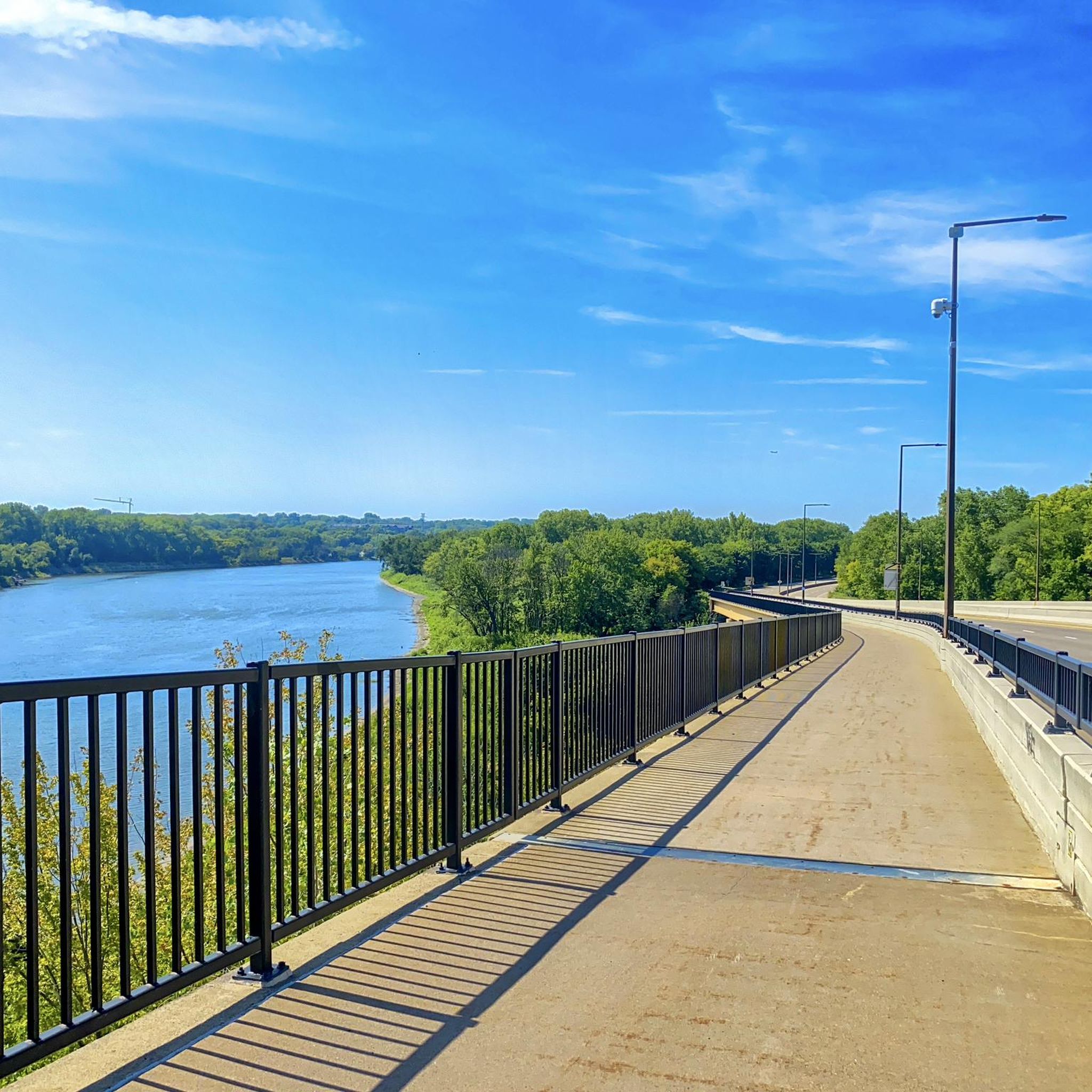
Tips from the Community

This is a pretty big park that has lots of features, mountain bike trails, paved trails, ballfields, playgrounds, goes for blocks.
1
0

The Brown's Creek State Trail and Gateway State Trail meet here at Duluth Junction. There is a large parking area along with restrooms at this trailhead, making it a great spot to start your ride.
0
0

Battle Creek Regional Park is over 1,800 acres of natural woodlands, grasslands, & wetlands. The miles and miles of trails are perfect for hikers, cyclists, and runners to escape the city and enjoy immersion in nature without needing to travel far from home.
0
0

The Battle Creek Pavilion Area is the northern section of Battle Creek Regional Park. There is a paved trail that loops through this section of the park and takes you along several ponds.
0
0

The Gateway State Trail is a paved 18-mile multi-use trail from the city of St. Paul to Pine Point Regional Park.
0
0

The Battle Creek Winthrop Recreation Area is a section of the bigger Battle Creek Regional Park. In comparison to the other sections, the area doesn't include any paved trails and follows grassy or gravel trails instead.
1
0
Battle Creek Regional Park is over 1,800 acres of natural woodlands, grasslands, & wetlands. The miles and miles of trails are perfect for hikers, cyclists, and runners to escape the city and enjoy immersion in nature without needing to travel far from home.
0
0

At Duluth Junction, two trails converge: the Gateway State Trail, a paved ribbon of green that links St. Paul with Pine Point Regional Park, and the Brown’s Creek State Trail, a scenic jaunt to Stillwater and the St. Croix River. Hike through diverse terrain, from city parks and marshes to forested hills and historic spans . Duluth Junction has parking, restrooms and local trail connections.
1
0
Frequently Asked Questions
How many running routes are available in Oakdale?
Oakdale offers a wide selection of running routes, with nearly 70 different options to explore. These routes cater to various preferences, ranging from easy strolls to more challenging runs.
Are there easy jogging routes suitable for beginners or families in Oakdale?
Yes, Oakdale has several easy jogging routes perfect for beginners or families. For instance, the Margaret Lake loop from Nordic Center is an easy 2.8-mile (4.5 km) trail that takes about 33 minutes to complete, leading through a recreational area around a lake. The region's commitment to accessible outdoor spaces, like the half-mile track at Oakdale Playground in Gretna, also provides dedicated paths for lighter jogging.
What are some scenic spots or attractions I can see while running in Oakdale?
Many running routes in Oakdale offer scenic views and pass by interesting attractions. You might encounter beautiful natural features like Lake Phalen or the expansive Battle Creek Regional Park. The Oakdale Nature Preserve, with its 28-acre lake, prairie land, and mature trees, also provides a picturesque backdrop for your run. Some routes, like those near the Gateway State Trail, might even lead you past points of interest such as Duluth Junction.
Are there any circular running routes in Oakdale?
Yes, Oakdale features several excellent circular running routes. A popular choice is the Running loop from Ruth St, a moderate 6.0-mile (9.7 km) path offering a balanced experience with varied terrain. The Margaret Lake loop from Nordic Center is another great circular option, ideal for a shorter, easy run.
What kind of terrain can I expect on jogging trails in Oakdale?
Jogging trails in Oakdale offer a diverse mix of terrain. You'll find extensive paved paths and bikeways, such as those within the Oakdale Nature Preserve or sections of the Long Island Greenbelt Trail. Additionally, many routes incorporate natural surfaces through parklands, prairies, and mature tree areas, providing a varied running experience.
Are there dog-friendly running routes in Oakdale?
While specific dog-friendly designations for every route aren't always listed, many natural preserves and park areas in Oakdale generally welcome dogs on leashes. The Oakdale Nature Preserve, with its extensive trails, is a popular spot for outdoor activities, and many local parks allow leashed pets. It's always a good idea to check local signage or park regulations for specific rules regarding dogs on trails.
Where can I find parking for jogging trails in Oakdale?
Parking availability varies by location, but many popular jogging areas in Oakdale, such as the Oakdale Nature Preserve, offer dedicated parking facilities. For trails like the Long Island Greenbelt Trail, specific access points often have parking lots. Community spaces like Oakdale Playground in Gretna also provide convenient parking for those using its track and facilities.
What do other runners enjoy most about jogging in Oakdale?
The komoot community highly rates the running experience in Oakdale, with an average score of 4.6 stars from over 5 reviews. Runners often praise the region's diverse landscape, which includes a mix of natural preserves, parklands, and dedicated trails. The variety of paved paths and natural surfaces, catering to different ability levels, is also frequently highlighted as a positive aspect.
Are there any longer or more challenging running routes in Oakdale?
Yes, for those seeking a longer or more challenging run, Oakdale has options. The Lower Afton Bikeway and Battle Creek Park Loop is a difficult 10.2-mile (16.5 km) trail that combines a bikeway with park trails, taking about 1 hour 46 minutes to complete. Another challenging option is the Gateway State Trail – Duluth Junction loop from Pine Springs, which spans 15.8 miles (25.5 km).
Can I find running routes that are less crowded in Oakdale?
While popular spots like the Oakdale Nature Preserve can see activity, Oakdale's extensive network of nearly 70 routes means you can often find less crowded options, especially during off-peak hours or by exploring some of the less-trafficked park trails. The region's diverse offerings, including various parklands and dedicated paths, allow for a more secluded running experience if desired.
Are there any specific events or community activities related to running in Oakdale?
Yes, the suitability and popularity of Oakdale for running are highlighted by events such as the Oakdale Nature Preserve 5K. This indicates a community focus on running and provides opportunities to participate in organized events. For more details on this specific event, you can visit the official city website: oakdalemn.gov.
What amenities are available along or near jogging routes in Oakdale?
Many jogging routes in Oakdale are situated near or within areas offering various amenities. The Oakdale Nature Preserve, for example, includes a playground area, picnic spots, a tree trek, and a forest garden. Oakdale Playground in Gretna provides outdoor fitness equipment and tennis courts alongside its running track. While specific cafes directly on trails might vary, many routes are accessible from areas with local businesses.
Most popular attractions around Oakdale

Get inspired with the komoot mobile app


Explore more
Browse the best Running Trails & Routes in other regions.
