The best cycling routes around Arbutus
4.4
(112)
1,098
riders
112
rides
Touring cycling routes around Arbutus are primarily defined by the Patapsco River Valley, an area characterized by dense forests, winding rivers, and varied terrain. The region encompasses parts of Patapsco Valley State Park, offering extensive trail networks with moderate elevation changes. These routes often follow river corridors and former rail lines, providing a mix of paved paths and natural surfaces. The landscape includes numerous hills, contributing to the diverse cycling experiences available.
Best touring cycling routes around Arbutus
- The most popular touring cycling route is BWI Trail, a 24.0 miles (38.6 km) trail that takes 2 hours 21 minutes to complete. This paved loop encircles the Baltimore/Washington International Airport, offering unique views and peaceful sections through pine forest.
- Another top favourite among local touring cyclists is Lost Lake – Patapsco Valley State Park loop from Saint Denis, an easy 11.5 miles (18.6 km) path. This route explores the natural beauty of Patapsco Valley State Park, featuring forests and river views.
- Local touring cyclists also love the Lost Lake – Rockburn Branch Park loop from University of Maryland Baltimore County, a 13.1 miles (21.2 km) trail leading through forested areas and parkland, often completed in about 1 hour 57 minutes.
- Touring cycling around Arbutus is defined by the Patapsco River Valley, dense forests, and extensive park trails like the BWI Trail. The network offers options for different ability levels, from easy loops to more moderate paths with varied terrain.
- The routes in Arbutus are highly rated by the komoot community with an average score of 4.4 stars from over 100 reviews. More than 1,200 touring cyclists have used komoot to explore Arbutus's varied terrain.
Last updated: May 21, 2026
16
riders
38.6km
02:21
280m
280m
Moderate bike ride. Good fitness required. Mostly paved surfaces. Suitable for all skill levels.
1
riders
20.0km
01:34
260m
260m
Moderate bike ride. Good fitness required. Some segments of this route may be unpaved and difficult to ride.

Sign up for free
5.0
(1)
13
riders
20.4km
01:15
130m
130m
Easy bike ride. Great for any fitness level. Mostly paved surfaces. Suitable for all skill levels.
10
riders
Moderate bike ride. Good fitness required. Mostly paved surfaces. Suitable for all skill levels.
4.9
(7)
7
riders
20.6km
01:20
220m
220m
Moderate bike ride. Good fitness required. Mostly paved surfaces. Suitable for all skill levels.
Get access to more routes and recommendations from other explorers.
Sign up for free
Already have an account?
Our route recommendations are based on thousands of hikes, rides, and runs completed by other people on komoot.
Start today with a free account
Your next adventure awaits.
Login or Signup
Tips from the Community

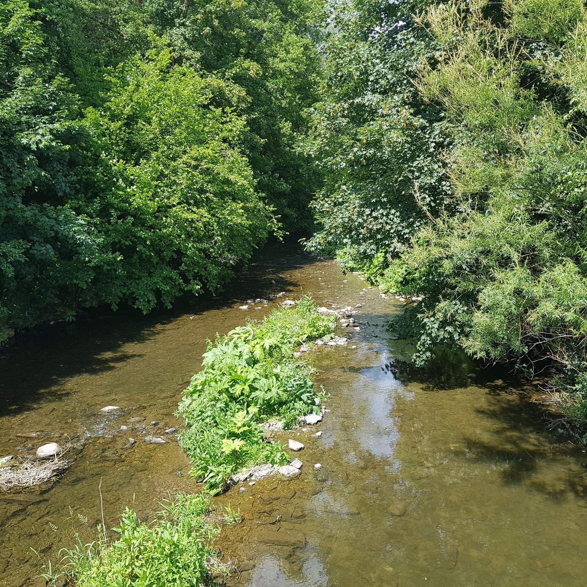
It gets very cold as you get close to Patapsco River near the bridge. The bridge does move a little but very secure as you cross it. Be mindful if you’re wearing a skirt (Ms Monroe)
0
0

The Ilchester Road access point to the Ridge Trail offers a thrilling start for cyclists exploring Patapsco Valley State Park. Expect a steep, technical climb with rocky sections, rewarding you with flowing trails and forest views at the top. For a longer ride, connect to the Orange Grove area to enjoy smoother paths and cross the historic swinging bridge. Be prepared for limited parking and challenging terrain that tests both endurance and skill.
0
0

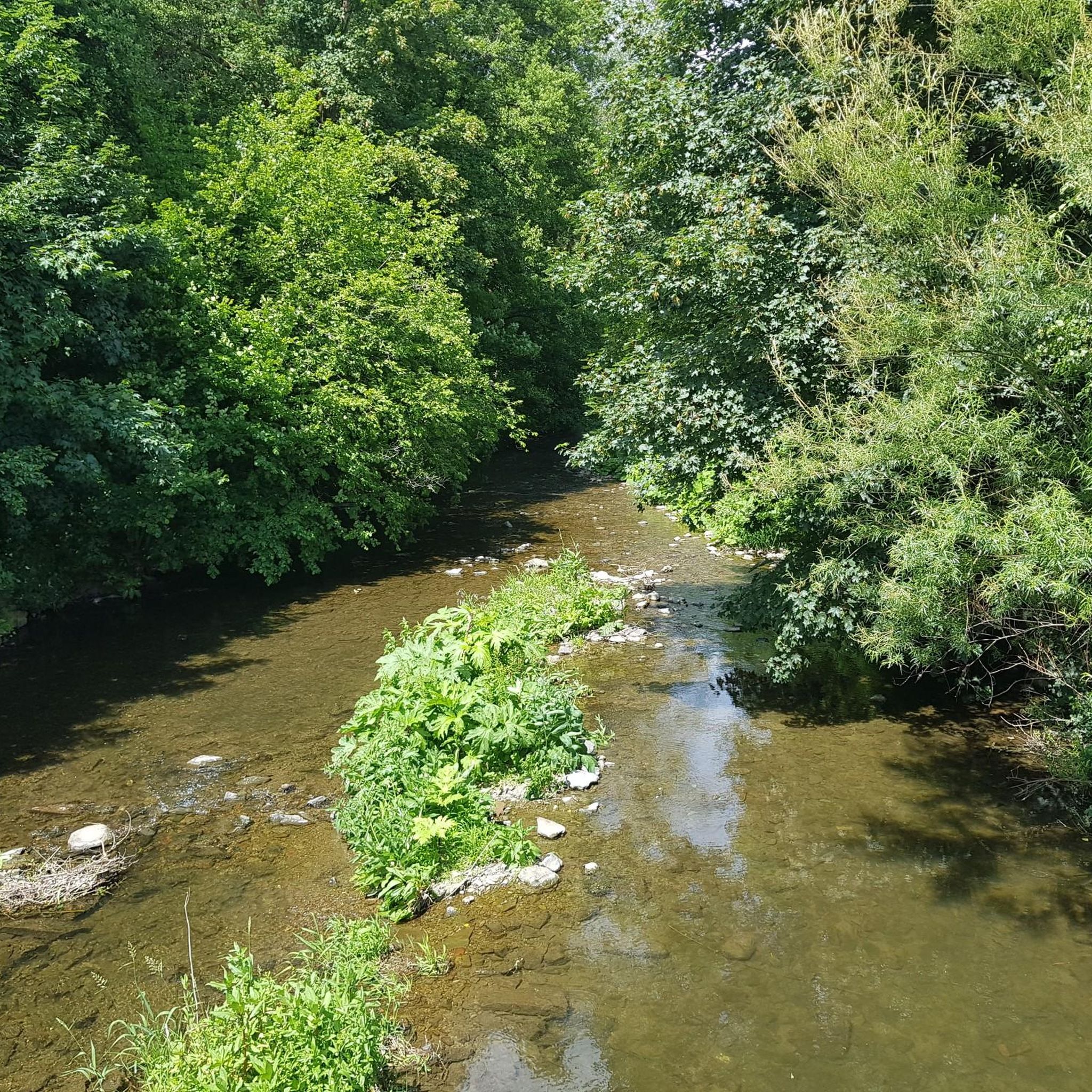
The Patapsco Valley was Maryland's first and remains its largest state park. The 14,000 acres (5,700 ha) are made up of forests, winding rivers and cascading waterfalls. It's a great place for hiking, camping, canoeing, horseback riding and mountain biking. Or simply just bring a picnic and relax by the river. Some historical sites are also worth visiting in the park such as the Thomas Viaduct and Orange Grove Flour Mill.
0
0

The BWI Trail is an 11-mile asphalt trail that encircles the BWI Airport. It was designed with commuters in mind, but it also makes for a great recreational outing.
0
0
Patapsco Valley State Park Hilton Area invites with its scenic beauty along the Patapsco River. Trails weave through wooded landscapes, offering a perfect blend of nature and recreation for visitors.
0
0

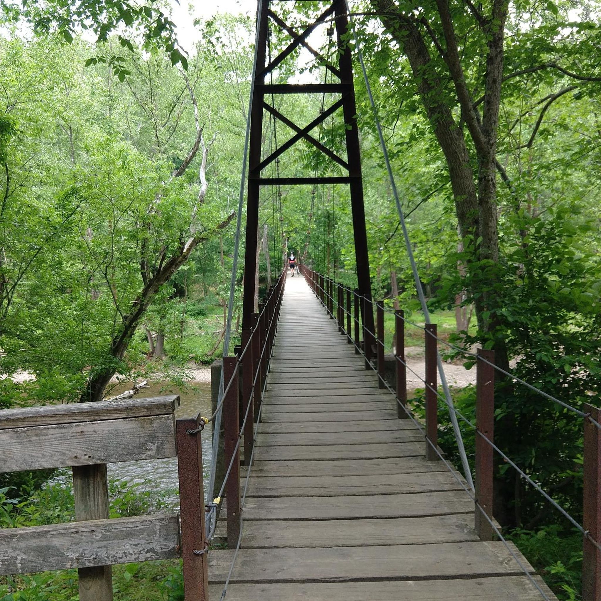
This popular swinging bridge crosses the Patapsco River. It is a wooden suspension bridge with metal cables. On the bridge you'll have great views of the river and surrounding woodland. It isn't too high up, so even if you're afraid of heights it's still worth passing over the bridge. Be courteous of other pedestrians as the bridge is fairly narrow!
1
0
The Grist Mist Trail passes through the Patapsco Valley State Park, alongside the Patapsco River. For a large part of the trail it also passes alongside the railroad. The surface is mostly paved and quite flat so well suited to families and kids. There are various historic sites of interest alongside the trail, including the famous swinging bridge which was originally used by mill workers to cross the river.
1
0
The Grist Mist Trail passes through Patapsco Valley State Park, alongside the Patapsco River. For a large part of the trail, it also passes alongside the railroad. It is best to walk over the bridge as it is not very wide and there may be pedestrians. The surface is mostly paved and quite flat so well suited to families and kids. There are various historic sites of interest alongside the trail, including the famous swinging bridge, which was originally used by mill workers to cross the river.
2
0
Frequently Asked Questions
How many touring cycling routes are available around Arbutus?
There are over 110 touring cycling routes around Arbutus, offering a wide range of options for different skill levels. You'll find nearly 50 easy routes, almost 60 moderate routes, and 10 more challenging paths for experienced cyclists.
What is the best time of year for touring cycling in Arbutus?
The Patapsco River Valley, which defines much of the cycling landscape around Arbutus, is beautiful year-round. Spring and fall generally offer the most pleasant temperatures and vibrant scenery, with lush greenery in spring and colorful foliage in autumn. Summer can be warm, but many routes are shaded by dense forests, making for enjoyable rides.
Are there easy touring cycling routes suitable for beginners in Arbutus?
Yes, Arbutus offers nearly 50 easy touring cycling routes perfect for beginners or those seeking a relaxed ride. An excellent option is the Lost Lake – Patapsco Valley State Park loop from Saint Denis, an easy 11.5-mile path that explores the natural beauty of Patapsco Valley State Park with river views. Another easy choice is the Lost Lake – Grist Mill Trail viewpoint loop from Belmont Estate, which is just over 5 miles long.
Are there any circular touring cycling routes in the Arbutus area?
Yes, many routes around Arbutus are designed as loops, allowing you to start and end at the same point. A popular circular route is the BWI Trail, a 24-mile paved loop encircling the Baltimore/Washington International Airport. Other loop options include the Lost Lake – Rockburn Branch Park loop from University of Maryland Baltimore County, which is 13.1 miles, and the Segment 1 – Grist Mill Trail viewpoint loop from Halethorpe, covering 12.7 miles.
What historical landmarks can I see while cycling in Arbutus?
The Patapsco River Valley is rich in history. Along various routes, you can encounter sites like the historic Swinging Bridge within Patapsco Valley State Park. The region also features remnants of the past such as the Thomas Viaduct, the Orange Grove Flour Mill, and the Old Gun Road Stone Arch Bridge, offering glimpses into the area's industrial and transportation heritage.
Are there opportunities for wild swimming near the cycling routes?
Yes, the Patapsco Valley State Park, which many cycling routes traverse, is known for its natural features including the Patapsco River. Specific areas within the park, such as Avalon, Orange Grove, and Glen Artney, are noted for providing access to 'wild swimming spots' along the river, offering a refreshing break during your ride.
Can I bring my dog on touring cycling routes in Arbutus?
Many trails within the Patapsco Valley State Park and other local parks are dog-friendly, typically requiring dogs to be on a leash. Always check specific park regulations or trail signage before heading out, but generally, the natural surface trails are suitable for cycling with a leashed dog.
Are there family-friendly touring cycling options in Arbutus?
Absolutely. The extensive trail networks, particularly the paved sections and easier loops, are great for families. The BWI Trail is a popular choice for families due to its paved surface and relatively flat terrain. Many routes within Patapsco Valley State Park also offer gentle gradients suitable for all ages.
What do other touring cyclists say about the routes in Arbutus?
The touring cycling routes around Arbutus are highly rated by the komoot community, with an average score of 4.4 stars from over 100 reviews. Cyclists often praise the diverse terrain, the beauty of the Patapsco River Valley, and the mix of paved and natural surfaces that cater to various preferences. The accessibility to extensive parkland and historical sites is also frequently highlighted.
Where can I find scenic viewpoints or natural attractions along the routes?
The Arbutus area is rich in natural beauty. While cycling, you can discover scenic spots like the Swinging Bridge and Patapsco Riverbank. The Patapsco Valley State Park itself offers stunning vistas, babbling brooks, and pleasing waterfalls. You might also encounter Druid Lake or the tranquil Lost Lake along certain routes.
Are there any specific starting points or trailheads for these routes?
Yes, several convenient starting points exist. The Morning Choice Trailhead is a popular access point for connecting to various trails within Patapsco Valley State Park. For the BWI Trail, there are multiple parking areas around the airport loop. Many routes also start from local parks or university campuses, as indicated in their descriptions.
How can I access the cycling routes using public transport?
While direct public transport to all trailheads might be limited, the Gwynns Falls Trail connects more than 30 neighborhoods in Baltimore, offering an alternate commuting route and access to recreational opportunities. For routes closer to urban centers, local bus services might provide access points. It's advisable to check local transit schedules and bike-on-bus policies for specific routes.
Are there any cafes or pubs near the cycling routes in Arbutus?
Yes, Arbutus and its surrounding areas offer various amenities. While specific cafes or pubs directly on remote trail sections might be scarce, routes that pass through or near towns and residential areas will have options. The Inner Harbor in Baltimore, accessible via the Gwynns Falls Trail, is a vibrant area with numerous dining and refreshment choices. The Guinness Open Gate Brewery is also a notable local attraction for those looking for a different kind of stop.
Most popular attractions around Arbutus

Get inspired with the komoot mobile app


Explore more
Browse the best Cycling routes in other regions.
