The best road cycling routes around Kattemeuterbos
4.3
(497)
22,205
riders
368
rides
Road cycling routes around Kattemeuterbos traverse the Flemish Brabant region, characterized by its flat to gently rolling terrain. The area features well-paved surfaces suitable for road bikes, often running alongside the Brussels-Willebroek canal and the Laarbeek stream. While direct access within the Kattemeuterbos itself is restricted, numerous cycling routes near Kattemeuterbos explore the surrounding landscapes of Grimbergen and Zemst, offering diverse experiences. The region's low elevation means ascents are generally gentle hills rather than challenging climbs.
Best road cycling routes…
Last updated: July 1, 2026
4.2
(6)
28
riders
30.2km
01:30
140m
140m
Easy road ride. Great for any fitness level. Mostly well-paved surfaces and easy to ride.
4.6
(11)
457
riders
Easy road ride. Great for any fitness level. Mostly well-paved surfaces and easy to ride.

Sign up for free
14
riders
23.9km
01:09
50m
50m
Easy road ride. Great for any fitness level. Mostly well-paved surfaces and easy to ride.
4.5
(35)
442
riders
Moderate road ride. Good fitness required. Some segments of this route may be unpaved and difficult to ride.
4.7
(7)
260
riders
Moderate road ride. Good fitness required. Mostly well-paved surfaces and easy to ride.
Get access to more routes and recommendations from other explorers.
Sign up for free
Already have an account?
Our route recommendations are based on thousands of hikes, rides, and runs completed by other people on komoot.
Start today with a free account
Your next adventure awaits.
Login or Signup
Tips from the Community

The F23 follows the Brussels–Scheldt Canal as a long, straight line connecting water, space, and city. The path lies tight along the bank, giving your ride a clear rhythm: flat asphalt, open sightlines, and a constant horizon where ships glide slowly by. The Vilvoorde canal zone provides the backdrop—a mix of new quays, industrial relics, and green accents that make the route both urban and tranquil.
6
0
For cyclists, this is a short but striking moment: you take the lift up, roll over the bridge, and descend again with the lift on the other side – a vertical movement that briefly breaks the rhythm of the ride. The bridge is located just behind the Vilvoorde viaduct, making it appear both small and striking within the grand infrastructure setting. The name refers to the salangan, a swift that returns over Vilvoorde in April, and to Frederik Vanclooster, whose totem name ‘entertaining salangan’ adds a personal layer to the work.
7
0
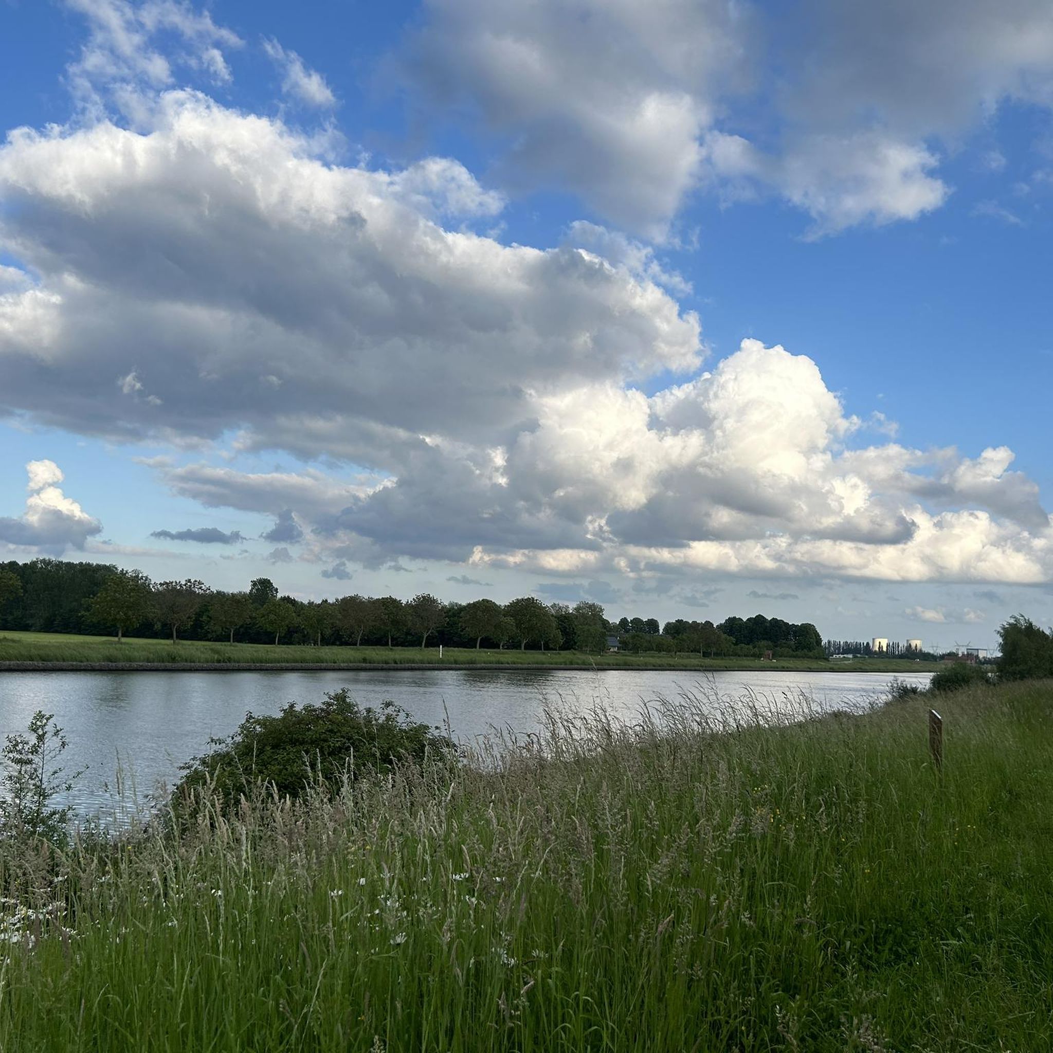
Straight, quiet waterline with a smooth asphalt path stretching between greenery and canal. The row of trees on the left provides a soft, natural framing for the route, while the water on the right opens up the horizon. In the distance, a cooling tower dominates the landscape as an industrial landmark that gives the whole an unexpected grandeur.
6
0
Two monumental cooling towers rise from the flat canal landscape, like silent sentinels of the industrial past. Their concrete forms dominate the horizon, but in the morning sun they acquire an almost sculptural softness. The straight canal road leads to them like a line of perspective — a trajectory that combines speed, silence, and symmetry.
7
0
Long, straight and almost geometric ribbon of water connecting Brussels to the Scheldt. The canal cuts through the landscape like a straight line of concrete, steel and water, flanked by locks, bridges and towers that give the whole an industrial monumentality. The open space along the canal — wide sky, long sightlines, wind that has free rein — makes it one of the most recognizable structures in the northern outskirts of Brussels.
7
0
Straight, fast canal strip along the Brussels–Scheldt Sea Canal, with wide sightlines and a smooth asphalt profile. The path runs parallel to the water, forming a clearly recognizable corridor between Humbeek and Vilvoorde. The industrial elements along the canal — bridges, locks, towers — give the route a distinctly linear character.
6
0
For road cyclists, this is a pure tempo point on the fast canal strip. The bridge lies on a straight, smooth line where you can maintain speed towards Humbeek, Kapelle‑op‑den‑Bos and Willebroek. Due to the open sightlines and the high bridge profile, it functions as an orientation beacon that you can see from afar on rides through the northern edge of Halle‑Vilvoorde.
5
0

Beautiful walk in the sun... perfect for recharging and getting your vitamin D fix.
0
0
Frequently Asked Questions
What is the typical terrain like for road cycling around Kattemeuterbos?
The region around Kattemeuterbos, primarily in Flemish Brabant, offers a mix of flat to gently rolling terrain. You'll find well-paved surfaces, often running alongside the Brussels-Willebroek canal and the Laarbeek stream. While there are gentle hills, the area is not known for challenging climbs, making it accessible for various fitness levels.
Are there challenging road cycling routes available, or are they mostly easy?
The routes around Kattemeuterbos cater to a range of abilities. While many are considered easy, such as the Cyclists' Bridge over the Zenne – Zenne Cycle Route loop from Humbeek, there are also moderate options like the Beautiful cycle path along the water – F1 Cycle Highway Zemst–Eppegem loop from Grimbergen. Out of 384 available routes, 45 are rated as difficult, offering more of a challenge.
What natural features or landmarks can I expect to see while cycling around Kattemeuterbos?
While direct access into Kattemeuterbos is restricted, the surrounding routes offer scenic views. You'll cycle alongside the Brussels-Willebroek Canal and the Laarbeek stream. The historic Groeneveld Castle is also located near the forest, adding a point of interest to the landscape.
Is there parking available for cyclists near the routes?
Yes, the Grimbergen and Zemst municipalities, where many of these routes begin or pass through, typically offer various parking options. It's advisable to check local parking regulations for specific starting points.
How can I reach the cycling routes around Kattemeuterbos using public transport?
The region around Kattemeuterbos, including Grimbergen and Zemst, is generally well-connected by public transport. You can often find bus or train services that can get you close to popular starting points for the cycling routes. We recommend checking local public transport schedules for the most convenient options.
What is the best time of year to go road cycling around Kattemeuterbos?
The region is enjoyable for road cycling throughout the warmer months, typically from spring through early autumn. During these periods, the weather is generally mild, and the landscapes are at their most vibrant, offering pleasant conditions for longer rides.
Are the road cycling routes around Kattemeuterbos suitable for families?
Many routes around Kattemeuterbos are suitable for families, especially those that are easy-rated and feature flat sections along canals or dedicated cycle paths. Routes like the F1 Cycle Route Mechelen–Zemst – F1 Cycle Highway Zemst–Eppegem loop from Eppegem offer a pleasant experience for all ages.
Can I bring my dog along on these road cycling routes?
While the routes are primarily designed for road cycling, the suitability for dogs depends on the specific route and your dog's ability to keep up. For safety, dogs should generally be on a leash and well-behaved around other cyclists and traffic. Consider routes with wider paths or less traffic if cycling with a dog.
Are there places to eat or drink along the cycling routes?
Yes, as the routes pass through or near towns like Grimbergen and Zemst, you will find various cafes, pubs, and restaurants where you can stop for refreshments or a meal. These towns offer convenient breaks during your ride.
How many road cycling routes are available around Kattemeuterbos?
There are over 380 road cycling routes available around Kattemeuterbos, offering a wide variety of distances and difficulty levels to explore the Flemish Brabant region.
What do other road cyclists enjoy the most about road cycling in Kattemeuterbos?
The area is highly rated by the komoot community, with an average score of 4.2 stars from over 440 reviews. Reviewers often praise the well-maintained cycle paths, the scenic flat sections along canals, and the diverse options for different ability levels.
Are there any long-distance road cycling routes in the area?
Yes, the region offers several longer routes. For example, the Beautiful cycle path along the water – F1 Cycle Highway Zemst–Eppegem loop from Grimbergen is a moderate 33.5-mile (54.0 km) trail, and there are many other options for those looking for extended rides.
Most popular routes around Kattemeuterbos

Get inspired with the komoot mobile app


Explore more
Browse the best Road cycling routes in other regions.
