The best walks and hikes around Hochhalde Trages
4.5
(4428)
16,469
hikers
480
hikes
Hiking around Hochhalde Trages offers a network of trails primarily exploring a reclaimed spoil heap, characterized by its elevated terrain and forested sections. The area features an observation tower, providing panoramic views of the surrounding landscape. Paths often lead through woodlands and open areas, with some routes incorporating former industrial sites now reforested.
Best hiking trails around Hochhalde Trages
- The most popular hiking route is Trages Observation Tower – Campfire area on Halde Trages loop from Mölbis, a 5.2…
Last updated: October 11, 2026
4.8
(50)
104
hikers
8.31km
02:14
100m
100m
Moderate hike. Good fitness required. Easily-accessible paths. Suitable for all skill levels.
4.7
(31)
127
hikers
Easy hike. Great for any fitness level. Easily-accessible paths. Suitable for all skill levels.

4.6
(17)
50
hikers
Moderate hike. Good fitness required. Easily-accessible paths. Suitable for all skill levels.
4.5
(14)
37
hikers
6.87km
01:50
70m
70m
Easy hike. Great for any fitness level. Easily-accessible paths. Suitable for all skill levels.
4.8
(4)
24
hikers
Easy hike. Great for any fitness level. Easily-accessible paths. Suitable for all skill levels.
Get access to more routes and recommendations from other explorers.
Already have an account?
Our route recommendations are based on thousands of hikes, rides, and runs completed by other people on komoot.
Start today with a free account
Your next adventure awaits.

Other adventures around Hochhalde Trages

Tips from the Community

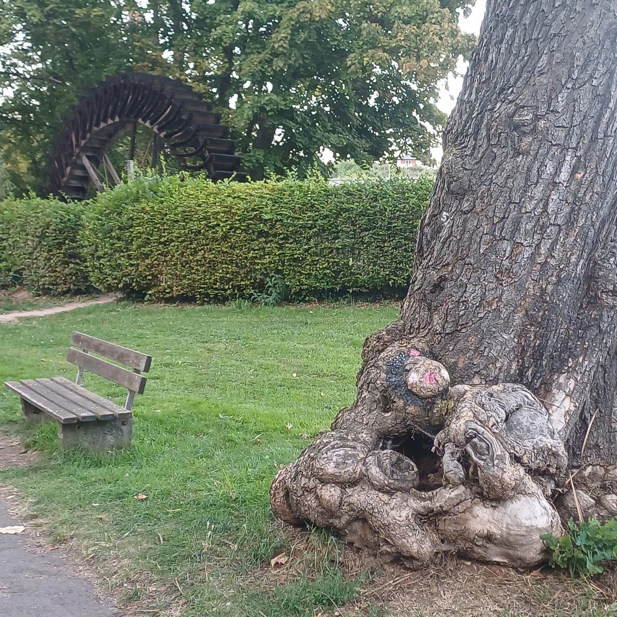
This is an interesting reuse of old open-pit mining technology
0
0
This is a nice picnic spot with a campfire possibility, if the wood is not too dry.
0
0
Beautiful picnic spot, with interesting views of the paddle wheel
1
0

Shortcut to the top
0
0

Please keep the area clean ✌🏻
1
0

Entire course of the nature trail: https://www.komoot.de/tour/1420552120
4
0
Entire course of the nature trail: https://www.komoot.de/tour/1420552120
4
0
Entire course of the nature trail: https://www.komoot.de/tour/1420552120
4
0
Frequently Asked Questions
What kind of terrain can I expect when hiking around Hochhalde Trages?
The Hochhalde Trages area is characterized by its origins as a reclaimed spoil heap. This means you'll find elevated terrain with a mix of forested sections and open areas. Many paths lead through woodlands, and some routes incorporate former industrial sites that have been reforested, offering a unique landscape.
How many hiking trails are available around Hochhalde Trages?
There are over 480 hiking routes available around Hochhalde Trages, catering to various fitness levels. This includes more than 320 easy trails and over 140 moderate options, ensuring there's a suitable path for almost everyone.
Are there any family-friendly hiking options in Hochhalde Trages?
Yes, Hochhalde Trages offers numerous family-friendly hiking options. Over 320 of the routes are classified as easy, featuring gentle gradients and shorter distances. A good example is the Campfire area on Halde Trages – Trages Observation Tower loop from Thierbach, which is an easy 3.3-mile (5.3 km) path.
What are the best circular walks around Hochhalde Trages?
Many of the trails around Hochhalde Trages are circular, allowing you to start and end at the same point. Popular loop options include the Trages Observation Tower – Campfire area on Halde Trages loop from Mölbis, a 5.2-mile (8.3 km) moderate route, or the Trages Observation Tower loop from Mölbis, an easy 4.3-mile (6.9 km) option.
What interesting landmarks or viewpoints can I find along the trails?
A prominent landmark is the Trages Observation Tower, which offers panoramic views of the surrounding landscape. You can also discover the Bucket Wheel Excavator Blade at Halde Trages, a remnant of the area's industrial past, now integrated into the natural setting.
Is Hochhalde Trages suitable for dog walking?
Yes, Hochhalde Trages is generally suitable for dog walking. The varied terrain of forested paths and open areas provides a good environment for dogs. Always ensure your dog is under control, especially near wildlife or other hikers, and check for any local regulations regarding leashes.
Are there any facilities like picnic areas or shelters available?
Yes, hikers can find facilities such as the Shelter and picnic area on the Mühlenweg near Mölbis. Additionally, the Halde Trages — Observation Tower, Shelters and Information Boards highlight also indicates the presence of shelters near the main observation tower.
What do other hikers enjoy most about the trails in Hochhalde Trages?
The trails in Hochhalde Trages are highly regarded by the komoot community, with an average rating of 4.6 stars from over 3,800 reviews. Hikers often praise the unique landscape of the reclaimed spoil heap, the panoramic views from the observation tower, and the well-maintained paths that offer a mix of forest and open-air experiences.
Can I reach the Hochhalde Trages trails using public transport?
While direct public transport links to the immediate trailheads might be limited, you can typically reach nearby towns like Mölbis or Thierbach via regional bus services. From there, you might need to walk a short distance to access the hiking routes. It's advisable to check local bus schedules for the most up-to-date information.
Are there options for longer hikes for experienced hikers?
Absolutely. While many routes are easy to moderate, there are longer options for those seeking more challenge. For instance, the Trages Observation Tower – Birch Forest Hiking Trail loop from Thierbach covers 7.2 miles (11.5 km) and takes around 3 hours, offering a more extended exploration of the area's birch forests and open landscapes.
Where can I park my car when visiting Hochhalde Trages?
Designated parking areas are typically available near the main access points to the trails, particularly in villages like Mölbis and Thierbach, which serve as common starting points for many routes. Look for signs indicating hiker parking upon arrival.
Is it possible to hike in Hochhalde Trages during winter?
Hiking in Hochhalde Trages is generally possible during winter, though conditions can vary. The trails are not typically groomed for winter sports, so expect natural conditions. Be prepared for potentially icy or snowy paths, and wear appropriate footwear and layers. The views can be particularly stark and beautiful in winter.
Most popular routes around Hochhalde Trages
Most popular attractions around Hochhalde Trages

Get inspired with the komoot mobile app


Explore more
Browse the best Hikes in other regions.
