The best cycling routes around Burnmoor Tarn
4.3
(30)
3,850
riders
33
rides
Touring cycling around Burnmoor Tarn offers routes through the rugged landscape of the Lake District, characterized by deep valleys, fells, and iconic tarns. The region features a mix of challenging mountain passes and more gentle routes along valley floors and near bodies of water like Wastwater. Cyclists can expect varied terrain, from paved roads winding through remote areas to paths offering views of the surrounding peaks and open moorland.
Best touring cycling routes around Burnmoor Tarn
- The most popular touring…
Last updated: August 18, 2026
4.7
(6)
59
riders
38.3km
02:22
330m
330m
Cycle the Wastwater & Seascale loop, a moderate 23.8-mile route in the Lake District with coastal views and dramatic fells.
5.0
(2)
30
riders
49.0km
03:56
1,250m
1,250m
Hard bike ride. Very good fitness required. Mostly paved surfaces. Suitable for all skill levels.

Sign up for free
192
riders
28.2km
02:25
980m
980m
Hard bike ride. Very good fitness required. Mostly paved surfaces. Suitable for all skill levels.
4.5
(2)
41
riders
20.0km
01:38
260m
260m
Hard bike ride. Good fitness required. You may need to push your bike for some segments of this route.
250
riders
16.1km
00:58
120m
120m
Easy bike ride. Great for any fitness level. Mostly paved surfaces. Suitable for all skill levels.
Get access to more routes and recommendations from other explorers.
Sign up for free
Already have an account?
Our route recommendations are based on thousands of hikes, rides, and runs completed by other people on komoot.
Start today with a free account
Your next adventure awaits.
Login or Signup

Tips from the Community

If heading north along the coast towards Sellafield follow the track on the seaward side of the railway all the way up to the Calder, then it's a loop under the railway and over the River
0
0
Great gravel track through the forest between Eskdale and Muncaster castle. A lovely ride
0
0
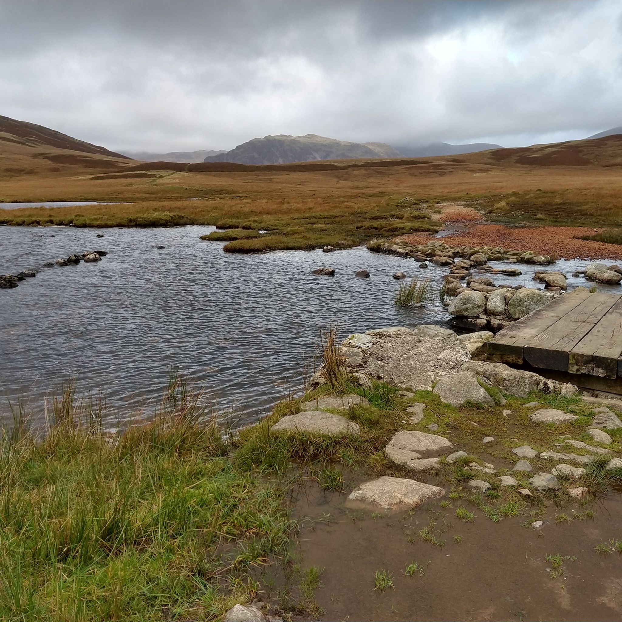
Well worth the detour down the track to the church of st Catherine's. Inside there's a font decorated with pagan marigold carvings, and the moving memorial at the door. Don't miss the stepping stones, cross if you dare
0
0

get here early during the busy season to insure you get a parking spot free parking
0
0

Lovely quiet road, pretty good surface
0
0

Large carpark with amazing views of the surrounding mountains but gets filled up quickly in the summer time.
0
0

Free car park at Wasdale Head. A great plce to start walks up towards Styhead, Mosedale or Scafell Pike.
0
0
The Three Shires Stone at the top of Wrynose Pass is the meeting point of the former counties of Lancashire, Cumberland and Westmorland. Now most people pass over en-route elsewhere. The road to east and west is single track with a few passing places. There is a small amount of parking here. Walkers often ascend up to Red Tarn to the north from here or south onto the Coniston fells.
0
0
Frequently Asked Questions
How many touring cycling routes are available around Burnmoor Tarn?
There are over 30 touring cycling routes around Burnmoor Tarn, offering a diverse range of experiences for cyclists. These include 5 easy routes, 12 moderate routes, and 16 difficult routes, catering to various skill levels.
What are the best times of year to go touring cycling in the Burnmoor Tarn area?
The best time for touring cycling around Burnmoor Tarn is typically from late spring through early autumn (May to October). During these months, the weather is generally milder, and the days are longer. Winter cycling is possible but requires careful planning due to potentially harsh conditions, including snow, ice, and strong winds, especially on higher passes like Hardknott and Wrynose.
Are there any family-friendly touring cycling routes near Burnmoor Tarn?
Yes, while many routes in the region are challenging, there are options suitable for families. For a more gentle ride, consider the Wast Water – View of Wast Water loop from St Olaf, which is classified as easy and offers scenic views over the lake without significant elevation gain.
Where can I find parking for touring cycling routes around Burnmoor Tarn?
Parking is available at various points around the Burnmoor Tarn area, often near trailheads or villages. For routes starting near Dalegarth, such as the Hardknott & Wrynose passes loop from Dalegarth Station, you can often find parking facilities. It's advisable to check local information for specific car park locations and any potential fees before your visit.
Are there any circular touring cycling routes in the Burnmoor Tarn region?
Yes, many of the touring cycling routes around Burnmoor Tarn are designed as loops. Examples include the moderate Wastwater & Seascale loop, which takes you from the lake to the coast and back, and the challenging Hardknott Pass Summit – Wrynose Pass loop from Eskdale.
What kind of terrain can I expect on touring cycling routes around Burnmoor Tarn?
The terrain around Burnmoor Tarn is highly varied. You'll encounter everything from paved roads winding through remote valleys to challenging mountain passes with significant elevation changes. Routes often feature views of fells, open moorland, and bodies of water like Wastwater and Muncaster Tarn. Some paths may include sections of gravel or unpaved surfaces, especially on more remote loops.
Are there any cafes or pubs accessible from the touring cycling routes?
Yes, while the Burnmoor Tarn area is quite remote, you can find cafes and pubs in the nearby villages and along some of the routes. For instance, routes passing through Eskdale or near Dalegarth Station often have options for refreshments. It's a good idea to plan your stops in advance, especially on longer rides, as facilities can be sparse in certain areas.
What are some notable natural features or landmarks to see while cycling?
The region is rich in natural beauty. You'll encounter iconic Lake District fells, deep valleys, and several tarns, including Wastwater, England's deepest lake, and Muncaster Tarn. The challenging mountain passes of Hardknott and Wrynose are also significant landmarks, offering breathtaking views for those who conquer them.
Can I reach the touring cycling routes around Burnmoor Tarn using public transport?
Public transport options to the immediate Burnmoor Tarn area are limited due to its remote nature. However, you can access the wider Lake District region by train to stations like Windermere or Penrith, and then use local bus services or the scenic Ravenglass and Eskdale Railway (La'al Ratty) which serves areas like Dalegarth Station, a starting point for some routes.
What do other touring cyclists enjoy most about cycling in Burnmoor Tarn?
The area is highly rated by the komoot community, with an average score of 4.3 stars from over 20 reviews. Reviewers often praise the stunning, rugged landscapes, the challenge of the mountain passes, and the sense of remoteness and tranquility found on many routes. The diverse terrain and scenic tarns are frequently highlighted as major attractions.
Are there any opportunities for wild swimming near the cycling routes?
Yes, the Lake District is known for its wild swimming spots. The River Esk Swimming Spot – Muncaster Tarn loop from Eskdale explicitly mentions a swimming spot. Wastwater, while cold, is also a popular location for experienced wild swimmers. Always exercise caution, check water conditions, and be aware of local regulations before swimming.
What is the longest touring cycling route in the Burnmoor Tarn area?
One of the longest and most challenging routes is the Hardknott & Wrynose passes loop from Dalegarth Station — Lake District National Park, which spans approximately 30.4 miles (49 km) and features significant elevation gain over two of England's steepest passes.
Most popular routes around Burnmoor Tarn

Get inspired with the komoot mobile app


Explore more
Browse the best Cycling routes in other regions.
