The best road cycling routes around Makaha Valley
23
riders
5
rides
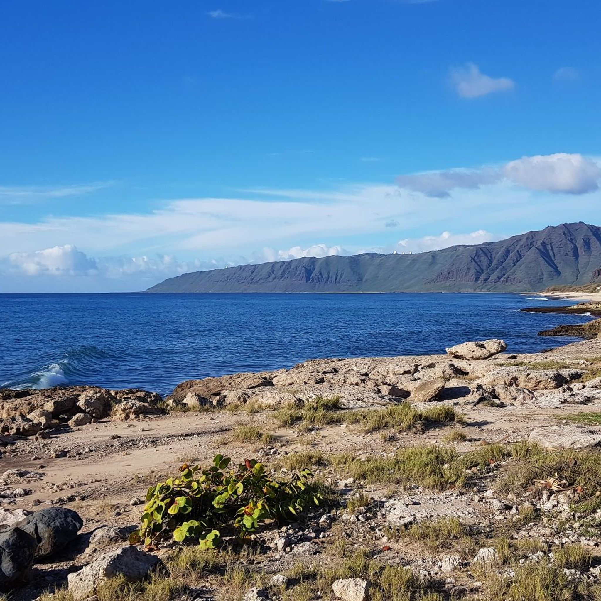
Road cycling around Makaha Valley offers routes through a landscape characterized by the Waianae Mountain Range and proximity to the Pacific coastline. The valley itself features agricultural areas and residential zones, transitioning to more natural settings as routes extend towards the coast or into the foothills. Elevations vary from sea level to moderate climbs, providing diverse terrain for road cyclists.
Best road cycling routes around Makaha Valley
- The most popular road cycling route is Farrington Highway to Kaʻena Point State…
Last updated: May 21, 2026
23
riders
28.8km
01:10
160m
160m
Embark on a scenic road cycling adventure along the Farrington Highway to Kaʻena Point State Park. This easy route spans 17.9 miles (28.8 km) and offers a smooth ride with…
34.5km
01:43
330m
330m
Cycle the Kolekole Pass Loop for a moderate road cycling challenge on Oahu. This route covers 21.4 miles (34.5 km) and climbs 1092 feet (333 metres), taking about 1 hour…

Sign up for free
19.1km
02:04
350m
350m
Cycle the Waianae to Kaneaki Heiau loop for a moderate racebike adventure through the Waianae Kai Forest Reserve. This route takes you past impressive volcanic mountains and offers expansive views…
20.6km
01:33
690m
690m
Embark on a moderate road cycling journey along Waianae Valley Road, a route that spans 12.8 miles (20.6 km) and challenges you with 2253 feet (687 metres) of elevation gain.…
25.9km
01:44
620m
620m
Embark on a moderate road cycling journey from Kuilioloa Heiau to Kolekole Pass, covering 16.1 miles (25.9 km) with a significant elevation gain of 2044 feet (623 metres). This route…
Our route recommendations are based on thousands of hikes, rides, and runs completed by other people on komoot.
Start today with a free account
Your next adventure awaits.
Login or Signup
Popular around Makaha Valley
Tips from the Community

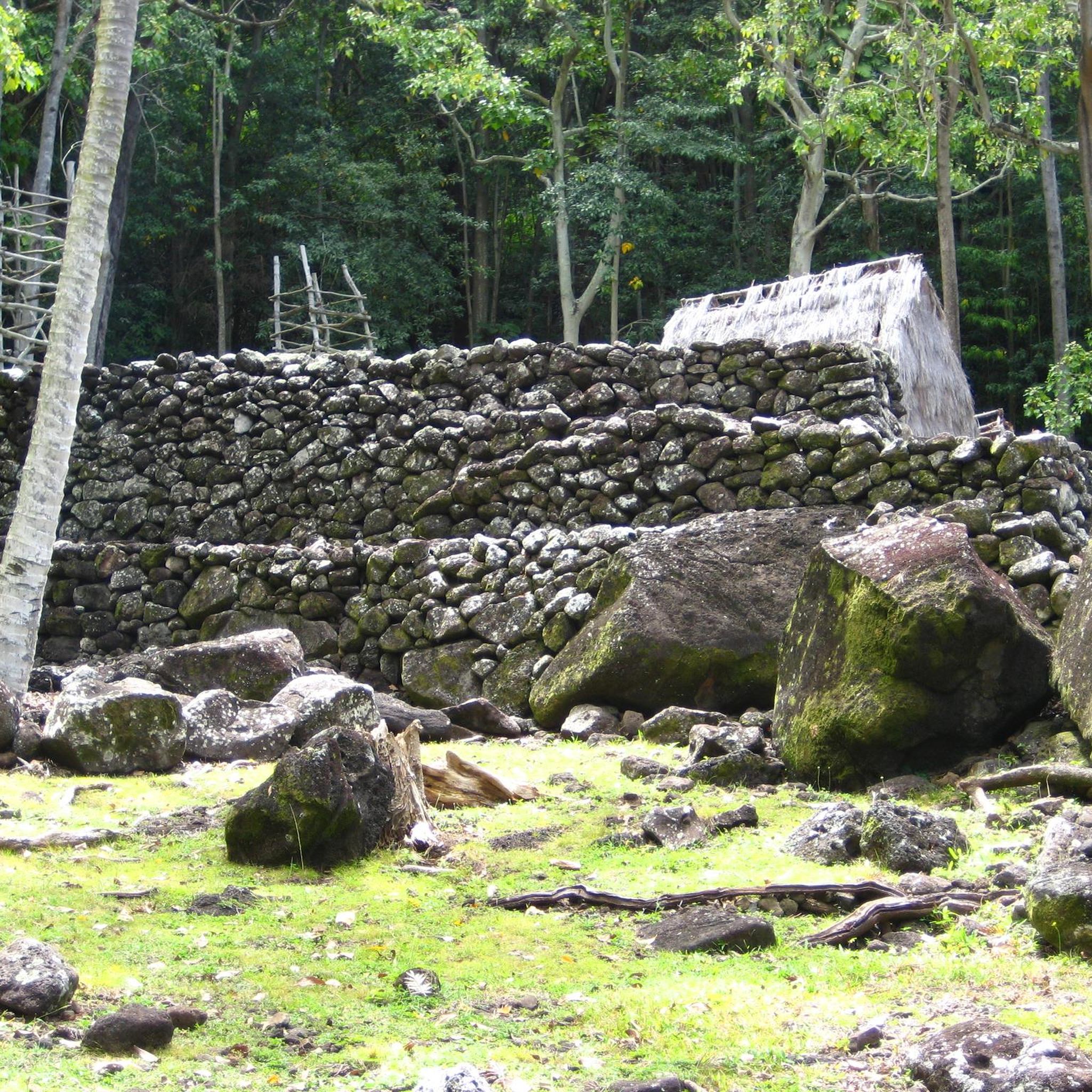
This heiau (temple), built in the 17th Century, was dedicated to Lono, the benevolent god of harvest and fertility. The grass and thatched huts were used as prayer and meditation chambers. This entire site has been completely restored to be historically correct. This center is open 10-2 everyday except Monday (closed).
0
0
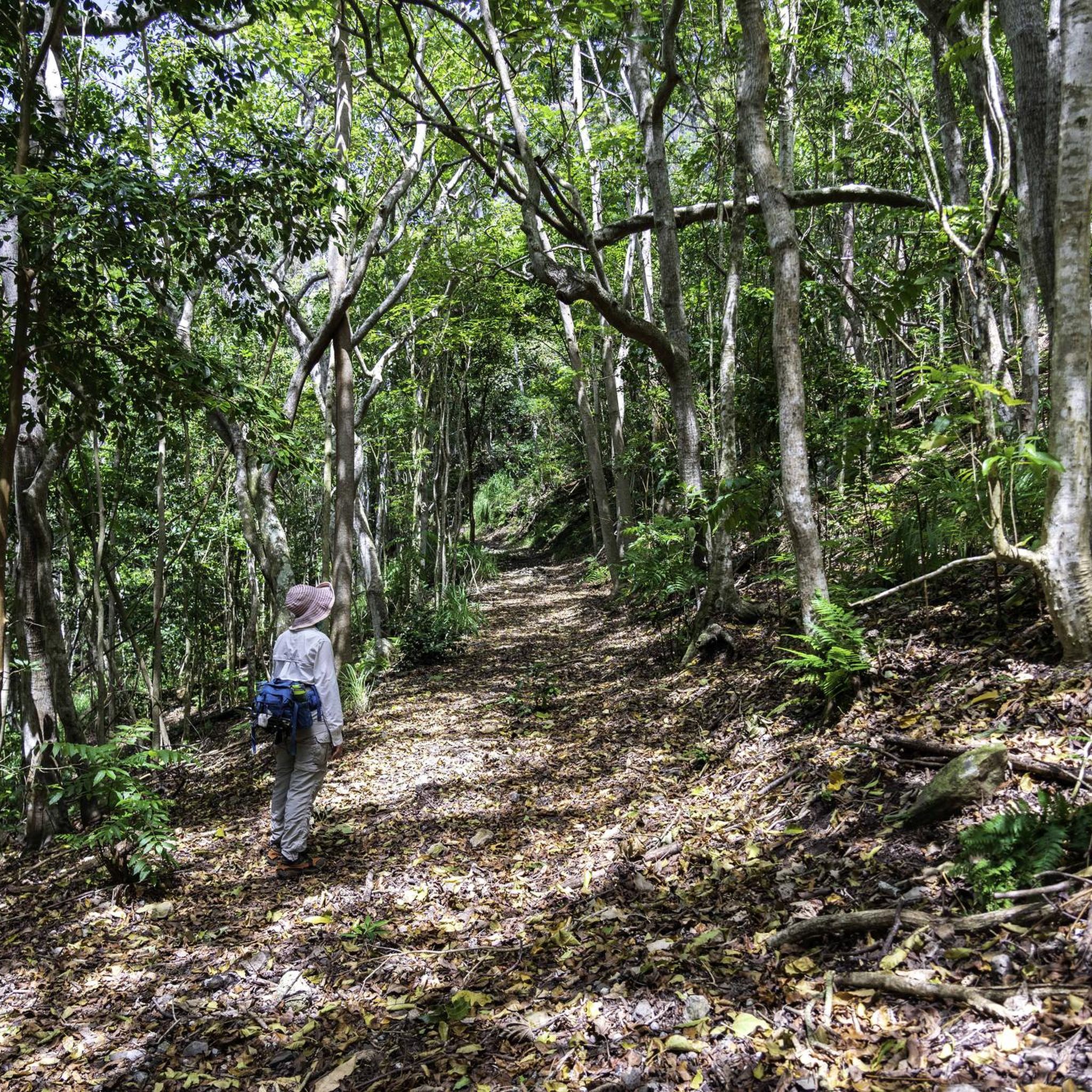
This road travels through very thick forest right at the foot of Pu'ukawiwi mountain. The Wai'anae Kai Forest Reserve delivers a diverse opportunity for recreational hunting which include two ungulate species (feral pig and goat).
0
0
From the road you can see the "Pink Pillbox" station on the ridge above. These stations were used as observation buildings in 1943. Although pillboxes are usually armed with weapons and used as defensive stations, these concrete platforms held observing instruments, which were used to determine the position of other boats.
0
0
Enjoy expansive views from the highest point you can climb, without a military ID. If you continue on entering Schofield Barracks and Post Amenities, guards will conduct a 100% ID check at all gates. All visitors must have a valid military ID or proceed to the visitor control center for a pass.
0
0
This is a narrow paved road heading up into the Waianae Kai Forest Reserve. The traffic you'll encounter will be hikers heading up to the trail.
0
0
The road ends here, but a trail continues on for quite a bit. Just off of the road (maybe 150 feet on the left) is a hole in the rocks that is shaped like a heart from the right angle.
0
0
This heiau (temple), built in the 17th Century, was dedicated to Lono, the benevolent god of harvest and fertility. The grass and thatched huts were used as prayer and meditation chambers. This entire site has been completely restored to be historically correct. This center is open 10-2 everyday except Monday (closed).
0
0
There is a small road that continues up into the canyon before turning to forest and continuing on. If you have a MTB or gravel bike, you can ride the forest road, otherwise this is a great place to turn around and enjoy the descent back into town!
0
0
Frequently Asked Questions
Are there easy road cycling routes suitable for beginners in Makaha Valley?
Yes, Makaha Valley offers routes suitable for beginners. The Farrington Highway to Kaʻena Point State Park route is an easy 17.9-mile ride along the coastline, perfect for those new to road cycling in the area.
What kind of terrain can I expect on road cycling routes in Makaha Valley?
Road cycling in Makaha Valley features a diverse landscape. You'll find coastal roads offering ocean views, routes through agricultural and residential valley areas, and climbs into the lower slopes of the Waianae Mountain Range. Elevations vary from sea level to moderate ascents, providing varied challenges.
Are there any road cycling routes that form a loop in Makaha Valley?
Yes, several routes in Makaha Valley are loops. For example, the Kolekole Pass Loop is a moderate 21.4-mile path that includes varied terrain and notable elevation changes as it traverses a mountain pass. Another option is the Waianae to Kaneaki Heiau loop, an 11.9-mile trail through the Waianae Valley.
What are some scenic viewpoints or natural attractions along the road cycling routes?
The routes often provide views of the Pacific coastline and the Waianae Mountain Range. You can explore natural monuments such as Kaneana Cave or the unique Heart-Shaped Rock Hole. For panoramic views, consider highlights like Mauna Lahilahi Summit and Overlook.
What is the best time of year for road cycling in Makaha Valley?
Makaha Valley generally offers good road cycling conditions year-round due to its tropical climate. However, the cooler, drier months from November to April are often preferred, as they avoid the peak heat and humidity of summer and the higher chance of rain in the wet season.
Are there any challenging road cycling routes for experienced riders?
Yes, for experienced riders seeking a challenge, routes like Waianae Valley Road and Kuilioloa Heiau to Kolekole Pass offer significant elevation gains, with climbs exceeding 600 meters. These moderate routes provide a good workout and rewarding views.
What are the typical distances for road cycling routes in Makaha Valley?
The road cycling routes in Makaha Valley vary in length. You can find shorter loops around 12 miles (19 km), such as the Waianae to Kaneaki Heiau loop, up to longer rides around 21 miles (34 km) like the Kolekole Pass Loop, offering options for different preferences.
What do other road cyclists enjoy most about road cycling in Makaha Valley?
Road cyclists who have explored Makaha Valley often praise the diverse terrain, from scenic coastal stretches to challenging mountain pass climbs. The combination of ocean views and the natural beauty of the Waianae Mountain Range makes for a memorable riding experience.
Are there any historical or cultural landmarks accessible by road bike in Makaha Valley?
Yes, the Waianae to Kaneaki Heiau loop specifically leads through the Waianae Valley towards Kaneaki Heiau, an ancient Hawaiian temple. This route offers a chance to combine your ride with a visit to a significant cultural site.
How many road cycling routes are available in the Makaha Valley guide?
The guide features 5 distinct road cycling routes around Makaha Valley, offering a range of options from easy coastal rides to more challenging climbs through the valley and mountain passes.
What is the elevation gain like on road cycling routes in Makaha Valley?
Elevation gains vary significantly across routes. Easy coastal rides like Farrington Highway to Kaʻena Point State Park have minimal climbs (around 150 meters), while more challenging routes such as Waianae Valley Road can feature over 680 meters of ascent, providing options for all fitness levels.
Most popular routes around Makaha Valley
Most popular attractions around Makaha Valley

Get inspired with the komoot mobile app


Explore more
Browse the best Road cycling routes in other regions.
