The best road cycling routes around Lough Nafooey
4.3
(5)
172
riders
7
rides
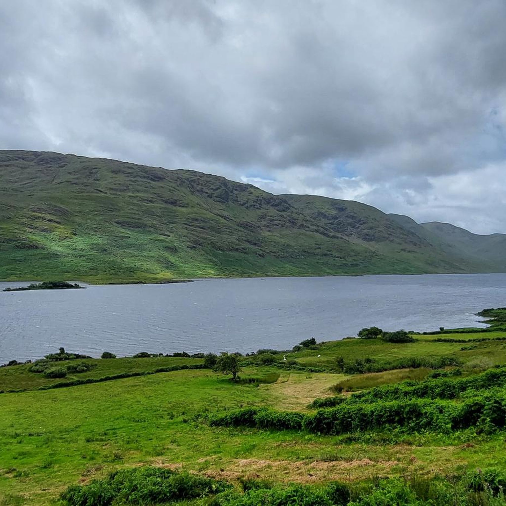
Road cycling routes around Lough Nafooey traverse a glacial lake region situated between the Maumturk Mountains and Partry Mountains. This area features a steep-sided valley with a rectangular lake, approximately 2.5 miles (4 km) long. The landscape includes remnants of ancient volcanic activity, with preserved volcanic rocks and numerous rivers feeding the lake. Cyclists encounter varied terrain, from lake-hugging roads to routes offering views of Killary Fjord.
Best road cycling routes around Lough Nafooey
- The most popular road cycling route is Clonbur Wood and Cornamona loop from Lough Nafooey, a 28.8 miles (46.4 km) trail that takes 2 hours 4 minutes to complete. This route features well-paved surfaces and views of the lough with Bencorragh in the background.
- Another top favourite among local road cyclists is Lough Mask viewpoint – Sheeffry Pass loop from Tourmakeady, a difficult 63.4 miles (102.0 km) path. This route includes significant elevation gain, offering expansive views of the surrounding mountains and Lough Mask.
- Local road cyclists also love the View of Killary Fjord – Doolough Valley loop from Aasleagh waterfall car park, a 35.6 miles (57.4 km) trail leading through a dramatic valley and offering views of Killary Fjord, often completed in about 2 hours 21 minutes.
- Road cycling around Lough Nafooey is defined by glacial lakes, rugged mountains, and coastal fjord views. The network offers options for different ability levels, from moderate loops to more challenging routes with significant climbs.
- The routes in Lough Nafooey are highly rated by the komoot community with an average score of 4.3 stars from over 4 reviews. More than 160 road cyclists have used komoot to explore Lough Nafooey's varied terrain.
Last updated: June 27, 2026
4.3
(4)
46
riders
46.4km
02:05
350m
350m
Moderate road ride. Good fitness required. Mostly well-paved surfaces and easy to ride.
18
riders
Moderate road ride. Good fitness required. Mostly well-paved surfaces and easy to ride.

Sign up for free
14
riders
102km
04:51
1,070m
1,070m
Hard road ride. Very good fitness required. Mostly well-paved surfaces and easy to ride.
16
riders
Moderate road ride. Good fitness required. Mostly well-paved surfaces and easy to ride.
4.0
(1)
11
riders
Moderate road ride. Good fitness required. Mostly well-paved surfaces and easy to ride.
Get access to more routes and recommendations from other explorers.
Sign up for free
Already have an account?
Our route recommendations are based on thousands of hikes, rides, and runs completed by other people on komoot.
Start today with a free account
Your next adventure awaits.
Login or Signup
Popular around Lough Nafooey
Tips from the Community

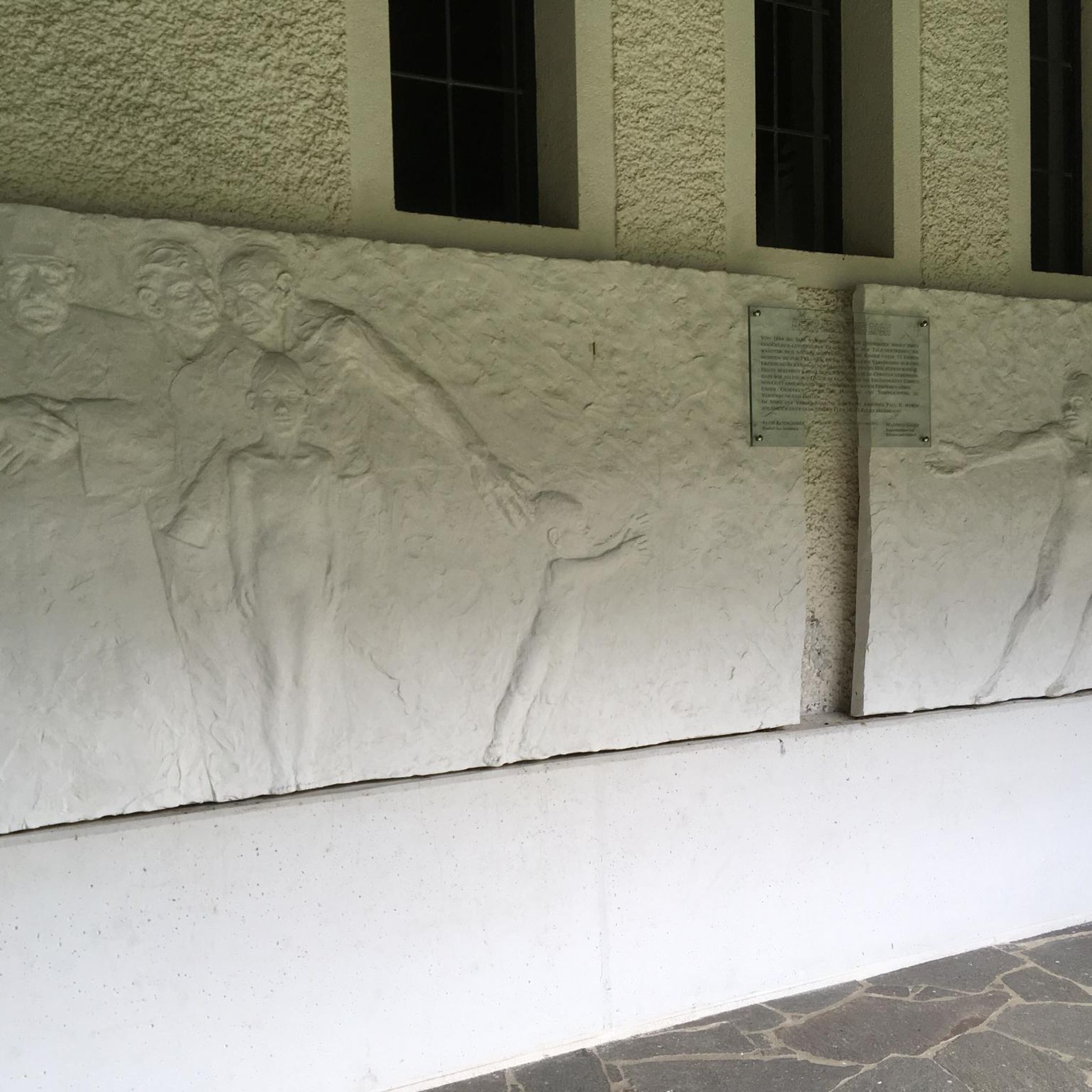
Wild Atlantic Way Discovery Point: The road through Doo Lough Valley is a quiet, narrow route with little traffic, allowing you to fully enjoy the wide views over the dark lake and surrounding mountain slopes. Along the shore are several photogenic spots where water, light, and landscape come together beautifully. This passage logically connects to Delphi Valley, the climb to Doolough Pass, and the understated 1849 memorial, making this stretch one of the most impressive links of the entire route.
4
0
The road through Doo Lough Valley is a quiet, narrow route with little traffic, allowing you to fully enjoy the wide views over the dark lake and the surrounding mountain slopes. Along the shore are several photogenic spots where water, light, and landscape come together beautifully. This passage logically connects to Delphi Valley, the climb to Doolough Pass, and the understated 1849 memorial, making this section one of the most impressive links of the entire route.
6
0
Cycling through the Doolough Pass feels like a journey through time. The road cuts through a deep glacial valley, where the imposing peaks of Mayo are reflected in the smooth, dark water of the lake. It is a place of raw beauty and deep silence, marked by a poignant monument to the region's history. An absolute highlight where the grandeur of nature makes you feel very small for a moment.
5
0
From this spot, you have an open, elevated view over Killary Fjord, with wide sightlines towards the steep flanks of Ben Gorm and Mweelrea. The fjord stretches out below you, clearly showing how the landscape opens up towards the ocean. In clear weather, you get deep contrasts between water and mountains; in fog, a typical Connemara atmosphere is created.
5
0
While the sheep graze on the surrounding hillsides, you stand here on the threshold of Killary Fjord. From the quay, you have a wonderful widescreen perspective of where the salt water cuts deep into the land, flanked by the impressive peaks of Mayo. It is the ideal place to put your bike aside for a moment, breathe in the salty air, and observe the activity at the small pier with the mighty Ben Gorm as a backdrop.
6
0
At this spot, the landscape opens up towards Killary Lough, Ireland's only true fjord. From the slight elevation, you see the long, narrow water between the Mweelrea mountains (Mayo) and the Twelve Bens/Maumturks (Galway). The view is broad and clear: a deep, straight fjord valley with steep flanks, tidal water, and often a strikingly silvery light. The road runs here along open peatland and low rocks, causing the fjord to suddenly come fully into view — a classic Connemara moment of space, water, and rugged mountains.
7
0
This is THE postcard moment of your tour through Connemara. From this elevated point along the N59, you have an unobstructed view over the deep blue fjord and the steep walls of the Mweelrea mountain on the other side. It's the perfect spot to get off your bike for a moment, breathe in the salty sea air, and take in the scale of this unique glacial landscape. Don't forget to wave to the dolphins that sometimes swim by in the depths below!
7
0
One of the most characteristic Connemara roads: narrow asphalt, slightly undulating, and constantly accompanied by water and low green ridges. Lough Fee lies elongated and open in the landscape; a little further on follows Lough Muck, more compact and quieter. The road runs close to the banks, offering almost continuous views of water, peat, and the surrounding hills. It feels remote and serene, with broad west coast air and an almost timeless tranquility.
6
0
Frequently Asked Questions
How many road cycling routes are available around Lough Nafooey?
There are 7 road cycling routes around Lough Nafooey, offering a range of experiences from moderate to difficult. These routes traverse a stunning glacial lake region, providing diverse terrain and breathtaking views.
What kind of terrain and difficulty can I expect on road cycling routes around Lough Nafooey?
Road cycling routes around Lough Nafooey feature varied terrain, from well-paved surfaces hugging the lake to routes with significant elevation gain. You'll find 5 moderate routes and 2 difficult routes, some including gentle switchbacks that lead to panoramic views. The landscape is characterized by glacial lakes, rugged mountains, and coastal fjord views.
What scenic landmarks and viewpoints can I expect to see while road cycling around Lough Nafooey?
Cyclists can enjoy a wealth of scenic landmarks. Routes often provide views of Lough Nafooey itself, with the dramatic backdrop of the Maumturk and Partry Mountains. You might also encounter the stunning Aasleagh Falls where the Erriff River meets Killary Fjord, or cycle along sections offering views of Killary Fjord. The region is also part of the wider Wild Atlantic Way, known for its breathtaking coastal scenery.
Are there any notable circular road cycling routes around Lough Nafooey?
Yes, several routes form loops, allowing you to start and end in the same location. A popular moderate option is the Clonbur Wood and Cornamona loop from Lough Nafooey, which offers well-paved surfaces and views of the lough with Bencorragh in the background. Another is the View of Killary Fjord – Doolough Valley loop from Aasleagh waterfall car park, leading through a dramatic valley.
What is the best time of year to go road cycling around Lough Nafooey?
The region's weather can be variable, but generally, the warmer months from late spring to early autumn (May to September) offer the most favorable conditions for road cycling. During this period, you're more likely to experience milder temperatures and less rainfall, making for a more enjoyable ride through the picturesque landscapes.
Where can I find parking for road cycling routes around Lough Nafooey?
Specific parking information varies by route. However, many routes, such as the View of Killary Fjord – Doolough Valley loop, often start from designated car parks like the Aasleagh waterfall car park. It's advisable to check the individual route details on komoot for precise starting points and parking availability.
What do other road cyclists enjoy the most about road cycling in Lough Nafooey?
The area is highly rated by the komoot community, with an average score of 4.3 stars. Reviewers often praise the stunning, wild, and rugged environment, the constant beautiful views of the lake and mountains, and the diverse range of routes suitable for various fitness levels. The well-paved surfaces on many routes are also frequently highlighted.
Are there any challenging road cycling routes for experienced riders?
Yes, for experienced riders seeking a challenge, the Lough Mask viewpoint – Sheeffry Pass loop from Tourmakeady is a difficult 102 km path with significant elevation gain, offering expansive views of the surrounding mountains and Lough Mask. Another challenging option is the View of Killary Lough – View of Killary Harbour loop from Aasleagh waterfall car park, a 106 km route with substantial climbing.
Can I find cafes or pubs along the road cycling routes for refreshments?
While the Lough Nafooey area is known for its wild and remote beauty, you can find amenities in nearby villages. For example, routes that pass through or near villages like Clonbur, Cornamona, or Leenaun may offer opportunities for cafes or pubs to refuel and relax. It's a good idea to plan your stops in advance, especially on longer routes.
Are there any routes that offer views of Lough Mask in addition to Lough Nafooey?
Yes, some routes extend to include views of the broader region. The Lough Mask viewpoint – View of Lough Nafooey loop from Leenaun is a moderate route that provides scenic vistas of both Lough Nafooey and the larger Lough Mask, offering a comprehensive experience of the area's stunning lakes.
Is the area around Lough Nafooey suitable for road cycling with children or less experienced riders?
While the guide features mostly moderate to difficult routes, the region does offer options that can be adapted for families or less experienced riders. The well-paved surfaces and less strenuous sections of some moderate loops, particularly those closer to the lake shore, can be suitable. Always check the route's distance and elevation profile to ensure it matches your group's ability.
Most popular routes around Lough Nafooey

Get inspired with the komoot mobile app


Explore more
Browse the best Road cycling routes in other regions.
