The best mountain hikes around Schliersee
4.7
(1259)
13,460
hikers
279
hikes
Mountaineering around Schliersee is characterized by the Mangfall Mountains, part of the Bavarian Prealps, offering diverse landscapes and prominent peaks. The region features alpine lakes such as Schliersee and Spitzingsee, which are often integrated into routes. Elevations range from the lake shores to summits like Rotwand (1,884 meters) and Wendelstein (1,838 meters), providing varied terrain from forested paths to exposed mountain trails. The area's topography includes significant ascents and descents, making it suitable for a range of mountaineering experiences.
Best…
Last updated: August 15, 2026
3.0
(1)
64
hikers
5.78km
01:52
260m
260m
Easy mountaineering route. Great for any fitness level. Easily-accessible paths. Suitable for all skill levels.
4.5
(2)
27
hikers
13.2km
04:24
570m
570m
Moderate mountaineering route. Good fitness required. Mostly accessible paths. Sure-footedness required.

Sign up for free
5.0
(2)
20
hikers
10.0km
03:03
300m
300m
Moderate mountaineering route. Good fitness required. Easily-accessible paths. Suitable for all skill levels.
5.0
(2)
17
hikers
Moderate mountaineering route. Good fitness required. Easily-accessible paths. Suitable for all skill levels.
5.0
(2)
25
hikers
Moderate mountaineering route. Good fitness required. Mostly accessible paths. Sure-footedness required.
Get access to more routes and recommendations from other explorers.
Sign up for free
Already have an account?
Our route recommendations are based on thousands of hikes, rides, and runs completed by other people on komoot.
Start today with a free account
Your next adventure awaits.
Login or Signup
Other adventures around Schliersee

Tips from the Community

Beautiful alpine pasture with exceptional delicacies, great view and very nice hosts. Quick overview Almbad Huberspitz: - Location: 55 km south of Munich, 1,100 m above sea level - Capacity: 30 beds, up to 84 guests - Civil wedding directly at the hut possible - Ideal for: Weddings, conferences, workshops Contact: Almbad Huberspitz Huberspitz 1 83734 Hausham Tel.: +49 (0)8026-9296760
0
0


Hiking to the Schliersbergalm is one of the most popular activities at Schliersee and is perfect for a family outing. The serpentine trail winds its way up in 45 minutes and is doable with an (off-road) Thule and the appropriate level of fitness. A stunning view of Schliersee awaits at the top, both in summer and winter. The relatively short route climbs just under 300 meters, but is still very manageable even with moderate fitness.
0
0

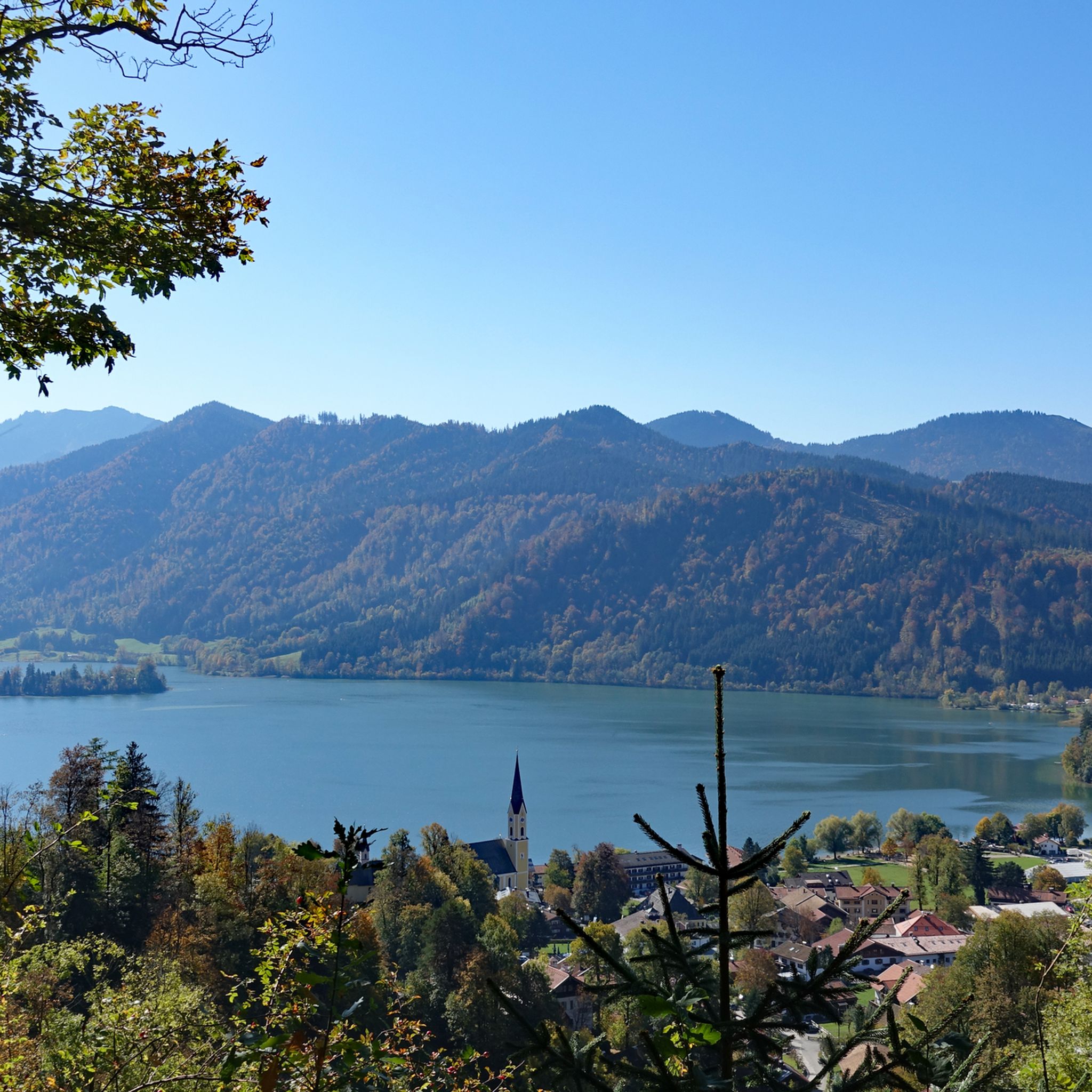
The Hohenwaldeck Castle ruins are well worth seeing because they contain large remains of walls dating back to the High Middle Ages. More important, however, is their stunningly beautiful location high above Schliersee, offering unobstructed views of the lake and the mountains. The Bavarian State Forests have carefully secured the castle ruins, so that this historic and romantic site can now also be visited with children. The climb to the castle is steep and takes 40 minutes from Fischhaus-Neuhaus. Supplying the castle must have been very difficult in the Middle Ages. Access is now via a new wooden bridge, and large sections of the shield wall with some rusticated blocks can still be seen. This makes it easy to narrow down the first construction phase to the second half of the 13th century, the Staufer period. Several new benches have been installed, and the short path down to the viewing point is definitely worth the effort. It offers a fantastic view of Schliersee and the surrounding mountains.
10
0

A beautiful view from above on the Sliersee.
1
0

The Oberlandstadion, built between 1946 and 1948, is located at the foot of the Freudenberg in Schliersee and is a pure natural ice stadium without a refrigeration system. Unfortunately, due to the requirements of the Bavarian Ice Sports Association, league games can no longer be played in a natural ice stadium. The stadium is therefore only used for training and friendly matches as well as for public ice skating and curling. Source and further information www.eisstadion-schliersee.de
1
0
The ice stadium is located on the edge of the forest near the Sliersee
0
0

Basically a small, inconspicuous intermediate peak above Hausham. There is a private alpine hut on the actual Huberspitz. A few meters further on is the Almbad Huberspitz with catering, plenty of space and a view towards Schliersee and Wendelstein. https://www.almbad.de/huberspitz/
4
0
Frequently Asked Questions
How many mountaineering routes are available around Schliersee?
Schliersee offers a vast network of nearly 300 mountaineering routes. This includes a diverse range of trails, with about 10 easy routes, 141 moderate routes, and 142 difficult routes, ensuring options for all skill levels.
Are there easy mountaineering routes suitable for beginners or families in Schliersee?
Yes, Schliersee has several easy mountaineering routes perfect for beginners or families. An excellent option is the Schliersbergalm loop from Schliersee, an easy 5.8 km trail that offers rewarding views over Lake Schliersee and features a summer toboggan run for the descent from Schliersbergalm. The region also offers the Tree Adventure Trail and an adventure trail along the western bank of Lake Schliersee, which are particularly appealing for families.
What are some challenging mountaineering routes for experienced hikers?
For experienced mountaineers seeking a challenge, the Schliersee region offers strenuous routes to prominent peaks. Trails to the Brecherspitz and routes offering views of the Taubenstein and Rotwand provide demanding ascents. These require good fitness, sure-footedness, sturdy shoes, and alpine experience. The Rotwand, at 1,884 meters, is the highest and most well-known summit in the Schliersee Mountains, accessible via challenging hikes.
Can I find circular mountaineering routes in Schliersee?
Absolutely, many mountaineering routes around Schliersee are designed as loops. For a moderate experience with panoramic views, consider the Gindelalmschneid Summit loop. Another popular moderate option is the Hohenwaldeck castle ruins – Schliersee West Shore loop, which combines historical ruins with lakeside paths.
Are there any mountaineering routes that pass by waterfalls?
Yes, the Schliersee region is home to natural wonders like the Hachelbach Waterfalls and Josefsthal Waterfalls. While specific komoot routes directly passing these aren't listed in the top routes, these waterfalls are popular hiking destinations in the area and can be integrated into your mountaineering plans for added scenic beauty.
What kind of natural features and landmarks can I expect to see along the routes?
Mountaineering routes around Schliersee offer diverse natural features and landmarks. You'll encounter stunning alpine lakes like Lake Schliersee and Spitzingsee, as well as prominent peaks such as Rotwand and Wendelstein. Many trails provide breathtaking views of the Mangfall Mountains. You might also discover historical sites like the Hohenwaldeck castle ruins or enjoy facilities like the Kneipp facility and barefoot path near the lake.
Are there mountain huts or places to stop for refreshments along the trails?
Yes, the Schliersee region is well-equipped with numerous serviced mountain huts, known as 'Alms,' where you can stop for refreshments and rest. Popular options include Schliersbergalm, Rixner-Alm, Gindelalm, Kreuzbergalm, and Rotwandhaus. Some even offer overnight stays, providing a comfortable break during longer mountaineering tours.
What do other mountaineers say about the routes in Schliersee?
The mountaineering routes in Schliersee are highly regarded by the komoot community, boasting an average rating of 4.7 stars from over 1000 reviews. Over 13,000 mountaineers have used komoot to explore the varied terrain. Reviewers often praise the well-marked paths, diverse landscapes, and the rewarding views from summits and viewpoints like those found on the Path to the Forgotten Summit loop.
Are there options for accessing higher altitudes without extensive climbing?
Yes, the region provides convenient access to higher altitudes. The Taubenstein Cable Car and Stümpfling Chairlift allow hikers to reach elevations between 1,100 and 1,800 meters, opening up trails and impressive views without the initial strenuous climb. From the Taubenstein cable car station, you can easily reach huts like Schönfeldhütte and Taubensteinhaus, or extend your treks to peaks such as Jägerkamp and Aiplspitz. The Wendelsteinbahn also transports visitors to the summit of Wendelstein.
What is the best time of year for mountaineering in Schliersee?
The best time for mountaineering in Schliersee largely depends on your preferred conditions. The region is popular year-round. Spring and autumn offer pleasant temperatures and vibrant scenery, ideal for most hikes. Summer provides warmer weather for higher alpine routes. In winter, the area transforms into a snowy landscape, suitable for snowshoeing and winter mountaineering, though specific conditions and avalanche warnings should always be checked for higher, more exposed routes.
Are there any routes that offer particularly good views of Lake Schliersee?
Many routes in the area provide stunning vistas of Lake Schliersee. The Schliersbergalm loop is an easy trail specifically known for its rewarding views over the lake. Another excellent option is the View of Schliersee loop, a moderate route designed to showcase the lake's beauty from various perspectives.
Can I reach mountaineering trailheads in Schliersee using public transport?
Schliersee is generally accessible by public transport, making it possible to reach many trailheads without a car. The town of Schliersee itself has a train station, and local buses connect to various points around the lake and into the surrounding mountains. It's advisable to check local timetables for specific routes to ensure direct access to your chosen starting point.
Most popular routes around Schliersee
Most popular attractions around Schliersee

Get inspired with the komoot mobile app


Explore more
Browse the best Mountain Hikes & Routes in other regions.
