The best running trails around Rollinsville
3.0
(2)
181
runners
27
runs
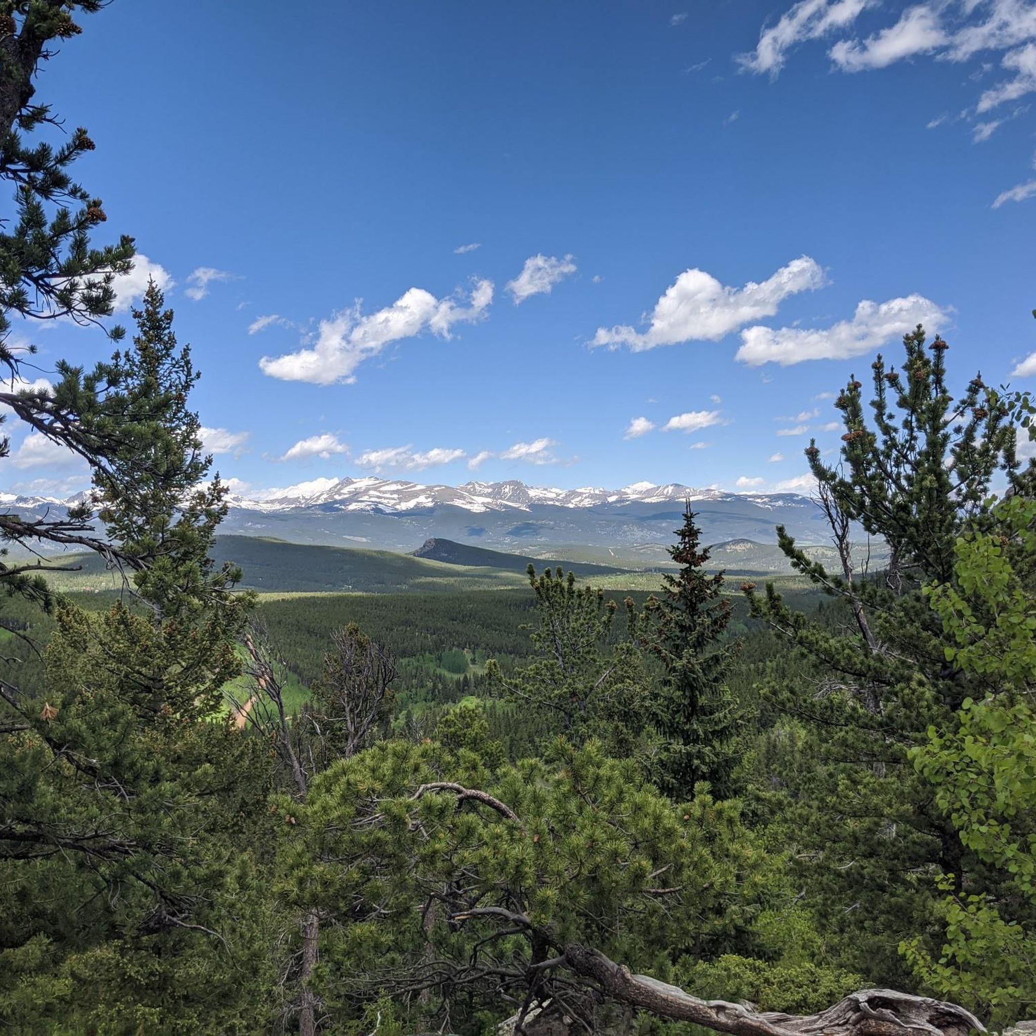
Jogging around Rollinsville, Colorado, offers a diverse range of routes set within a high-altitude environment. The region is characterized by its mountain terrain, dense forests, and alpine lakes, providing varied landscapes for runners. Situated at 8,474 feet, Rollinsville provides access to extensive federal lands like Arapaho National Forest and Roosevelt National Forest. These areas feature a mix of challenging mountain trails and more accessible paths, catering to different fitness levels.
Best jogging routes around Rollinsville
- The most popular jogging route…
Last updated: August 31, 2026
7
runners
5.90km
00:38
20m
20m
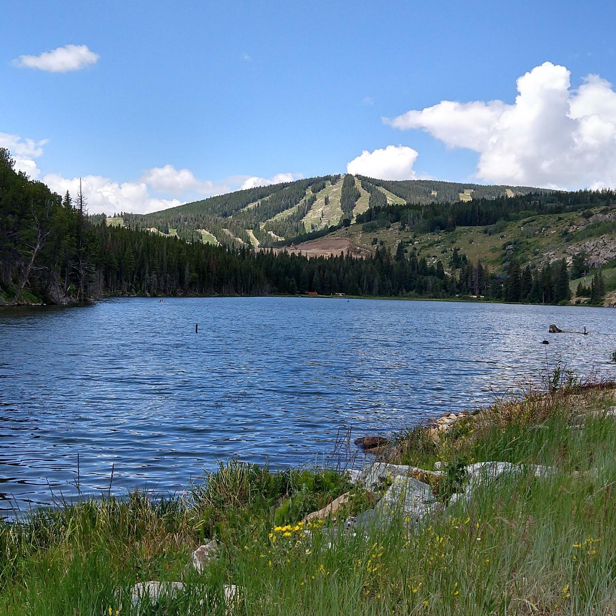
Jog the moderate 3.7-mile Barker Reservoir Trail near Nederland, Colorado, for scenic views of the reservoir and Rocky Mountains.
3
runners
17.7km
02:19
380m
380m
This difficult 11.0-mile jogging loop in Roosevelt National Forest features varied terrain, mountain views, and an abandoned school bus.

Sign up for free
2
runners
18.3km
02:30
400m
400m
Jog the difficult 11.3-mile Blue Dot Trail Loop in Arapaho & Roosevelt National Forests, featuring canyon views and a waterfall.
1.0
(1)
2
runners
3.91km
00:31
80m
80m
Jog the difficult 2.4-mile Aspen Alley Trail through stunning aspen groves with views of the Ten Mile Range near Breckenridge.
6.37km
00:45
140m
140m
Jog the moderate 4.0-mile Kinnickinnick and Tungsten Loop in Mud Lake Open Space, enjoying lake views and forest scenery.
Get access to more routes and recommendations from other explorers.
Sign up for free
Already have an account?
Our route recommendations are based on thousands of hikes, rides, and runs completed by other people on komoot.
Start today with a free account
Your next adventure awaits.
Login or Signup
Tips from the Community

The trail network here has numerous nontechnical singletrack trails that weave around the lake and through the forest. The trails are fast and flowy.
0
0

This sub-alpine trail has tons of wild flowers, gorgeous mountain views, and aspen lined trails, all while being within a stones throw from town!
0
0
While swimming is prohibited in this body of water, you can hike the perimeter of the reservoir and fish. The trail is a easy flat run with a hard packed dirt surface. In the winter you can spectate ice fishing from the shore!
0
0
There is a dirt parking lot here with room for around a dozen vehicles. From here you can run, hike or bike on the dense trail system east or west of the highway
0
0
Barker Meadow Reservoir was purchased by Boulder in 2010 from a Mrs. Barker (who was forced to sell, but didn't want to). The reservoir provides hydro-electricity and features a plethora of activities including trail running, hiking and fishing. There are several nice areas to picnic with great views of the reservoir.
0
0
Schoolbus trail is a popular route for running, hiking and mountain biking. The trail is not overly technical and it offer a diverse views of forest, meadows, and mountains.
0
0
There is an excellent network of running and mountain biking trails from the trailhead, which has a sign map and a decently sized dirt parking lot.
0
0
Observatory Trail is a relatively flat loop spanning through the West Magnolia Campground. Being that it is so close to town, the trails trafficked heavily and winter runs typically don't require snowshoes. There isn't a whole lot of shade, but that just means the views aren't obstructed!
0
0
Frequently Asked Questions
What kind of terrain can I expect on running trails around Rollinsville?
Rollinsville, situated at 8,474 feet in the Colorado Rockies, offers a diverse range of terrain. You'll find challenging mountain paths, dense forests, and serene alpine lakes. The area includes extensive federal lands like Arapaho National Forest and Roosevelt National Forest, providing a mix of rugged mountain scenery and more accessible trails through aspen groves and along creeks.
Are there any easy jogging routes suitable for beginners or a relaxed run?
Yes, while many routes offer a challenge, there are easier options. The Barker Reservoir Trail, though rated moderate, is a popular 3.7-mile path offering scenic views without extreme elevation changes. Additionally, the West Magnolia Trails network, while not listed in the guide, is known for its easy-to-moderate singletrack trails suitable for stringing together shorter, relaxed runs.
Which running routes offer the best scenic views or viewpoints?
Many routes in the Rollinsville area boast spectacular views. The high-altitude setting provides panoramic vistas of Rocky Mountain National Park and the Continental Divide. For specific routes, the Barker Reservoir Trail offers scenic views of the reservoir and surrounding mountains. The School Bus Trail loop also features expansive mountain views within Roosevelt National Forest. Rollins Pass itself is known for high-altitude views and alpine lakes like Yankee Doodle Lake.
Are there any circular jogging routes in the Rollinsville area?
Yes, several routes are designed as loops, perfect for a continuous run. The School Bus Trail loop is an 11.0-mile difficult path, while the Kinnickinnick and Tungsten Loop is a moderate 4.0-mile trail offering lake views and forest scenery.
What historical landmarks or points of interest can I explore while running?
Rollinsville has a rich mining and railroad history. You can encounter remnants of this past along various trails. The Switzerland Trail, once a railway, is now a pleasant path. The West Magnolia Trails offer glimpses of mining history, including the Champion Mill and Lone Star Mine remnants. The Moffat Tunnel East Portal is another significant historical site. You can also find historical sites like John Frazer's Cabin and the DeLonde Homestead nearby.
Are there any running trails near lakes or water features?
Absolutely. The region is dotted with beautiful lakes. The Barker Reservoir Trail provides scenic views of Barker Reservoir. The Kinnickinnick and Tungsten Loop offers views of Mud Lake. South Boulder Creek also cuts through the southern part of town, providing scenic routes. You might also encounter Lost Lake in the vicinity.
What is the best time of year for jogging in Rollinsville?
The best time to jog in Rollinsville largely depends on your preference for weather and scenery. Fall offers stunning colors as the aspen groves change. Summer provides pleasant temperatures for high-altitude runs. While winter jogging is possible, be prepared for snow and colder conditions, especially on higher elevation trails. Always check local weather and trail conditions before heading out.
How many running routes are available around Rollinsville?
There are over 25 dedicated running routes around Rollinsville, catering to various fitness levels. These include 2 easy routes, 13 moderate routes, and 13 difficult routes, ensuring options for everyone from casual joggers to experienced trail runners.
What do other runners say about the trails in Rollinsville?
The running routes in Rollinsville are highly regarded by the komoot community, with an average score of 5.0 stars from reviews. Over 180 runners have used komoot to explore the varied terrain, often praising the breathtaking mountain views, diverse landscapes, and the sense of adventure offered by the high-altitude trails.
Are there any particularly challenging running routes for experienced runners?
Yes, Rollinsville offers several difficult routes for those seeking a strenuous experience. The School Bus Trail loop is an 11.0-mile difficult path with varied terrain and significant elevation gain. Another challenging option is the Blue Dot Trail Loop, which spans over 11 miles and features considerable elevation changes. The Aspen Alley Trail is also rated difficult.
Where can I find parking for the running trails in Rollinsville?
Parking is available at various trailheads. For instance, the Rollinsville Tolland Road, a 13.2-mile dirt road popular for running, offers parking directly in Rollinsville. The Moffat Tunnel East Portal area is also known for ample parking, providing access to several outdoor recreation opportunities. For specific trails, it's always advisable to check the individual route details for designated parking areas.
Are there any trails that are particularly good for experiencing the fall foliage?
Rollinsville is surrounded by lush aspen groves, which provide stunning fall colors. While not a specific route name, the West Magnolia Trailhead area is known for its system of singletrack trails winding through aspens with views of the Continental Divide, making it an excellent choice for experiencing the vibrant autumn scenery during a run.
Most popular routes around Rollinsville
Most popular attractions around Rollinsville

Get inspired with the komoot mobile app


Explore more
Browse the best Running Trails & Routes in other regions.
