The best road cycling routes around Chacra
23
riders
5
rides
Road cycling around Chacra offers routes through varied terrain, characterized by open landscapes and some elevation changes. The region features a mix of paved roads and scenic paths, providing opportunities for cyclists to explore the area. Distant hills and natural features define the backdrop for many of the cycling routes. The network of routes caters to those seeking moderate road cycling experiences.
Best road cycling routes around Chacra
- The most popular road cycling route is New Castle to Rifle Gap…
Last updated: October 1, 2026
4
riders
64.8km
02:49
630m
630m
Moderate road ride. Good fitness required. Mostly well-paved surfaces and easy to ride.
8
riders
35.2km
01:38
400m
400m
Moderate road ride. Good fitness required. Mostly well-paved surfaces and easy to ride.

4
riders
64.8km
02:48
590m
590m
Moderate road ride. Good fitness required. Mostly well-paved surfaces and easy to ride.
4
riders
75.5km
03:26
880m
880m
Moderate road ride. Good fitness required. Mostly well-paved surfaces and easy to ride.
4
riders
54.7km
02:21
460m
460m
Moderate road ride. Good fitness required. Mostly well-paved surfaces and easy to ride.
Our route recommendations are based on thousands of hikes, rides, and runs completed by other people on komoot.
Tips from the Community

Good start/stop point is downtown New Castle at the Down Valley Brewery for a post ride beverage.
0
0

Grass Valley Reservoir, located in Harvey Gap State Park, is a scenic lake set amid the Rocky Mountains.
0
0

Rifle is located along the Colorado River and Interstate 70, just east of the Roan Plateau. While it's known for cattle ranching, there are however a wide variety of outdoor activities in the Rifle area.
1
0
New Castle is just west of Glenwood Springs at 5,597 feet in elevation. The historic downtown area, with local restaurants and shops, is perfect for exploring on foot or bike.
0
0
Rifle is located along the Colorado River and Interstate 70, just east of the Roan Plateau. While it's known for cattle ranching, there are however a wide variety of outdoor activities in the Rifle area.
0
0
This 350-acre reservoir is part of Rifle Gap State Park and provides some of Colorado's best boating, fishing, swimming and windsurfing. There is also a campground along the northern shore of the reservoir.
0
0
Frequently Asked Questions
What kind of road cycling experience can I expect in Chacra?
Road cycling around Chacra offers a moderate experience through open landscapes with some elevation changes. The routes feature a mix of paved roads and scenic paths, providing opportunities to explore the area with distant hills and natural features as a backdrop. All listed routes are of moderate difficulty, making them suitable for a range of cyclists.
Are there any loop routes for road cycling in Chacra?
Yes, Chacra features several excellent loop routes. For example, you can explore the New Castle to Rifle Gap State Park loop, which is 40.2 miles (64.8 km) long, or the slightly longer New Castle – Rifle Gap Reservoir loop from New Castle, spanning 43.1 miles (69.4 km).
What are some of the longer road cycling routes available?
For longer rides, consider the New Castle – Rifle Gap Reservoir loop from New Castle, which covers 43.1 miles (69.4 km) and includes significant climbs. Another substantial option is the New Castle to Rifle Gap State Park loop, at 40.2 miles (64.8 km).
Are there any attractions or points of interest along the road cycling routes in Chacra?
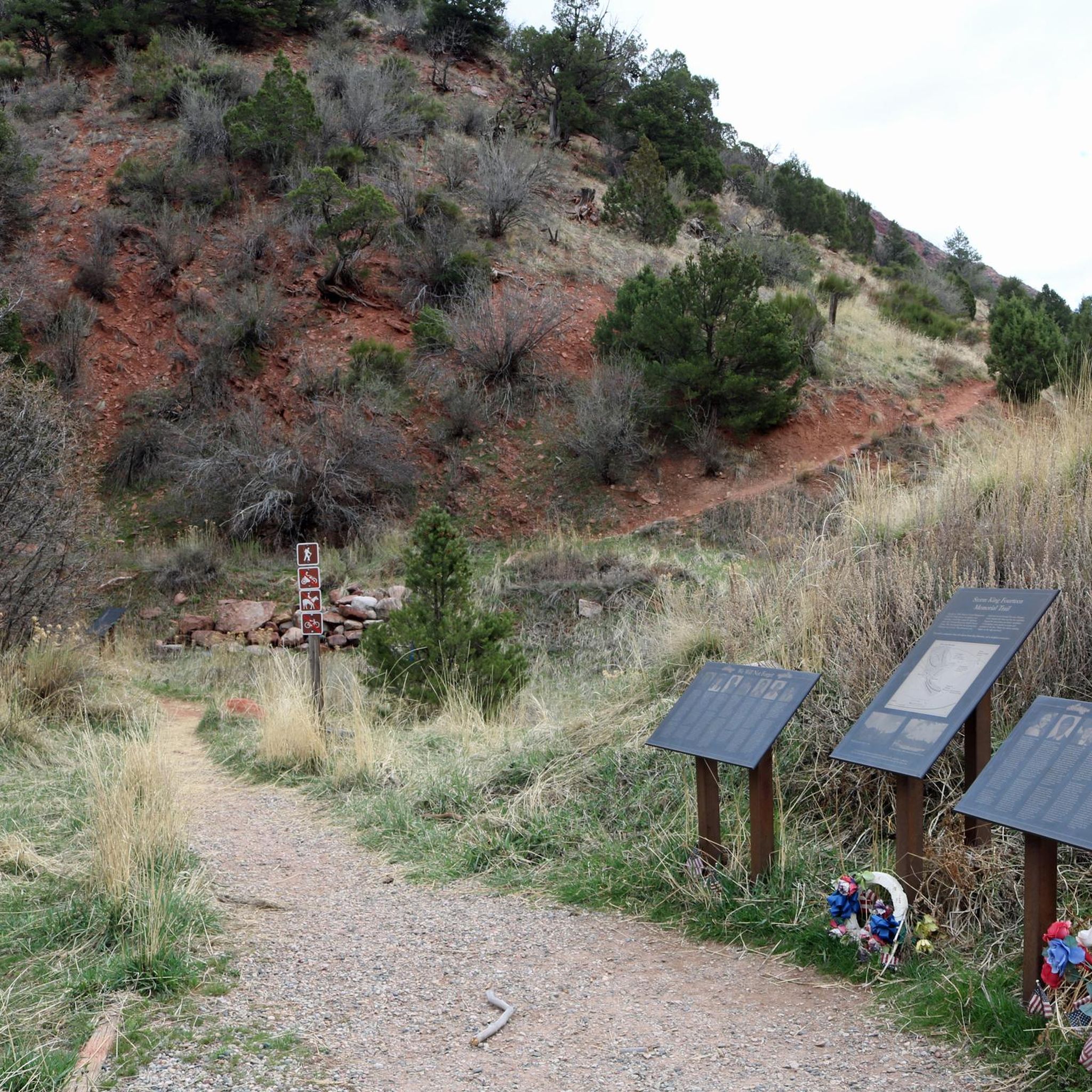
Yes, while cycling in Chacra, you can find several interesting spots. Consider visiting Storm King Mountain Memorial Trail or the Storm King Firefighters Memorial. For a relaxing stop, Two Rivers Park offers facilities, and the Red Hill Trailhead is another notable point.
What is the difficulty level of road cycling routes in Chacra?
All road cycling routes listed for Chacra are categorized as moderate difficulty. They feature varied paved surfaces and moderate climbs, making them accessible for cyclists with some experience looking for a rewarding ride.
How many road cyclists have explored Chacra using komoot?
More than 30 road cyclists have used komoot to explore the varied terrain around Chacra, indicating a growing community enjoying the region's routes.
Are there any shorter road cycling routes in Chacra?
Yes, for a slightly shorter ride, you can try the Glenwood Springs – Boy Scout Trailhead loop from Glenwood Park and Ride. This route covers 16.6 miles (26.7 km) and offers a moderate cycling experience.
What kind of elevation gain can I expect on Chacra's road cycling routes?
The routes in Chacra feature moderate elevation gains. For instance, the New Castle – Rifle Gap Reservoir loop from New Castle has an elevation gain of approximately 738 meters, while the New Castle to Rifle Gap State Park loop involves about 625 meters of climbing.
What makes Chacra a good destination for road cycling?
Chacra is an appealing destination for road cycling due to its scenic landscapes, characterized by open vistas and distant hills. The region offers a network of well-maintained paved roads and paths, providing a balanced challenge with moderate climbs suitable for various skill levels. The presence of nearby attractions also adds to the overall experience.
Can I find routes that offer expansive views in Chacra?
Absolutely. Routes like the New Castle – Rifle Gap Reservoir loop from New Castle are known for offering expansive views of the surrounding area, especially after significant climbs, providing rewarding panoramas for cyclists.
Are there any other moderate road cycling routes besides the most popular ones?
Beyond the most popular options, you can also enjoy the New Castle – Grass Valley Reservoir loop from New Castle, a moderate 21.8 miles (35.2 km) route, or the Rifle Gap Reservoir – Rifle loop from New Castle, which is 40.2 miles (64.8 km) and leads through open landscapes.
Most popular routes around Chacra
Most popular attractions around Chacra

Get inspired with the komoot mobile app


Explore more
Browse the best Road cycling routes in other regions.
