The best running trails around Fruitdale
4.4
(19)
2,559
runners
145
runs
If you've ever tried to plan your next run, you know how overwhelming the options can be, especially when looking for the best jogging routes around Fruitdale. It's tough to tell which trails are genuinely worth your time and effort from the sheer volume of choices out there. That's exactly why we're here: our komoot community has meticulously mapped, run, and reviewed these routes, so we can cut through the noise and give you a curated shortlist of the ones that truly shine.
Jogging in Fruitdale is all about accessible creek-side paths and urban green spaces, offering a delightful blend of natural scenery within a developed area. You'll find gentle terrain and minimal elevation changes here, making it perfect for everything from a quick, easy jog to a more moderate, longer distance challenge. The routes often follow natural waterways, connecting you to local parks and providing a refreshing escape without ever feeling too far from civilization.
If you only do one run, make it the classic Los Gatos Creek Trail. This 2.6 miles (4.2 km) easy route is a local favorite for a reason, offering scenic stretches along the creek that are perfect for a relaxed outing. For those looking to extend their run and explore a bit more, the Los Gatos Creek and Downtown Campbell Loop, at 2.7 miles (4.3 km), is a fantastic moderate option that takes you through urban green spaces and into the charming downtown area. With over 2,400 runners having already explored Fruitdale's varied terrain with komoot, you know you're in good company.
Last updated: May 28, 2026
5.0
(3)
79
runners
4.16km
00:26
10m
10m
The Los Gatos Creek Trail is a delightful escape, offering a varied and scenic jogging experience through riparian habitats and open spaces. You'll find yourself winding along the creek, with sections of paved path giving way to unpaved gravel and dirt, and even charming boardwalks. The route provides ample shade and picturesque views of Vasona Lake, making it a refreshing outing where you might even spot blue herons or turtles.
This easy 2.6-mile (4.2 km) route, with its gentle 43 feet (13 metres) of elevation gain, can be completed in about 26 minutes, making it perfect for a quick jog or a family-friendly run. The trail is well-maintained, featuring mile markers, restrooms, and drinking fountains at various access points. It's also dog-friendly, so your canine companion can join the fun.
Beyond its appeal for joggers, the Los Gatos Creek Trail is a multi-use pathway popular for walking, cycling, and skating. It connects to other local paths like the Jones Trail and Flume Trail, and provides access to St. Joseph's Hill, expanding your options for exploration in the area. This trail is a local favorite for its blend of natural beauty and urban accessibility.
24
runners
7.02km
00:44
10m
10m
The Los Gatos Creek Trail is a fantastic option for a refreshing jog, offering a diverse experience that blends urban convenience with natural charm. You'll find yourself moving between smooth paved paths and unpaved sections of gravel and dirt, with picturesque boardwalks adding variety underfoot. The route meanders alongside the sparkling creek, providing ample shade and views of Vasona Lake, making this moderate 4.4-mile (7.0 km) jogging route, with its 41 feet (13 metres) of elevation gain, a delightful way to spend about 43 minutes.
Planning your visit is straightforward, as the trail is well-equipped with amenities like mile markers, restrooms, and drinking fountains at various points. It's a popular multi-use pathway, so you'll share the space with walkers and cyclists, creating a vibrant community atmosphere. The trail is also dog-friendly, making it a great spot to bring your canine companion for some exercise.
Beyond its recreational appeal, the Los Gatos Creek Trail holds a touch of history, following a former South Pacific Coast Railroad line in its southern portion. It connects a string of beloved parks, including Los Gatos Creek Park and Oak Meadow Park, and is known for its abundant wildlife, such as blue herons and turtles. This trail serves as a bustling community hub, offering a unique blend of natural beauty and accessibility for joggers of all levels.

Sign up for free
4.35km
00:27
10m
10m
The Los Gatos Creek and Downtown Campbell Loop offers a refreshing blend of natural and urban landscapes, making it a fantastic choice for an easy outing. You'll enjoy a smooth, paved surface as you follow the serene Los Gatos Creek, surrounded by lush greenery, before transitioning into the lively atmosphere of Downtown Campbell. This 2.7-mile (4.3 km) route features a mere 36 feet (11 metres) of elevation gain, making it an easy jog that most can complete in just 26 minutes.
This accessible route is perfect for a quick workout or a leisurely stroll, connecting you directly to the shops and cafes of Downtown Campbell. It's a multi-use path, popular with joggers, cyclists, and walkers alike, and its connection to various parks like Campbell Park means amenities such as restrooms and water fountains are often nearby. The trail is well-maintained and offers a pleasant experience year-round.
Beyond its scenic appeal, the trail holds a touch of history, with portions of the broader Los Gatos Creek Trail following a former South Pacific Coast Railroad line. Despite its urban proximity, you can still catch glimpses of natural habitat and wildlife along the creek. It's a well-rounded, undemanding option for anyone looking for a convenient and enjoyable outdoor activity in the area.
5.0
(2)
73
runners
3.90km
00:24
10m
10m
The Los Gatos Creek (east bank) loop from Campbell offers a delightful and easy jogging experience, winding through lush riparian undergrowth alongside the sparkling Los Gatos Creek. You'll encounter a mix of paved asphalt and unpaved dirt and gravel sections, providing a varied surface underfoot. The route passes through open green spaces and near percolation ponds, with ample tree coverage offering shade, making it a visually appealing and peaceful escape from the urban hustle.
This 2.4-mile (3.9 km) loop is rated easy, with a minimal 36 feet (11 metres) of elevation gain, and can be completed in about 24 minutes, making it perfect for a quick, accessible run. You'll find plentiful access points, with parking, restrooms, and drinking fountains available at nearby park entrances like Oak Meadow Park and Vasona County Park. It's a popular multi-use path, so expect to share the trail with walkers and cyclists.
Historically, a southern portion of the Los Gatos Creek Trail follows a former South Pacific Coast Railroad line, adding a unique element to its character. The trail's versatility allows for creating various loops, with options to run on either side of the creek, offering a choice between paved and unpaved surfaces. It connects communities like Los Gatos, Campbell, and San Jose, providing access to downtown areas for post-jog refreshments.
3.0
(1)
51
runners
This moderate 5.6-mile (9.0 km) jogging loop along the Los Gatos Creek Trail, taking approximately 56 minutes with just 70 feet (21 metres) of elevation gain, offers a delightful escape into nature right from the Fruitdale Avenue area. You'll enjoy a smooth, paved surface winding alongside the Los Gatos Creek, surrounded by lush riparian undergrowth and a mix of sunny and shaded sections. It's a fantastic option for a quick, accessible run where you can spot local wildlife and enjoy peaceful creek-side views.
Accessing the trail from the Fruitdale Avenue area is straightforward, providing a convenient starting point for this loop. While specific parking details for this exact spot aren't always highlighted, the extensive Los Gatos Creek Trail system generally offers ample parking at various access points. The trail's abundant shade makes it enjoyable throughout much of the day, and its multi-use nature means you'll find amenities like restrooms and water fountains in nearby parks along the wider trail.
The Los Gatos Creek Trail is renowned for its accessibility and diverse appeal, making it one of the best trails for jogging in the area. It's a dog-friendly location, allowing you to bring your furry companion along for the run. Historically, parts of the southern section follow a former railroad line, adding a unique layer to its character, though this specific loop focuses on the northern, flatter stretches ideal for a consistent jog.
Get access to more routes and recommendations from other explorers.
Sign up for free
Already have an account?
Our route recommendations are based on thousands of hikes, rides, and runs completed by other people on komoot.
Start today with a free account
Your next adventure awaits.
Login or Signup

Tips from the Community

A lovely truss bridge spans the small forested canyon carved by Los Gatos Creek. On the south side there is a large parking lot for the Los Gatos Creek Trail.
1
0

The Los Gatos Creek Trail offers a nice paved path through trees for walkers, joggers, bicyclists, skaters, non-motorized scooters, and nature lovers. The path is completely off the main roads and follows a creek that serves as a habitat corridor for many species.
0
0

It's a good footpath and cycle path without traffic lights and similar interruptions (so rare that you can celebrate it XD)
0
0

Small but vibrant little town with restaurants and shops. For the Sunday farmers market the entire downtown street is closed to traffic
0
0
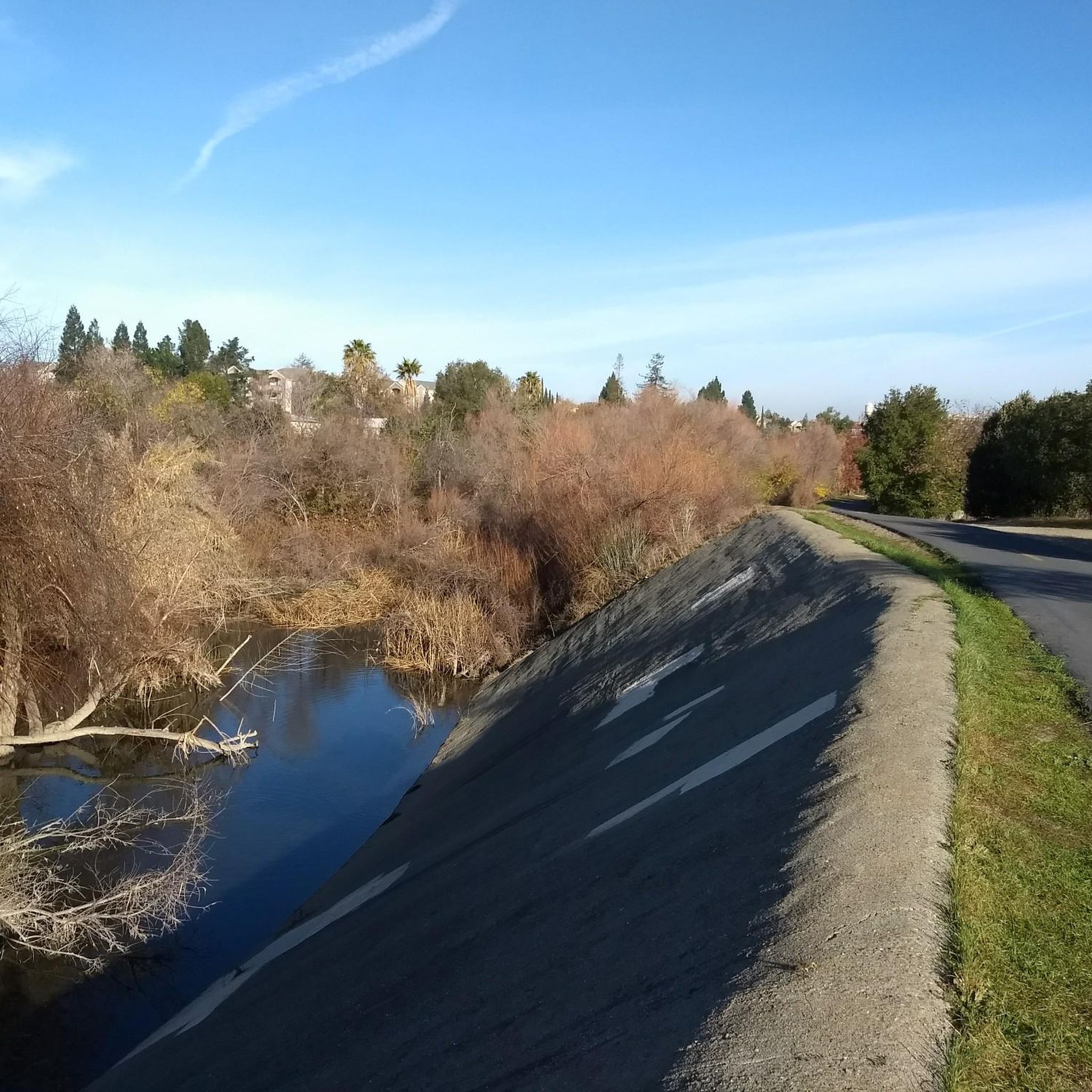
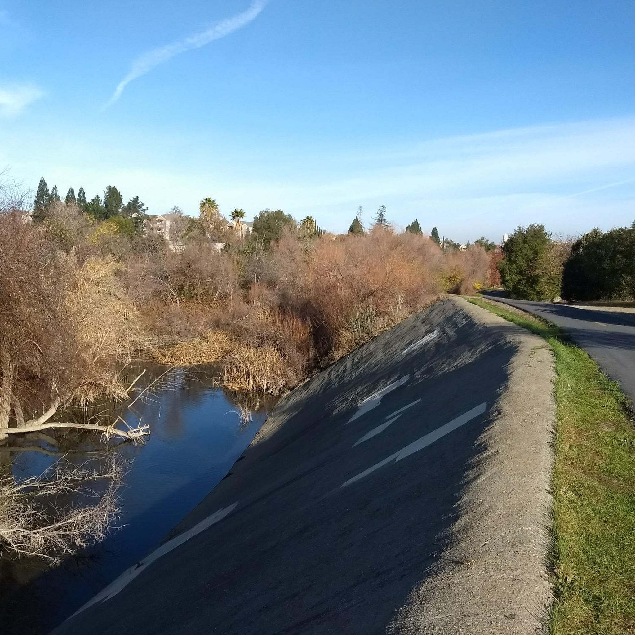
Los Gatos Creek is squeezed into an artificial concrete canal. Weirs and barrages occasionally slow down the flow. On the positive side, the excellent paved bike and multiuser trail that follows the canal is equally straightened and has enough room.
2
0
Frequently Asked Questions
How many running routes are available in Fruitdale?
Fruitdale offers a wide selection of running routes, with over 120 different options to explore. These include 24 easy routes, 89 moderate routes, and 10 more challenging trails, catering to various fitness levels.
Are there any easy running routes suitable for beginners in Fruitdale?
Yes, Fruitdale has 24 easy running routes perfect for beginners or those looking for a relaxed jog. Many of these routes feature gentle terrain and minimal elevation changes, such as the shorter segment of the Los Gatos Creek Trail, which is 2.6 miles (4.2 km) long.
What kind of terrain can I expect on jogging trails around Fruitdale?
Jogging routes in Fruitdale are primarily characterized by gentle terrain and minimal elevation changes. You'll find accessible creek-side paths, urban green spaces, and often paved surfaces, offering a comfortable running experience within a developed area.
Are there any circular running routes in Fruitdale?
Yes, there are several circular running routes. A popular option is the Los Gatos Creek and Downtown Campbell Loop, which is 2.7 miles (4.3 km) and takes you through urban green spaces and connects to downtown areas.
What do other runners enjoy most about jogging in Fruitdale?
The running routes in Fruitdale are highly rated by the komoot community, with an average score of 4.0 stars from more than 10 reviews. Runners often praise the accessible creek-side paths and the blend of natural scenery with urban convenience.
Are there any family-friendly jogging paths in Fruitdale?
Many of Fruitdale's routes, especially the easy ones with gentle terrain, are suitable for families. The creek-side paths and urban green spaces provide safe and enjoyable environments for all ages. Consider routes like the Los Gatos Creek Trail for a pleasant family outing.
What are some scenic running routes with viewpoints or interesting sights?
While specific viewpoints aren't highlighted, many routes follow natural waterways like the Los Gatos Creek, offering pleasant scenery. You can also find interesting sights along routes that pass by local parks or connect to downtown areas. For example, the Los Gatos Creek and Downtown Campbell Loop offers a mix of natural and urban views.
Are there any lakes or natural attractions near the running trails?
Yes, several natural attractions are close to the running routes. You can find lakes like Camden Ponds, Vasona Lake County Park, and Almaden Lake. The Guadalupe River Trail, Park & Gardens also offers a beautiful setting for a run.
What is the best time of year for running in Fruitdale?
Fruitdale's generally mild climate, characterized by gentle terrain, makes it suitable for running year-round. Spring and fall offer particularly pleasant temperatures, but the accessible paths and urban green spaces are enjoyable in most seasons.
Are there any longer, more challenging running routes in the area?
For those seeking a longer challenge, Fruitdale offers 10 difficult routes. One such route is the San Jose Municipal Rose Garden loop from Santana Row, which spans over 10 miles (16.7 km) and includes some elevation changes.
Can I find running routes that connect to downtown areas or urban centers?
Absolutely. Many routes in Fruitdale connect to local parks and urban centers. The Los Gatos Creek and Downtown Campbell Loop is a prime example, leading through urban green spaces and directly into downtown areas.
Most popular attractions around Fruitdale

Get inspired with the komoot mobile app


Explore more
Browse the best Running Trails & Routes in other regions.
