The best road cycling routes around Agoura Hills
4.5
(27)
3,261
riders
17
rides
Road cycling around Agoura Hills offers diverse landscapes within the Santa Monica Mountains, characterized by significant elevation changes and well-paved surfaces. The region features winding roads, oak groves, and ridgelines that provide expansive views. Its proximity to Malibu allows for routes that combine mountain and coastal scenery, with terrain ranging from rolling hills to challenging climbs.
Best road cycling routes around Agoura Hills
- The most popular road cycling route is Westlake Lake – View of Lake Eleanor Ridge loop from…
Last updated: August 20, 2026
5.0
(1)
195
riders
128km
06:36
2,020m
2,020m
Hard road ride. Very good fitness required. Mostly well-paved surfaces and easy to ride.
5.0
(1)
129
riders
76.8km
03:34
880m
880m
Moderate road ride. Good fitness required. Some segments of this route may be unpaved and difficult to ride.

Sign up for free
5.0
(2)
112
riders
42.4km
02:02
440m
440m
Moderate road ride. Good fitness required. Mostly well-paved surfaces and easy to ride.
3.0
(1)
102
riders
55.4km
02:38
580m
580m
Moderate road ride. Good fitness required. Mostly well-paved surfaces and easy to ride.
5.0
(1)
78
riders
79.4km
04:29
1,540m
1,540m
Hard road ride. Very good fitness required. Mostly well-paved surfaces and easy to ride.
Get access to more routes and recommendations from other explorers.
Sign up for free
Already have an account?
Our route recommendations are based on thousands of hikes, rides, and runs completed by other people on komoot.
Start today with a free account
Your next adventure awaits.
Login or Signup

Tips from the Community

Lake Sherwood Drive takes you out along the water, and though the shoulder isn't great, there is a space for bikes and cars to pull over and enjoy the view.
0
0

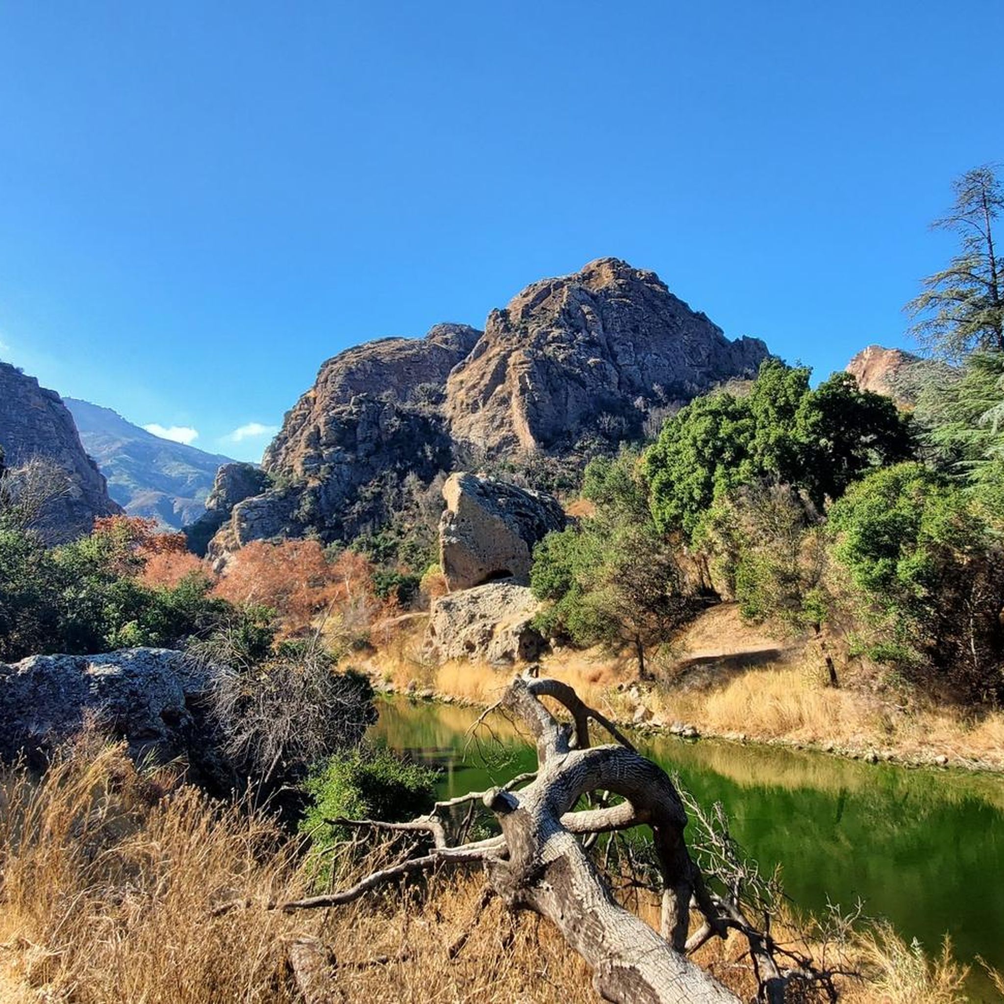
Tucked in the Santa Monica Mountains near Agoura Hills, Malibou Lake is a private reservoir surrounded by rustic homes and hillsides dotted with oak trees. Created in 1922, the Medea and Triunfo creeks feed the reservoir, which sits adjacent to Malibu Creek State Park. The lake has a long history as a Hollywood filming location, most notably Frankenstein (1931)—the iconic scene of the monster and a little girl.
0
0

Pick up the Wendy Trail from hear and head off into the Boney Mountain State Wilderness. There are miles and miles of trails to explore, so take your pick and enjoy your run.
0
0
Pedalers Fork is a unique combination of a restaurant, bar, coffee shop, and boutique bike shop in the heart of Calabasas. It offers delicious farm-to-table dining and artisan coffee with a casual vibe and a great patio, making it a fantastic place to relax after a ride.
0
0
This stretch of West Potrero Road is incredibly scenic, offering breathtaking views whether you're traveling east toward the rolling hills or west toward the coastline. The winding path provides a perfect backdrop for picturesque sunsets, making it a delightful route for both a leisurely ride or a fast-paced descent.
0
0

This is one of the prettiest sections of bikeable roadway near Thousand Oaks, with gorgeous Lake Sherwood just off the road to the south. If you head west on West Potrero Road you can connect into a large loop of roughly 20 miles, doubling back toward Thousand Oaks before returning to the lake.
4
0

Beautiful area, green everywhere
5
0
Frequently Asked Questions
What kind of terrain can I expect on road cycling routes around Agoura Hills?
Road cycling routes in Agoura Hills offer a diverse range of terrain, primarily within the Santa Monica Mountains. You'll find routes with significant elevation changes for challenging climbs, as well as more moderate paths with well-paved surfaces. Expect winding roads, scenic oak groves, and ridgelines that provide expansive vistas. Proximity to Malibu also means some routes extend to the coast, offering a combination of mountain and ocean views.
Are there road cycling routes suitable for beginners in Agoura Hills?
Yes, Agoura Hills offers routes for various skill levels. While many routes feature substantial elevation gain, there are options suitable for beginners. The guide lists 1 easy route and 5 moderate routes, providing a good starting point for those new to road cycling in the area. For example, the Westlake Lake – View of Lake Eleanor Ridge loop from Agoura Hills is a moderate option offering scenic views.
What are some challenging road cycling routes for experienced riders?
Agoura Hills is known for its challenging climbs, attracting experienced cyclists. Many routes feature significant elevation gains, with 9 difficult routes listed in the guide. Notable climbs include those found on routes like the King Gillette Ranch – King Gillette Ranch State Park loop from Agoura Hills, which has over 1,100 meters of elevation gain, or the Malibu Lake Vista – Dan Blocker Beach loop from Agoura Hills, featuring over 1,500 meters of ascent.
Can I find circular road cycling routes in Agoura Hills?
Yes, many of the road cycling routes around Agoura Hills are designed as loops, allowing you to start and end at the same point. Examples include the King Gillette Ranch – King Gillette Ranch State Park loop from Agoura Hills and the Westlake Lake – View of Lake Eleanor Ridge loop from Agoura Hills, both offering a complete circular experience.
What kind of scenic viewpoints or natural features can I expect along the routes?
Road cycling in Agoura Hills offers numerous scenic viewpoints and natural features. You can expect expansive vistas of the Santa Monica Mountains, views of lakes like Century Lake and Westlake Lake, and coastal views when routes extend towards Malibu. Highlights like the Viewpoint at Backbone Trail offer stunning panoramas. The region also features oak groves and access to areas like Malibu Creek State Park.
Are there any interesting landmarks or attractions near the road cycling routes?
Absolutely. Many routes pass by or near significant landmarks and attractions. You can cycle past King Gillette Ranch, a historic site, or explore areas close to Malibu Creek State Park, which features the Malibu Creek Rock Pools. Some routes also lead towards coastal spots like Dan Blocker Beach, known for various water activities.
What do other road cyclists say about the routes in Agoura Hills?
The road cycling routes in Agoura Hills are highly rated by the komoot community, with an average score of 4.6 stars from over 20 reviews. Cyclists often praise the diverse landscapes, the challenging climbs, and the stunning views of the Santa Monica Mountains and the coast. Over 3,000 road cyclists have used komoot to explore this varied terrain.
What is the best time of year for road cycling in Agoura Hills?
Agoura Hills generally offers favorable conditions for road cycling for much of the year. The region's Mediterranean climate means mild, wet winters and hot, dry summers. Spring and fall often provide the most comfortable temperatures for longer rides, with pleasant weather and vibrant scenery. Summer mornings can also be ideal before temperatures rise significantly.
Are there options for parking near the road cycling routes in Agoura Hills?
Yes, parking is generally available at various access points for road cycling routes in Agoura Hills. Many routes start from areas with public parking, such as near Reyes Adobe Park or other local parks. When planning your ride, it's advisable to check specific starting points for available parking facilities.
Can I access road cycling routes in Agoura Hills using public transport?
While Agoura Hills is primarily accessed by car, some public transport options exist, though they may require additional planning to reach specific route starting points. For detailed information on local public transport, including bus routes that might serve the area, you may consult local transit authority websites.
Are there any long-distance road cycling routes in the Agoura Hills area?
Yes, Agoura Hills offers several long-distance road cycling routes for those seeking extended rides. For example, the Malibu Lagoon State Beach – Dan Blocker Beach loop from Agoura Hills is a challenging route spanning over 115 kilometers with significant elevation gain, providing a substantial day out on the bike.
Are there any family-friendly road cycling options in Agoura Hills?
While many routes in Agoura Hills feature significant elevation changes, some local parks like Reyes Adobe Park and Medea Creek Park offer trails that could be suitable for family cycling. For dedicated road cycling, look for the easier rated routes, which will have less challenging terrain and elevation, though specific family-friendly road routes are not explicitly detailed in the guide.
Most popular routes around Agoura Hills
Most popular attractions around Agoura Hills

Get inspired with the komoot mobile app


Explore more
Browse the best Road cycling routes in other regions.
