The best road cycling routes around Lomita
4.3
(24)
1,757
riders
49
rides
Road cycling routes around Lomita offer access to diverse terrain in the South Bay of Los Angeles County. The region is characterized by its proximity to the Palos Verdes Peninsula, which features challenging climbs and descents with varied elevation gains. While not directly coastal, Lomita is conveniently close to beaches and protected bike paths, providing opportunities for scenic coastal rides. The area includes both urban routes and hilly sections, catering to different fitness levels for road bike trails Lomita.
Best road cycling routes around Lomita
- The most popular road cycling route is Carson & Inglewood loop from Wilmington — Los Angeles, a 63.7 miles (102.6 km) trail that takes 4 hours 39 minutes to complete. This moderate route explores urban and suburban areas.
- Another top favourite among local road cyclists is Miramar Park – Bluff Cove loop from Rolling Hills Estates, a difficult 42.9 miles (69.0 km) path. This route features significant elevation gain and coastal bluffs.
- Local road cyclists also love the Marilyn Ryan Sunset Point Park – Via Del Monte Climb loop from West Carson, a 39.4 miles (63.4 km) trail leading through hilly terrain and coastal viewpoints, often completed in about 3 hours 7 minutes.
- Road cycling around Lomita is defined by varied terrain, including urban routes, coastal bluffs, and hilly sections of the Palos Verdes Peninsula. The network offers options for different ability levels, from moderate to difficult.
- The routes in Lomita are highly rated by the komoot community with an average score of 4.3 stars from over 12 reviews. More than 600 road cyclists have used komoot to explore Lomita's varied terrain.
Last updated: October 5, 2026
12
riders
103km
04:40
430m
430m
This moderate 63.7-mile road cycling route, the Tour de Los Angeles, offers a diverse ride with 1421 feet of elevation gain.
5.0
(2)
119
riders
Moderate road ride. Good fitness required. Mostly well-paved surfaces and easy to ride.

4.5
(2)
84
riders
45.0km
02:17
760m
760m
Moderate road ride. Good fitness required. Mostly well-paved surfaces and easy to ride.
5.0
(1)
60
riders
82.0km
04:03
1,140m
1,140m
Hard road ride. Very good fitness required. Some segments of this route may be unpaved and difficult to ride.
5.0
(2)
122
riders
29.6km
01:19
130m
130m
Easy road ride. Great for any fitness level. Mostly well-paved surfaces and easy to ride.
Get access to more routes and recommendations from other explorers.
Already have an account?
Our route recommendations are based on thousands of hikes, rides, and runs completed by other people on komoot.
Start today with a free account
Your next adventure awaits.
Tips from the Community

Long stretch of car-free public beachfront, only accessible by an excellent bike/pedestrian boardwalk trail.
0
0

Redondo Beach State Park, located along Pacific Coast Highway 1, offers a vibrant mix of attractions. Once a commercial port, the area now features the Redondo Pier with shops, restaurants, marinas, live music, a skate park, and a sport fishing fleet. The oceanfront esplanade is a walkway known for its stunning sunsets and scenic ocean views. King Harbor has great seafood swimming beaches, surfing, boating, and fishing. More attractions like Veterans Park, Czuleger Park, and the famous “Whaling Wall” by artist Wyland on the old power plant are just as popular as the Redondo beach.
0
0

This is your quintessential beachside food stand: Lots of shade, cold drinks, frozen treats, and good food, too. It typically opens in mid-May.
1
0
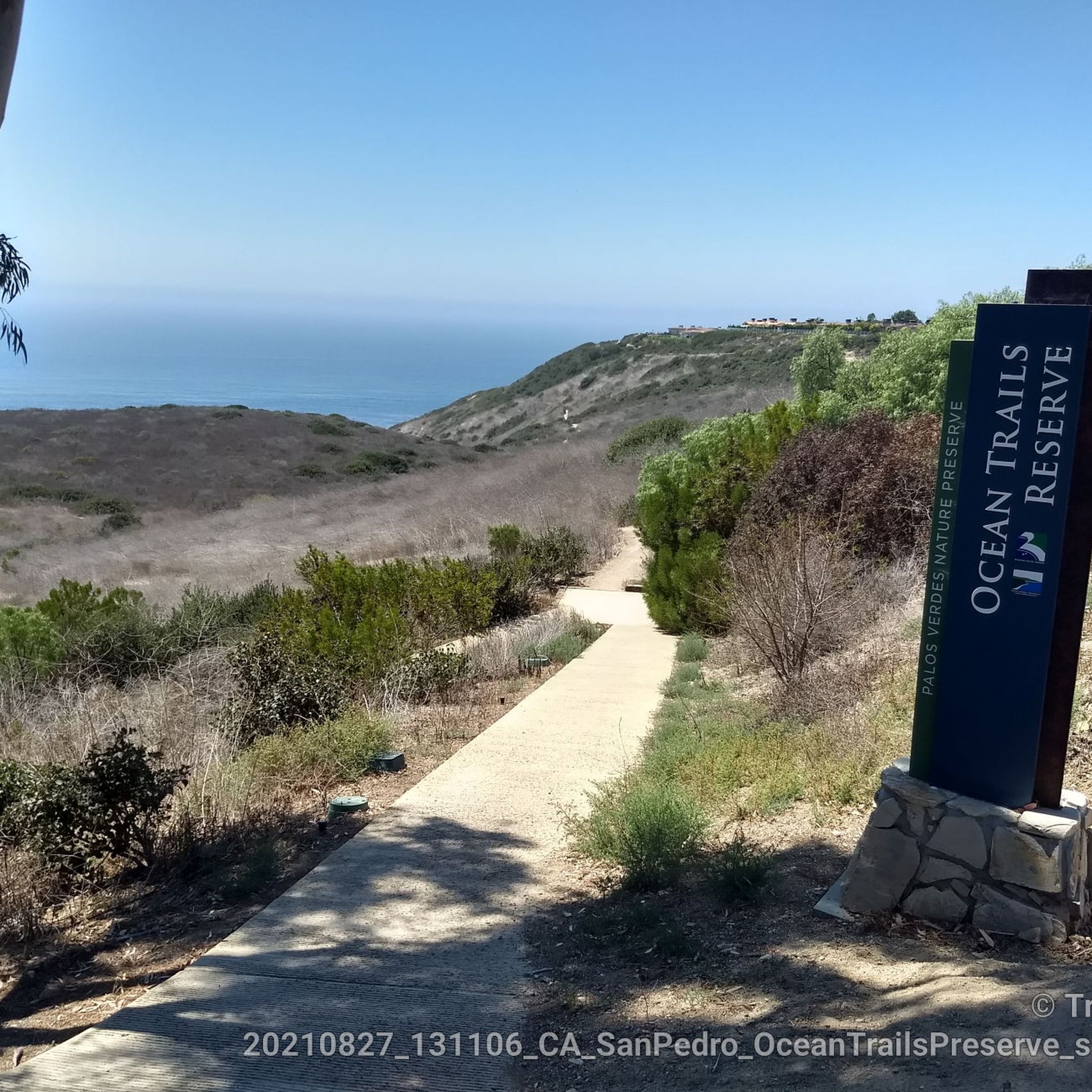
Ocean Trails Preserve Trailhead from Palos Verdes Drive & W 25th St
1
0
On a clear day, you can see Catalina Island in the distance. The island sits 47 miles off the coast.
0
0
Palos Verdes Drive is a scenic ride with climbs, descents, and turns. The South segment near the Portuguese Bend is prone to landslides and is sometimes closed. The best times to ride are in the mornings on weed days, when there is minimal traffic and cooler temperatures. Public restrooms and water are available at the Point Vicente Interpretive Center, Abalone Cove Park, and Malaga Cove School, located in the parking area.
1
0
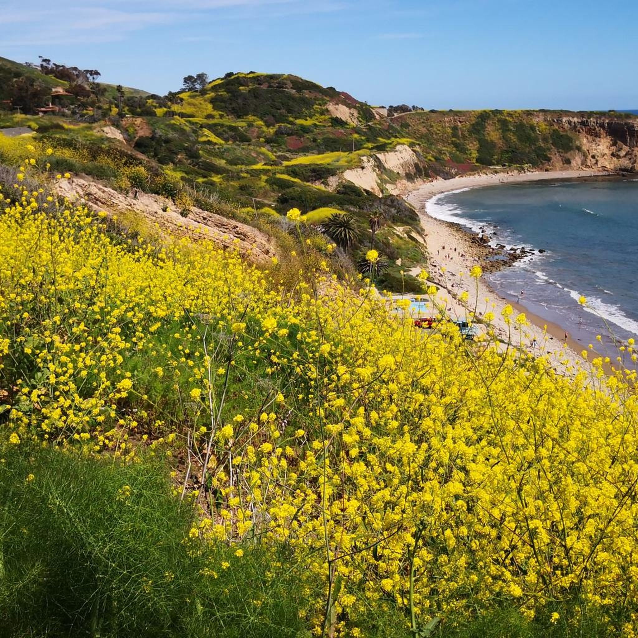
Palos Verdes Cove begins at Flat Rock Point and rounds into Rancho Palos Verdes. The cove is a protected marine preserve and a well-known surf spot, with both left and right waves. The views from the tops of the cliffs are amazing.
1
0
As you ride along Palos Verdes Drive West, look down into Bluff Cove, a scenic rocky cove popular with local surfers, scuba divers, and snorkelers braveing the shoreline. A hiking trail descends to Bluff Cove Beach, with a steeper trail leading to Flat Rock Point, where you can explore tide pools at low tide. Walking south beyond the cove takes you into Palos Verdes Estate Shoreline Preserve, continuing to Palos Verdes Point and the rusted remains of a shipwreck along the Shipwreck Hiking Trail.
1
0
Frequently Asked Questions
How many road cycling routes are available around Lomita?
There are over 45 road cycling routes around Lomita, offering a diverse range of options for different skill levels and preferences.
What kind of terrain can I expect on road cycling routes near Lomita?
Road cycling around Lomita offers varied terrain, including urban routes, scenic coastal bluffs, and challenging hilly sections, particularly on the Palos Verdes Peninsula. You'll find everything from mostly well-paved surfaces to routes with significant elevation gains.
Are there road cycling routes suitable for beginners in Lomita?
Yes, Lomita offers several routes suitable for beginners. There are 14 easy-rated routes, often on well-paved surfaces, perfect for those new to road cycling or looking for a more relaxed ride. Look for routes that stick to flatter urban areas or protected bike paths.
Where can I find challenging road cycling routes with significant elevation gain?
For challenging rides with significant elevation gain, focus on routes that venture into the Palos Verdes Peninsula. Routes like the Miramar Park – Bluff Cove loop from Rolling Hills Estates or the Marilyn Ryan Sunset Point Park – Via Del Monte Climb loop from West Carson offer substantial climbs and descents, providing a good workout for experienced cyclists.
What scenic viewpoints or landmarks can I see along the road cycling routes?
Many routes offer stunning views, especially those near the coast. You can pass by scenic spots like Torrance Beach, the dramatic Bluff Cove, and the historic Point Vicente Lighthouse. Miramar Park and Pelican Cove Park - Vincente Bluffs also offer excellent viewpoints.
Are there any coastal road cycling routes near Lomita?
While Lomita isn't directly on the coast, its proximity to the Palos Verdes Peninsula and beaches like Torrance Beach means you can easily access coastal routes. The region features protected trails like the Coast Highway Protected Trail and routes that offer panoramic ocean views, such as the Via Del Monte Climb – Bluff Cove loop from Lomita.
Is parking available for road cyclists near the routes?
Yes, parking is generally available at various points near the start of many routes, especially in parks or designated public areas within Lomita and the surrounding communities. Specific parking details can often be found on individual route descriptions on komoot.
How can I access road cycling routes in Lomita using public transport?
Lomita is part of the Los Angeles County public transport network. While bringing bikes on all forms of public transport can vary, many buses are equipped with bike racks. Planning your route with local transit agencies' websites will provide the most up-to-date information on bike accessibility to reach starting points.
What is the best time of year for road cycling in Lomita?
Lomita enjoys pleasant temperatures year-round, making it suitable for road cycling in any season. The mild climate, especially in the South Bay, means you can often find comfortable riding conditions, though checking the daily forecast is always recommended.
Are there family-friendly road cycling options in Lomita?
Yes, Lomita and its surroundings offer family-friendly road cycling options, particularly on easier routes and protected bike paths. Look for routes with minimal elevation gain and away from heavy traffic, such as sections of the Marvin Braude Bike Trail or routes around local parks like Esther Henderson Park.
Can I find loop routes for road cycling around Lomita?
Absolutely. Many of the best road cycling routes around Lomita are designed as loops, allowing you to start and end at the same point. Examples include the Carson & Inglewood loop from Wilmington — Los Angeles and the Bluff Cove – Via Del Monte Climb loop from South Bay.
What do other road cyclists appreciate about the routes in Lomita?
The road cycling routes in Lomita are highly rated by the komoot community, with an average score of 4.4 stars from over 40 reviews. Reviewers often praise the diverse terrain, from urban exploration to challenging coastal climbs, and the stunning ocean views encountered on many routes.
Most popular routes around Lomita
Most popular attractions around Lomita

Get inspired with the komoot mobile app


Explore more
Browse the best Road cycling routes in other regions.
