The best cycling routes around South San Francisco
4.3
(133)
3,085
riders
151
rides
Touring cycling routes around South San Francisco offer a diverse landscape, characterized by bayfront areas, prominent hills, and dedicated pathways. The region provides a mix of urban and natural environments, including views of the San Francisco Bay and access to natural open spaces like San Bruno Mountain. Cyclists can find routes along the San Andreas Lake and through developed linear parks such as Centennial Way. This varied terrain supports a range of touring cycling experiences.
Best touring cycling routes around…
Last updated: August 19, 2026
4.7
(6)
57
riders
46.8km
03:00
560m
560m
Hard bike ride. Very good fitness required. Mostly paved surfaces. Suitable for all skill levels.
5.0
(1)
20
riders
18.8km
01:07
60m
60m
Easy bike ride. Great for any fitness level. Mostly paved surfaces. Suitable for all skill levels.

Sign up for free
20
riders
31.0km
02:14
480m
480m
Hard bike ride. Very good fitness required. Mostly paved surfaces. Suitable for all skill levels.
3.0
(2)
17
riders
70.8km
04:50
1,020m
1,020m
Hard bike ride. Very good fitness required. Mostly paved surfaces. Suitable for all skill levels.
2.7
(3)
12
riders
Easy bike ride. Great for any fitness level. Mostly paved surfaces. Suitable for all skill levels.
Get access to more routes and recommendations from other explorers.
Sign up for free
Already have an account?
Our route recommendations are based on thousands of hikes, rides, and runs completed by other people on komoot.
Start today with a free account
Your next adventure awaits.
Login or Signup
Tips from the Community

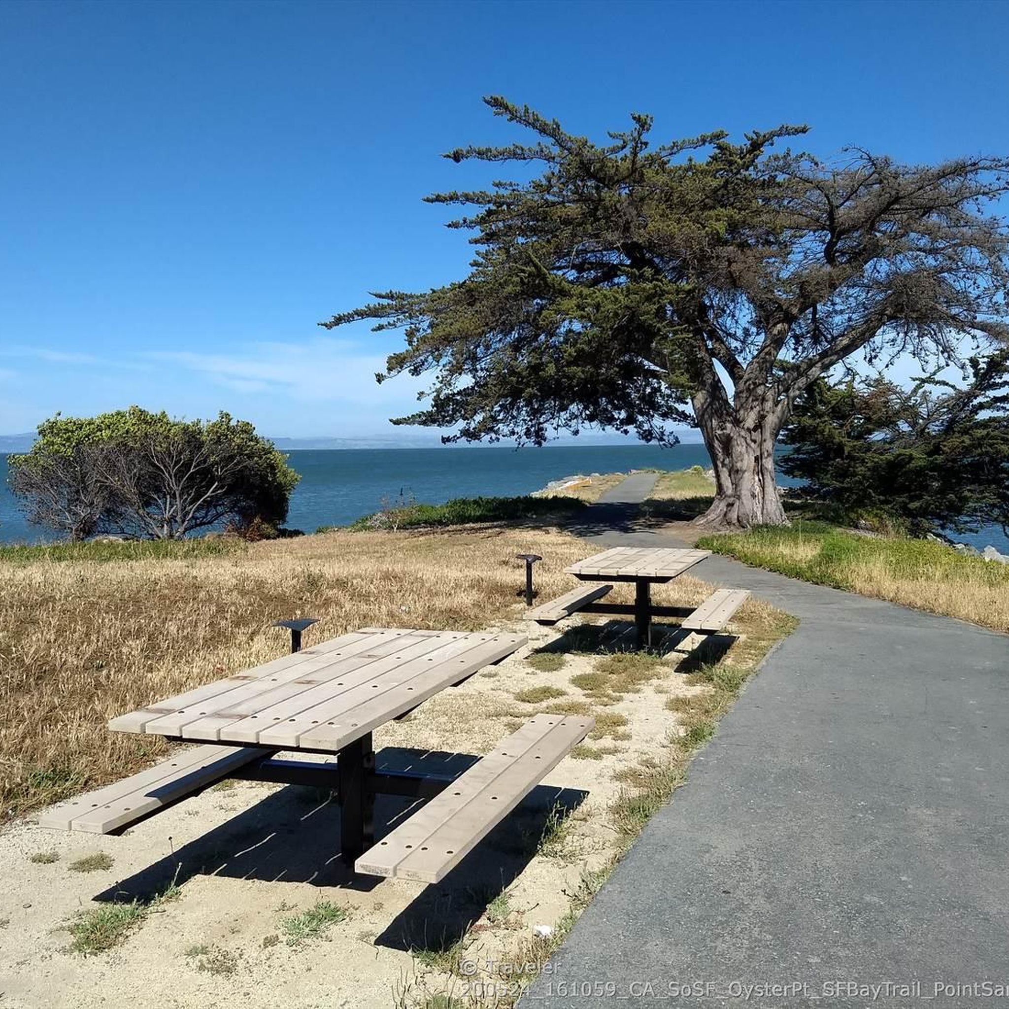
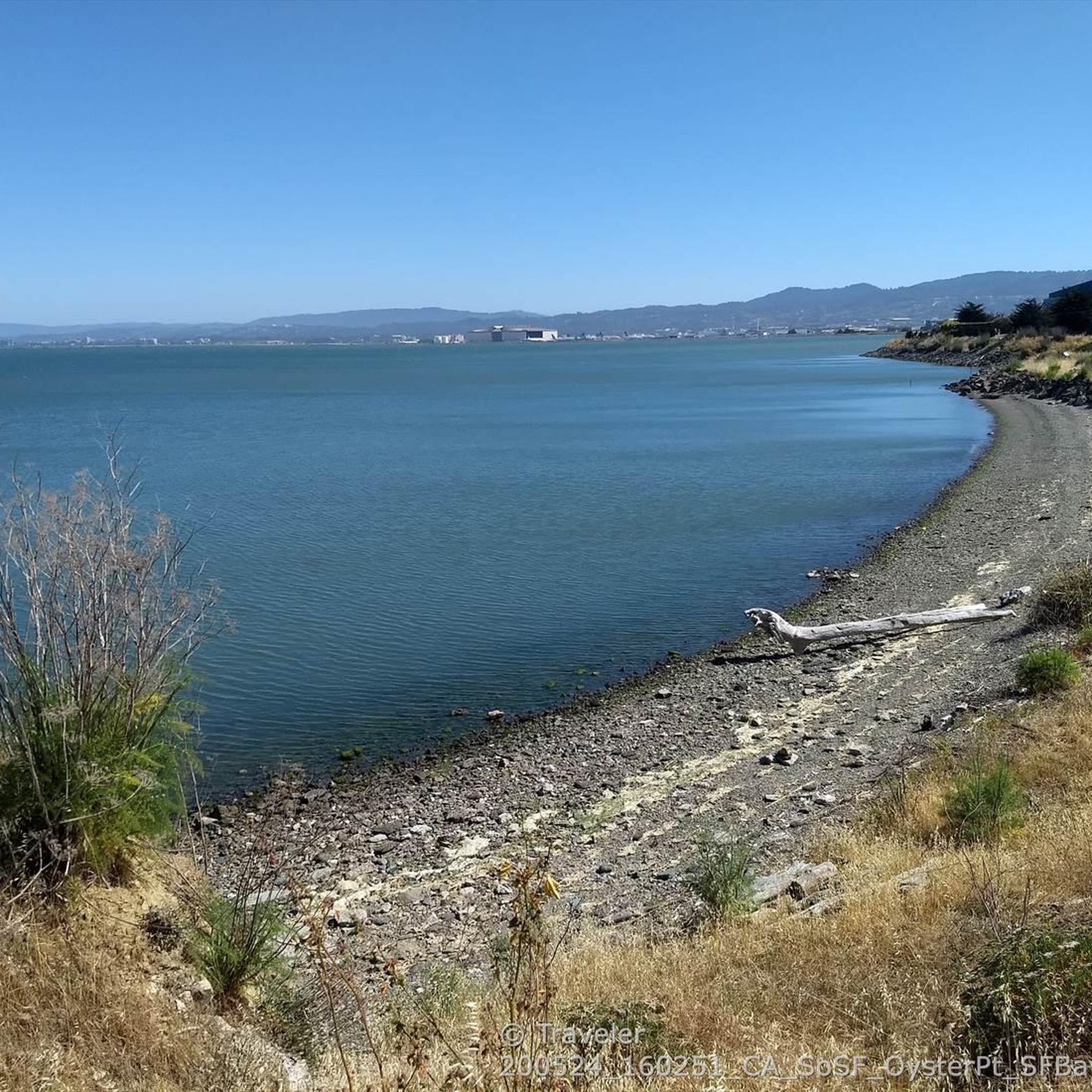
The road along the lagoon has wide cycle paths on both sides and low traffic into Oyster Park. It is however exposed to high winds so take care when riding. Smooth road right by the clear water in the shadow of Mt. Bruno make for a great bypass between SF and South SF that avoids the high traffic Bayshore Blvd and the hill.
0
0
The headwind when riding north can be brutal some days. The bike lane on both sides is wide and expansive. It's a really safe place to ride with beautiful views.
0
0

In the 1870s and 1880s, Golden Gate Park was planted on sand dunes and required substantial irrigation. In 1902, the Park Commission authorized the construction of two windmills to pump groundwater for park irrigation rather than purchasing water at exorbitant costs from the Spring Valley Water Company. The Murphy Mill was completed in 1908,[4] and pumped 40,000 US gallons (150,000 L) per hour to the park.
0
0
Pedestrians taking their walks, be cautious and alert.
0
0

Spectacular summit overlook of the city and across the San Francisco Bay at the end of the paved Radio Road
0
0

The sculpture depicts "living-giving science" according to its artist, Marco Cochrane. It stands 24 feet tall, and was erected in front of biotech company Genesis Towers in 2020 to represent their mission. It shows a man and woman standing on top of a DNA strand, holding their hands in the shape of a heart.
1
0

Lower Crystal Springs Reservoir is part of the Crystal Springs Reservoir system, and provides water to the San Francisco Bay Area. The area surrounding the reservoir is rich in biodiversity, home to rare and endangered species like the San Mateo thornmint and the Marin Dwarf Flax. While recreational activities on the water are restricted to protect the watershed, the adjacent Crystal Springs Regional Trail offers scenic views for hikers and cyclists.
0
0
San Andreas Lake is a hidden gem tucked into the hills of San Mateo County, just south of San Francisco. Originally a natural sag pond formed by the San Andreas Fault, it was transformed into a reservoir in the late 1800s and now serves as a vital water source for the region. The lake is off-limits for swimming or boating, but you can enjoy its peaceful beauty from the San Andreas Trail or the popular Sawyer Camp Trail, which runs along its eastern edge. It's a serene spot where you can walk or bike with sweeping views of the water and surrounding hills, all while standing right on one of the world’s most famous fault lines. Despite its proximity to urban life, San Andreas Lake offers a quiet, scenic escape steeped in natural and historical significance.
1
0
Frequently Asked Questions
How many touring cycling routes are available around South San Francisco?
There are over 140 touring cycling routes around South San Francisco listed on komoot. These routes cater to various skill levels, with 42 easy, 63 moderate, and 36 difficult options.
Are there any easy, family-friendly touring cycling routes in South San Francisco?
Yes, South San Francisco offers several easy touring cycling routes suitable for families. A great option is the Brisbane Lagoon – Sierra Point Marina ⚓ Brisbane loop from Long Term Parking, which is 17.9 miles (28.7 km) and leads through bayfront areas and marinas. Another easy route is the San Andreas Lake – San Andreas Trail loop from Sneath Lane & Earl Avenue, a 13.4 km path offering serene views.
What scenic viewpoints or natural features can I expect to see on touring cycling routes in South San Francisco?
Touring cycling routes in South San Francisco offer diverse scenery. You can enjoy expansive views of San Andreas Lake and the surrounding hills, especially on routes like the San Andreas Trail – San Andreas Lake loop from San Bruno. Other routes provide stunning views of the San Francisco Bay, particularly around Oyster Point Park & Marina, and the prominent natural landscapes of San Bruno Mountain State & County Park.
Are there any circular touring cycling routes available?
Yes, many touring cycling routes in South San Francisco are designed as loops. For instance, the San Andreas Trail – San Andreas Lake loop from San Bruno is a popular circular route. Another option is the Brisbane Lagoon – Sierra Point Marina ⚓ Brisbane loop from Long Term Parking, which offers a bayfront experience.
What do other touring cyclists enjoy most about cycling in South San Francisco?
The touring cycling routes in South San Francisco are highly rated by the komoot community, with an average score of 4.4 stars from over 130 reviews. Cyclists often praise the diverse terrain, from bay views and dedicated pathways like Centennial Way to the more challenging climbs around San Bruno Mountain. The mix of urban and natural environments, including access to San Andreas Lake, is frequently highlighted.
Are there any challenging touring cycling routes for experienced riders?
Absolutely. For experienced touring cyclists seeking a challenge, routes like the San Andreas Trail – San Andreas Lake loop from San Bruno offer significant elevation gain over 46.1 km. Another demanding option is the Murphy Windmill – Golden Gate Park loop from South San Francisco, a 53.0 km path that connects to iconic urban park landscapes with considerable climbing.
Can I reach touring cycling routes using public transport in South San Francisco?
Yes, South San Francisco is well-served by public transport, making many cycling routes accessible. The Centennial Way, a Class I bicycle and pedestrian trail, runs through the center of town between the South San Francisco and San Bruno BART Stations, providing excellent access for cyclists using public transit. For more details on local biking and walking resources, you can consult the city's official map: SSF Walking & Biking Map.
What are some notable landmarks or attractions to explore near the cycling routes?
Beyond the cycling itself, you can explore several attractions. San Andreas Lake is a significant natural feature with the popular Sawyer Camp Trail along its eastern edge. San Bruno Mountain State & County Park offers diverse wildlife and expansive vistas. You might also encounter the iconic 'SOUTH SAN FRANCISCO THE INDUSTRIAL CITY' sign at Sign Hill Park. For bay views, Oyster Bay Regional Shoreline is a great spot.
Are there any dedicated bike paths or trails in South San Francisco?
Yes, South San Francisco has dedicated bike paths. A prime example is the Centennial Way, a Class I bicycle and pedestrian trail that is three miles long and runs through the city, built on top of the BART tube. It's a wide asphalt pathway designed for safe and enjoyable cycling. The city actively promotes walking and biking with various trails, and a comprehensive 'SSF Walking & Biking Map' is available for more information: SSF Walking & Biking Map.
What is the best time of year for touring cycling in South San Francisco?
South San Francisco generally offers pleasant cycling conditions year-round, but spring and fall often provide the most comfortable temperatures and clearer skies. Summer can bring coastal fog, especially in the mornings, which can be refreshing for cycling. Winters are typically mild, though you might encounter more rain. Always check the local weather forecast before heading out.
Are there any routes that incorporate San Bruno Mountain?
Yes, San Bruno Mountain State & County Park is a prominent natural feature in the area, and some touring cycling routes incorporate its terrain. For example, the San Bruno Mountain – Old Ranch Rd Trail 🐄 San Bruno loop from San Bruno is a difficult 31.0 km route that takes you through this area, offering challenging climbs and rewarding views.
Most popular routes around South San Francisco
Most popular attractions around South San Francisco

Get inspired with the komoot mobile app


Explore more
Browse the best Cycling routes in other regions.
