The best road cycling routes around Millbrae
4.8
(51)
2,535
riders
102
rides
Road cycling around Millbrae offers diverse landscapes across the San Francisco Peninsula. The region features a mix of flat, paved paths alongside scenic reservoirs and challenging hilly terrains. Cyclists can explore areas like the Crystal Springs Regional Trail and San Andreas Lake, which provide car-free segments and views. The proximity to the coast also allows for routes that combine road cycling with ocean vistas.
Best road cycling routes around Millbrae
- The most popular road cycling route is Tunitas Creek Road…
Last updated: August 31, 2026
5.0
(1)
130
riders
104km
05:13
1,490m
1,490m
Hard road ride. Very good fitness required. Mostly well-paved surfaces and easy to ride.
126
riders
73.7km
03:20
750m
750m
Moderate road ride. Good fitness required. Mostly well-paved surfaces and easy to ride.

Sign up for free
64
riders
42.0km
02:04
500m
500m
Moderate road ride. Good fitness required. Mostly well-paved surfaces and easy to ride.
30
riders
62.1km
02:43
450m
450m
Moderate road ride. Good fitness required. Mostly well-paved surfaces and easy to ride.
5.0
(1)
41
riders
72.9km
03:37
1,070m
1,070m
Hard road ride. Very good fitness required. Mostly well-paved surfaces and easy to ride.
Get access to more routes and recommendations from other explorers.
Sign up for free
Already have an account?
Our route recommendations are based on thousands of hikes, rides, and runs completed by other people on komoot.
Start today with a free account
Your next adventure awaits.
Login or Signup
Tips from the Community

A fun, pretty place to stop while riding Cañada road. I has water and an air pump and bathrooms. Take a photo with friends.
0
0

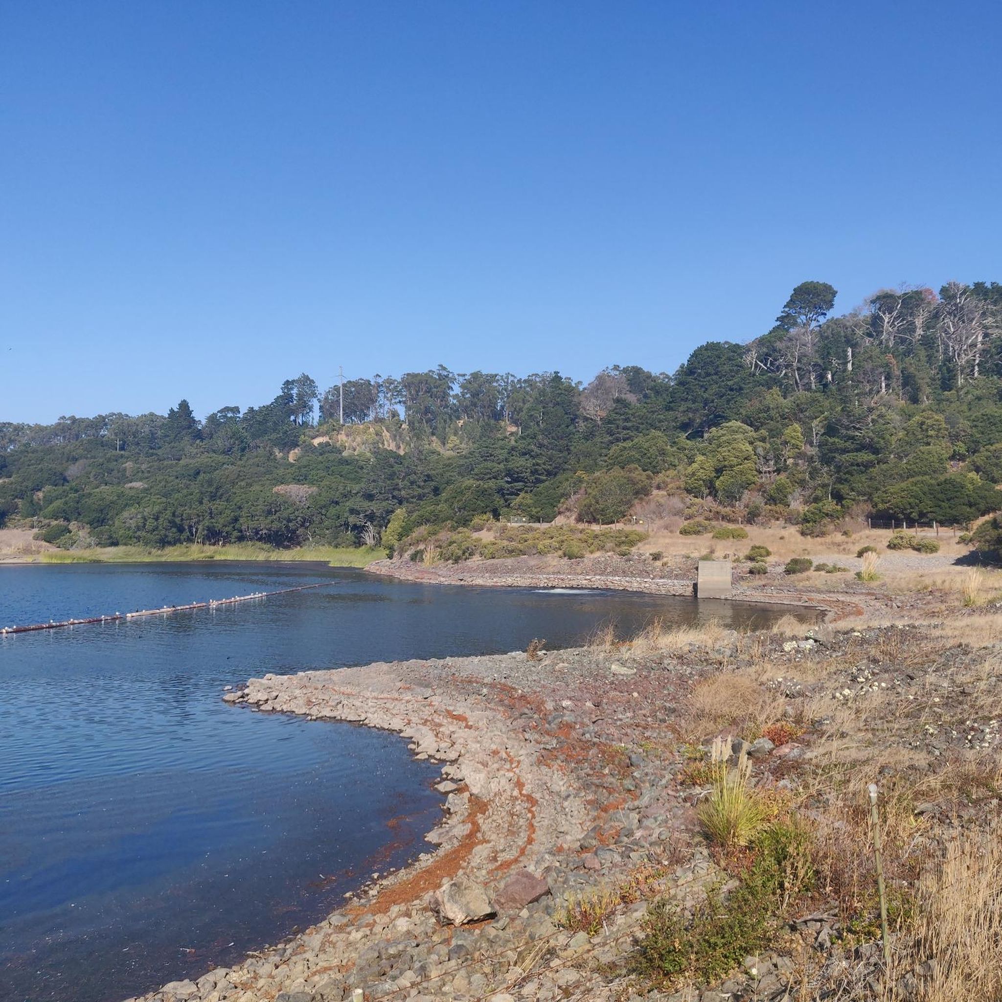
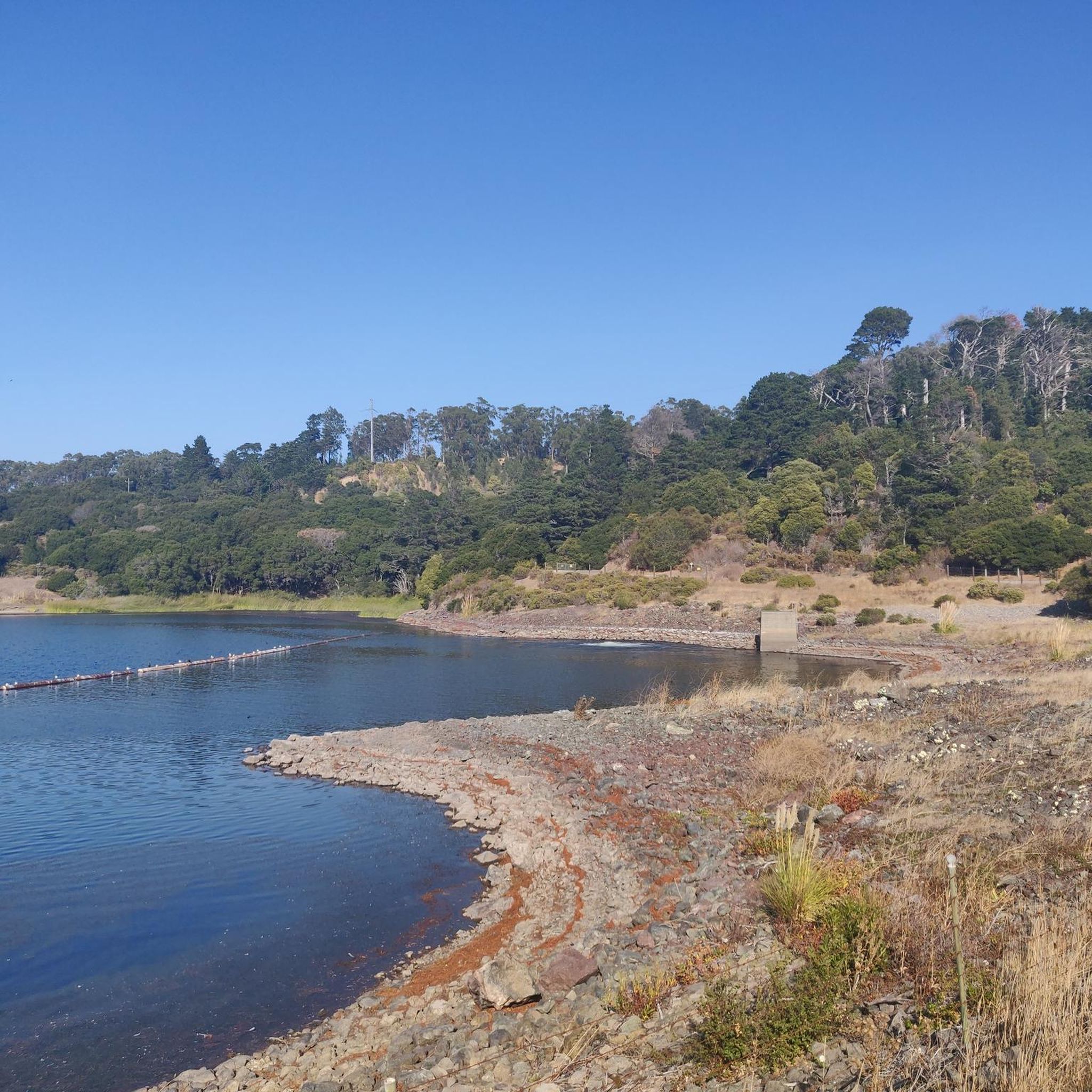
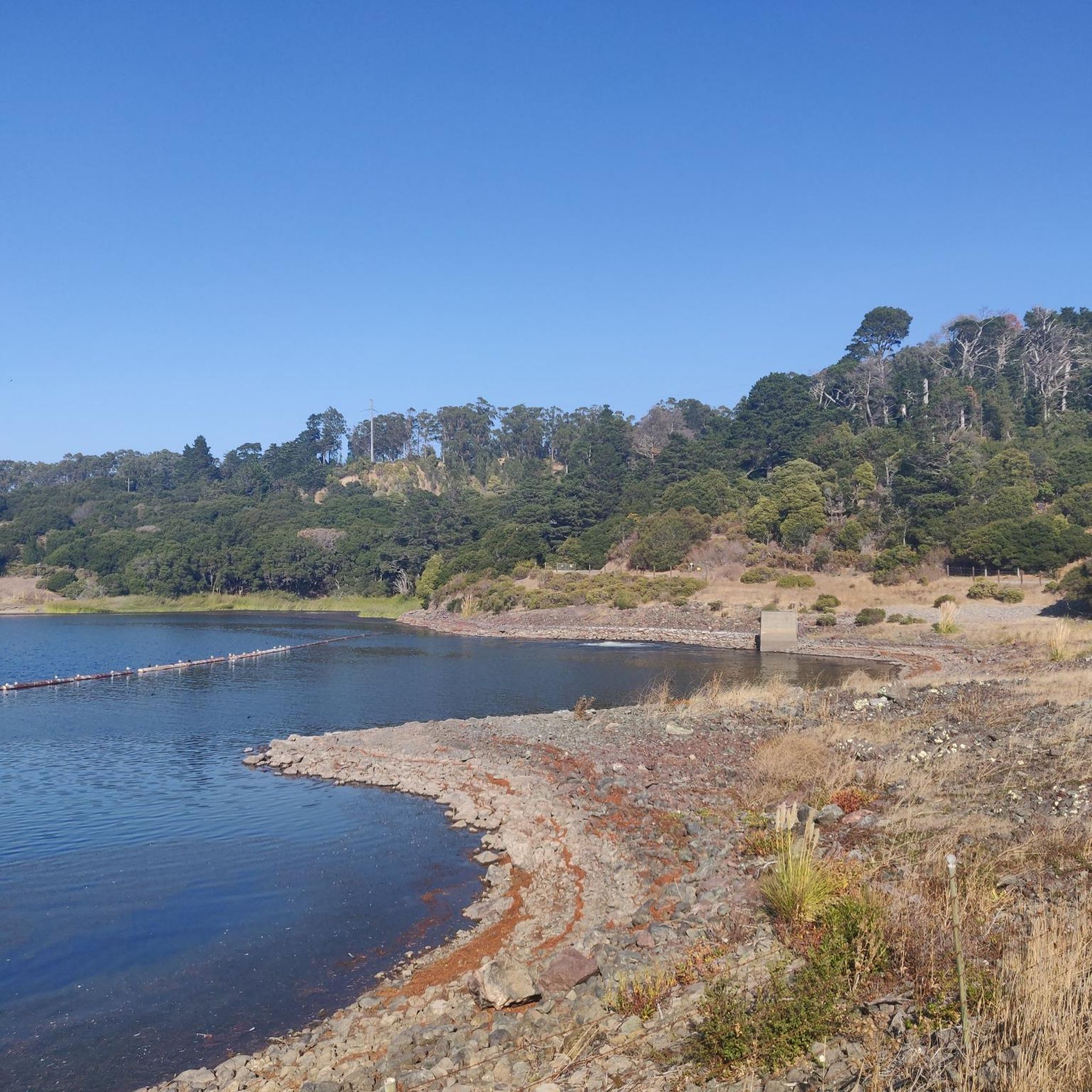
Lower Crystal Springs Reservoir is part of the Crystal Springs Reservoir system, and provides water to the San Francisco Bay Area. The area surrounding the reservoir is rich in biodiversity, home to rare and endangered species like the San Mateo thornmint and the Marin Dwarf Flax. While recreational activities on the water are restricted to protect the watershed, the adjacent Crystal Springs Regional Trail offers scenic views for hikers and cyclists.
0
0
San Andreas Lake is a hidden gem tucked into the hills of San Mateo County, just south of San Francisco. Originally a natural sag pond formed by the San Andreas Fault, it was transformed into a reservoir in the late 1800s and now serves as a vital water source for the region. The lake is off-limits for swimming or boating, but you can enjoy its peaceful beauty from the San Andreas Trail or the popular Sawyer Camp Trail, which runs along its eastern edge. It's a serene spot where you can walk or bike with sweeping views of the water and surrounding hills, all while standing right on one of the world’s most famous fault lines. Despite its proximity to urban life, San Andreas Lake offers a quiet, scenic escape steeped in natural and historical significance.
1
0

You're not hallucinating: This monument was deliberately built in the style of ancient Greek and Roman architecture, to commemorate the Great Depression-era Hetchy Hetchy Project that brought water down from the mountains to the Bay Area. The frieze says, “I give waters in the wilderness and rivers in the desert, to give drink to my people.”
1
0

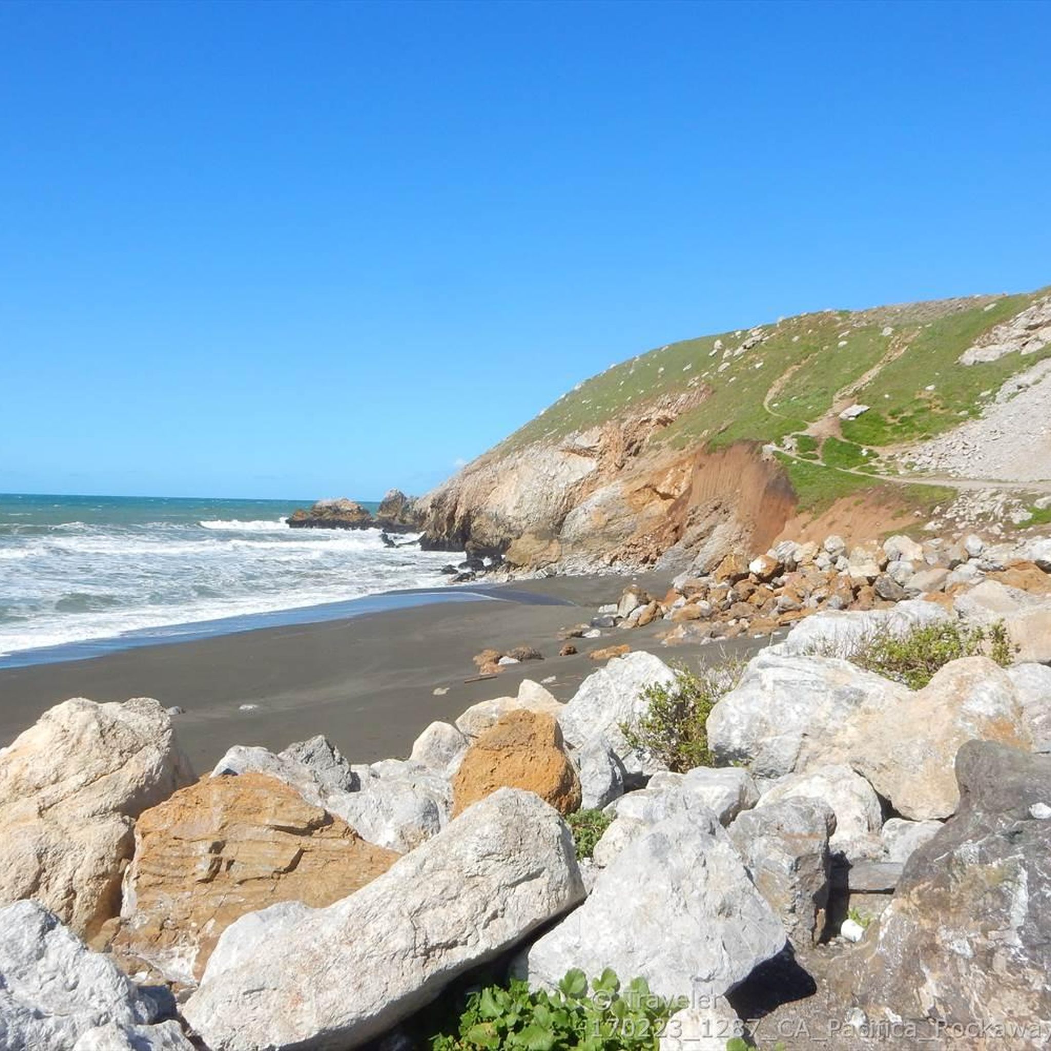
Devils slide itself is nice and just to the south is the beautiful Gray Whales Cove beach. There is plenty of parking at both places. Two notes for cyclist: 1. cycling along Hwy 1, coming from Pacifica, requires climbing on a relatively narrow but highly frequented road. It is not a long climb until the turnoff to Devils slide, but it might be stressful for cyclists who are not used to riding in heavy traffic. Hwy 1 south of Devils slide has enough space for everyone. 2. If you cycle on Hwy1, then check the wind forecast beforehand. Dominant wind direction is NW, which means cycling southbound maximizes tailwind and minimizes breathing in all the air pollution from stinky cars.
0
0
The stretch of El Camino Real through downtown Milbrae is an area of focus for repurposing some of the 6 lanes for more cycle, pedestrian, and business traffic. The goal is to make a safer, friendly slow traffic zone for residents and visitors alike.
0
0

Woodside Store was built back in the 1850s by two pioneers who came to California for the gold rush. At the time it was the only stagecoach stop between San Francisco and Santa Clara, and it carried all the essential items that travelers riding between cities might need. The store has been restored, inside and out, to look exactly as it did centuries ago. You can call the museum ahead of your trip to book tours.
0
0

The Crystal Springs Regional Trail is a top spot for cyclists, featuring mostly paved paths with minimal car traffic. The trail runs through scenic areas like Lower Crystal Springs Reservoir, offering beautiful lake views. On Sundays, you can ride the car-free Cañada Road segment for a more relaxed experience. Be mindful of the 15 mph speed limit, especially around hikers. The Sawyer Camp segment provides a gentle descent and stunning views, perfect for an easy ride through woodlands and along the reservoir.
0
1
Frequently Asked Questions
How many road cycling routes are available around Millbrae?
There are over 100 road cycling routes around Millbrae, offering diverse options for various skill levels. This includes 51 easy routes, 54 moderate routes, and 10 challenging routes.
What are some easy road cycling routes suitable for beginners or families?
For an easy and scenic ride, consider the San Andreas Lake – San Andreas Lake loop from Millbrae. This 20.3 km path features mostly paved surfaces with minimal car traffic and offers stunning views of the Lower Crystal Springs Reservoir and San Andreas Lake. Another easy option is the San Andreas Lake – San Andrea's Lake View loop from San Bruno, which is 14.8 km long.
Are there challenging road cycling routes for experienced cyclists?
Yes, for those seeking a challenge, the Millbrae area offers routes with significant elevation gain. The Tunitas Creek Road Loop is a demanding 104.2 km route with over 1,490 meters of ascent, offering diverse scenery. Another difficult option is the Lake Merced – Twin Peaks - North/Eureka Peak loop from West Field Road, which covers 65.8 km with nearly 1,000 meters of climbing.
What kind of landscapes can I expect to see while road cycling near Millbrae?
Road cycling around Millbrae offers a variety of landscapes. You'll find flat, paved paths alongside scenic reservoirs like San Andreas Lake, as well as challenging hilly terrains. The region also provides access to coastal areas, allowing for routes that combine road cycling with ocean views.
What do other road cyclists enjoy most about the routes in Millbrae?
The road cycling routes in Millbrae are highly rated by the komoot community, with an average score of 4.7 stars from over 70 reviews. Cyclists often praise the diverse landscapes, the scenic reservoirs, and the variety of options available for different ability levels, from gentle rides to strenuous climbs.
Are there any loop road cycling routes in the Millbrae area?
Many routes in the Millbrae area are designed as loops, allowing you to start and end at the same point. Examples include the easy San Andreas Lake – San Andreas Lake loop from Millbrae and the more challenging Tunitas Creek Road Loop.
What are some scenic viewpoints or natural attractions along the road cycling routes?
Along the routes, you can enjoy views of San Andreas Lake and the Lower Crystal Springs Reservoir. For broader vistas, routes might lead you towards areas with viewpoints like The Point or offer glimpses of San Bruno Mountain State & County Park.
What is the best season for road cycling in Millbrae?
Millbrae benefits from a mild, temperate climate, making it suitable for year-round outdoor activities, including road cycling. This means you can enjoy the routes in any season, though checking local weather conditions is always recommended.
Are there any routes that offer a car-free cycling experience?
Yes, the Crystal Springs Regional Trail, particularly the Sawyer Camp segment, provides mostly paved paths with minimal car traffic. Additionally, a segment of Cañada Road is closed to vehicles on Sundays, creating an extended car-free cycling opportunity.
Can I access road cycling routes near Millbrae using public transport?
Millbrae is actively working on improving its biking and walking infrastructure, including enhancing connections to transit facilities. While specific route access points via public transport vary, the city's Active Transportation Plan aims to make it easier to connect to existing routes and destinations.
Are there any routes that pass by coastal areas?
While Millbrae is not directly on the coast, its location allows for routes that can lead to coastal areas like Pacifica, offering opportunities to combine road cycling with views of the Pacific Ocean.
Most popular attractions around Millbrae

Get inspired with the komoot mobile app


Explore more
Browse the best Road cycling routes in other regions.
