Routes

Planner

Features

Updates

App

Login or Signup

Get the App

Login or Signup

Routes
Road cycling routes
United States
California
Orange County

Santa Ana

The best road cycling routes around Santa Ana

4.7

(315)

9,501

riders

11

rides

If you've ever tried to plan road cycling around Santa Ana, you know how overwhelming the options can be. With so many paths and trails, it's tough to figure out which routes are genuinely worth your time and effort, and which are just filler. We get it – you want to hit the road, not spend hours sifting through maps. That's where komoot comes in. Our community has ridden, reviewed, and curated the best road cycling routes in Santa Ana, so we can give you a shortcut to the rides that truly deliver.

Road cycling in Santa Ana offers a fantastic mix of terrain. You'll find extensive river trails and urban paths that are largely flat, perfect for getting into a rhythm. As you head west, these gradually transition to scenic coastal routes near the Pacific Ocean, offering beautiful views. Look north, and you'll catch glimpses of the Santa Ana Mountains, adding a dramatic backdrop to your ride. It's a region that truly caters to all levels, from leisurely spins to longer, more challenging distances.

If you're looking for a classic, we'd start with the Santiago Creek Bike Trail – Angel Stadium loop from Santa Ana Regional Transportation Center. At 25.1 miles (40.4 km), it’s a moderate ride that takes you through an urban river corridor with some great landmarks. For something a bit shorter and easier, the Santa Ana River Trail loop from Santa Ana College is a fantastic choice at 11.0 miles (17.8 km), offering a taste of the iconic river trail. With over 6,000 road cyclists having explored Santa Ana with komoot, you know these routes come highly recommended.

Last updated: May 29, 2026

4.3

(3)

136

riders

#1.

San Diego Creek Trail – San Diego Creek loop from North Tustin

40.4km

01:50

140m

140m

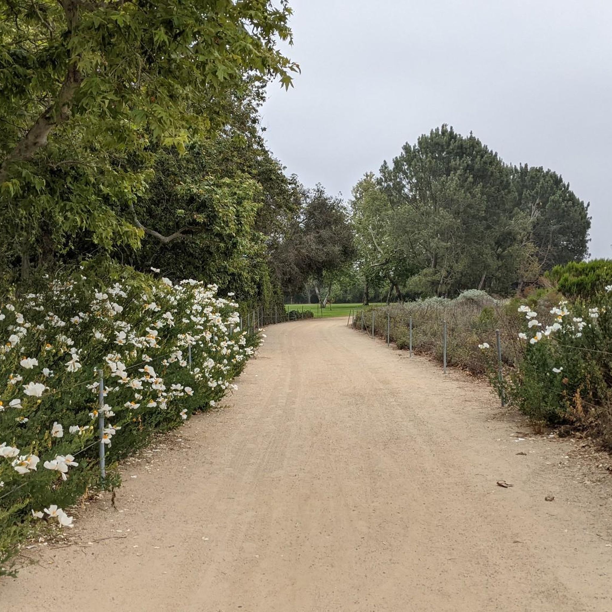
The San Diego Creek Trail – San Diego Creek loop from North Tustin offers a delightful road cycling experience, blending urban convenience with natural beauty. As you pedal along the well-maintained, paved surfaces, you'll follow the San Diego Creek, passing through wetlands and enjoying shaded sections near community parks. Keep an eye out for diverse bird species as you approach the Upper Newport Bay Nature Preserve, a significant scenic highlight that provides a welcome natural escape.

This easy 25.1-mile (40.4 km) loop, with a minimal 468 feet (143 metres) of elevation gain, is perfect for a relaxed ride lasting about 1 hour and 50 minutes. It's an excellent choice for beginner road cyclists or anyone seeking a leisurely outing. The trail's origin in North Tustin means easy access, and its year-round accessibility makes it a reliable option for a quick spin whenever you're in the mood.

More than just a standalone route, the San Diego Creek Trail is a vital artery in Irvine's extensive cycling network, connecting to numerous other bikeways like the Back Bay Drive and Mountains to Sea Trail. This connectivity allows for endless possibilities to extend your ride or explore different loop configurations. It's a superb starting point for discovering the region's broader cycling options, offering both a pleasant ride and a gateway to further adventures.

Navigate with device

Send to Phone

Save

Easy

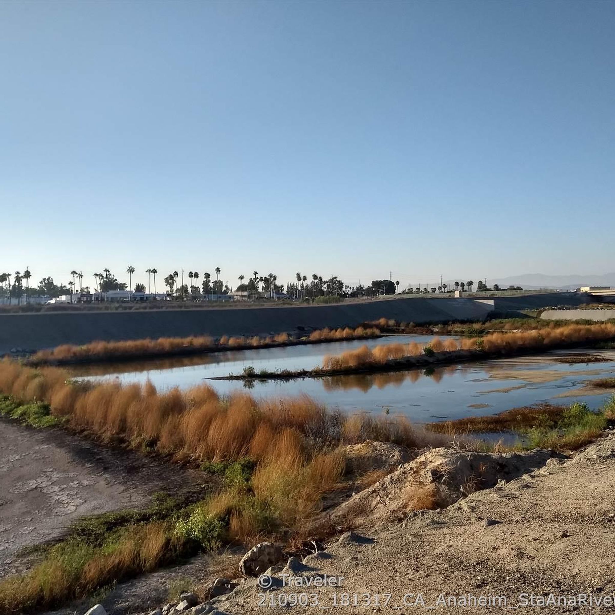
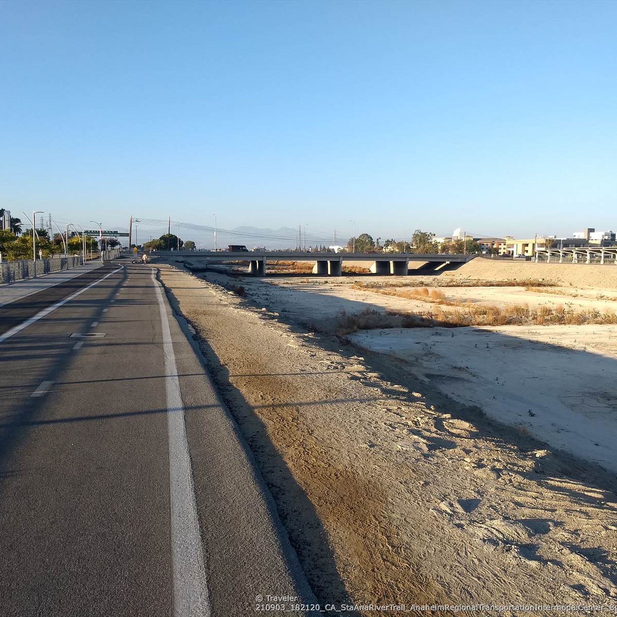
The Santa Ana River Trail offers a predominantly flat and paved road cycling experience, perfect for a relaxed ride through Orange County. While starting from Santa Ana College means connecting via local streets, you'll soon be on the main trail, enjoying a continuous path that bypasses most street intersections. Expect a mix of urban scenery, including views of Angel Stadium, transitioning to more natural settings with shaded areas and river views as you head towards Yorba Regional Park.

This easy 11.0-mile (17.8 km) route has a minimal 106 feet (32 metres) of elevation gain and can be completed in about 47 minutes, making it highly accessible for various fitness levels. The trail is multi-use, so you'll share it with others; riding during daylight hours is advisable. If you plan to extend your ride towards the coast, be prepared for potential headwinds on your return journey in the afternoon.

Often referred to as a "bicycle freeway," the Santa Ana River Trail is a significant regional asset, designed for long, uninterrupted rides. Its grade-separated nature allows for smooth cycling without frequent stops, distinguishing it from typical city routes. This trail is part of a larger vision to create Southern California's longest multi-use path, connecting the mountains to the Pacific Ocean.

Easy
guide_signup
Let us show you the way with the komoot mobile app
With a free komoot account, you can easily find, customize, and navigate endless outdoor adventures.

Sign up for free

Easy road ride. Great for any fitness level. Mostly well-paved surfaces and easy to ride.

Easy

This moderate 25.1-mile (40.4 km) road cycling loop, typically completed in about 2 hours and 4 minutes with 907 feet (276 metres) of elevation gain, offers a unique urban escape. You'll pedal along the Santiago Creek Bike Trail, enjoying views of native vegetation and shaded oak trees, before transitioning to the Santa Ana River Trail with its iconic landmarks like Angel Stadium and the striking architecture of the ARTIC. The route is mostly flat and paved, but be ready for a short section of street navigation to connect the two main trails.

Starting at the Santa Ana Regional Transportation Center (ARTIC) couldn't be easier, as it's a major hub for Amtrak, Metrolink, and bus services, complete with bicycle lockers. This makes it a fantastic option if you're looking to access a quality ride via public transport. While the trails are generally easy, the need to navigate surface streets for a brief segment is the main planning consideration, so ensure you're comfortable with urban riding.

What makes this route stand out is its excellent connectivity, linking a peaceful creek-side path with a major urban river trail and significant Orange County landmarks. Beyond the paved sections, the Santiago Creek Trail system also offers unpaved segments further upstream towards Santiago Oaks Regional Park, providing options for those with mountain bikes or a desire to explore different terrains.

Moderate

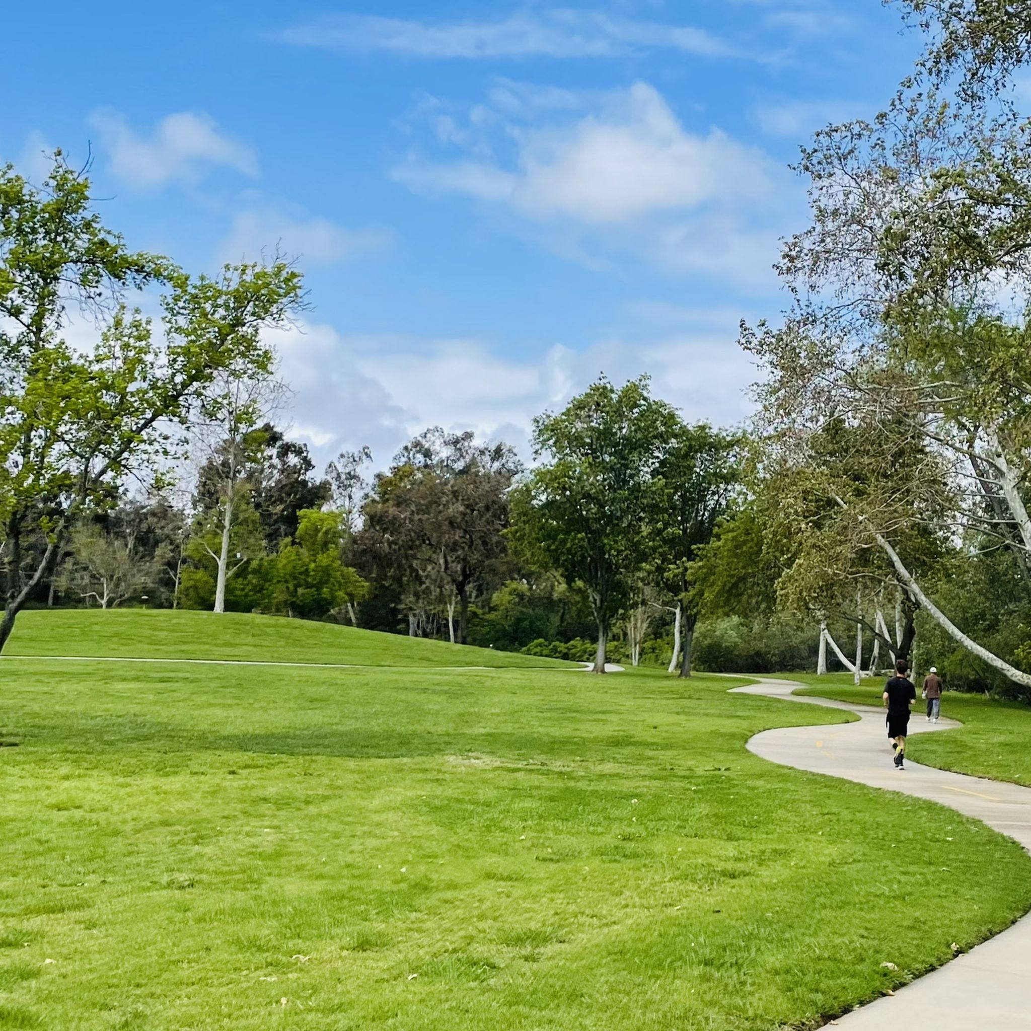
The Santiago Creek Bike Trail offers a refreshing escape into nature right in Orange County, perfect for road cycling. This multi-use path winds alongside Santiago Creek, providing scenic views of natural habitat and mature oak trees that offer welcome shade. You'll find yourself pedaling through a surprisingly peaceful environment, connecting various local parks like Hart Park and Santiago Park, which often feature additional amenities.

Planning your ride is straightforward, with easy access points near the Discovery Science Center, close to the MainPlace Mall. Parking is typically available in this area, making it a convenient starting point for your adventure. The 23.3-mile (37.4 km) loop, with its moderate difficulty and 732 feet (223 metres) of elevation gain, takes about 2 hours and 33 minutes, making it a great option for a morning or afternoon outing. Consider starting early to enjoy the cooler temperatures and avoid potential crowds.

This trail is a vital link in Orange County's regional trail system, providing a safer and more serene alternative to some other urban routes. It's known for being family-friendly and popular with a diverse mix of cyclists, joggers, and walkers. The paved surface is well-suited for road bikes, offering a smooth ride through an urban green corridor that feels miles away from city traffic.

Moderate
Sign up for free to see 7 more rides around Santa Ana.

Get access to more routes and recommendations from other explorers.

Sign up for free

Already have an account?

Our route recommendations are based on thousands of hikes, rides, and runs completed by other people on komoot.

Start today with a free account

Your next adventure awaits.
Login or Signup

Popular around Santa Ana

Hiking around Santa Ana

MTB Trails around Santa Ana

Cycling around Santa Ana

Running Trails around Santa Ana

Gravel biking around Santa Ana

Tips from the Community

jim
July 31, 2025, Angel Stadium

The climb from imperial to cannon is no joke but it’s a short walk to the top so bring flipflops😀.

0

0

The trail is quite wide, making it easy for different users to share the path safely. You can start your journey at Centennial Park and travel for miles, enjoying views of the river and passing through various landscapes.

0

0

Irvine Park is a popular park outside Orange, CA. It is a family friendly park, with a lot of activities for kids, as well as restrooms and parking.

0

0

Angel Stadium of Anaheim is the home of the Los Angeles Angels of Anaheim. The Santa Ana River Trail passes right by the stadium, so you get a great view. As you can imagine, it can get pretty busy on the trail on a game day.

1

0

Bike along the Santa Ana River Trail for a fantastic view of Angel Stadium’s iconic “Big A” sign, a 230-foot-tall landmark that originally served as the stadium's scoreboard. The halo atop the sign lights up after every Angels victory, glowing even brighter for home wins. Be sure to avoid the surrounding streets on game days, as the area can get crowded.

1

0

Andrus
January 14, 2025, Anaheim Coves Trail

Nice and easy paved trail that has a surprising amount of wildlife around. It can get busy so be ready to share space with other trail users.

0

0

Snaking alongside Santiago Creek, this paved cycling route offers an engaging urban riding experience. The well-maintained trail alternates between shaded sections beneath native oaks and open stretches with creek views. Regular elevation changes provide a moderate workout, while clear signage and multiple access points make navigation straightforward. Morning rides typically enjoy cooler temperatures and lighter trail traffic.

1

0

Alex
February 5, 2024, San Diego Creek

San Diego Creek is a 16-mile urban river that empties into Upper Newport Bay in Orange County. It follows Irvine's extensive system of trails and bike lanes, flowing through industrial areas, residential neighborhoods, and even the borders of the university campus.

1

0

Frequently Asked Questions

How many road cycling routes are available around Santa Ana?

There are over 10 dedicated road cycling routes around Santa Ana, offering a variety of experiences. These include routes along river trails, urban paths, and scenic coastal stretches.

What types of landscapes can I expect on road cycling routes in Santa Ana?

Road cycling routes in Santa Ana offer diverse scenery. You can expect to ride along extensive river trails like the Santa Ana River Trail, urban pathways, and beautiful coastal routes with views of the Pacific Ocean. Some routes also provide distant views of the Santa Ana Mountains.

Are there road cycling routes suitable for beginners in Santa Ana?

Yes, Santa Ana offers several easy road cycling routes perfect for beginners. For instance, the Santa Ana River Trail – Talbert Regional Park loop from Valley High School is an easy 12.3-mile ride, and the Santa Ana River Trail – Angel Stadium loop from Santa Ana College is another accessible option at 8.7 miles.

Can I find challenging road cycling routes in Santa Ana?

While many routes are relatively flat, there are options for more experienced cyclists. The region's diverse terrain allows for longer distances and routes that might include more varied elevation, especially as you explore areas closer to the Santa Ana Mountains.

What is the best time of year for road cycling in Santa Ana?

Santa Ana and the wider Orange County region benefit from mild year-round weather, making it an excellent destination for road cycling almost any time. The pleasant climate ensures comfortable riding conditions throughout the seasons.

Are there long-distance road cycling options in Santa Ana?

Yes, several routes offer significant distances. The Santa Ana River Trail loop from Santa Ana Regional Transportation Center covers 33.6 miles, and the San Diego Creek loop from Santa Ana Regional Transportation Center is 32.3 miles, providing ample distance for endurance cyclists.

What scenic viewpoints or natural features can I see along road cycling routes?

Many routes offer beautiful scenery. Along the coast, you can enjoy views from the Huntington Beach Pier or ride past Huntington City Beach. Inland, routes may pass by natural areas like Talbert Regional Park or the Upper Newport Bay Ecological Reserve, offering opportunities for bird-watching and enjoying wetlands.

Are there any parks or natural areas accessible by road bike in Santa Ana?

Absolutely. The Santa Ana River Trail connects to parks like Santiago Park Nature Reserve and Centennial Regional Park. Other notable natural areas accessible nearby include Crystal Cove State Park, the Newport Bay Nature Preserve, and the San Joaquin Marsh Wildlife Sanctuary, all offering unique natural beauty.

What do other road cyclists enjoy most about road cycling in Santa Ana?

The road cycling routes in Santa Ana are highly rated by the komoot community, with an average score of 4.6 stars from over 390 reviews. Cyclists often praise the well-maintained river trails, the scenic coastal views, and the variety of routes that cater to different skill levels.

Are there loop road cycling routes available in Santa Ana?

Yes, many of the popular road cycling routes in Santa Ana are designed as loops, making it convenient to start and end your ride at the same point. Examples include the Santa Ana River Trail loop and the Huntington State Beach loop.

Can I access road cycling routes using public transport in Santa Ana?

Many routes, such as the Santa Ana River Trail loop and the San Diego Creek loop, start from the Santa Ana Regional Transportation Center, which is a major hub for public transport, making them easily accessible without a car.

Are there family-friendly road cycling options in Santa Ana?

The largely flat terrain of the river trails, such as sections of the Santa Ana River Trail, makes them ideal for family rides. These paths often provide a safe and enjoyable environment away from heavy traffic, suitable for cyclists of all ages.

Most popular routes around Santa Ana

Easy hikes around Santa Ana

Most popular attractions around Santa Ana

Places to see

Store rating

Get inspired with the komoot mobile app

With a free komoot account, you can easily find, customize, and navigate endless outdoor adventures.

or

Join komoot Now

Store rating

Explore more

Browse the best Road cycling routes in other regions.

TustinNewport BeachAnaheimSeal BeachRossmoorLos AlamitosSanta Ana MountainsSeal Beach National Wildlife RefugeCypressIrvineOrangeVilla ParkLa PalmaWestminsterLadera RanchFountain ValleyBuena ParkCrystal Cove State ParkHuntington BeachCosta MesaLaguna HillsMission ViejoLas FloresGarden GroveLa HabraLaguna NiguelStantonSantiago Oaks Regional ParkYorba LindaPlacentiaWeir Canyon Regional ParkMidway CitySan ClementeRonald W. Caspers Wilderness ParkRancho Mission ViejoFullertonSan Juan CapistranoPeters Canyon Regional ParkWilliam R. Mason Regional Park (Wilderness Area)Quail Hill Open Space PreserveBommer Canyon Open Space PreserveLaguna Coast Wilderness ParkThomas F. Riley Wilderness ParkAliso And Wood Canyons Wilderness ParkNorth TustinIrvine Regional ParkDana PointLaguna BeachO'Neill Regional ParkLake ForestWilliams CanyonSilveradoModjeskaTrabuco CanyonLaguna WoodsShady Canyon Open Space PreserveBreaWhiting Ranch Wilderness ParkCoto De CazaRancho Santa MargaritaAliso Viejo

Nearby adventure guides

Things to Do around Tustin

background

Get ready to conquer new peaks

Sign up for Free

Explore
RoutesRoute plannerFeaturesHikesMTB TrailsRoad cycling routesBikepackingSitemap
Download the app
Follow Us on Socials

© komoot GmbH

Privacy Policy