The best walks and hikes around South Tucson
4.8
(54)
1,038
hikers
54
hikes
Hiking around South Tucson provides access to the Sonoran Desert landscape, characterized by saguaro cacti, desert washes, and low hills. The region offers a mix of terrain, from paved urban paths to more rugged trails in nearby mountain parks. Prominent features include hills like Tumamoc Hill and Sentinel Peak, offering varied elevation changes and panoramic views.
Best hiking trails around South Tucson
- The most popular hiking route is Tumamoc Hill Trail, a 3.3 miles (5.3 km) trail that takes…
Last updated: September 27, 2026
7
hikers
4.09km
01:02
10m
10m
Easy hike. Great for any fitness level. Easily-accessible paths. Suitable for all skill levels.
1.75km
00:29
30m
30m
Easy hike. Great for any fitness level. Easily-accessible paths. Suitable for all skill levels.

8.57km
02:11
20m
40m
Moderate hike. Good fitness required. Easily-accessible paths. Suitable for all skill levels.
4.8
(9)
254
hikers
5.28km
01:39
210m
210m
Easy hike. Great for any fitness level. Easily-accessible paths. Suitable for all skill levels.
4.3
(3)
30
hikers
3.75km
01:06
100m
100m
Easy hike. Great for any fitness level. Easily-accessible paths. Suitable for all skill levels.
Get access to more routes and recommendations from other explorers.
Already have an account?
Our route recommendations are based on thousands of hikes, rides, and runs completed by other people on komoot.
Start today with a free account
Your next adventure awaits.
Tips from the Community

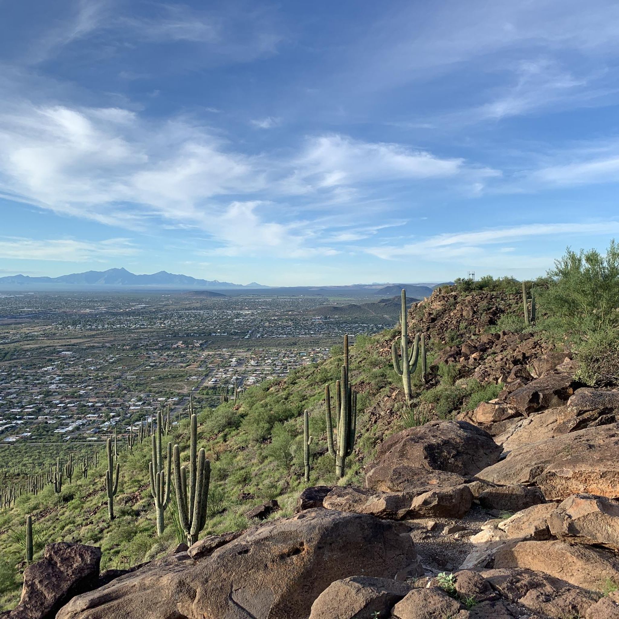
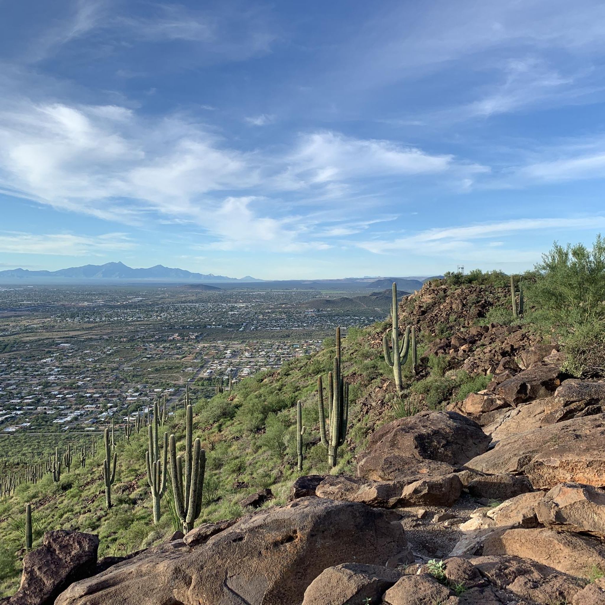
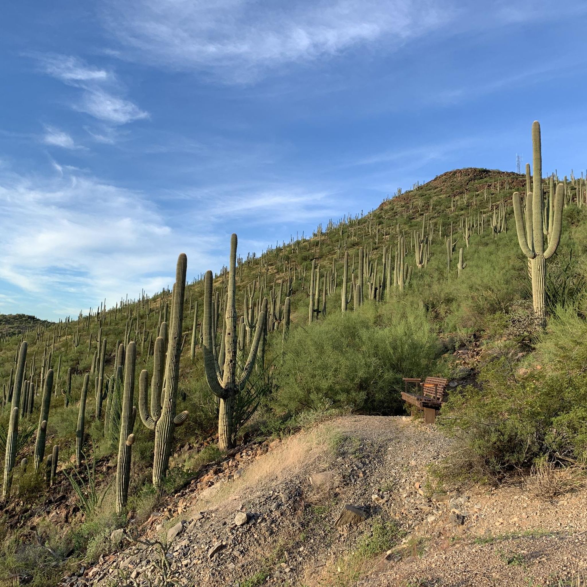
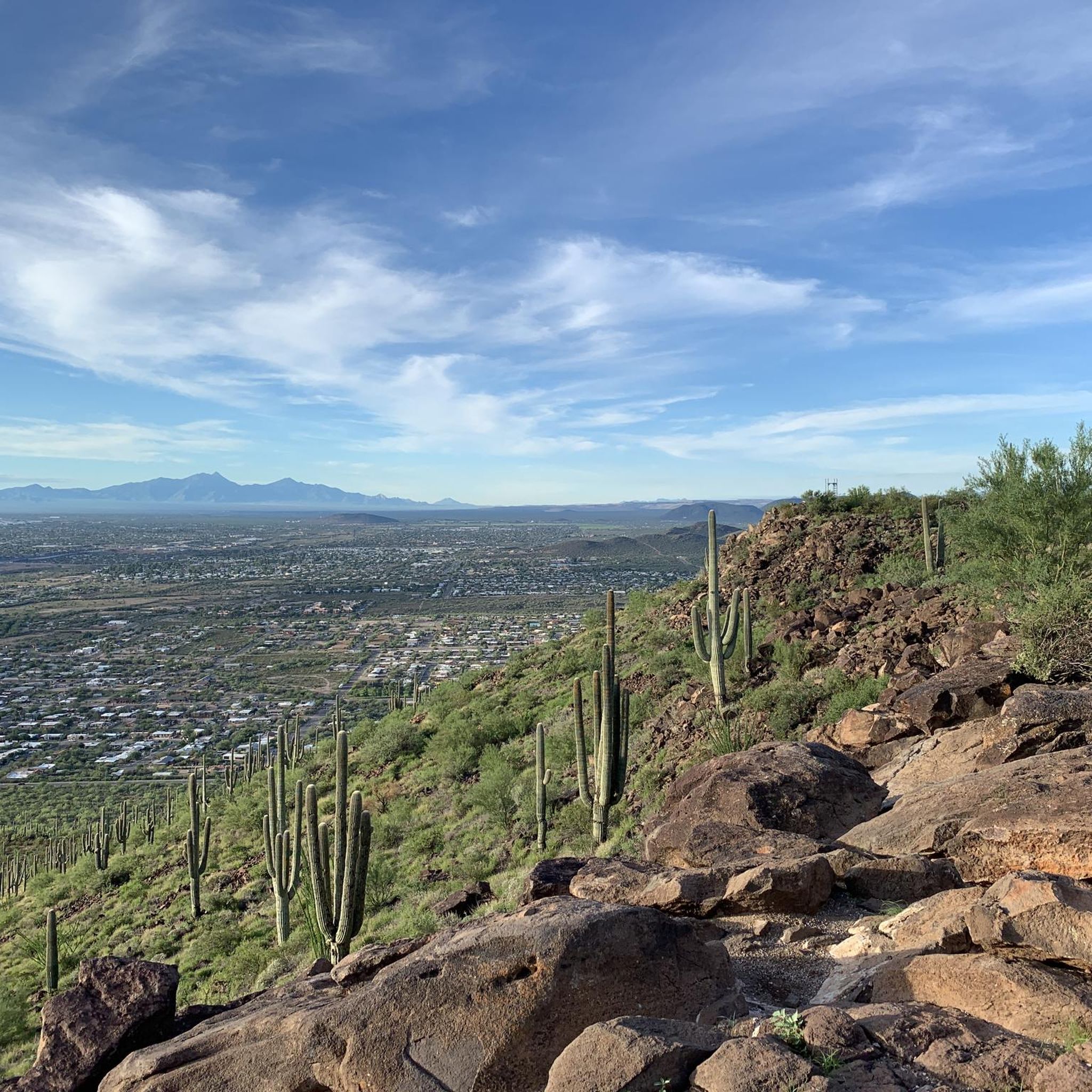
Hike by clusters of saguaros, keeping in mind some can live to be over 200 years old. Saguaros here are a protected, native plant.
1
0
Tumamoc Hill, known as Cemamagĭ Doʼag ("Horned Lizard Mountain") in O'odham, is a butte west of "A" Mountain. Established in 1903 by the Carnegie Institution, this 860-acre ecological reserve and U.S. National Historic Landmark serves as a hub for ecological and anthropological research. The Steward Observatory operates a 20-inch telescope here as well as some radio, television, and public safety transmitters. Tumamoc Hill offers panoramic views of Tucson and is open to the public for hiking daily from 4 a.m. to 10 p.m.
1
0

The Juan Bautista de Anza Trail passes through three states and two countries as it follows the historic route of Spanish colonizers from Mexico to what is now San Francisco. This particular spot in the trail is close to Sentinel Peak Park (yes, you can bike up the road to the peak). The trail also parallels the Santa Cruz River for a stretch.
2
0

Extending 6 miles, the El Paso and Southwestern Greenway provides a versatile pathway for cyclists and pedestrians. Tracing the path of a former railroad corridor, it traverses from north of downtown Tucson through the City of South Tucson, all the way to the Kino Sports Complex. This car-free route seamlessly connects to other regional bikeways and neighboring communities along its course.
0
0

The El Paso and Southwestern Greenway is a 6-mile paved multi-use greenway. This pathway around Ed Pastor Kino Environmental Restoration Project also connects with other regional bikeways and to many of the neighborhoods that the path travels through.
0
0

Sentinel Peak is an easy access summit that is great for watching the sunset over Tucson. It is also known as "A" Mountain because of the giant A on it's east side.
0
0
Great spot to look out over Tucson! Open for hiking from 4 a.m. to 10 p.m. daily.
0
0

Frequently Asked Questions
What is the best time of year for hiking around South Tucson?
The best seasons for hiking are fall, winter, and spring, typically from October through April. The temperatures are cooler and more pleasant for outdoor activities. Summer hikes are possible but require extreme caution due to very high temperatures; if you do hike in summer, go early in the morning and bring extra water.
Are there any hiking trails with waterfalls near South Tucson?
Yes, but they are seasonal. The most well-known destination is Seven Falls, located within the Sabino Canyon Recreation Area. The falls are most impressive after winter snowmelt or summer monsoon rains. The hike to the falls involves multiple creek crossings and is a rewarding experience when the water is flowing.
What should I pack for a desert hike in the Tucson area?
Packing correctly is crucial for safety and comfort. Essentials include:
- Water: More than you think you'll need, at least 1 liter per hour of hiking.
- Sun Protection: A wide-brimmed hat, sunglasses, and high-SPF sunscreen are non-negotiable.
- Sturdy Footwear: Wear hiking boots or shoes with good grip for rocky terrain.
- Snacks: Salty snacks help replace electrolytes lost through sweat.
- Navigation: A map or a GPS device, as cell service can be unreliable.
- First-Aid Kit: Include tweezers for cactus spine removal.
Are there many easy, beginner-friendly hikes near South Tucson?
Absolutely. The area has numerous options for beginners and families. Many trails are relatively flat and well-maintained, such as the paved greenways along the Julian Wash and Arroyo Chico. For a gentle introduction to the desert landscape, consider the Reid Park Zoo and Rose Garden loop, which is a pleasant walk in a more urban park setting.
Can I bring my dog on the hiking trails?
Dog policies vary by park. While many city parks and trails like the Julian Wash Greenway are dog-friendly (on-leash), the major natural parks have stricter rules. Saguaro National Park generally prohibits dogs on trails to protect wildlife. Tucson Mountain Park has some shared-use trails where dogs may be permitted. Always check the specific park's regulations before you go.
What kind of wildlife might I see while hiking?
The Sonoran Desert is rich with wildlife. Keep an eye out for Gambel's quail, roadrunners, and various lizards. You might also spot javelinas, coyotes, or deer. It's also home to rattlesnakes, so always be aware of your surroundings, watch where you step, and never try to approach or handle any wildlife.
Where can I find the best sunset views on a hike?
The Tucson area is famous for its spectacular sunsets. Gates Pass Trailhead is a highly regarded local favorite for watching the sun dip below the horizon amidst dense saguaro cacti. For a view from above, the trails on Sentinel Peak ("A" Mountain) offer panoramic vistas of the city and surrounding mountains, making it a prime spot for sunset photography.
How many hiking trails are available around South Tucson?
There are over 40 curated hiking routes accessible from South Tucson, covering a wide range of difficulties and lengths. This includes everything from short, paved city loops to more demanding trails in the nearby mountain parks, ensuring there's a trail for every skill level.
What do other hikers enjoy most about the trails here?
The trails around South Tucson are highly rated by the komoot community. Hikers frequently praise the iconic Sonoran Desert scenery, especially the dense forests of saguaro cacti. The accessibility of trails that offer stunning panoramic views after a relatively short climb is another commonly highlighted feature.
Are there any challenging day hikes available?
Yes, for those seeking a challenge, the surrounding mountain parks offer strenuous hikes. Trails in Saguaro National Park and the Santa Catalina Mountains, such as the one to Wasson Peak, provide significant elevation gain and rugged terrain. These routes reward hikers with incredible views and a true sense of wilderness.
What are the key differences between Saguaro National Park East and West?
Saguaro National Park is split into two districts. The West (Tucson Mountain District) is closer to South Tucson, known for its denser saguaro forests and lower elevation trails. The East (Rincon Mountain District) is more remote, features higher elevations leading to 'sky island' ecosystems, and offers more extensive backcountry hiking opportunities. You can find more details on the official National Park Service website.
Are there any good circular hikes?
Yes, loop trails are a great way to see varied scenery without backtracking. For a short and scenic loop with a bit of elevation, the Tecolote Trail loop to Enchanted Peak is a great option that offers nice views from the top.
Most popular attractions around South Tucson

Get inspired with the komoot mobile app


Explore more
Browse the best Hikes in other regions.
