The best running trails around Fountain Hills
5.0
(3)
602
runners
50
runs
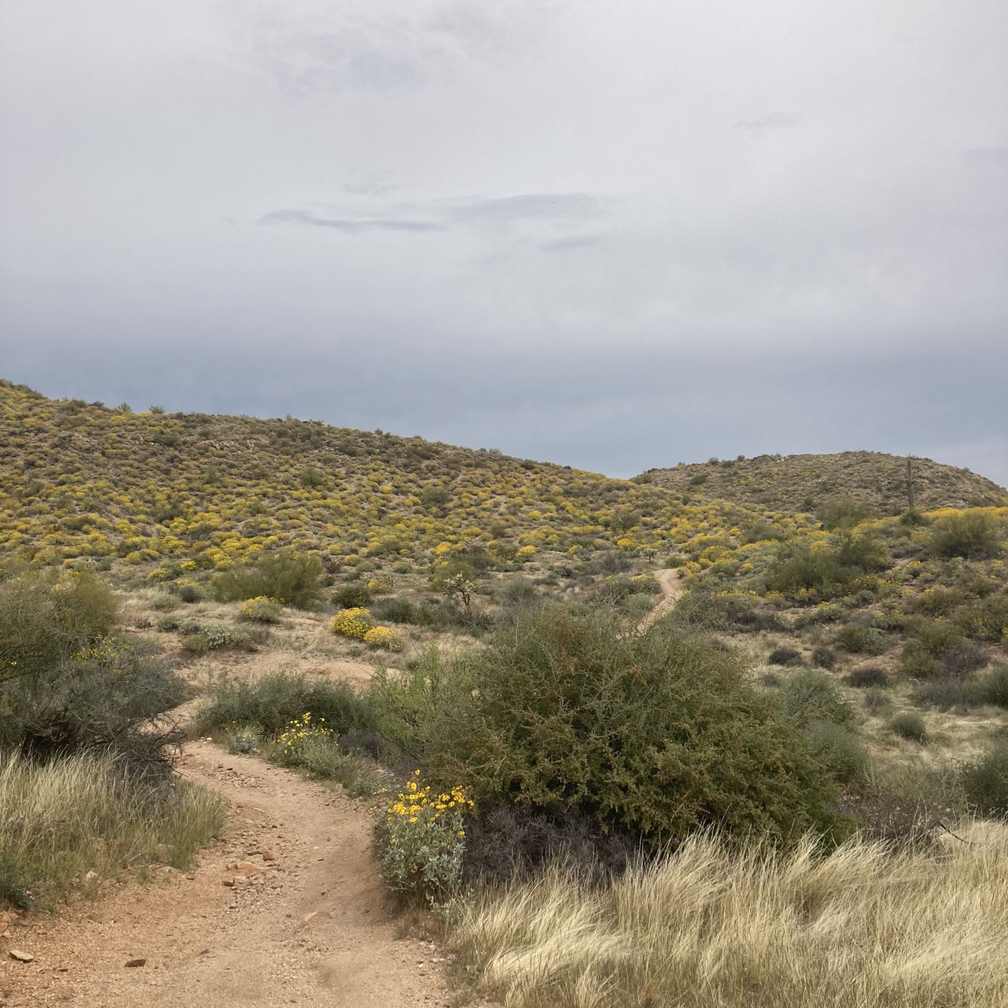
Jogging routes around Fountain Hills offer diverse trail systems and scenic parks set within the Sonoran Desert. The region features distinctive desert flora and fauna, providing a natural environment for running. Varied elevations are present, from mostly flat paths to significant climbs, catering to different fitness levels. Surrounding mountains like the Superstition Mountains and Four Peaks offer panoramic views.
Best jogging routes around Fountain Hills
- The most popular jogging route is Lost Dog Wash and Ringtail Trail Loop, a…
Last updated: October 10, 2026
17
runners
6.06km
00:55
310m
310m
Prepare for a challenging jogging experience on the Sunrise Trail, a difficult 3.8-mile (6.1 km) route that climbs steadily through a varied desert landscape. You will gain 1002 feet (305…
16
runners
6.95km
00:53
130m
130m
Lace up your jogging shoes for the Lost Dog Wash and Ringtail Trail Loop, a moderate route through the McDowell Sonoran Preserve. This 4.3-mile (6.9 km) loop involves a 424-foot…

15
runners
9.82km
01:24
390m
390m
Prepare for a challenging jogging experience on the Sunrise Trail to Sunrise Peak, a difficult route spanning 6.1 miles (9.8 km). As you ascend, you'll gain 1274 feet (388 metres)…
15.6km
02:14
580m
580m
Jog the challenging Thompson Peak Trail in McDowell Sonoran Preserve for 9.7 miles and 1902 feet of elevation gain, with 360-degree views.
16.5km
02:20
580m
580m
This difficult 10.3-mile jogging trail to Thompson Peak offers challenging climbs, Sonoran Desert scenery, and panoramic views of Arizona's
Get access to more routes and recommendations from other explorers.
Already have an account?
Our route recommendations are based on thousands of hikes, rides, and runs completed by other people on komoot.
Start today with a free account
Your next adventure awaits.

Tips from the Community

Thompson Peak is a 3,982-foot mountain in McDowell Mountain Regional Park. There is a trail and a jeep road that both go to the top, but the views at the top are all that make this mountain worth visiting. The climb up is a good workout, but it is exposed the whole way and pretty rocky/washed out.
1
0

There are a few routes to the top, but the best bike route is the paved Thompson Peak Road. Though it's a bit of a climb, the views are great! Thompson Peak has high satellite towers behind yellow and gold-colored boulders. Check out the trail along the east side of Four Peaks Wilderness as a reward for the effort to get to the top.
0
0
Thompson Peak is a 3,982-foot mountain in McDowell Mountain Regional Park. There is a trail and a jeep road that both go to the top, but the views at the top are all that make this mountain worth visiting. The climb up is a good workout, but it is exposed the whole way and pretty rocky/washed out.
0
0

This trailhead has received an award for its Sustainable Desert Design. It offers plenty of parking for vehicles and equestrians, along with multiple gathering areas.
0
0
This trail has received recognition and awards for its Sustainable Desert design in planning, preservation, and construction. With a rocky terrain and a moderate incline, the trail presents a steady and enjoyable challenge.
0
0
This trail offers an alternative and steep route to reach the impressive Sunrise Peak. It requires proper pacing due to the consistent incline and some sections with loose rocks, but the effort pays off with the breathtaking views awaiting you at the summit.
0
0
Sunrise Peak, standing at 3,069 feet, offers stunning panoramic views of the surrounding landscape, 4 Peaks Wilderness, Superstition Wilderness, and other peaks in the McDowell range.
0
0
At 3,069 feet, Sunrise Peak is one of few summits that you can actually reach the top of in the McDowell Mountains. The final summit trail can be reached from two different directions, but the peak can only be climbed by the spur trail over the last few hundred feet.
0
0
Frequently Asked Questions
How many running routes are available in Fountain Hills?
Fountain Hills offers a wide variety of running routes, with over 50 options available. These range from easy paths to challenging trails, catering to all fitness levels.
Are there easy running trails suitable for beginners or families in Fountain Hills?
Yes, Fountain Hills has several easy running trails. The town's central Gateway Trailhead provides access to less strenuous paths, and Fountain Park features a scenic, leisurely trail around the famous fountain, perfect for a relaxed jog or a family outing.
Where can I find challenging running routes with significant elevation gain?
For a more challenging run, consider routes like the Sunrise Trail or the Sunrise Trail to Sunrise Peak, both located in the McDowell Sonoran Preserve. These routes feature substantial elevation changes and offer rewarding views. The Thompson Peak Trail is another difficult option, spanning over 9 miles with significant climbs.
What kind of scenery can I expect on jogging routes in Fountain Hills?
Jogging in Fountain Hills immerses you in the stunning Sonoran Desert scenery. You'll encounter distinctive desert flora and fauna, breathtaking panoramic views of surrounding mountains like the Superstition Mountains and Four Peaks, and varied landscapes from flat paths to rugged terrain.
Are there any loop running trails in the area?
Yes, many routes in Fountain Hills are designed as loops, offering a convenient running experience. A popular example is the Lost Dog Wash and Ringtail Trail Loop, which provides classic desert scenery within the McDowell Sonoran Preserve.
What are some notable landmarks or points of interest I might see while running?
While running, you might encounter iconic landmarks such as the world's tallest fountain at Fountain Park. Trails also offer views of natural features like Tom's Thumb and access to various trailheads within the McDowell Sonoran Preserve, including Gateway Trailhead and Lost Dog Wash Trail.
What do other runners enjoy most about jogging in Fountain Hills?
The running routes in Fountain Hills are highly rated by the komoot community. Runners often praise the diverse trail systems, the stunning Sonoran Desert scenery, and the variety of routes that cater to different ability levels, from leisurely jogs around Fountain Park to challenging mountain climbs.
Are there any specific parks or areas known for good running in Fountain Hills?
Absolutely. The McDowell Sonoran Preserve is a significant draw, offering numerous trails like the Sunrise Trail. Fountain Park is ideal for a leisurely run around its famous fountain, and Golden Eagle Park also provides beautiful views and access to trails like the Dixie Mine Trail.
When is the best time of year to go running in Fountain Hills?
The cooler months, particularly fall, winter, and spring, are generally considered the best time for running in Fountain Hills. The mild temperatures make for a more comfortable experience, allowing you to fully enjoy the desert landscape without the intense summer heat.
Are there long-distance running routes available for endurance training?
Yes, Fountain Hills offers several options for longer runs. The Thompson Peak Trail, for instance, is a challenging route over 9 miles long, providing ample distance and elevation for endurance training amidst the desert landscape.
Can I find less crowded running routes for a more peaceful experience?
While popular trails can see more activity, exploring routes during off-peak hours (early mornings or late afternoons) or venturing into less-trafficked sections of the McDowell Sonoran Preserve can offer a more serene running experience. Many trails wind through vast desert areas, providing opportunities for solitude.
Most popular attractions around Fountain Hills

Get inspired with the komoot mobile app


Explore more
Browse the best Running Trails & Routes in other regions.
