The best walks and hikes in Ashley National Forest
5.0
(21)
560
hikers
14
hikes
Hikes in Ashley National Forest explore a vast landscape in northeastern Utah, characterized by the high peaks of the Uinta Mountains and the canyons of the Flaming Gorge National Recreation Area. The terrain varies with elevation, ranging from high desert scrub to dense conifer forests and alpine environments. The trail network includes routes along reservoir shorelines, through deep canyons, and to scenic overlooks.
Best hiking trails in Ashley National Forest
- The most popular hiking route is Canyon Rim Trail — Flaming Gorge National Recreation Area, a 9.6 mile (15.5 km) trail that takes about 4 hours 15 minutes to complete. This route follows the edge of Red Canyon, providing views into the gorge below.
- Another top favourite among local hiking enthusiasts is Little Hole Trail — Dutch John, Utah, a moderate 6.6 mile (10.7 km) path. The trail follows the Green River below the Flaming Gorge Dam.
- Local hiking enthusiasts also love the Bear Canyon Bootleg Trail — Flaming Gorge National Recreation Area, a 3.0 mile (4.9 km) trail leading through forested terrain, often completed in about 1 hour 15 minutes.
- Hiking in Ashley National Forest is defined by high-elevation mountain ranges, deep red rock canyons, and large reservoirs. The trail system offers accessible lakeside paths and more challenging routes in the High Uintas Wilderness.
- The routes in Ashley National Forest are highly rated by the komoot community with an average score of 4.9 stars from more than 10 reviews. More than 450 hikers have used komoot to explore Ashley National Forest's varied terrain.
Last updated: June 25, 2026
9
hikers
5.88km
01:47
280m
90m
Hike the easy 3.7-mile Grandaddy Lake via Hades Pass Trail in Utah's High Uintas Wilderness, offering alpine views and wildflowers.
1
hikers
9.89km
02:59
370m
260m
Hike the challenging Swasey Lakes via Center Park Trail for 6.1 miles through the High Uintas Wilderness to remote alpine lakes.

Sign up for free
3.96km
01:06
60m
80m
Hike the easy Red Canyon Rim Trail for 2.5 miles (4.0 km) with 196 feet (60 metres) of elevation gain, offering views of Flaming Gorge.
4.5
(2)
19
hikers
4.89km
01:17
40m
40m
Hike the easy 3.0-mile Bear Canyon Bootleg Trail in Flaming Gorge National Recreation Area for rewarding views of Red Canyon and the reservo
5
hikers
15.5km
04:15
250m
250m
Hike the moderate 9.6-mile Canyon Rim Trail in Flaming Gorge for stunning views, wildlife, and a rewarding outdoor experience.
Get access to more routes and recommendations from other explorers.
Sign up for free
Already have an account?
Our route recommendations are based on thousands of hikes, rides, and runs completed by other people on komoot.
Start today with a free account
Your next adventure awaits.
Login or Signup

Other adventures in Ashley National Forest

Tips from the Community

If you're not staying at Firefighters Memorial Campground across the street, people often park at the side of the road to access this trail that, despite its name, leads to a nice overlook of Lake Flaming Gorge. Along the way, watch for wildlife and for wildflowers in season. This trail is also popular for cross-country skiing.
0
0
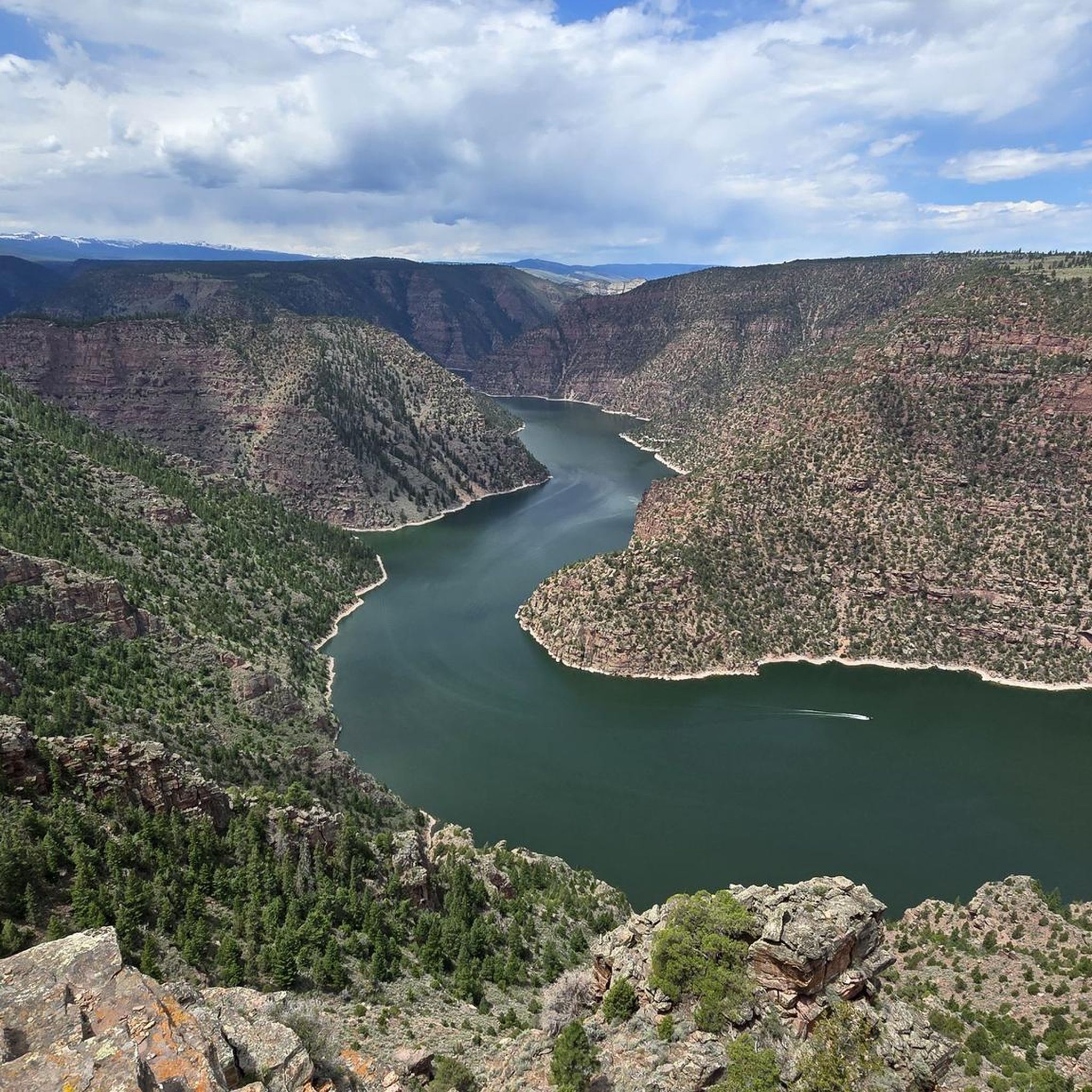
The trail to get here is easy and relatively short (about three miles round-trip) if you park across the street from the Firefighters Memorial Campground. For your efforts, you get a beautiful, sort of side-on view of the Green River as it flows through Red Canyon, a part of Flaming Gorge National Recreation Area.
1
0
This viewpoint, just a short walk outside Canyon Rim Campground, offers impressive lookouts down into Red Canyon, with the Flaming Gorge Reservior, created from the Green River, in its depths. If you're up for hiking a couple miles northwest, the views get even better.
0
0
This overlook is famous for its wildflowers, which sprouted in profusion following a decades-past wildfire. You also get nice views into the nearby valley. You can't see all the way into Red Canyon from here, but you can hike there along the Canyon Rim Trail, and it's well worth it for the views.
0
0
Whether you're coming from the visitor center to the northwest, or staying at the Canyon Rim Campground to the southeast, this is one of several particularly great viewpoints along the Canyon Rim Trail.
0
0
This visitor center is a great place to get oriented to Flaming Gorge National Recreation Area. You can also enjoy spectacular views into 1,400-foot deep Red Canyon just a short walk to the north, or southeast along the Canyon Rim Trail.
0
0
Red Canyon is some 700 feet wide and 1,400 deep, and you get amazing views of it from this lookout point, as well as spots along the trail as you approach. The water at the bottom is Flaming Gorge Reservoir.
0
0

Frequently Asked Questions
Are there many easy, family-friendly hikes in Ashley National Forest?
Yes, the forest offers many options suitable for families. A great choice is the Red Canyon Overlook trail, which is a very short walk to a stunning viewpoint. For a slightly longer but still easy walk, consider the Red Canyon Overlook – Red Canyon Visitor Center loop, a 4.5 km circular route that offers great views of the Flaming Gorge.
Can I bring my dog on hikes in Ashley National Forest?
Yes, dogs are generally permitted on trails in Ashley National Forest, but they must be kept on a leash at all times. It's important to be mindful of wildlife and other hikers. Always pack enough water for your dog, especially on warmer days, and be prepared to clean up after them.
What are the trail conditions like and where can I check for closures?
Trail conditions vary significantly based on elevation and season. Higher elevation trails in the Uinta Mountains can hold snow until early summer. Lower elevation trails, especially around Flaming Gorge, are accessible for a longer portion of the year. For the most current information on trail conditions, closures, or fire restrictions, it is best to check the official Ashley National Forest website before you go.
When is the best time of year to hike in the forest?
The prime hiking season is typically from June to September, especially for high-elevation trails in the Uintas which are often snow-covered outside of these months. Lower elevation areas, like those in the Flaming Gorge National Recreation Area, can be enjoyed in late spring and early fall. Winters are cold and snowy, making the area suitable for snowshoeing and cross-country skiing.
Are there any good backpacking or multi-day hiking loops?
While the 100-mile Highline Trail is the most famous long-distance route, the forest has other excellent multi-day options. The High Uintas Wilderness offers numerous possibilities for creating backpacking loops that connect different lakes and basins. These routes are typically strenuous and require careful planning and navigation skills in a remote, high-alpine environment.
What should I pack for a day hike in Ashley National Forest?
For any hike, you should carry the essentials: plenty of water, snacks, a map, and a first-aid kit. The weather can change rapidly in the mountains, so packing layers, including a waterproof jacket, is crucial even on a sunny day. Sun protection like a hat, sunglasses, and sunscreen is also very important due to the high elevation.
Do I need a permit or have to pay a fee to hike here?
For general day hiking in most of the national forest, a permit is not required. However, some specific areas, particularly the Flaming Gorge National Recreation Area, require a recreation pass for vehicles parked at trailheads and facilities. Fees are used for the upkeep of trails and amenities. It's always a good idea to check the specific requirements for the area you plan to visit.
How do I get to trailheads? Is public transport an option?
Access to trailheads within Ashley National Forest is almost exclusively by private vehicle. There is no public transportation system that serves the trailheads. The forest is vast, and many access roads can be unpaved, so a vehicle with good clearance can be beneficial for reaching more remote starting points. Always check road conditions before you depart.
What do other hikers enjoy about Ashley National Forest?
The area is highly regarded by the komoot community. Hikers often praise the incredible diversity of the landscape, from the dramatic red rock canyons of Flaming Gorge to the pristine alpine scenery of the High Uintas. The sense of solitude and the extensive network of well-maintained trails are also frequently mentioned as major highlights.
Are there any scenic drives in the area for non-hikers?
Absolutely. The Flaming Gorge-Uintas National Scenic Byway offers spectacular views of the reservoir and surrounding geology. For a more rugged experience, the Red Cloud Loop takes you through high mountain meadows and forests. Another unique option is the Nine Mile Canyon scenic backway, known as "the world's longest art gallery" for its thousands of ancient petroglyphs.
What kind of wildlife might I see while hiking?
The forest's diverse ecosystems support a wide variety of animals. It's common to see mule deer and pronghorn. In more remote or forested areas, you might be lucky enough to spot elk, moose, or bighorn sheep. The region is also home to a rich array of birdlife. Remember to always observe wildlife from a safe and respectful distance.
Most popular attractions in Ashley National Forest

Get inspired with the komoot mobile app


Explore more
Browse the best Hikes in other regions.
