The best walks and hikes around Grote Geule
4.4
(1912)
11,823
hikers
529
hikes
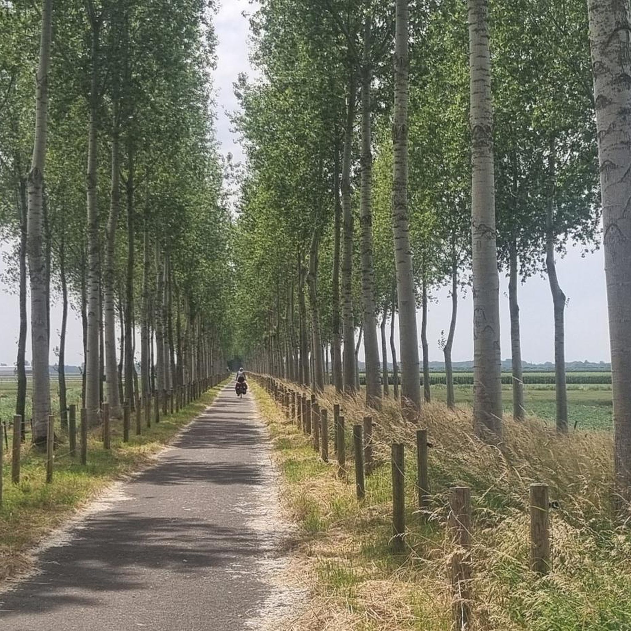
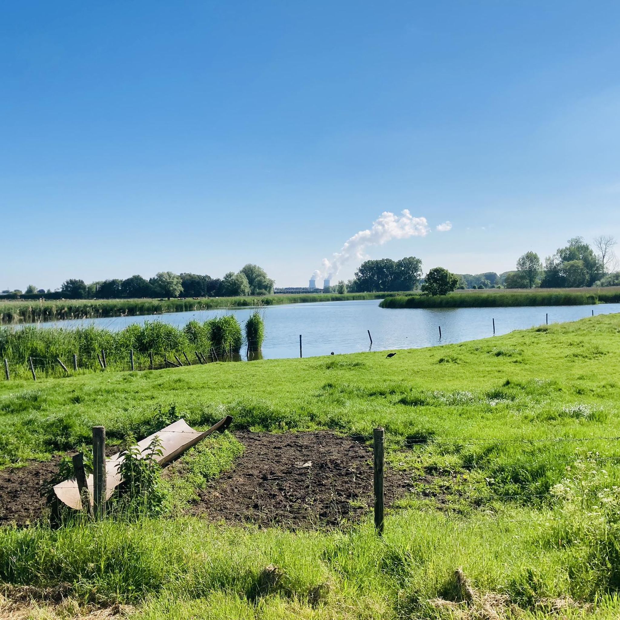
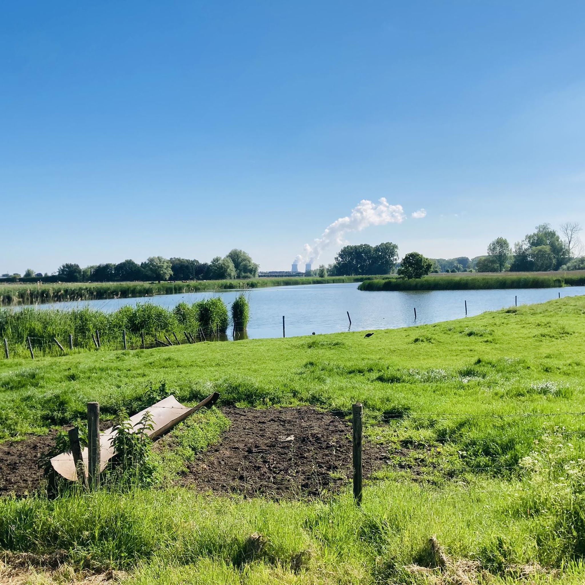
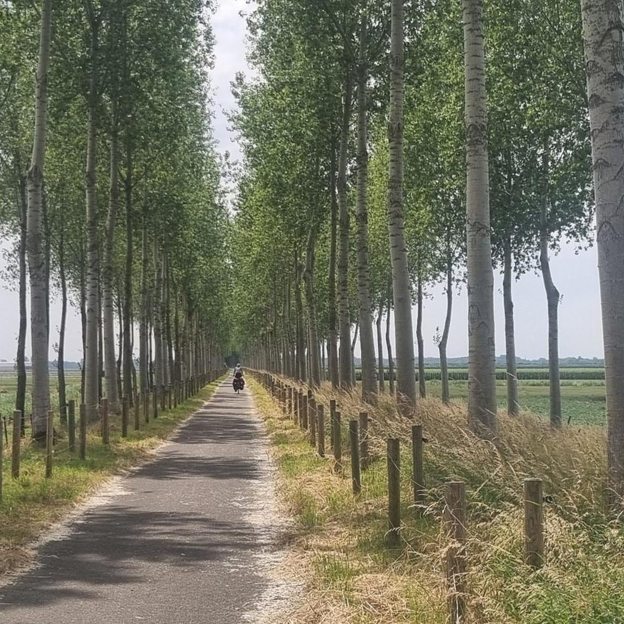
Hiking around Grote Geule, located in the Belgian municipality of Beveren within the Krekengebied of Noord-Oost Vlaanderen, offers routes through a unique nature reserve. The landscape is characterized by its origin as an overflow channel, featuring rows of pollard willows, extensive reed beds, and an open water body. This area provides diverse ecosystems influenced by both brackish and peaty conditions, supporting varied flora and fauna.
Best hiking trails around Grote Geule
- The most popular hiking route is Kieldrecht Wetlands –…
Last updated: May 22, 2026
4.0
(9)
42
hikers
Moderate hike. Good fitness required. Easily-accessible paths. Suitable for all skill levels.
5.0
(1)
21
hikers
6.35km
01:36
10m
10m
Easy hike. Great for any fitness level. Easily-accessible paths. Suitable for all skill levels.

Sign up for free
18
hikers
Moderate hike. Good fitness required. Easily-accessible paths. Suitable for all skill levels.
5.0
(1)
14
hikers
6.44km
01:37
10m
10m
Easy hike. Great for any fitness level. Easily-accessible paths. Suitable for all skill levels.
4.0
(1)
7
hikers
10.1km
02:32
10m
10m
Moderate hike. Good fitness required. Easily-accessible paths. Suitable for all skill levels.
Get access to more routes and recommendations from other explorers.
Sign up for free
Already have an account?
Our route recommendations are based on thousands of hikes, rides, and runs completed by other people on komoot.
Start today with a free account
Your next adventure awaits.
Login or Signup
Tips from the Community

The bench and information board are located at the eastern end of a four-kilometer-long low sand ridge that connects Kieldrecht with De Klinge. Due to its higher elevation, this sand ridge is less susceptible to flooding than the surrounding areas. This also made it of great military importance during the various wars of the 16th, 17th, and 18th centuries. We therefore find several old forts and lines on the sand ridge: fort De Klinge (1595), fort Fuentes (1591, renamed fort Spinola in 1626), the Koningsdijk (1674), and fort Bedmar (1701-1702). In 1701, the Spanish army decided to build a new fort north of Kieldrecht. The fort was built on the spot where the Koningsdijk met the sand ridge of the so-called Kouter(berg). The new defensive work was named after the Fleming Prosper Georges Verboom, an important officer in the Spanish army and one of the engineers of the Bedmar line. The fort served in the War of the Spanish Succession (1702-1714). As early as 1703, it was captured by the army of the Republic of the United Netherlands, the so-called 'Staatsen'. After the war, the fort lost its military importance and almost completely disappeared into the landscape. Fort Verboom has a triangular shape, deviating from the usual four- or five-sided fort construction. The point of the fort is directed north, and thus straight at the enemy. The southern side is equipped with two pentagonal bastions. The entrance to the fort is located between the two bastions. Fort Verboom is quite large. The distance between the two bastion points is approximately 250 meters. The size of a fort is determined by the range of the cannons. The defensive belt is formed by a glacis (a gently sloping strip), a moat, and an earthen rampart. The fort is entirely constructed of earth, as was customary for forts of this period. Earth is a cheaper building material than stone. Furthermore, an earthen fort can be built faster than a stone one and is more resistant to heavy cannonballs. Today, Fort Verboom has largely disappeared, and the site has been completely incorporated into the built environment. The fort lies right on the national border, with its point in the Netherlands and its southern side with the two bastions in Belgium. Remnants of the moats can still be seen in some backyards. ... so reads the information board.
2
0
The Sint-Jozefkerk of Nieuw Namen was taken into use in 1860, shortly after the founding of the village. In 1898 the church was expanded, in 1912 a new tower was built, and in 1923 the side aisles were extended. In front of the church is a bronze Sacred Heart statue from around 1920, made by P. de Roeck. source: Wikipedia
2
0
The silhouette of a walking man is a work (from 2010) by the Melsele-based artist Stefaan van Biesen (°1953), titled "Grenzer"; it is therefore not by chance that it stands on the Belgian-Dutch border. The man walks through a screen, a transit zone from one area to another. He is a passer-by, on his way between two worlds. The work refers both to borders in our minds, limitations to our freedom, but also to how that freedom is only real freedom when it is not at the expense of our fellow human beings... and to how topographical borders have been conceived by the same freedom-seeking human. ... the artist himself explains his work. (see etcetera.plus)
2
0
The monument at the Sint-Michielskerk of Kieldrecht commemorates the victims of both world wars. In front are 12 names of "Fallen on the field of honor". On one of the sides are 5 more names. On the other side are 4 names "Died in Exile". At the back hangs a copper plate relating to the 2nd World War. There are 4 names on it "fallen on the field of honor", in addition 1 man died as a political prisoner. source: tracesofwar.nl
2
0
The demarcation of the Belgian-Dutch border came about after the Treaty of Maastricht in 1843. Border post number 1 is located at the Drielandenpunt in Vaals, the last post, border post number 365, is in the Zwin west of Retranchement in Zeeland-Flandres. Here, between Kieldrecht (B) and Nieuw-Namen (NL) is number 271.
2
0
The Sint-Michielskerk of Kieldracht dates from 1854. Only the west tower is older - as the sole remnant of the previous, 18th-century church - it was added in 1788. Currently, restoration work is being carried out on that tower. In 1964, the original floor was replaced, and the gravestones were removed at the same time. The Rococo pulpit, confessionals, and statues (of Saint Michael, among others, of course) are all 18th-century. The Way of the Cross is 19th-century. There are also a number of 20th-century statues to be seen. Source: Inventory of Immovable Heritage
2
0
A 'weel' (also called 'wiel' or 'kolk') is a deep pool of water that originated after a dike breach. The enormous force of the water during such a breach created a deep hole behind the dike, which often remained in the landscape as a mere or pool after the dike was repaired. Such 'welen' often develop into valuable nature reserves. The Grote and Kleine Weel form an important link between the nature reserves Grote Geule and Drijdijck. The Grote Geule is an offshoot of the former, much larger Land van Saeftinghe. source: natuurpunt.be
1
0
The Verrebroek pumping station is currently under scaffolding: the pumps are due for overhaul, with a choice being made for an energy-efficient and fish-friendly solution. Source: Coordination Committee for Integrated Water Policy, 2025
2
0
Frequently Asked Questions
How many hiking trails are available in Grote Geule?
Grote Geule offers a wide variety of hiking opportunities, with over 500 routes available. These range from easy strolls to more challenging treks, catering to different preferences and fitness levels.
What kind of landscape can I expect to see while hiking in Grote Geule?
The landscape of Grote Geule is unique, shaped by its history as an overflow channel. You'll encounter picturesque rows of pollard willows, extensive reed beds, and open water bodies. The area is also known for its diverse flora, influenced by both brackish and peaty conditions, and is a haven for various bird species.
Are there any specific landmarks or viewpoints to look out for in Grote Geule?
Yes, a key attraction is the revitalized Vissersparadijs (Fisherman's Paradise), an old boathouse that now serves as an information point with a bird-watching wall and a viewing platform. This offers excellent opportunities for observing the diverse avian life. You can also explore areas like Drijdijck and the Spanish Fort nearby.
Are there family-friendly hiking options in Grote Geule?
Yes, Grote Geule has many routes suitable for families. For an easy and scenic walk, consider the Dike Houses – Book Exchange Box loop from Kieldrecht, which is 6.4 km long and takes about 1 hour 37 minutes to complete. This trail offers gentle terrain and pleasant views.
Can I bring my dog on the hiking trails in Grote Geule?
While general free access within the core of the Grote Geule reserve is restricted to protect its sensitive ecosystem, many surrounding trails are dog-friendly. Always keep your dog on a leash and respect local signage, especially in nature-sensitive areas.
What are the typical difficulty levels of hikes in Grote Geule?
The trails around Grote Geule offer a range of difficulties. You'll find over 320 easy routes, 165 moderate routes, and 19 more difficult options. This variety ensures there's a suitable path for almost every hiker, from beginners to more experienced adventurers.
Are there any circular walks available in Grote Geule?
Yes, many of the routes in Grote Geule are circular, allowing you to start and end at the same point. An example is the Silhouette of a Hiker – Border Marker No. 271 (1843) loop from Kieldrecht, an easy 6.3 km path offering views of the polder landscape and historical markers.
What is the best time of year to visit Grote Geule for hiking?
Grote Geule offers unique experiences throughout the year. From May to July, it's particularly crucial for observing reed birds like the common reed warbler and bluethroat. Winter can bring sightings of rare goosanders. The diverse flora also changes seasonally, making spring and summer vibrant. Always be mindful of potential muddy conditions after rain.
Is parking available near the hiking trails in Grote Geule?
Yes, parking is generally available in and around the starting points of many trails, particularly in villages like Kieldrecht. It's advisable to check specific route details on komoot for designated parking areas closest to your chosen hike.
Can I access Grote Geule using public transport?
Public transport options are available to reach the vicinity of Grote Geule, particularly to towns like Kieldrecht. From there, you can access various trailheads. It's recommended to check local bus schedules for the most up-to-date information on connections to the area.
Are there guided walks available in Grote Geule?
Yes, to experience the sensitive core of the nature reserve more deeply, guided walks can be arranged through Natuurpunt. These walks offer an opportunity for in-depth exploration and learning about the reserve's unique features and biodiversity.
What is the average rating for hikes in Grote Geule?
The hiking routes in Grote Geule are highly rated by the komoot community, with an average score of 4.4 stars from over 1,700 reviews. Hikers often praise the unique natural beauty, the tranquility, and the well-maintained paths that showcase the region's diverse ecosystems.
Are there any easy, shorter hikes for beginners in Grote Geule?
Absolutely. For beginners or those looking for a shorter, less strenuous walk, the Boundary post 271 – Silhouette of a Hiker loop from Kieldrecht is an excellent choice. This easy 4.6 km route can be completed in about 1 hour 10 minutes, offering a pleasant introduction to the area's scenery.
Most popular routes around Grote Geule

Get inspired with the komoot mobile app


Explore more
Browse the best Hikes in other regions.
