The best walks and hikes around Wienerwaldsee
4.5
(4318)
20,181
hikers
796
hikes
Hiking trails around Wienerwaldsee offer a diverse landscape centered around a reservoir, the largest still body of water in the Vienna Woods. The area is characterized by dense deciduous and pine forests, interspersed with meadows and fields, forming part of the Vienna Woods Biosphere Reserve. Hikers can experience rolling sandstone ridges and occasional rugged limestone cliffs, with varied terrain suitable for different activity levels.
Best hiking trails around Wienerwaldsee
- The most popular hiking route is Wienerwaldsee – Bartberg Seestraße loop…
Last updated: October 5, 2026
4.3
(3)
9
hikers
5.21km
01:27
100m
100m
Easy hike. Great for any fitness level. Easily-accessible paths. Suitable for all skill levels.
4.1
(75)
504
hikers
5.20km
01:20
20m
20m
Easy hike. Great for any fitness level. Easily-accessible paths. Suitable for all skill levels.

4.0
(81)
528
hikers
5.94km
01:32
30m
30m
Easy hike. Great for any fitness level. Easily-accessible paths. Suitable for all skill levels.
4.4
(5)
31
hikers
Moderate hike. Good fitness required. Easily-accessible paths. Suitable for all skill levels.
4.0
(1)
31
hikers
Easy hike. Great for any fitness level. Easily-accessible paths. Suitable for all skill levels.
Get access to more routes and recommendations from other explorers.
Already have an account?
Our route recommendations are based on thousands of hikes, rides, and runs completed by other people on komoot.
Start today with a free account
Your next adventure awaits.

Tips from the Community

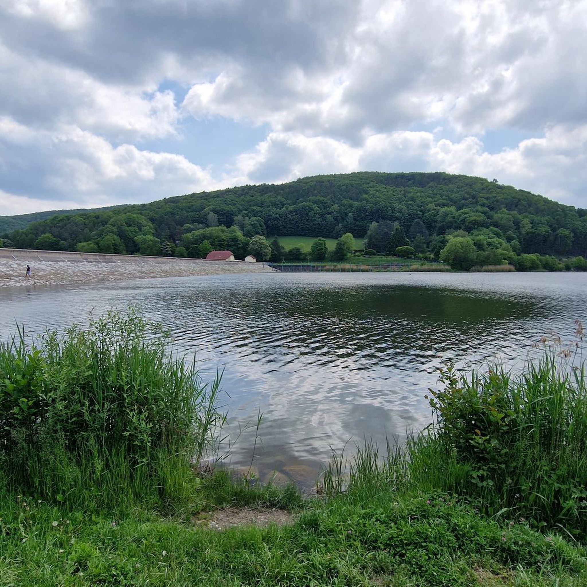
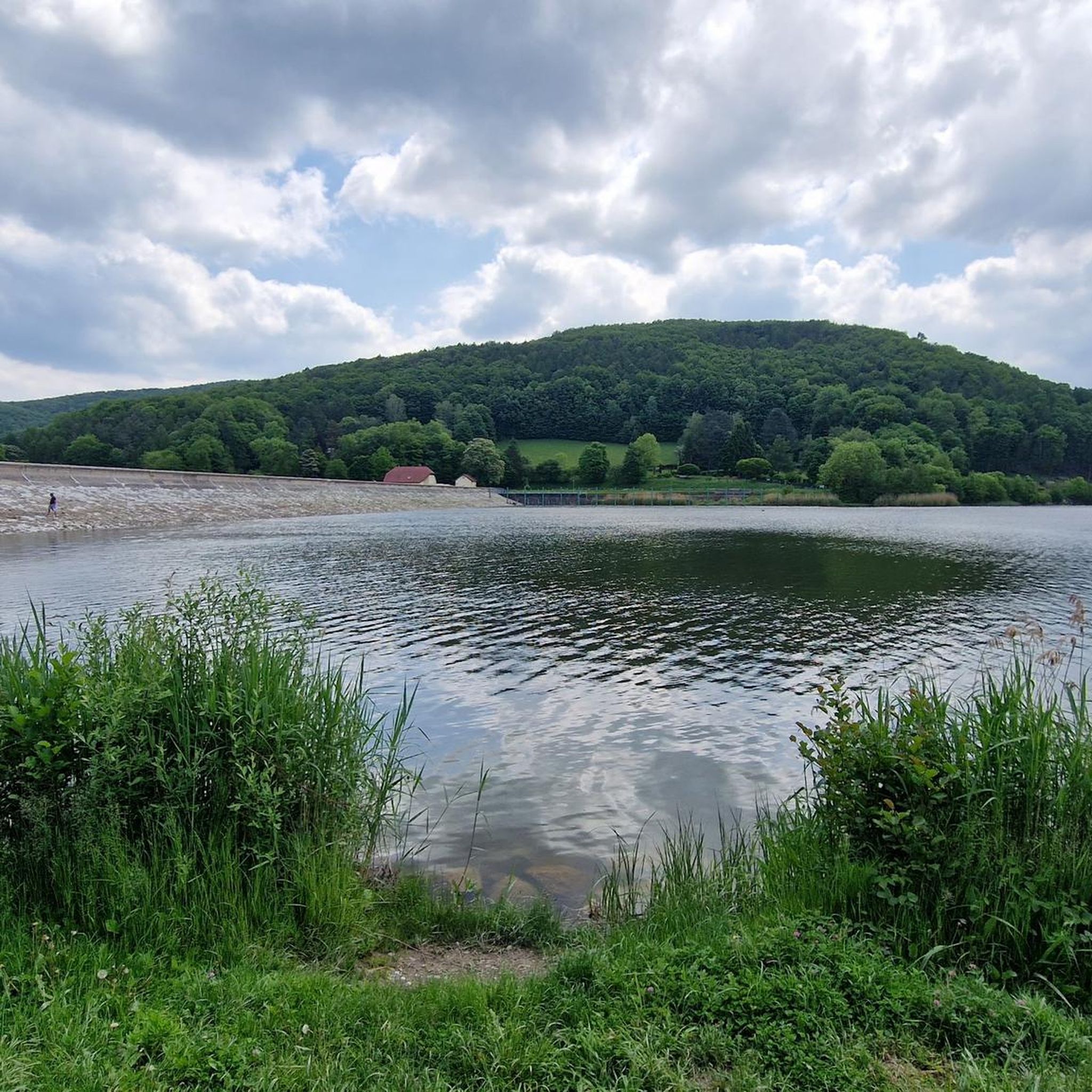
The first plans already existed in 1781 by the architect Wilhelm Bayer. The lake, upon its construction in 1895–1897, was used only as a utility water reservoir, and until recently as a drinking water reservoir for the Wiental water pipeline of the Wiental waterworks. The content of the basin, which is created by a 240-meter-long and 13-meter-high dam, was 1,430,000 cubic meters at the time.
1
0

Fantastic gravel, a dream for hikers, runners, and cyclists alike! 💚👍
0
0
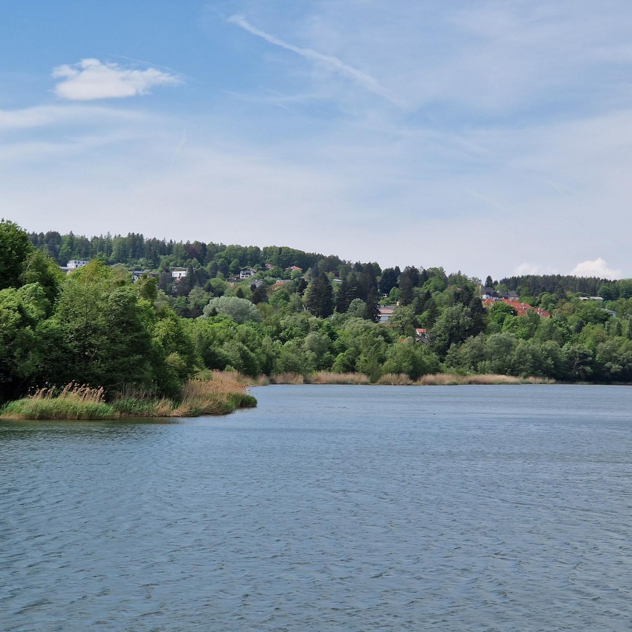
Beautiful little spot that invites you to pause and reflect, right in the middle of the magical Wienerwald 💚
0
0
Great walking, running, and cycling path; especially popular in good weather. A lovely place to linger! 👍
0
0

MTB rather easier route
0
0


The Fairytale Forest Chapel is a chapel in Purkersdorf. It is located near the Hüttenkogel and Sagberg peaks.
1
0

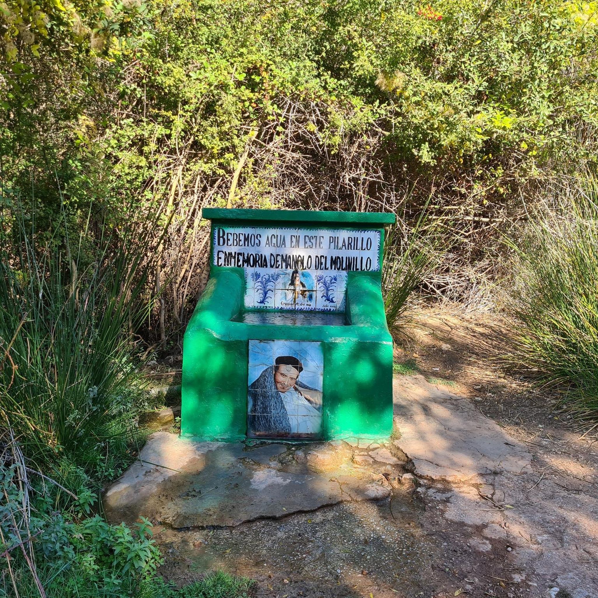
There is a drinking fountain at Wilhelm Kress Park.
3
0
Frequently Asked Questions
How many hiking trails are available around Wienerwaldsee?
There are over 800 hiking routes available around Wienerwaldsee, catering to various preferences and fitness levels. These include easy lakeside walks, moderate forest trails, and more challenging excursions into the surrounding Vienna Woods.
What types of terrain can I expect on hikes around Wienerwaldsee?
The terrain around Wienerwaldsee is diverse, featuring dense deciduous and pine forests, interspersed with meadows and fields. You'll encounter rolling sandstone ridges and sometimes rugged limestone cliffs, especially in the broader Vienna Woods area. The popular loop around the lake itself is often asphalted and flat.
Are there any easy, family-friendly hikes around Wienerwaldsee?
Yes, Wienerwaldsee offers many easy and family-friendly options. The approximately 4.2-kilometer loop around the lake is particularly suitable for families and strollers, offering continuous lake views. An example is the Wienerwaldsee Dam – Wienerwaldsee loop from Wienerwaldsee, an easy 3.3-mile (5.4 km) path.
Can I bring my dog on the hiking trails?
Many trails around Wienerwaldsee are dog-friendly, allowing you to enjoy the natural beauty with your canine companion. It's always recommended to keep dogs on a leash, especially in protected areas like the Vienna Woods Biosphere Reserve, and to be mindful of local regulations and other hikers.
What are the best viewpoints around Wienerwaldsee?
For stunning vistas of Wienerwaldsee and its surroundings, a hike to the nearby Beerwart (450 meters high) is highly recommended. The popular lakeside paths also offer continuous scenic views of the lake and its forested backdrop.
Are there any circular hiking routes around Wienerwaldsee?
Yes, circular routes are very popular here. A notable example is the Wienerwaldsee – Bartberg Seestraße loop from Wolfsgraben, a 2.5-mile (4.0 km) easy trail. Another option is the Wienerwaldsee – Wienerwaldsee Dam loop from Untertullnerbach, which is 3.8 miles (6.1 km) long.
What is the best time of year to hike around Wienerwaldsee?
The Wienerwaldsee area is beautiful year-round. Spring brings vibrant flower meadows, summer offers lush green forests, autumn transforms the landscape with rich colors, and winter provides serene snowy paths. The choice depends on your preference for scenery and trail conditions, though the lakeside paths are generally accessible in most seasons.
What natural features can I expect to see while hiking?
You'll experience the Wienerwaldsee itself, the largest still body of water in the Vienna Woods, fed by the Vienna River. The area is part of the Vienna Woods Biosphere Reserve, characterized by dense deciduous and pine forests, meadows, and diverse flora and fauna. The dam is also a prominent feature.
What do other hikers enjoy most about hiking in Wienerwaldsee?
The area is highly rated by the komoot community, with an average score of 4.6 stars from over 3,700 reviews. Reviewers often praise the tranquil environment, the continuous lake views, the well-maintained paths, and the diverse options for all fitness levels, from easy lakeside strolls to more challenging forest trails.
Is there parking available near the hiking trails?
Yes, there are parking facilities available around Wienerwaldsee, particularly near popular access points and trailheads. It's advisable to check specific starting points for parking availability when planning your hike.
Are there any moderate hikes for more experienced hikers?
For more avid hikers, the surrounding Vienna Woods offer numerous trails with moderate difficulty, some involving up to 1,000 feet of elevation gain. An example of a moderate route is the Fairy Tale Forest Chapel and Pond – At the Hüttenkogel loop from Untertullnerbach, which is 4.6 miles (7.3 km) long.
What kind of wildlife might I spot around Wienerwaldsee?
As part of the Vienna Woods Biosphere Reserve, the area is a diverse habitat. While specific sightings can vary, you might encounter various bird species, small mammals, and insects typical of central European forests and wetlands. The protected nature of the area supports a rich ecosystem.
Most popular routes around Wienerwaldsee
Most popular attractions around Wienerwaldsee

Get inspired with the komoot mobile app


Explore more
Browse the best Hikes in other regions.
