The best walks and hikes around Tappenkarsee
4.8
(5210)
28,080
hikers
175
hikes
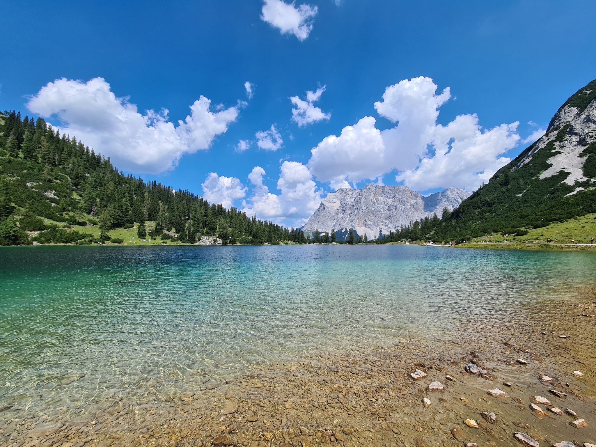
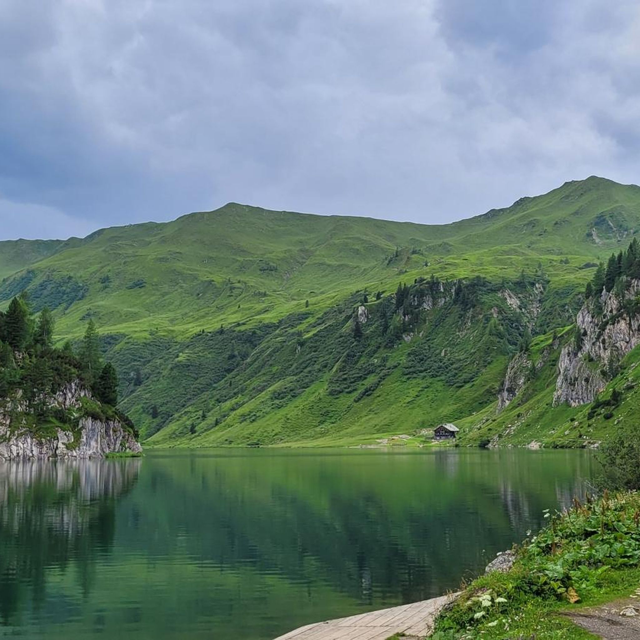
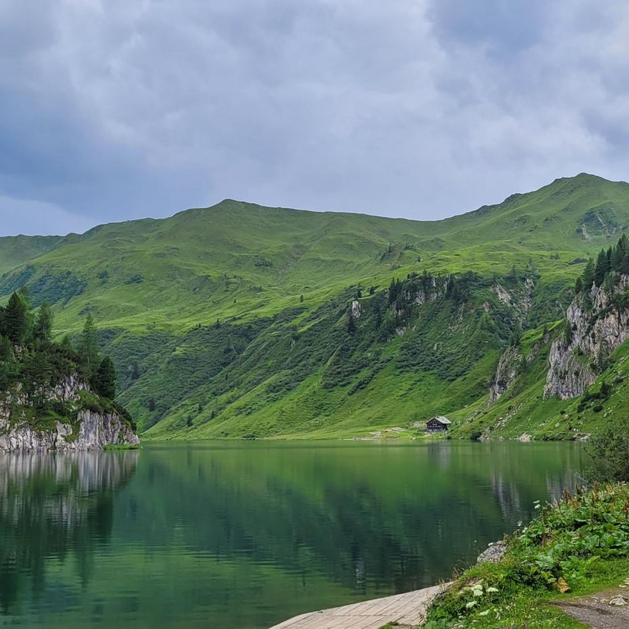
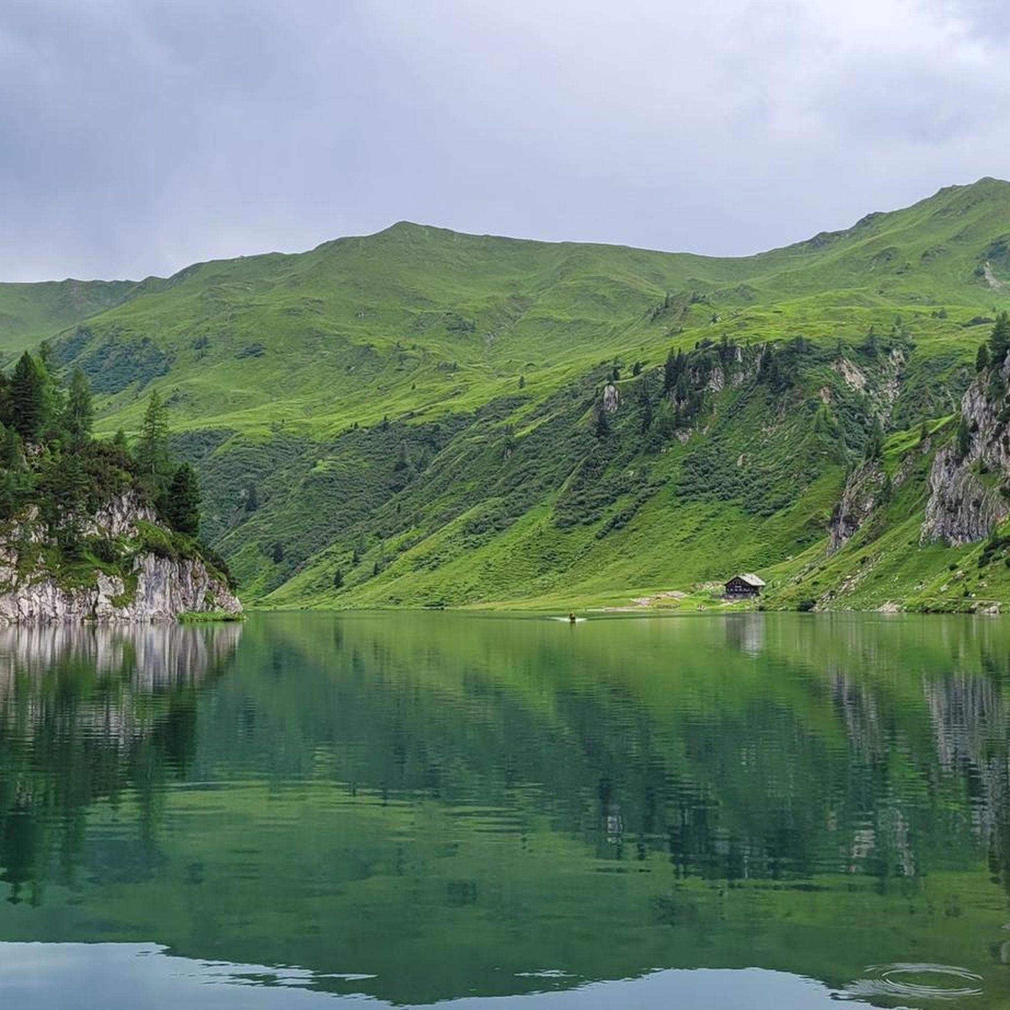
Hiking around Tappenkarsee offers access to one of the largest mountain lakes in the Eastern Alps, situated at 1,762 meters (5,781 feet) in the Radstädter Tauern Mountains. The region is characterized by steep mountain slopes rising to approximately 2400 meters, rugged peaks, and lush alpine meadows. Trails often traverse mixed forests and pass by waterfalls, leading to the lake which is only accessible by foot.
Best hiking trails around Tappenkarsee
- The most popular hiking route is Lake Zauner – Franz-Fischer Hut loop from Gurenstein, a 8.5 miles (13.7 km) difficult trail that takes 6 hours 2 minutes to complete, traversing alpine terrain with expansive views.
- Another top favourite among local hikers is Tappenkarsee Hut – Draugsteintörl loop from Gurenstein, a moderate 4.1 miles (6.6 km) path that leads to a mountain hut and a saddle offering panoramic vistas.
- Local hikers also love the Draugsteintörl – Tappenkarsee Alpine Pasture loop from Gurenstein, a 2.8 miles (4.5 km) trail leading through alpine pastures and offering scenic views, often completed in about 2 hours 4 minutes.
- Hiking around Tappenkarsee is defined by high-alpine mountain lakes, rugged peaks, and verdant alpine meadows. The network offers options for different ability levels, from moderate ascents to more challenging high-altitude routes.
- The routes in Tappenkarsee are highly rated by the komoot community with an average score of 4.8 stars from over 5,000 reviews. More than 27,000 hikers have used komoot to explore Tappenkarsee's varied terrain.
Last updated: May 12, 2026
4.9
(10)
78
hikers
13.7km
06:02
760m
760m
Hard hike. Very good fitness required. Mostly accessible paths. Sure-footedness required.
7
hikers
6.62km
02:55
410m
400m
Moderate hike. Good fitness required. Mostly accessible paths. Sure-footedness required.

Sign up for free
5.0
(1)
11
hikers
4.55km
02:05
280m
290m
Moderate hike. Good fitness required. Mostly accessible paths. Sure-footedness required.
11
hikers
8.08km
04:08
610m
600m
Hard hike. Good fitness required. Sure-footedness, sturdy shoes and alpine experience required.
6
hikers
6.24km
02:54
420m
430m
Hard hike. Good fitness required. Sure-footedness, sturdy shoes and alpine experience required.
Get access to more routes and recommendations from other explorers.
Sign up for free
Already have an account?
Our route recommendations are based on thousands of hikes, rides, and runs completed by other people on komoot.
Start today with a free account
Your next adventure awaits.
Login or Signup
Other adventures around Tappenkarsee

Tips from the Community

Very nice view, good surefootedness necessary
0
0

Not really a summit, but there is a summit cross and great views. The Draugsteintörl is definitely worth a detour, for example when climbing up or descending from the Tappenkarseehütte.
1
0
The Tappenkarseehütte is located just above the lake of the same name and is an ÖAV hut. In summer, it's a popular destination, including for overnight stays. We even managed to get a spot in the camp at short notice, but it was completely full. Because it was so crowded, everything felt a bit like a mass processing operation. Unfortunately, we didn't get the famous Kaiserschmarrn in the evening either; it's only available during the day. There are few vegetarian options, and no (posted) mountaineering food.
1
0
I think the view of Lake Tappenkar is beautiful from everywhere.
1
0
The view of Lake Tappenkar from above the Tappenkarseealm is particularly beautiful. The trail up leads to the Draugsteintörl (and further to Großarl) and is steep and exposed in some sections.
1
0


A look that you can't get enough of. After the strenuous climb, the view is pure relaxation.
1
1

Wonderful hiking area. My absolute favorite: the left side of the day Lots of very nice alpine pastures.
0
0
Frequently Asked Questions
How many hiking trails are available around Tappenkarsee?
The Tappenkarsee region offers a wide variety of hiking experiences, with over 170 routes available. These range from moderate ascents through forests and meadows to more challenging high-altitude routes around the lake and surrounding peaks.
What kind of terrain will I encounter on hikes to Tappenkarsee?
Hikers can expect diverse alpine terrain, including winding paths through mixed forests of birch, beech, spruce, and larch, leading to lush alpine meadows. As you ascend, you'll find trails passing impressive waterfalls and navigating steep mountain slopes, culminating in the dramatic cirque surrounding the Tappenkarsee itself.
Are there any circular hiking routes around Tappenkarsee?
Yes, there are several circular routes that allow you to fully experience the area. For example, the Tappenkarsee Hut – Draugsteintörl loop from Gurenstein is a moderate 4.1-mile path that offers panoramic vistas, while the Draugsteintörl – Tappenkarsee Alpine Pasture loop from Gurenstein is a shorter 2.8-mile trail through scenic alpine pastures.
Are the hiking trails around Tappenkarsee suitable for families?
While Tappenkarsee is known for its alpine character, there are options for various fitness levels. Some routes involve significant elevation gain, but families with older children who are accustomed to hiking can enjoy the experience. The presence of mountain huts for rest and refreshments can also make longer hikes more manageable.
Can I bring my dog on the hiking trails in Tappenkarsee?
The Tappenkarsee area is generally dog-friendly, allowing you to enjoy the alpine scenery with your canine companion. However, as it is a nature reserve and an active grazing area for cows, it's essential to keep dogs on a leash, especially when passing livestock, and to clean up after them to preserve the pristine environment.
Are there mountain huts or places to get refreshments along the trails?
Yes, the Tappenkarseealm and Tappenkarseehütte are charming mountain huts located near the lake. They provide excellent opportunities for rest, refreshments, and even overnight stays. These huts are typically staffed from early June to mid/late September, offering a welcoming stop during your hike.
What natural features or landmarks can I see while hiking to Tappenkarsee?
Beyond the stunning Tappenkarsee itself, you'll encounter dramatic peaks, lush alpine meadows, and impressive waterfalls along the trails. The area is also characterized by mixed forests and offers glimpses of glacial formations, hinting at the region's geological history. For those seeking extended views, the Draugsteintörl saddle provides continuously changing vistas of the lake and surrounding mountains.
What is the best time of year to hike in Tappenkarsee?
The best time to hike in Tappenkarsee is generally from early June to mid/late September. During this period, the mountain huts are typically open, and the alpine meadows are particularly vibrant with flora. However, weather conditions can change rapidly in the Alps, so it's always advisable to check forecasts and be prepared for varying conditions.
How can I get to the starting points for hikes to Tappenkarsee?
Common starting points include Jägersee and the Schwabalm car park. A toll road to Schwabalm can significantly shorten the hike, though it's important to check its seasonal opening. While the lake itself is only accessible on foot, these access points provide convenient starting points for your adventure.
What do other hikers enjoy most about Tappenkarsee?
The area is highly rated by the komoot community, with an average score of 4.8 stars from over 5,000 reviews. Hikers frequently praise the breathtaking alpine landscapes, the serene beauty of the Tappenkarsee lake, and the diverse trails that offer a rewarding experience for various skill levels. The presence of welcoming mountain huts and the sense of untouched nature are also often highlighted.
Are there any challenging hikes for experienced trekkers?
Absolutely. For experienced hikers, routes like the Lake Zauner – Franz-Fischer Hut loop from Gurenstein offer a difficult 8.5-mile journey traversing alpine terrain with expansive views and significant elevation changes. Another challenging option is the View from Kreuzeck – Tappenkarsee Hut loop from Gurenstein, which covers 8.1 miles with considerable ascent.
Most popular routes around Tappenkarsee

Get inspired with the komoot mobile app


Explore more
Browse the best Hikes in other regions.
