The best road cycling routes around Wellesley
4.5
(19)
488
riders
49
rides
Road cycling around Wellesley is characterized by a network of trails and scenic routes, often incorporating segments of multi-use paths and quiet residential streets. The region features a mix of green spaces, river views along the Charles River, and the picturesque surroundings of Lake Waban, offering varied terrain for cyclists. While some trails are unpaved, many sections are suitable for road bikes, providing access to conservation lands and local landmarks. The town's commitment to preserving natural areas contributes to its…
Last updated: June 28, 2026
5.0
(1)
19
riders
39.0km
01:50
260m
260m
Moderate road ride. Great for any fitness level. Some segments of this route may be unpaved and difficult to ride.
14
riders
26.0km
01:15
110m
110m
Moderate road ride. Great for any fitness level. Some segments of this route may be unpaved and difficult to ride.

Sign up for free
5
riders
Easy road ride. Great for any fitness level. Mostly well-paved surfaces and easy to ride.
9
riders
Moderate road ride. Great for any fitness level. Some segments of this route may be unpaved and difficult to ride.
4
riders
53.0km
02:19
270m
270m
Moderate road ride. Good fitness required. Mostly well-paved surfaces and easy to ride.
Get access to more routes and recommendations from other explorers.
Sign up for free
Already have an account?
Our route recommendations are based on thousands of hikes, rides, and runs completed by other people on komoot.
Start today with a free account
Your next adventure awaits.
Login or Signup

Tips from the Community

The monument does more than just show off old European design. It sits at the center of modern community conversations. As you walk by, you might notice how it serves as a powerful reminder of Canada's complex colonial past. In fact, local groups are working to add new Indigenous artwork nearby to give you a fuller look at the area's diverse history.
0
0
Officially named Otis Little Lake but known by locals simply as the lake at Victoria Park, this man-made gem has been a community hub since 1896.
0
0
Built back in 1896, this rare, iron-and-steel cantilever truss bridge is one of the oldest of its kind in Canada.
1
0

Columbia Lake is a shallow, man-made lake designed as part of a stormwater and wetland system on the University of Waterloo campus. The water is generally still, with large sections of reeds and marsh around the edges rather than open shoreline. It’s not used for swimming or boating, but it attracts plenty of birdlife, especially around the quieter sections. The level can fluctuate depending on rainfall, so it can look different throughout the year.
0
0
This is the north end of RIM Park and the end of the Walter Bean Grand River Trail section, but there’s no parking available here. If you’re planning to walk this route, you’ll need to park at the main RIM Park parking area that is located on Park Road. It’s a common point of confusion, so it’s worth planning ahead.
0
0
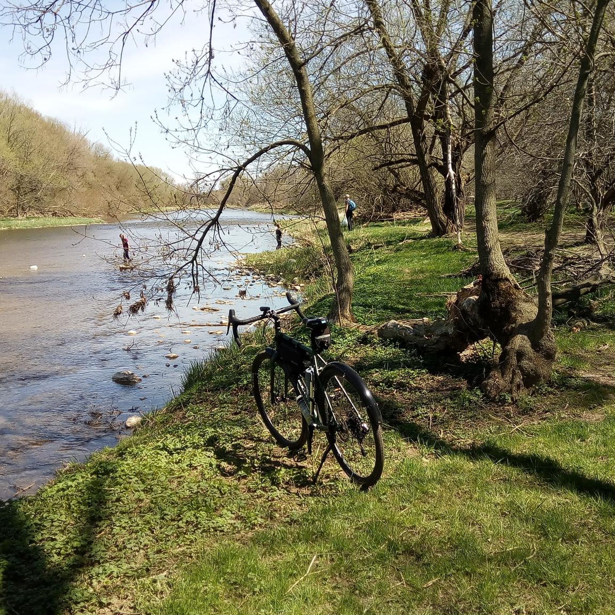
Running alongside the trail, the Grand River is the main backdrop for this entire section. For much of the route, you’re walking right beside the water, with open views in some areas and more filtered glimpses through trees in others. The river moves steadily here, and you’ll often see birds along the banks or on the water. It’s part of a much larger river system that flows south across the region toward Lake Erie, adding a quiet sense of scale to an otherwise easy, local walk.
0
0
This section of the Walter Bean Grand River Trail follows a wide, easy path alongside the Grand River, making it more of a relaxed walk or run than a traditional hike. The trail is mostly flat, with a mix of paved and gravel surfaces, and stays close to the water for much of the route. You’ll move between open parkland and shaded sections through trees, with occasional views of the river. It’s part of a much longer trail system that runs through the region, but this stretch is especially accessible and easy to follow.
0
0
Often called the “jewel of the city,” Waterloo Park blends natural trails, open lawns and multi-use pathways with an impressive mix of facilities for all ages and interests. The park features three paved trail systems (including the Iron Horse and Trans-Canada trails) for walkers, runners and cyclists. The park also features sports fields, a skate park, and a summer splash pad. Families and nature lovers can explore Silver Lake’s boardwalk, Victorian-style gardens, picnic shelters, and the city’s oldest log schoolhouse tucked into the green space.Whether you’re here for a short neighbourhood walk, a scenic bike ride, an energetic skate session or a relaxed picnic by the lake, Waterloo Park delivers something for everyone in a lush, urban-forest setting.
0
0
Frequently Asked Questions
How many road cycling routes are available around Wellesley?
Komoot offers over 50 road cycling routes around Wellesley, catering to various skill levels. You'll find a diverse selection, from easy loops to more challenging rides with moderate elevation changes.
What are the typical difficulty levels for road cycling routes in Wellesley?
The routes around Wellesley offer a good mix of challenges. You'll find 11 easy routes, 38 moderate routes, and 1 difficult route, ensuring options for beginners and experienced cyclists alike. For example, the West Montrose Covered Bridge loop from University of Waterloo is a moderate ride with over 1,200 feet of elevation gain.
What kind of terrain can I expect on Wellesley's road cycling routes?
Wellesley's road cycling routes feature a compelling mix of well-maintained infrastructure and natural beauty. You'll encounter segments of multi-use paths, quiet residential streets, and hard-packed dirt trails suitable for road bikes. The area is known for its green spaces, river views along the Charles River, and the picturesque surroundings of Lake Waban.
Are there any scenic viewpoints or natural features to look out for on road cycling routes?
Absolutely. Wellesley offers numerous scenic spots. You can enjoy views along the Charles River, particularly on sections of the Charles River Path. The residential streets surrounding Lake Waban on the Wellesley College campus also provide lovely water and campus views. Additionally, the town's extensive trail network, including parts of the Crosstown Trail and Sudbury Path, winds through conservation lands and offers a pleasant natural environment.
What do other road cyclists enjoy most about cycling in Wellesley?
The road cycling routes in Wellesley are highly rated by the komoot community, with an average score of 4.5 stars from over 10 reviews. Cyclists often praise the varied terrain, accessible green spaces, and the network of trails that allow for diverse riding experiences.
Are there any family-friendly road cycling options in Wellesley?
Yes, Wellesley has several options suitable for families. The Upper Falls Greenway, though short, is a car-free, stone dust linear park that offers a safe and pleasant ride. Many of the town's multi-use trails, particularly the paved or hard-packed sections, are also suitable for family outings. The town's commitment to the Complete Streets program aims to increase bike lanes, further enhancing safety for all riders.
Can I incorporate iconic landmarks into my road cycling routes in Wellesley?
For an iconic experience, you can cycle a segment of the Boston Marathon route, as Wellesley marks its halfway point. While the path directly around Lake Waban is not ideal for bikes, the surrounding campus and residential streets offer scenic views of Wellesley College, recognized for its beautiful landscape. You might also pass by highlights such as Waterloo Park or the Grand River Trail.
Are there any circular road cycling routes in Wellesley?
Yes, many of the routes around Wellesley are designed as loops, allowing you to start and end in the same location. For example, the Columbia Forest – Forest Path loop from University of Waterloo is a popular moderate circular route, and the Waterloo Park – Flower Garden with Fountain loop from University of Waterloo also offers a circular experience.
What are the best times of year for road cycling in Wellesley?
Wellesley offers enjoyable road cycling for much of the year. Spring and fall provide pleasant temperatures and beautiful scenery. Summer is also great, though you might prefer earlier morning or late afternoon rides to avoid the midday heat. Winter cycling is possible, but conditions will depend on snow and ice, so checking local weather is advisable.
Where can I find parking for road cycling routes in Wellesley?
Wellesley provides convenient access for cyclists. Bike racks are available at various town destinations. For specific trailheads or starting points, you'll often find public parking nearby. The Wellesley Police Department also offers a bike repair station and pump, which can be a useful starting or ending point.
Are there any facilities or places to stop for refreshments along the routes?
Wellesley's 'human scale' layout means you're often close to amenities. The Crosstown Trail, for instance, passes through the downtown area, offering access to cafes and shops. The Upper Falls Greenway also connects to commercial areas. You can plan your route to include stops at local cafes or explore the town's offerings. For example, the Waterloo Park – City Cafe Bakery loop from Farmer's Market specifically highlights a cafe stop.
Can I reach Wellesley's cycling paths using public transport?
Wellesley is accessible by public transport, which can help you reach various starting points for cycling routes. The town has commuter rail service, and local bus routes can connect you to different parts of the trail network. It's advisable to check specific public transport schedules and bike policies for the most up-to-date information.
Most popular routes around Wellesley
Most popular attractions around Wellesley

Get inspired with the komoot mobile app


Explore more
Browse the best Road cycling routes in other regions.
