The best walks and hikes around Wellesley
4.7
(11)
231
hikers
29
hikes
Hiking around Wellesley, Massachusetts, offers diverse landscapes with over 25 miles of wooded trails, conservation lands, and waterways. The terrain features unique glacial formations like erratics and eskers, alongside hills such as Maugus Hill. Waterways like the Charles River, Morses Pond, and Rockridge Pond enhance the natural beauty, providing varied environments for exploration.
Best hiking trails around Wellesley
- The most popular hiking route is Columbia Forest loop via Geo-Time Trail — Waterloo, an easy 2.7 miles (4.4 km) trail…
Last updated: August 17, 2026
5.0
(2)
24
hikers
4.38km
01:10
50m
50m
Easy hike. Great for any fitness level. Easily-accessible paths. Suitable for all skill levels.
3.0
(1)
10
hikers
4.53km
01:10
30m
30m
Easy hike. Great for any fitness level. Easily-accessible paths. Suitable for all skill levels.

Sign up for free
2
hikers
4.35km
01:10
60m
60m
Easy hike. Great for any fitness level. Easily-accessible paths. Suitable for all skill levels.
1
hikers
3.88km
01:03
50m
50m
Easy hike. Great for any fitness level. Easily-accessible paths. Suitable for all skill levels.
31.1km
07:55
80m
80m
Hard hike. Very good fitness required. Easily-accessible paths. Suitable for all skill levels.
Get access to more routes and recommendations from other explorers.
Sign up for free
Already have an account?
Our route recommendations are based on thousands of hikes, rides, and runs completed by other people on komoot.
Start today with a free account
Your next adventure awaits.
Login or Signup

Tips from the Community

This forest trail passes through one of Laurel Creek Conservation Area's woodland habitats, offering a quieter alternative to the nearby reservoir and meadow trails. The dense canopy provides shade through much of the route, while seasonal changes make this section particularly attractive in autumn when the leaves begin to change colour.
0
0
This trail passes through one of Laurel Creek Conservation Area's wetland habitats, where shallow water, cattails, and marsh vegetation provide food and shelter for a wide range of wildlife. Wetlands play an important role in filtering water, reducing flooding, and supporting birds, amphibians, and insects. The contrast between open wetland areas and the surrounding forest makes this one of the most ecologically diverse sections of the conservation area.
0
0
This quiet section of Laurel Creek Reservoir offers open views across the water, a contrast to the surrounding forest and meadow trails. The reservoir was created in the 1960s for flood control and water management and is now a popular destination for paddling, birdwatching, and outdoor recreation.
0
0

From here you'll have access to a multitude of trail like Upper Ities, Downtown, The 4 Ities, and A-Line. The are all multi-use trail with some features built for mountain bikers, so keep an eye out for your fellow trail users.
0
0
The West Side Trails are a collection of multi-use trails that run through the Columbia Forest on the west side of Waterloo. You'll find paved and natural surfaces with a little something for all abilitiy levels.
0
0
The Columbia Forest is a wonderful natural escape on the outer edge of Waterloo. There is a robust trail network through the woods that allows hikers, runners, and mountain bikers access to a variety of terrain.
0
0

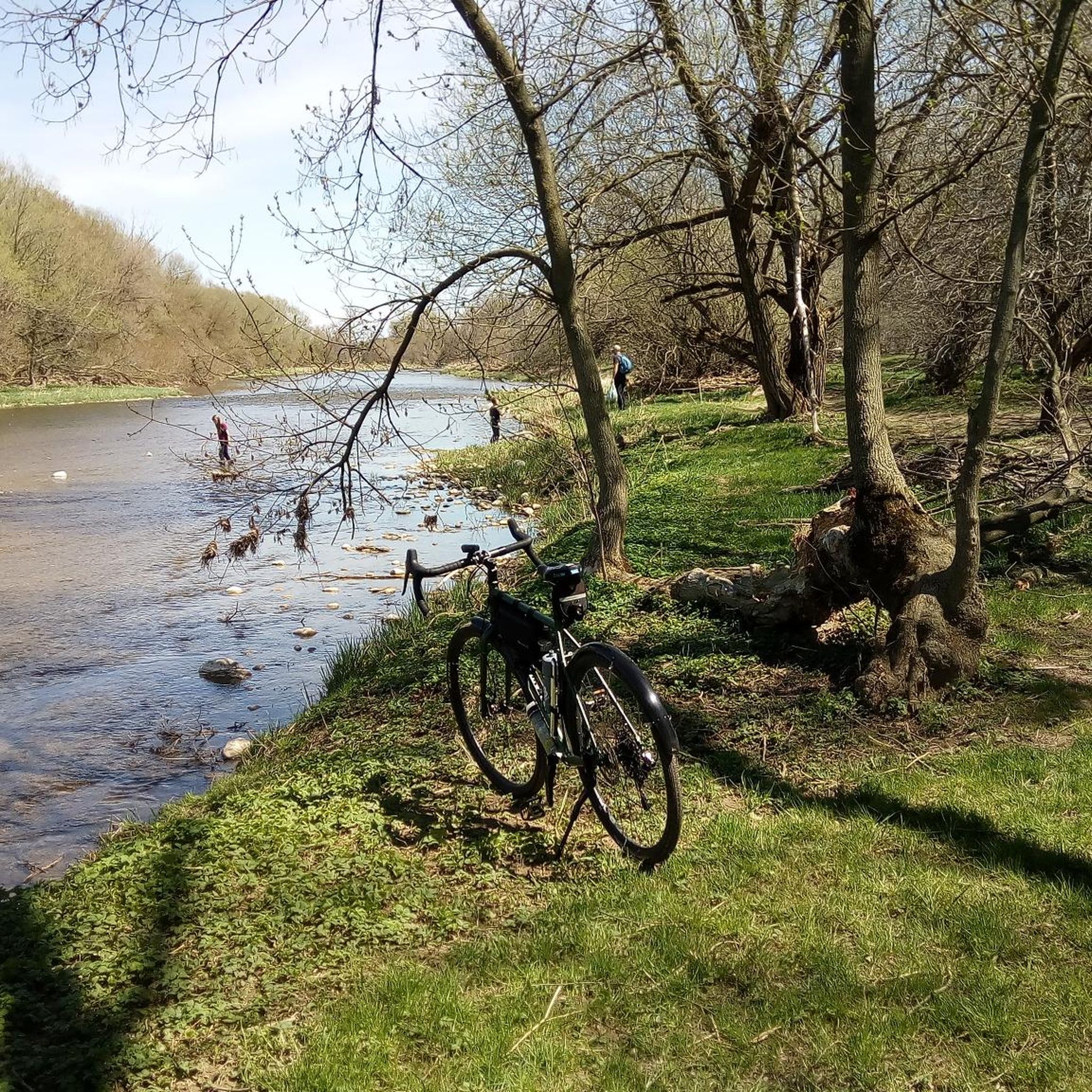
A long, easy rail trail linking small towns and open farm country, great for cycling, running, or a steady walk. The gravel surface is smooth and wide, with big views of fields, barns, and rural stretches. One of the highlights is the series of rest areas along the route, with simple shelters, benches, and little stopping points lovingly maintained by local families and volunteers. The G2G stretches for 132 km, but you can do a short section of it, like this one connecting Wallenstein to Millbank, and stop in Linwood to spend the night.
0
0
A classic country stop in Millbank, known for hearty homemade meals, fresh pies, and warm, small-town hospitality. It’s the kind of place where you come for comfort food, and you find big portions, baked goods made from scratch, and a cozy, down-to-earth atmosphere. A great detour if you’re hiking or biking the G2G Rail Trail and want a home-style meal.
0
0
Frequently Asked Questions
How many hiking trails are available in Wellesley?
Wellesley offers a network of nearly 30 hiking trails, providing diverse options for outdoor enthusiasts. Most of these, about 21 routes, are considered easy, making them accessible for various skill levels.
Are there trails suitable for families with children in Wellesley?
Yes, Wellesley has many family-friendly options. With 21 easy routes, there are plenty of trails suitable for all ages. For example, the Woolwich Dam – Old Railway Bridge loop from St. Jacobs Village is an easy 2.5-mile path that can be completed in about an hour, perfect for a family outing.
What kind of natural features can I expect to see on Wellesley's hiking trails?
Wellesley's trails showcase a variety of natural features, including unique glacial formations like erratics and eskers, rolling hills such as Maugus Hill, and scenic waterways. You'll find trails along the Charles River, Morses Pond, and Rockridge Pond, offering diverse landscapes from woodlands to open meadows.
Are there any circular hiking routes in Wellesley?
Yes, Wellesley features several circular routes. A popular choice is the Laurel Creek Conservation Area loop from Waterloo, an easy 4.1-mile path offering varied scenery. Another option is the Woolwich Reservoir loop from Woolwich Reservoir, which is 4.6 miles long and also considered easy.
What do other hikers enjoy the most about hiking in Wellesley?
The area is highly rated by the komoot community, with an average score of 4.7 stars from over 14 reviews. Hikers often praise the well-maintained trails, the diverse landscapes, and the peaceful atmosphere of Wellesley's conservation lands and waterways.
Are Wellesley's hiking trails dog-friendly?
Many of Wellesley's trails are dog-friendly, though it's always recommended to check specific trail regulations for leash requirements. The town's extensive network of wooded trails and conservation lands provides ample space for you and your canine companion to explore.
What are some notable landmarks or attractions near the hiking trails?
Beyond the trails themselves, you can explore several interesting spots. The Conestogo River Trails and Grand River Trail offer additional scenic walking. For a break, you might visit Waterloo Park or the Kuepfer Family Rest Area. The historic town of Linwood is also nearby.
What is the best time of year to go hiking in Wellesley?
Wellesley offers enjoyable hiking throughout the year. Spring brings lush greenery and blooming wildflowers, while autumn showcases vibrant fall foliage. Summer is ideal for longer days, and even winter hiking can be beautiful, especially after a fresh snowfall, though some trails might be icy.
Are there any challenging hiking routes in Wellesley?
While most trails in Wellesley are easy or moderate, there are a few more challenging options for experienced hikers. For instance, the Kissing Bridge Trailway is a difficult 19.3-mile route, offering a longer and more demanding experience.
Where can I find information about parking and public transport for Wellesley's trails?
Information regarding parking locations and public transport access for specific trailheads can often be found on the Wellesley town website. You can check resources like Wellesley's Favorite Trail Walks or Maps, Guides & Descriptions for detailed access information.
What is the average length and duration of hikes in Wellesley?
The length and duration of hikes in Wellesley vary widely. Many easy trails, like the Columbia Forest loop via Geo-Time Trail — Waterloo, are around 2.7 miles and take about 1 hour 10 minutes. However, longer routes like the 19.3-mile Kissing Bridge Trailway can take several hours to complete.
Most popular attractions around Wellesley

Get inspired with the komoot mobile app


Explore more
Browse the best Hikes in other regions.
