The best road cycling routes around Brant
33
riders
9
rides
Road cycling routes around Brant traverse diverse landscapes, including the picturesque Grand River Valley and portions of the Carolinian Forest. The region features an interconnected trail system, offering both paved and unpaved surfaces suitable for various cycling preferences. Riders can expect to encounter rolling farmland and scenic river views, with routes often following the Grand and Nith Rivers. The terrain generally includes gentle gradients and some rolling hills, providing options for different skill levels.
Best road cycling routes around Brant
…Last updated: June 28, 2026
8
riders
Moderate road ride. Good fitness required. Some segments of this route may be unpaved and difficult to ride.
2
riders
52.6km
02:14
240m
240m
Moderate road ride. Good fitness required. Some segments of this route may be unpaved and difficult to ride.

Sign up for free
4
riders
19.7km
00:48
110m
110m
Easy road ride. Great for any fitness level. Mostly well-paved surfaces and easy to ride.
5
riders
76.0km
03:18
390m
390m
Moderate road ride. Good fitness required. Some segments of this route may be unpaved and difficult to ride.
2
riders
15.9km
00:45
130m
130m
Easy road ride. Great for any fitness level. Mostly well-paved surfaces and easy to ride.
Get access to more routes and recommendations from other explorers.
Sign up for free
Already have an account?
Our route recommendations are based on thousands of hikes, rides, and runs completed by other people on komoot.
Start today with a free account
Your next adventure awaits.
Login or Signup
Tips from the Community

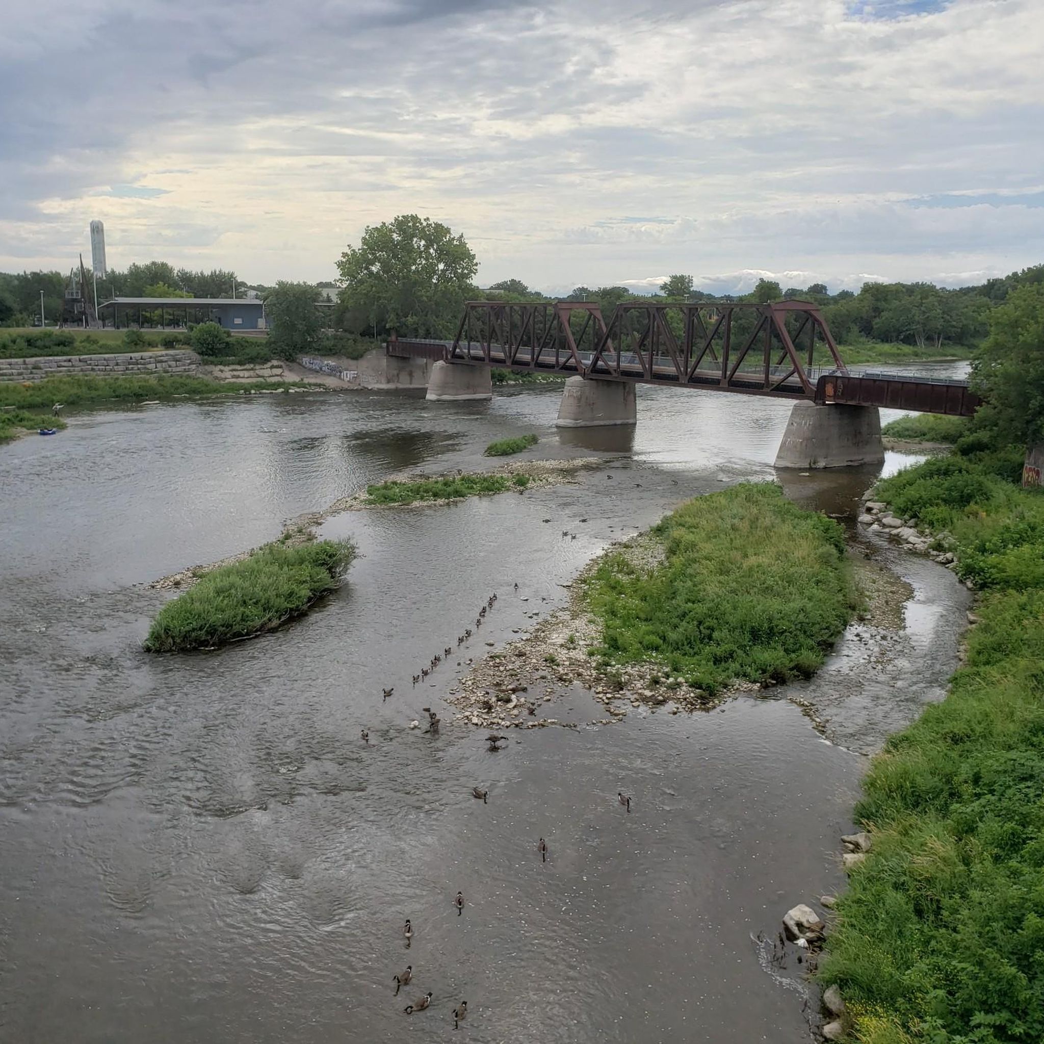
Just a few meters past where the Grand Trunk Trail meets the Walter Bean Grand River Trail is a concrete viewing platform with a metal guard. There are fantastic views over the Grand River and interpretive signage about the railway, the bridge, and the rivers' history. It's a scenic and educational stop.
0
0

Moffat's Creek is a small tributary of the Grand River that flows through south Cambridge. Much of its final run is paralleled by the Moffat's Creek Trail, so you enjoy a peaceful creekside excursion as it makes its way to its confluence with the river.
0
0

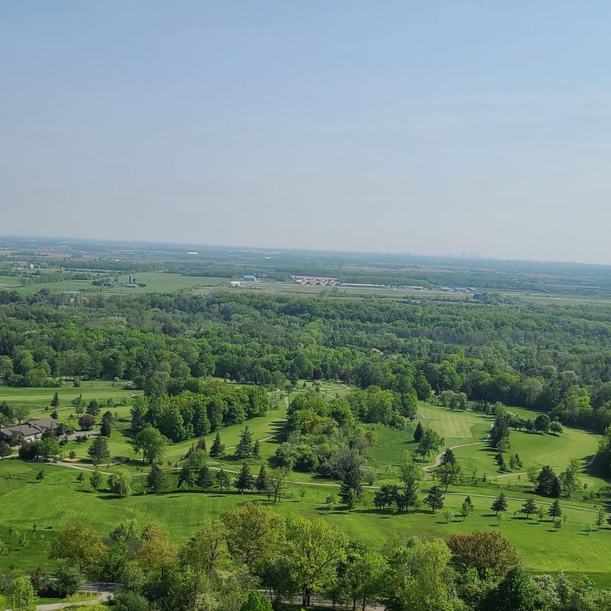
You will notice the landscape shifts quickly from open farmer's fields to a deep, shaded forest that sits right on the edge of the Dundas Valley. The trail is a perfectly flat, crushed-stone surface that cuts through a nice "green corridor" of dense trees.
0
0
Brantford Rail Bridge, or Brant's Crossing Bridge, is a pedestrian bridge that was once a railway line. The bridge has two trusses, but they are not exactly identical in construction, making it unique. There are great views over the Grand River, and it's a safe place to spot wildlife like beavers and birds.
0
0

The Grand River runs through Cambridge, creating a green corridor along its banks, with the Grand Trunk Trail running alongside it, a paved path with viewpoints and benches along the way. From here, you can access the Devil’s Creek Trail.
0
0

Recreation area with trails & fishing, sports fields, lookouts & eagle sightings. Sits on nice flat partially pawed railroad trail
0
0
Frequently Asked Questions
What kind of terrain can I expect on road cycling routes in Brant?
Road cycling in Brant offers a diverse landscape. You'll find routes traversing the picturesque Grand River Valley, with many trails running alongside the Grand and Nith Rivers. The region also features portions of the Carolinian Forest, providing lush, forested backdrops, and extensive rolling farmland. The terrain generally includes gentle gradients and some rolling hills, catering to various skill levels.
How many road cycling routes are available in Brant?
There are over 10 road cycling routes around Brant featured in this guide, offering options for both easy and moderate ability levels. More than 30 road cyclists have already explored Brant's varied terrain using komoot.
Are there easy road cycling routes suitable for beginners in Brant?
Yes, Brant offers several easy road cycling routes perfect for beginners. For instance, the Branchton Pond loop from Cornerstone Community Church is an easy 12.2 miles (19.7 km) path featuring gentle gradients around Branchton Pond, ideal for a shorter ride. Another easy option is the Cowan's Lake loop from Cambridge, which is 15.9 km long.
Are there longer road cycling routes for experienced riders in Brant?
Absolutely. For more experienced riders looking for longer distances, Brant has several moderate routes. The Sydenham Descent – Wilson Street Climb loop from Shaver is a challenging 104.7 km route with significant elevation gain. Another great option is the Grand River – Devil’s Creek Trail loop from Glenview Park Secondary School, a 72.0 km moderate trail offering extensive views along the Grand River.
What is the best time of year for road cycling in Brant?
The best time for road cycling in Brant is typically from spring through fall. During these seasons, the weather is generally pleasant, and the scenic views of the Grand River Valley, Carolinian Forests, and farmlands are at their most vibrant. While some trails are paved, others are stone-dust, so checking local conditions is always recommended, especially after rain or in early spring.
Are there any scenic viewpoints or landmarks along the road cycling routes in Brant?
Yes, many routes in Brant offer scenic viewpoints and pass by notable landmarks. You can cycle through areas with views of the Grand and Nith Rivers, and the Carolinian Forest. Specific points of interest include Paris, Ontario, known for its charm, and Wilkes Dam. The SC Johnson Rail Trail Along the Nith River also provides beautiful river views.
Are there loop road cycling trails in Brant?
Yes, many of the road cycling routes in Brant are designed as loops, allowing you to start and end at the same point. Examples include the Grand River – Devil’s Creek Trail loop from Glenview Park Secondary School and the Wilkes Dam loop from Brantford. The region also features dedicated road cycling loops like the 50 km Paris–Scotland Loop and the 18 km Paris/Falkland Loop.
Where can I find parking access points for road cycling trails in Brant?
Brant offers numerous parking access points for its extensive trail system. Many rail trails, such as the Hamilton to Brantford Rail Trail and the Cambridge to Paris Rail Trail, have designated parking areas at various access points. Major towns like Brantford and Paris also provide convenient parking options near trailheads.
Are there family-friendly road biking options in Brant?
Brant is very family-friendly for cycling, especially on its multi-use rail trails. These trails, like the Cambridge to Paris Rail Trail and the SC Johnson Trail, are mostly flat with stone-dust or asphalt surfaces, making them suitable for various types of bikes and riders of all ages. The Branchton Pond loop from Cornerstone Community Church is also an easy option for families.
Can I find cafes, pubs, or accommodation near cycling trails in Brant?
Yes, the region supports cyclists with bicycle-friendly businesses, particularly in Brantford and Paris. You'll find various cafes, pubs, and accommodation options in these towns, which are often located conveniently near trail access points. The 'Grand Trails' organization also provides self-guided itineraries that highlight local businesses and points of interest.
What is the Gordon Glaves Grand River Loop Trail?
The Gordon Glaves Grand River Loop Trail is a 15 km off-road trail located in Brantford. It features both paved and stone-dust sections and runs along the scenic Grand River, offering a great option for a varied cycling experience within the city.
Are there any rail trails suitable for road cycling in Brant?
Yes, Brant is known for its impressive rail trail network, many of which are suitable for road cycling, especially those with paved or well-maintained stone-dust surfaces. Notable examples include the Hamilton to Brantford Rail Trail, the Cambridge to Paris Rail Trail, and the SC Johnson Trail. These trails offer mostly flat routes through scenic landscapes.
What makes Brant a 'Hub of Ontario Trails'?
Brant is considered a 'Hub of Ontario Trails' due to its extensive and interconnected trail system, boasting over 90 kilometers of trails. This network links various multi-use rail trails and dedicated cycling routes, allowing for seamless transitions and broader exploration across the region's diverse landscapes.
Most popular attractions around Brant

Get inspired with the komoot mobile app


Explore more
Browse the best Road cycling routes in other regions.
