The best walks and hikes around Area F (Grindrod/Ashton Creek/Mabel Lake)
4.6
(77)
520
hikers
18
hikes
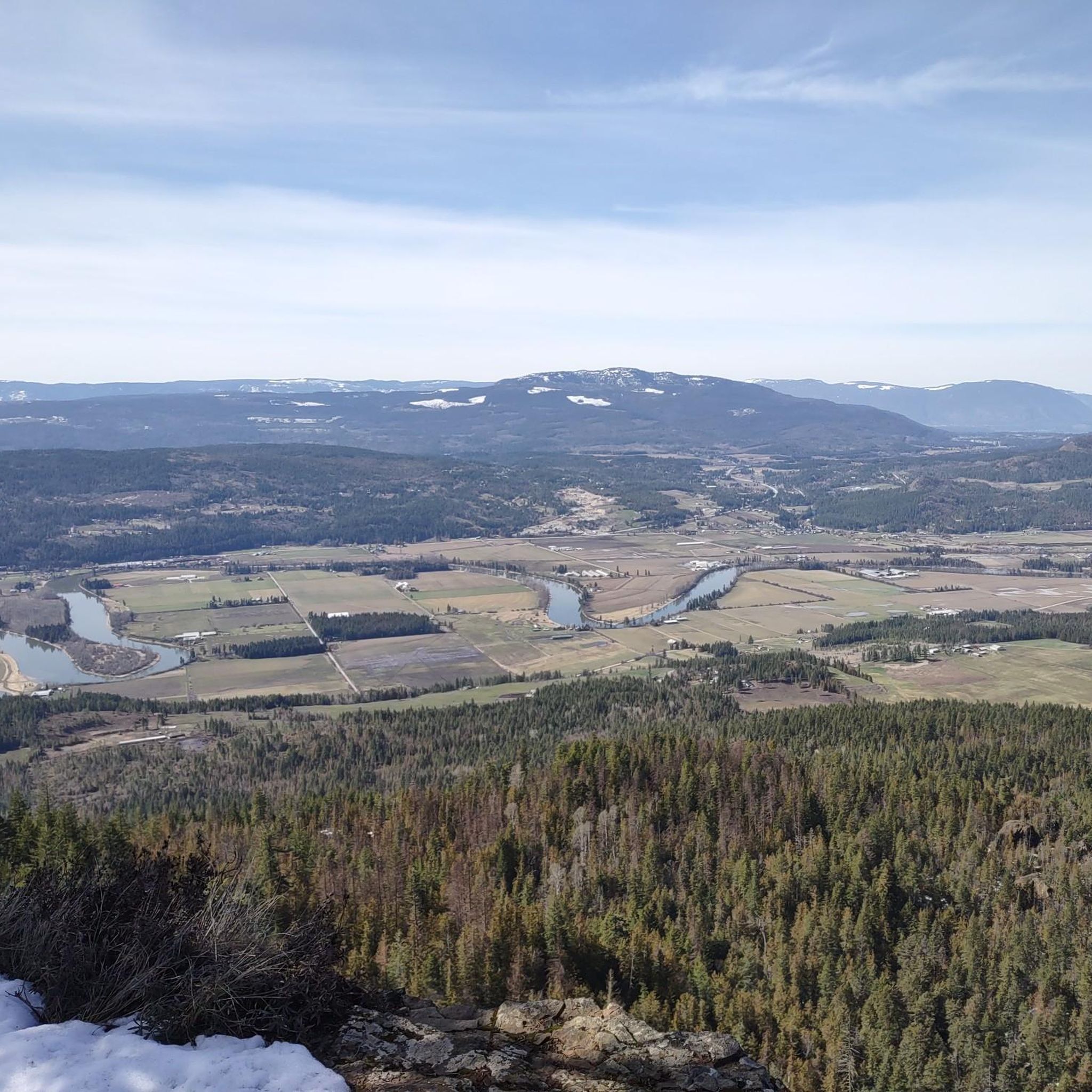
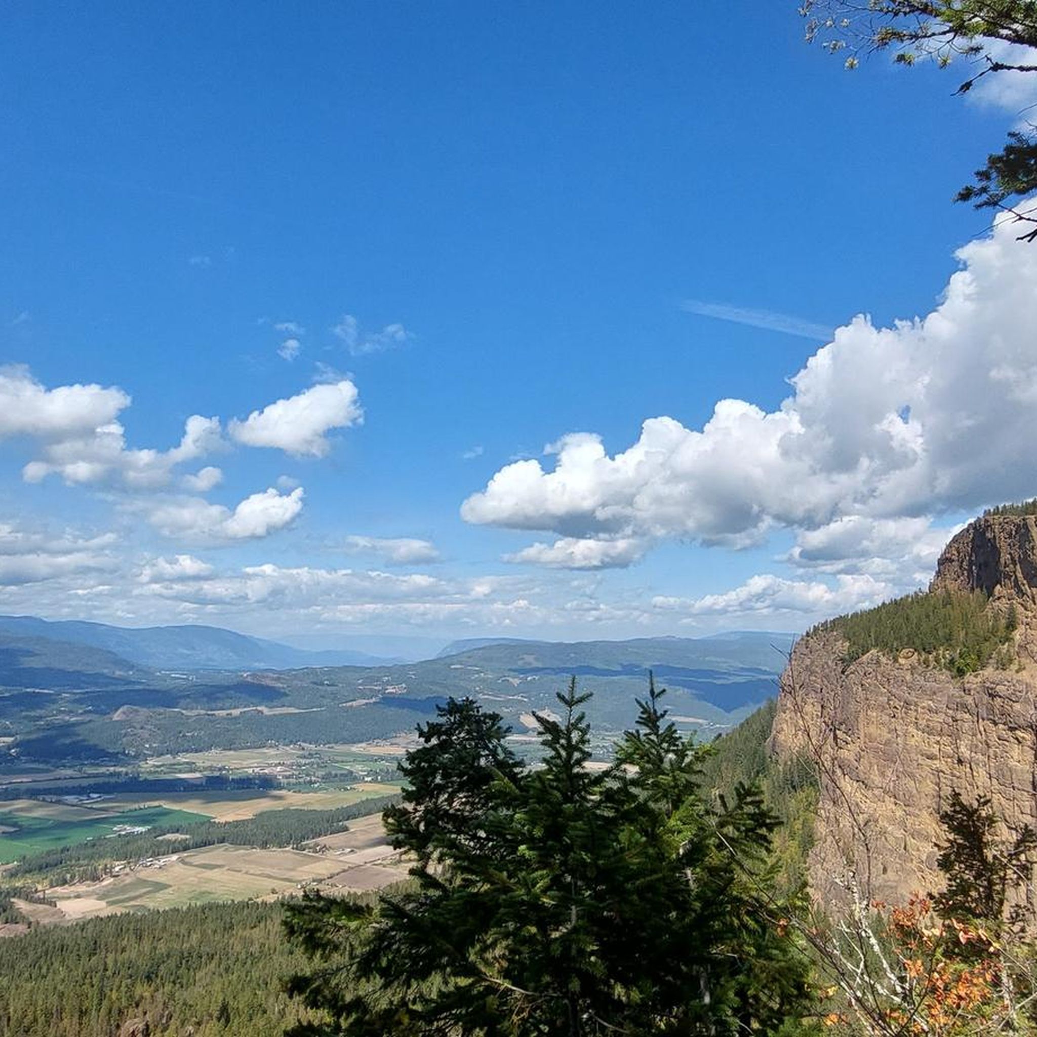
Hiking around Area F (Grindrod/Ashton Creek/Mabel Lake) offers diverse terrain, from lush forests to lakefront paths and elevated viewpoints. The region is characterized by the meandering Shuswap River Valley, the expansive Mabel Lake, and the prominent Enderby Cliffs. Hikers can explore environments ranging from moss-carpeted old-growth forests to open bluffs providing panoramic views of the surrounding valleys and distant mountains. This area provides a blend of natural features suitable for various hiking experiences.
Best hiking trails around Area F (Grindrod/Ashton…
Last updated: July 1, 2026
4.9
(8)
44
hikers
5.18km
01:42
230m
220m
Easy hike. Great for any fitness level. Easily-accessible paths. Suitable for all skill levels.
5.0
(3)
18
hikers
16.8km
08:31
2,000m
2,000m
Hike the difficult Mount Begbie Trail, a 10.4-mile route with 6556 feet of elevation gain, offering alpine views near Revelstoke.

Sign up for free
4.0
(1)
11
hikers
5.99km
01:33
30m
30m
Easy hike. Great for any fitness level. Easily-accessible paths. Suitable for all skill levels.
5.0
(2)
6
hikers
926m
00:20
60m
60m
Easy hike. Great for any fitness level. Easily-accessible paths. Suitable for all skill levels.
1
hikers
8.72km
03:57
840m
840m
Moderate hike. Good fitness required. Easily-accessible paths. Suitable for all skill levels.
Get access to more routes and recommendations from other explorers.
Sign up for free
Already have an account?
Our route recommendations are based on thousands of hikes, rides, and runs completed by other people on komoot.
Start today with a free account
Your next adventure awaits.
Login or Signup
Popular around Area F (Grindrod/Ashton Creek/Mabel Lake)
Tips from the Community

Reinecker Creek tumbles through a narrow forested canyon on its way to Margaret Falls, carving through the rock that gives this trail its dramatic scenery. The creek flows year-round, with spring snowmelt and periods of heavy rain creating particularly impressive cascades and fast-moving water. Moss-covered boulders, cedar trees, and the constant sound of rushing water make the creek a defining feature of the Margaret Falls Trail.
0
0
This short forest trail follows Reinecker Creek through a lush canyon of moss-covered rock walls and towering cedars. Wooden bridges and boardwalks help navigate the damp terrain, while the sound of rushing water accompanies much of the walk. The route's most distinctive feature is a natural rock passage near the end of the trail, just before reaching Margaret Falls.
0
0
Parking for the western approach is along rough forestry roads leading toward the trailhead, with a few informal pull offs used by hikers near the upper access road. The drive in is part of the adventure here — expect rocky sections, deep ruts and potholes, especially after rain or snowmelt. Lower clearance vehicles will likely struggle on the final stretch.
0
0
The western approach to Joss Mountain follows a long climb through dense forest, old forestry roads and alpine ridgelines before reaching the historic fire lookout at the summit. As elevation is gained, the terrain becomes rockier and more exposed, with wide views opening across the Monashee Mountains and surrounding backcountry lakes. The route is physically demanding, with rough access roads, sustained elevation gain and lingering snow possible well into summer at higher elevations.
0
0
At 2,362 metres, the summit of Joss Mountain is topped by a historic fire lookout originally built in 1921 to help protect timber within the Railway Belt from wildfires. The small square shelter, with windows facing in every direction, still stands near the summit and was restored in the early 2000s after years of abandonment. From the lookout, views stretch across the Monashee Mountains, Blanket Glacier, alpine lakes and surrounding wilderness, making it one of the most expansive viewpoints in the region.
0
0

This wide trail follows along the shoreline of Shuswap Lake across boardwalks and through parklands. You'll pass by a viewing platform, benches, and picnic areas which will all invite you to stop for a while to enjoy the stunning views across the water.
0
0

Shuswap Lake, which has over 400 kilometers of navigable coastline, is home to several species of salmonids, such as chinook salmon, coho salmon, sockeye salmon, rainbow trout, and lake trout. These fish are of great importance for recreational fishing in the area.
0
0

From a viewing platform at the end of the trail, you can take in the majesty of the 90-foot, two-step Margaret Falls.
0
0
Frequently Asked Questions
How many hiking trails are available in Area F (Grindrod/Ashton Creek/Mabel Lake)?
There are over 10 hiking routes available in Area F (Grindrod/Ashton Creek/Mabel Lake) for you to explore. These trails offer diverse terrain, from lush forests to lakefront paths and elevated viewpoints.
What is the best time of year to go hiking in the Mabel Lake area?
The best time for hiking in the Mabel Lake area is generally from spring through autumn. During these seasons, trails are typically clear of snow, and the weather is pleasant for exploring the diverse landscapes. Always check local conditions, especially for higher elevation trails like the Enderby Cliffs, as conditions can vary.
Are there any waterfalls to see along the hiking trails in Area F?
Yes, the region features stunning waterfalls. You can visit Margaret Falls, a beautiful two-step cascade accessible via a viewing platform. Another notable waterfall is Cascade Falls, known for its thundering waters.
What kind of viewpoints can I expect on hikes in this region?
Many trails in Area F lead to rewarding viewpoints. For instance, the Mount Rose-Swanson Trails offer climbs through shaded forests to breezy bluffs with panoramic views of rolling farmland, forested hills, and distant lakes. The Tower Lookout provides clear vistas over the valley, and the Enderby Cliffs offer breathtaking views of the Shuswap Valley, Otter Lake, Swan Lake, and distant Okanagan Lake.
Are there family-friendly hiking options in Area F?
Yes, there are several family-friendly options. The Mabel Lake Provincial Park features a short, self-guided "Changing Rainforest" interpretive trail, a gentle 1 km loop through a moss-carpeted forest. The Margaret Falls loop is another accessible option, offering a pleasant walk to a beautiful waterfall.
Are dogs allowed on hiking trails in Area F?
Dog policies vary by specific trail and park. While some trails may be dog-friendly, it's always best to check the regulations for individual parks or protected areas, such as Mabel Lake Provincial Park or Enderby Cliffs Provincial Park, before bringing your dog. Always keep dogs on a leash and clean up after them.
What are the typical difficulty levels of hikes in Area F?
Area F offers a range of difficulty levels. You'll find easy, gentle interpretive trails like the Changing Rainforest trail at Mabel Lake Provincial Park, as well as moderate routes such as the Mount Rose Swanson Trail. For more challenging experiences, the Enderby Cliffs Trail is a demanding 10 km hike, and Monashee Provincial Park offers rugged, longer ascents.
What natural features make hiking in Area F unique?
The region is characterized by its diverse natural beauty. You'll encounter lush forests of hemlock, red cedar, and birch, the expansive Mabel Lake with its sandy beaches, and the meandering Shuswap River Valley. The towering Enderby Cliffs and unique columnar basalt formations at Aberdeen Columns also add to the distinctive landscape.
Are there circular hiking routes available in Area F?
Yes, several trails offer circular routes, allowing you to experience varied scenery without retracing your steps. An example is the Margaret Falls loop, which provides a pleasant circular walk through a shaded forest to the waterfall.
What do other hikers enjoy most about the trails in Area F?
The trails in Area F are highly rated by the komoot community, with an average score of 4.5 stars. Hikers often praise the diverse terrain, from serene forest paths to rewarding viewpoints overlooking valleys and lakes. The opportunity to encounter wildlife and the peaceful escape offered by the natural settings are also frequently highlighted.
Is public transport available to reach trailheads in Area F?
Public transport options directly to many trailheads in Area F are limited. It is generally recommended to have private transportation to access the more remote hiking areas and provincial parks within the region.
Are there any specific geological formations to look out for?
Yes, the Aberdeen Columns are a notable geological feature, presenting unique formations of steep columnar basalt. These are not only interesting to observe but are also popular for rock climbing.
Most popular routes around Area F (Grindrod/Ashton Creek/Mabel Lake)
Most popular attractions around Area F (Grindrod/Ashton Creek/Mabel Lake)

Get inspired with the komoot mobile app


Explore more
Browse the best Hikes in other regions.
