The best walks and hikes around Area C (Pemberton Valley/Mount Currie/D'Arcy)
4.5
(1184)
11,057
hikers
159
hikes
Hiking around Area C (Pemberton Valley/Mount Currie/D'Arcy) offers a diverse landscape characterized by a wide valley framed by mountains, glacier-capped peaks, and dense old-growth forests. Dominant features include the 8,000-foot (2,591 m) Mount Currie and numerous lakes such as Birkenhead, Anderson, and Lillooet. The region also features significant rivers like the Birkenhead and Lillooet, along with natural attractions like Nairn Falls Provincial Park. This varied terrain provides a range of hiking experiences from valley floors to alpine environments.
Best hiking trails around Area C (Pemberton Valley/Mount Currie/D'Arcy)
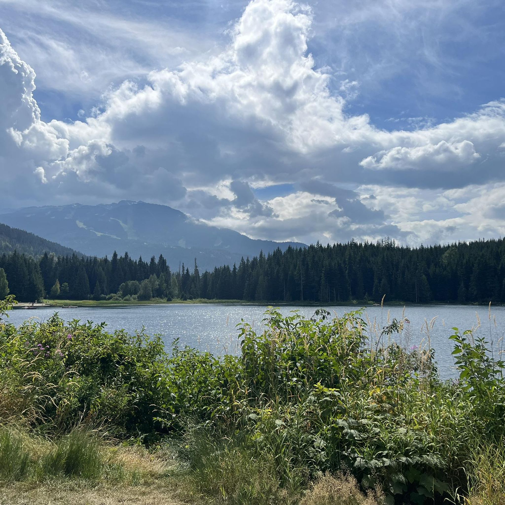
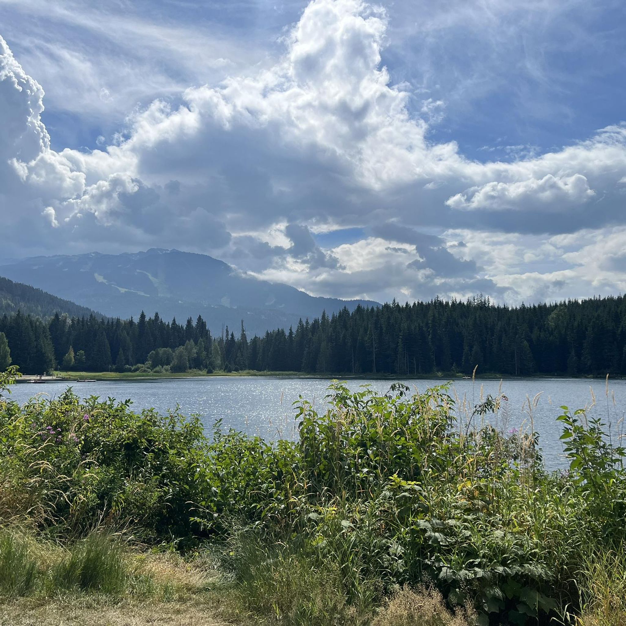
- The most popular hiking route is Lost Lake loop — Whistler, a 2.8 miles (4.5 km) trail that takes 1 hour 10 minutes to complete. This easy loop offers scenic views around Lost Lake.
- Another top favourite among local hikers is Riverside & Farside to Cheakamus River Suspension Bridge loop, an easy 3.2 miles (5.2 km) path. This route features riverside scenery and leads to a suspension bridge.
- Local hikers also love the Semaphore Lakes Trail, a 3.8 miles (6.0 km) trail leading through woodlands to alpine lakes, often completed in about 2 hours 37 minutes.
- Hiking around Area C (Pemberton Valley/Mount Currie/D'Arcy) is defined by glacier-capped peaks, clear lakes, and old-growth forests. The network offers options for easy walks, moderate ascents, and challenging alpine trails.
- The routes in Area C (Pemberton Valley/Mount Currie/D'Arcy) are highly rated by the komoot community with an average score of 4.6 stars from over 850 reviews. More than 7,300 hikers have used komoot to explore Area C (Pemberton Valley/Mount Currie/D'Arcy)'s varied terrain.
Last updated: August 22, 2026
4.9
(40)
362
hikers
4.45km
01:11
40m
40m
Easy hike. Great for any fitness level. Easily-accessible paths. Suitable for all skill levels.
4.5
(27)
180
hikers
5.22km
01:25
70m
70m
Easy hike. Great for any fitness level. Easily-accessible paths. Suitable for all skill levels.

Sign up for free
4.7
(16)
137
hikers
16.3km
05:49
890m
890m
Hard hike. Very good fitness required. Mostly accessible paths. Sure-footedness required.
4.6
(12)
41
hikers
6.78km
01:51
110m
110m
Easy hike. Great for any fitness level. Easily-accessible paths. Suitable for all skill levels.
66
hikers
6.04km
02:37
350m
350m
Hike the moderate 3.8-mile Semaphore Lakes Trail to discover serene alpine lakes, towering peaks, and beautiful meadows north of Pemberton,
Get access to more routes and recommendations from other explorers.
Sign up for free
Already have an account?
Our route recommendations are based on thousands of hikes, rides, and runs completed by other people on komoot.
Start today with a free account
Your next adventure awaits.
Login or Signup
Popular around Area C (Pemberton Valley/Mount Currie/D'Arcy)

Pacific charm and peak happiness in British Columbia

Forests, desert, wilderness - day tours in British Columbia

Breathtaking British Columbia — hikes near Squamish & Whistler

Vancouver roundtrip — Bikepacking British Columbia

MTB Road Trip Sea-to-Sky – dream trails in British Columbia
Cycling around Area C (Pemberton Valley/Mount Currie/D'Arcy)
MTB Trails around Area C (Pemberton Valley/Mount Currie/D'Arcy)
Running Trails around Area C (Pemberton Valley/Mount Currie/D'Arcy)
Road Cycling Routes around Area C (Pemberton Valley/Mount Currie/D'Arcy)
Other adventures around Area C (Pemberton Valley/Mount Currie/D'Arcy)


Tips from the Community

Lost Lake Beach is part of Lost Lake Park, with a sandy beach bordered by a grassy lawn. Swimming is allowed, but it will be refreshing! Other amenities the park has to offer include picnic areas, BBQs, and restrooms as well as a parking area.
1
0

Centennial Trail is a picturesque multi-use path that winds through a forested landscape and is a mix of gravel and natural surfaces. As it meanders through areas of varying tree density, it offers a peaceful escape and is a lovely contrast to some of the other crowded trails.
0
0
Memorial Rock has become an informal place of remembrance. There are often flowers, handwritten notes, and painted stones left in memory of loved ones. Please enjoy this unofficial area peacefully and respectfully, as it is important to the community.
1
0
Don MacLaurin's Crossing, more widely known as the Cheakamus River Suspension Bridge, is a pedestrian bridge spanning the turquoise waters of the Cheakamus River. The bridge sways, but it is sturdy and safe. The river is especially amazing to watch from the bridge above during spring runoff when water levels are high.
1
0
The Cheakamus River is known for its blue and turquoise water and the dramatic canyon it thunders through. The color comes from glacial melt from the nearby Coast Mountains. Hikers and bikers will pass rock cliffs and gorges carved by centuries of rushing water. The Cheakamus River is often dotted with fly fishers fishing for rainbow trout and bull trout. When the water is flowing strongly, whitewater paddlers brave the cold waters. In the fall, the surrounding trees turn amazing colors.
1
0

This third lake along Semaphore Lakes Trail offers a few camping spots and a pit toilet, along with some stunning views. This lake marks the end of the Semaphore Lakes Trail.
0
0
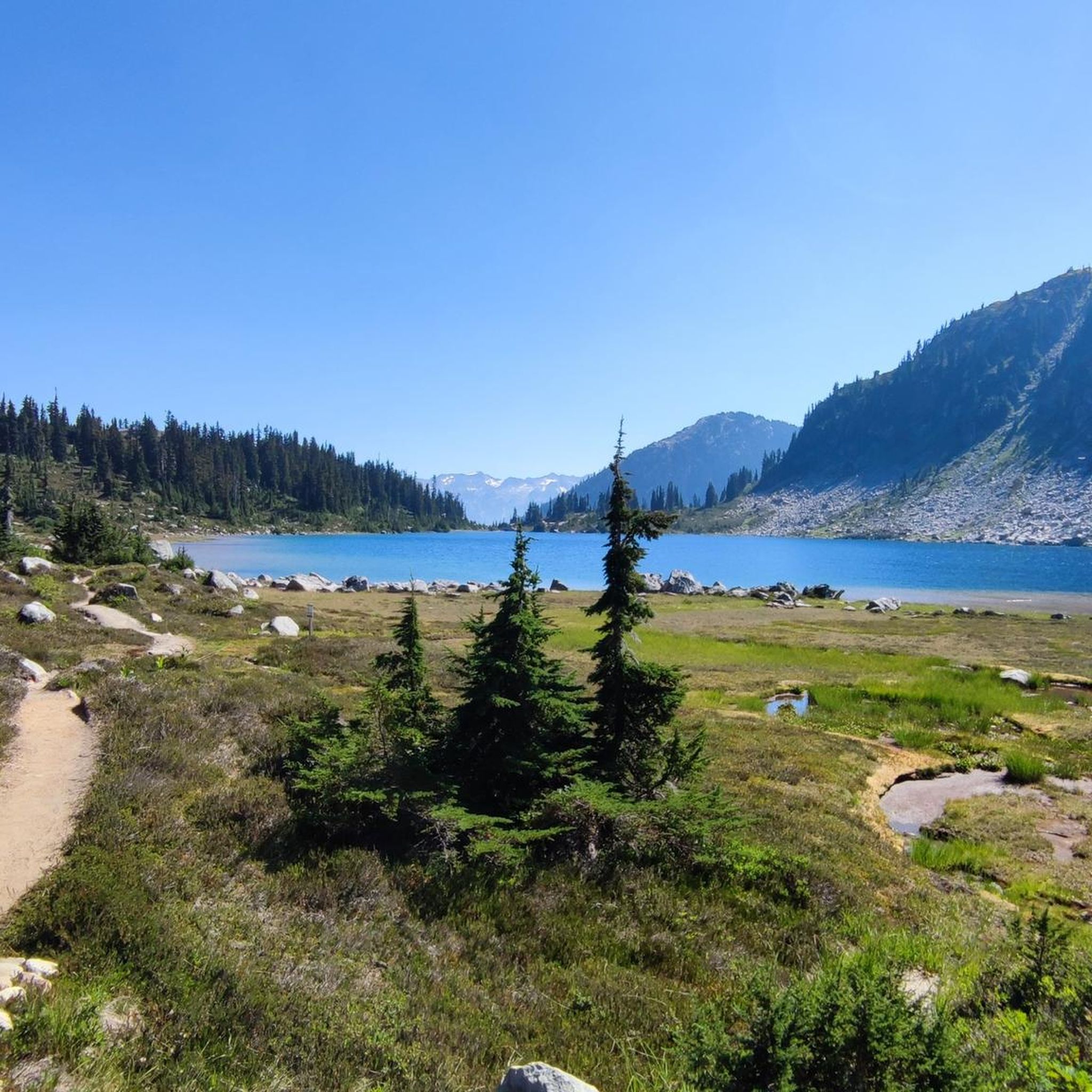
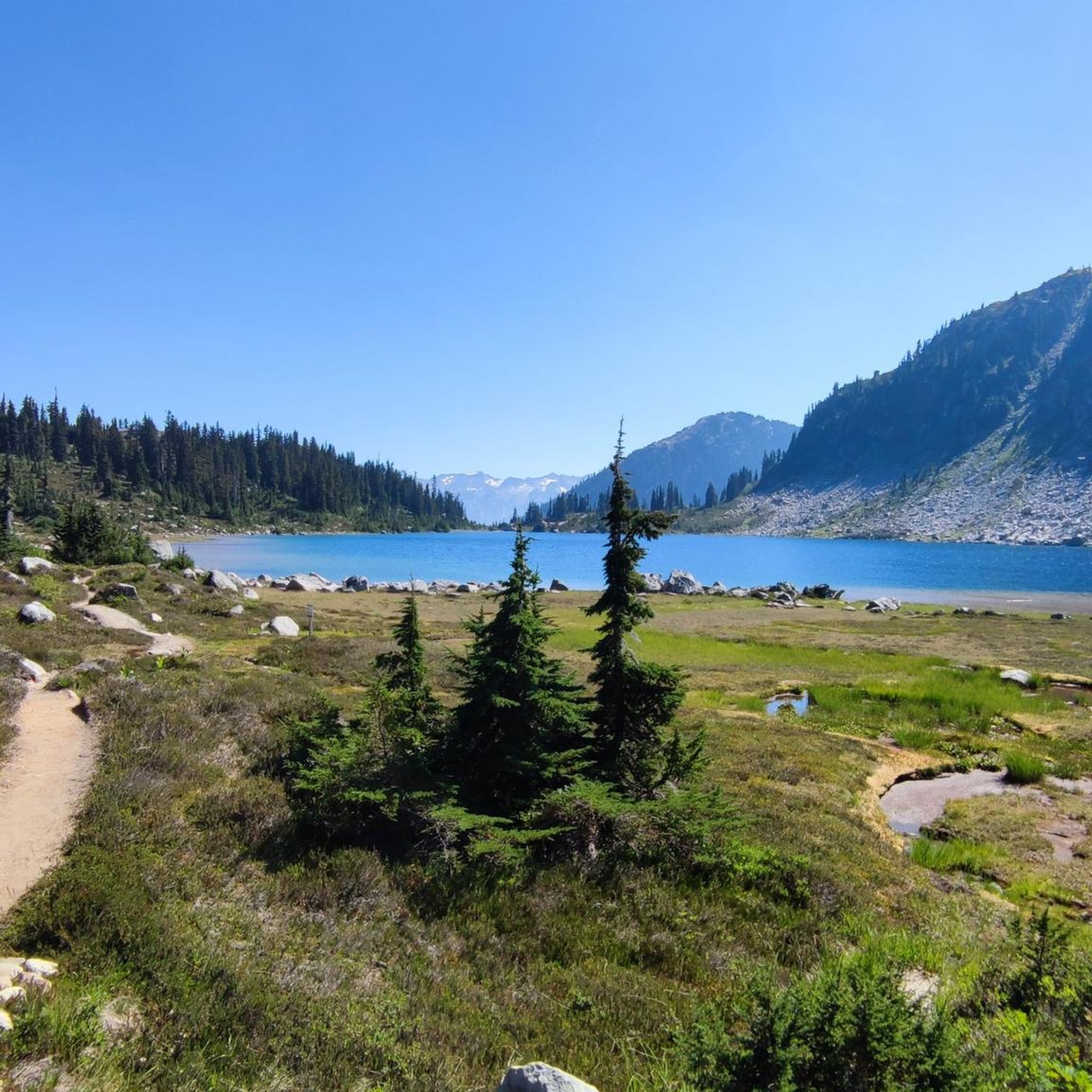
This unnamed alpine lake is scenic and right off the Semaphore Lakes Trail. There are no camping spots or facilities here, but it's a nice area to explore. A short trail circles the entire lake, and it's less crowded than Semaphore Lake.
0
0
Semaphore Lake is a gem tucked in the Coast Mountains with a turquoise alpine lake and totally framed by the rocky peaks of the Railroad Group. Aim to hike up to Semaphore Lakes during a snow-free time of the year. You can always check current FSR conditions and closures before you go.
0
0
Frequently Asked Questions
How many hiking trails are available in Area C (Pemberton Valley/Mount Currie/D'Arcy)?
There are over 160 hiking routes in Area C, offering a diverse range of experiences. You'll find everything from easy strolls through valley floors to challenging ascents in the alpine environment.
What is the best time of year to go hiking in Area C?
The Pemberton Valley and surrounding Area C are generally warmer than nearby Whistler, making late spring through early fall ideal for hiking. Summer offers access to high alpine trails and wildflower meadows, while spring and fall provide pleasant temperatures for lower elevation routes. Always check conditions for higher trails, as snow can persist into early summer.
Are there any family-friendly hiking trails in the region?
Yes, Area C offers several excellent options for families. The Lost Lake loop — Whistler is an easy 4.5 km trail with scenic views. Another great choice is the One Mile Lake Trail, an easy loop through woodlands with views of the lake and valley. Nairn Falls Provincial Park also features an easy hike to impressive waterfalls, suitable for all ages.
Which trails offer the most challenging hiking experiences?
For experienced hikers seeking a challenge, the Mount Currie Trail involves grueling switchbacks and a technical scramble to the summit, offering unbeatable panoramic views. Another demanding option is Mount Rohr, known for its steep ascent through alpine meadows with sweeping 360-degree views of the Coast Mountains. There are 28 difficult routes in the area for those looking for a strenuous adventure.
Can I bring my dog on the hiking trails in Area C?
Many trails in Area C are dog-friendly, but regulations can vary by park or specific trail. For example, the Riverside & Farside to Cheakamus River Suspension Bridge loop is a popular option where dogs are generally welcome. Always check local signage and park rules regarding leashes and waste disposal before heading out with your pet.
Are there any trails that feature waterfalls?
Absolutely. Nairn Falls Provincial Park is a highlight, offering an easy hike to the powerful Nairn Falls, where whitewater drops 60 meters. Viewing platforms provide stunning vistas of the falls, making it a rewarding destination.
What kind of natural landmarks or viewpoints can I expect to see?
The region is rich in natural landmarks. You can find stunning vistas like the Old Viewpoint of the Coast Mountains and the View of Black Tusk. Iconic Mount Currie dominates the skyline, and many trails lead to serene alpine lakes such as Joffre Lake and Semaphore Lakes, offering picturesque views of glacier-capped peaks and old-growth forests.
Are there any circular hiking routes in Area C?
Yes, several circular routes are available. The Lost Lake loop — Whistler is a popular easy circular trail. Another option is the Riverside & Farside to Cheakamus River Suspension Bridge loop, which offers riverside scenery on an easy path.
What do other hikers enjoy most about hiking in Area C (Pemberton Valley/Mount Currie/D'Arcy)?
The area is highly rated by the komoot community, with an average score of 4.6 stars from over 850 reviews. Hikers frequently praise the diverse landscapes, from serene alpine lakes and wildflower meadows to dramatic glacier-capped peaks and dense old-growth forests. The variety of trails, catering to all skill levels, is also a common highlight.
Are there any hot springs accessible after a hike?
Yes, the region is home to natural hot springs. Sloquet Hot Springs, located along the Lillooet River, features tub-style pools. Skookumchuck Hot Springs (also known as St. Agnes Well Hot Springs) are another option, nestled beside the Harrison River, offering public access to soaking tubs in a beautiful natural setting.
What are the options for parking and public transport near trailheads?
While specific details vary by trailhead, many popular hiking areas like Nairn Falls Provincial Park and Joffre Lakes Provincial Park have designated parking lots. Public transport options are more limited, so planning for personal vehicle access is generally recommended for reaching most trailheads in Area C. Always check for any parking fees or permit requirements in advance.
Are there any permits required for hiking certain trails?
Some popular areas, particularly provincial parks like Joffre Lakes, may require day-use passes or permits, especially during peak seasons, to manage visitor numbers and protect the environment. It's advisable to check the official BC Parks website or specific park regulations before your visit to determine if a permit is needed for your chosen trail.
Most popular routes around Area C (Pemberton Valley/Mount Currie/D'Arcy)
Most popular attractions around Area C (Pemberton Valley/Mount Currie/D'Arcy)

Get inspired with the komoot mobile app


Explore more
Browse the best Hikes in other regions.
