The best running trails around Øvre Leirungen
4.5
(5)
284
runners
9
runs
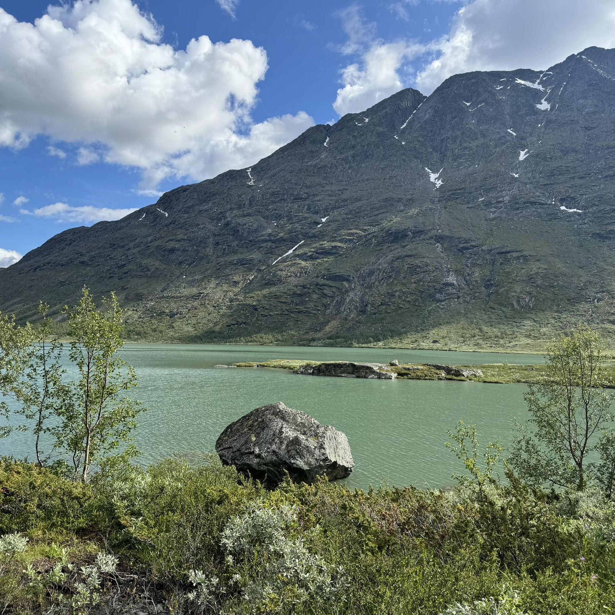
Jogging around Øvre Leirungen offers an experience within the Jotunheimen mountain range and Jotunheimen National Park in Innlandet county, Norway. The region is characterized by rugged mountain peaks, an alpine environment, and picturesque valleys. Notable natural features include Øvre Leirungen lake, the nearby Gjende lake, and the Leirungåse river, all contributing to the diverse terrain. Elevated points like Knutshøe Mountain provide panoramic views of the surrounding landscape.
Best jogging routes around Øvre Leirungen
- The most popular jogging route is Knutshøe…
Last updated: August 24, 2026
54
runners
12.6km
02:13
480m
480m
Hard run. Very good fitness required. Sure-footedness, sturdy shoes and alpine experience required.
5.0
(1)
167
runners
14.3km
03:20
1,100m
1,110m
Hard run. Very good fitness required. Sure-footedness, sturdy shoes and alpine experience required.

Sign up for free
8
runners
10.1km
01:10
170m
170m
Hard run. Good fitness required. Sure-footedness, sturdy shoes and alpine experience required.
4.0
(2)
17
runners
12.3km
01:52
460m
470m
Hard run. Very good fitness required. Sure-footedness, sturdy shoes and alpine experience required.
21
runners
14.1km
02:38
800m
800m
Hard run. Very good fitness required. Sure-footedness, sturdy shoes and alpine experience required.
Get access to more routes and recommendations from other explorers.
Sign up for free
Already have an account?
Our route recommendations are based on thousands of hikes, rides, and runs completed by other people on komoot.
Start today with a free account
Your next adventure awaits.
Login or Signup
Popular around Øvre Leirungen
Tips from the Community

From the wooden bridge that crosses the stream, you can admire both the crystal-clear color of the torrent's waters and its power. A stop like an entrance into the wild world.
0
0

A very beautiful, multi-tiered waterfall. Definitely worth a visit.
0
0


This is a beautiful lake beneath the Knutshøe ridgeline. To the north it flows into the beautiful Gjende lake, which lies beneath the famous Besseggen Ridge. A run over Knutshøe, followed by the section along the lake's northern banks is superb.
0
0
Knutshøe is a fantastic objective for an adventurous trail run and you can expect the trails to be much quieter than on the neighbouring Besseggen Ridge. The summit offers magnificent views of the mountains and lakes.
0
0
Café Gjendeosen enjoys an enviable spot by the ferry terminal looking across Gjende lake. It's a nice place to grab a drink before taking the ferry. A coffee here tastes even better if you've just completed the Besseggen Ridge, a Norwegian classic!
0
0
At 5,718 feet (1,743 m), Veslfjellet is the highest point on the famous Besseggen Ridge. In contrast to some of the narrower sections on the route, the summit is relatively broad but the views are still spectacular.
0
0
This is a classic section of the famous Bessegen Ridge, with Bessvatnet on one side and Gjende on the other. It's a simply stunning run. The trails are usually snow free from mid-June to mid-October and this is when the ferries run on Gjende.
0
0
Frequently Asked Questions
How many running routes are available around Øvre Leirungen?
There are over 10 running routes documented on komoot for the Øvre Leirungen area. These trails offer a variety of experiences within the stunning Jotunheimen mountain range.
What is the general difficulty level of running trails in Øvre Leirungen?
The majority of running trails around Øvre Leirungen are considered challenging, featuring significant elevation gains and rugged terrain. For example, the Knutshøe Trail - Jotunheimen National Park is a difficult 7.8-mile route with considerable ascent.
What kind of terrain can I expect on the jogging paths near Øvre Leirungen?
You can expect a diverse alpine environment with rugged mountain peaks, picturesque valleys, and serene lakes. Trails often feature varied surfaces, from rocky paths to more established tracks, providing a stimulating backdrop for your run. The region is nestled within the majestic Jotunheimen mountain range.
Are there any running routes that offer panoramic views?
Yes, many routes provide breathtaking vistas. For instance, the Besseggen Ridge - Jotunheimen National Park offers iconic views of the Gjende lake and surrounding rugged peaks. Elevated points like Knutshøe Mountain also provide panoramic scenes encompassing both Gjende and Øvre Leirungen lakes.
What do other runners say about the trails in Øvre Leirungen?
The running routes in Øvre Leirungen are highly rated by the komoot community, with an average score of 4.5 stars from over 5 reviews. More than 270 runners have used komoot to explore the varied terrain, often praising the challenging nature and stunning alpine scenery.
Are there any circular running routes available?
Yes, there are several loop options. A popular choice is the Besseggen Rapids – DNT Gjendesheim loop from Leirungsbuin, a 6.4-mile trail that takes you through the scenic Leirungsdalen Valley.
Can I find routes with waterfalls or interesting natural features?
Absolutely. The region is rich in natural beauty. The Bessvatnet – Waterfall Near Bessvatnet loop from Gjendesheimkrysset is a great option if you're looking to incorporate a waterfall into your run, alongside the beautiful Bessvatnet lake.
What is the best time of year for jogging in Øvre Leirungen?
The best time for jogging is typically during the warmer months, from late spring to early autumn, when trails are free of snow and ice. This period offers the most accessible and enjoyable conditions for exploring the alpine environment.
Are there any easy or beginner-friendly running trails around Øvre Leirungen?
While many routes are challenging, the region does offer some paths suitable for various fitness levels. However, the routes specifically listed in this guide are generally considered difficult. For easier options, you might look for less elevated paths around the lakes or in the valleys, though these may not be explicitly categorized as 'easy' running trails on komoot.
Are there places to eat or stay near the running routes?
Yes, the area is close to key sites like the Gjendesheim mountain hotel, which serves as a base for outdoor activities and offers amenities. Nedre Leirungen also serves as a common waypoint, suggesting connectivity to areas with facilities.
Is public transport available to reach the trailheads?
The area around Øvre Leirungen, being part of Jotunheimen National Park, is accessible. Gjendesheim is a significant hub, and public transport options, such as buses, often connect to this area, providing access to various trailheads.
What landmarks can I see while running in the area?
Beyond the stunning natural landscapes, you'll encounter iconic landmarks such as the prominent Gjende lake, the Leirungåse river, and the dramatic peaks of Knutsholstinden and Tjønnholstinden. The famous Besseggen ridge is also a major landmark visible from many elevated points.
Most popular routes around Øvre Leirungen

Get inspired with the komoot mobile app


Explore more
Browse the best Running Trails & Routes in other regions.
