The best walks and hikes around Øvre Leirungen
4.6
(1535)
9,996
hikers
51
hikes
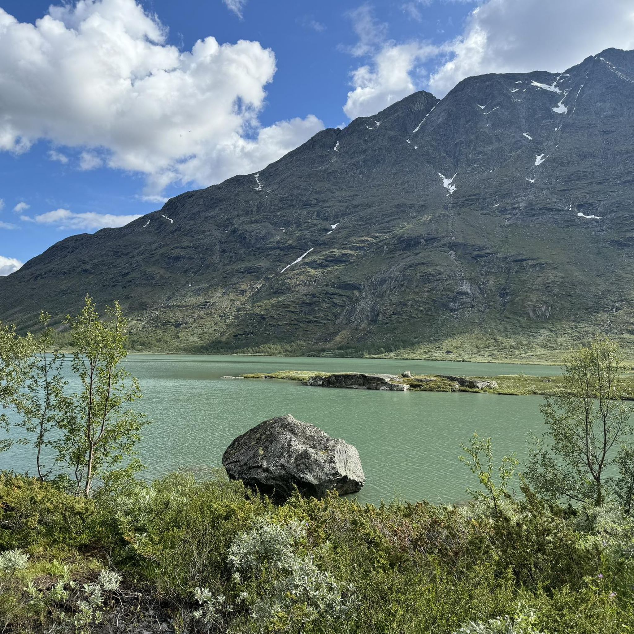
Hiking around Øvre Leirungen provides access to the dramatic alpine landscapes of Jotunheimen National Park, often referred to as the "Home of the Giants." The region is characterized by high mountains, glaciers, and stunning turquoise alpine lakes, including Øvre Leirungen. This area features diverse terrain, from the impressive Knutshøe ridgeline to the scenic Leirungsdalen Valley.
Best hiking trails around Øvre Leirungen
- The most popular hiking route is Knutshøe - Besseggen's tough little brother, a 7.8 miles (12.5 km) trail that takes 4 hours 59 minutes to complete. This challenging route offers panoramic views of the surrounding alpine scenery.
- Another top favourite among local hikers is Vargebakkan – Knutshøe Summit loop from Vargebakkan, a difficult 4.8 miles (7.7 km) path. This trail ascends to the Knutshøe Summit, providing expansive vistas.
- Local hikers also love the View of Leirungen – Vargebakkan loop from Vargebakken, a 6.3 miles (10.1 km) trail leading through varied terrain, often completed in about 3 hours 3 minutes.
- Hiking around Øvre Leirungen is defined by high alpine mountains, glacial valleys, and clear lakes. The network offers options for various ability levels, from moderate paths to challenging mountain ascents.
- The routes in Øvre Leirungen are highly rated by the komoot community with an average score of 4.7 stars from over 1,000 reviews. More than 5,900 hikers have used komoot to explore Øvre Leirungen's varied terrain.
Last updated: August 20, 2026
4.9
(157)
1,003
hikers
12.5km
04:59
470m
470m
Hard hike. Good fitness required. Sure-footedness, sturdy shoes and alpine experience required.
5.0
(17)
94
hikers
7.67km
03:21
400m
400m
Hard hike. Good fitness required. Sure-footedness, sturdy shoes and alpine experience required.

Sign up for free
4.2
(13)
59
hikers
10.1km
03:04
150m
150m
Moderate hike. Good fitness required. Mostly accessible paths. Sure-footedness required.
4.0
(4)
23
hikers
15.1km
05:41
590m
590m
Hard hike. Very good fitness required. Sure-footedness, sturdy shoes and alpine experience required.
4.3
(9)
27
hikers
16.1km
05:21
200m
200m
Hard hike. Very good fitness required. Mostly accessible paths. Sure-footedness required.
Get access to more routes and recommendations from other explorers.
Sign up for free
Already have an account?
Our route recommendations are based on thousands of hikes, rides, and runs completed by other people on komoot.
Start today with a free account
Your next adventure awaits.
Login or Signup
Popular around Øvre Leirungen
Tips from the Community


The last section before Knutshøe contains a climbing passage of approx. 20m. For dogs, this is not an option. People should be sure-footed and concentrated here.
0
0

Super cool here in the summer this was 20 degrees
0
0

Before the summit, there's another steep climb (assuming we've chosen the right path) 🙈. The picture, however, looks a bit more challenging than it actually was. After that, we continued leisurely down to the valley, without any vertigo-inducing paths.
0
0

There are a few sections of easy scrambling on the ascent of Knutshøe and this is one of them. Confident runners shouldn't have too much difficulty though. One of the other notable sections comes just before the very summit.
0
0
Knutshøe is a fantastic objective for an adventurous trail run and you can expect the trails to be much quieter than on the neighbouring Besseggen Ridge. The summit offers magnificent views of the mountains and lakes.
0
0

From here you can enjoy an amazing view of the lakes.
0
0
Frequently Asked Questions
How many hiking trails are available in Øvre Leirungen?
There are over 50 hiking trails around Øvre Leirungen, offering a wide range of experiences from easy walks to challenging mountain ascents. The komoot community has explored these routes over 5,900 times, providing valuable insights.
What kind of terrain can I expect on hikes around Øvre Leirungen?
The terrain around Øvre Leirungen is characterized by dramatic alpine landscapes, high mountains, glacial valleys, and clear turquoise lakes within Jotunheimen National Park. You'll find diverse paths, from well-marked trails to more rugged, challenging ascents that require good fitness and sure-footedness.
Are there any easy or family-friendly hiking options in Øvre Leirungen?
Yes, while many routes are challenging, the region does offer easy, accessible paths suitable for various skill levels, including families. These trails allow you to enjoy the stunning alpine scenery without requiring extensive hiking experience.
What are the most notable natural features or landmarks to see while hiking?
Øvre Leirungen is nestled in Jotunheimen National Park, known as the 'Home of the Giants,' featuring Norway's highest mountains and glaciers. You can expect stunning views of Lake Øvre Leirungen itself, and the impressive Knutshøe ridgeline. The area is also close to the famous Gjende lake and the renowned Besseggen Ridge.
When is the best time of year to go hiking in Øvre Leirungen?
The best time for hiking in Jotunheimen National Park, including Øvre Leirungen, is typically from mid-July to mid-August. June and September can also offer pleasant conditions, though you should be prepared for varying weather in the mountains.
Are there any circular hiking routes available?
Yes, there are several circular routes around Øvre Leirungen. For example, the Vargebakkan – Knutshøe Summit loop from Vargebakkan is a challenging 4.8-mile path ascending to the Knutshøe Summit. Another option is the View of Leirungen – Vargebakkan loop from Vargebakken, a moderate 6.3-mile trail.
What do other hikers say about the trails in Øvre Leirungen?
The hiking routes in Øvre Leirungen are highly rated by the komoot community, with an average score of 4.7 stars from over 1,000 reviews. Hikers frequently praise the dramatic alpine scenery, the challenging nature of some routes, and the expansive vistas from mountain summits.
Can I bring my dog on the hiking trails around Øvre Leirungen?
Jotunheimen National Park generally welcomes dogs, but they must be kept on a leash. It's always advisable to check specific trail regulations or local signage for any restrictions, especially in protected areas or during certain seasons to protect wildlife.
Are there options for parking near the trailheads in Øvre Leirungen?
Yes, parking is generally available near popular trailheads in the Øvre Leirungen area, especially those serving routes like the Knutshøe ridgeline. Specific parking information can often be found on individual route descriptions or local visitor information.
What is the difficulty level of hikes in Øvre Leirungen?
The hikes in Øvre Leirungen range from moderate to difficult. Out of 51 available tours, 22 are rated moderate and 24 are rated difficult. These challenging routes often involve significant elevation gain and require good fitness and appropriate gear.
Are there any particularly challenging hikes for experienced trekkers?
Experienced trekkers will find several challenging options. The Knutshøe - Besseggen's tough little brother is a difficult 7.8-mile trail known for its panoramic views. Another demanding option is the Knutshøe Summit – Vargebakkan loop from Beito, covering 9.3 miles with significant elevation.
Most popular routes around Øvre Leirungen

Get inspired with the komoot mobile app


Explore more
Browse the best Hikes in other regions.
