The best running trails around Langlivannet
61
runners
8
runs
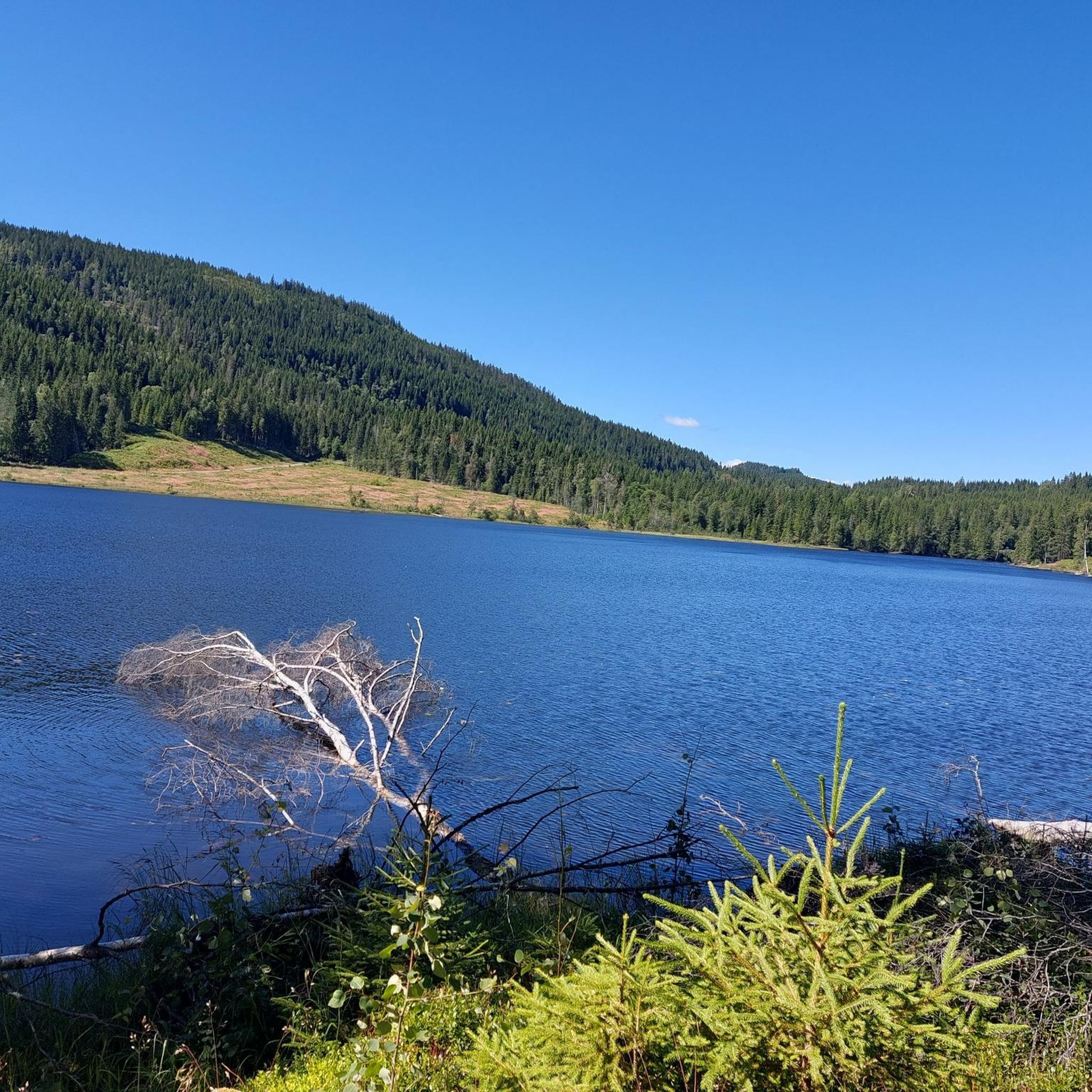
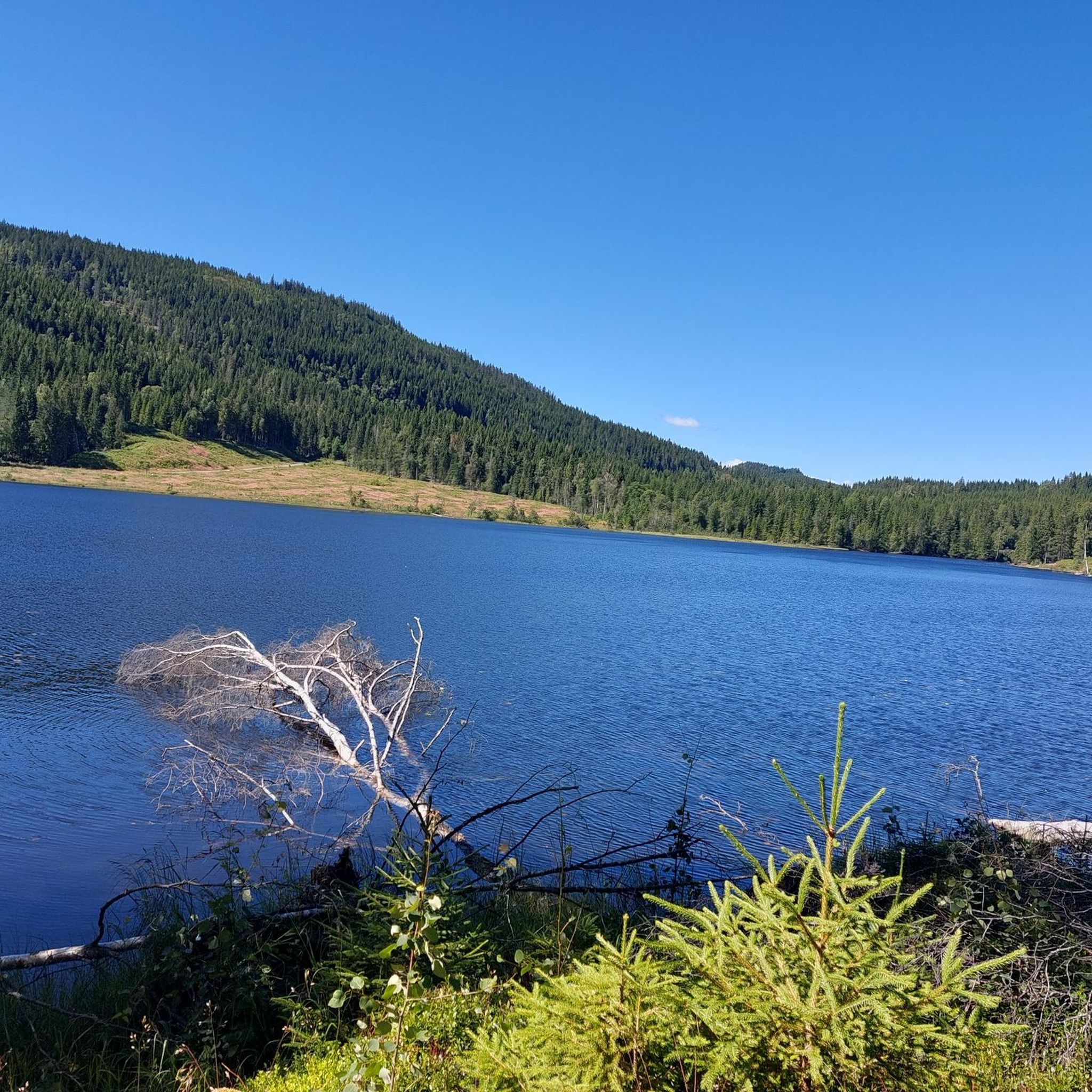
Jogging routes around Langlivannet offer a diverse range of experiences within a forested, natural environment. The region is characterized by an elongated lake, extensive woodlands, and a comprehensive network of trails. These running trails feature varied surfaces, from paved paths to gravel roads and well-trodden forest routes, with significant elevation changes on many of the longer paths.
Best jogging routes around Langlivannet
- The most popular jogging route is Midtre Lysedammen – Nedre Lysedammen loop from Sørkedalen, a 12.7 miles…
Last updated: October 27, 2026
10
runners
20.4km
02:13
380m
380m
Hard run. Very good fitness required. Mostly paved surfaces.
6
runners
34.7km
03:54
580m
580m
Hard run. Very good fitness required. Mostly paved surfaces.

5
runners
34.5km
04:01
650m
650m
Hard run. Very good fitness required. Mostly paved surfaces.
5
runners
19.8km
02:28
450m
450m
Hard run. Very good fitness required. Mostly paved surfaces.
23
runners
9.13km
01:01
140m
140m
Moderate run. Good fitness required. Mostly paved surfaces.
Get access to more routes and recommendations from other explorers.
Already have an account?
Our route recommendations are based on thousands of hikes, rides, and runs completed by other people on komoot.
Start today with a free account
Your next adventure awaits.
Popular around Langlivannet

Tips from the Community

Enjoy the view of the forests and rolling hills from here.
0
0

On the eastern shores of Bogstadvannet is Bogstad Manor, a beautiful manor house. There's a cafe here for some post run refreshment, while there's also a museum where you can find out more about the history of the lake and house.
0
0

Watch the farm animals, the old buildings, the view and enjoy the café.
1
0

On a small circular path you pass sheep, goats, cows and horses
0
0


The museum courtyard is still in use. Very well-kept park and beautiful buildings. Unfortunately, the cafe was still closed.
0
0

An old farmhouse with an interesting history and a park. Also a Cafe inside.
0
0
Frequently Asked Questions
How many running routes are available around Langlivannet?
Komoot features around 8 running routes in the Langlivannet area, offering a diverse range of experiences. These trails vary in length and difficulty, providing options for different fitness levels.
What kind of terrain can I expect on the jogging trails near Langlivannet?
The jogging trails around Langlivannet offer a mix of surfaces, from mostly paved paths to gravel roads and well-trodden forest routes. You can expect varied terrain, including significant elevation changes on many of the longer paths, providing a challenging and engaging running experience.
Are there any easy or moderate running routes in the Langlivannet area?
While many of the routes around Langlivannet are considered difficult, there are at least 2 moderate running trails available. These provide a good option for those looking for a less strenuous run while still enjoying the scenic natural environment.
Are there any circular running routes around Langlivannet?
Yes, many of the running routes around Langlivannet are designed as loops, allowing you to start and finish in the same location. For example, the challenging Midtre Lysedammen – Nedre Lysedammen loop from Sørkedalen is a popular circular option.
What are some of the longer, more challenging running routes in the region?
For experienced runners seeking a challenge, Langlivannet offers several difficult routes. Notable options include the 21.5-mile Gråberghaugen loop from Sørkedalen and the 22.5-mile Skamrek – Nibbitjern loop from Sørkedalen, both traversing varied terrain with substantial elevation gain.
What makes Langlivannet a good destination for trail running?
Langlivannet is an excellent destination for trail running due to its diverse trail system, ranging from accessible paths to demanding wilderness routes. The area features scenic lake views, tranquil forest paths, and a natural environment within Nordmarka and Krokskogen, making it ideal for varied outdoor pursuits.
Are there any historical landmarks or points of interest along the running trails?
While specific highlights are not detailed for these routes, Langlivannet itself has historical significance as a reserve drinking water source for Oslo. You might encounter old dam structures, including a concrete dam from 1938-42 and even older stone dams from the 1600s, which become visible during low water levels, adding a unique historical element to your run.
What do other runners say about the trails around Langlivannet?
Over 60 runners have explored Langlivannet's varied terrain using komoot. They often praise the scenic lake views, tranquil forest paths, and the diverse trail system that offers options for different ability levels, from accessible paths to more demanding routes with significant elevation.
Can I find running routes with good viewpoints in the Langlivannet area?
Yes, many trails in the Langlivannet region offer scenic vistas. For instance, the Skamrek – Nibbitjern loop from Sørkedalen leads through dense woodlands and provides panoramic views, allowing you to enjoy the natural beauty of the area during your run.
Are the running trails around Langlivannet suitable for all seasons?
The Langlivannet area offers diverse trail conditions. While many routes are excellent for spring, summer, and autumn, winter running conditions can vary. Some trails might be suitable for winter, especially if groomed, but others may require specific gear or experience with snow and ice. Always check local conditions before heading out.
Is there public transport access to the Langlivannet running routes?
Access to Langlivannet and its running routes often involves reaching the Sørkedalen area. While specific public transport details for direct access to trailheads are not provided, Sørkedalen is generally accessible by bus from Oslo. It's advisable to check local public transport schedules for the most up-to-date information on reaching the starting points of these trails.
Are there any cafes or places to eat near the running trails in Langlivannet?
The Langlivannet area is primarily a natural wilderness setting. While there might not be cafes directly on the trails, the nearby Sørkedalen valley, which serves as a common starting point for many routes, may offer some options for refreshments or a meal after your run. It's recommended to check local listings for current establishments.

Get inspired with the komoot mobile app


Explore more
Browse the best Running Trails & Routes in other regions.
